MT ISA TO GUMHOLE CAMPGROUND, DIAMANTINA NATIONAL PARK

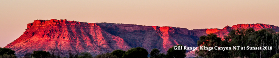
The country around Mt Isa was really lovely, with red, rocky hills, covered in white, multi-trunked eucalypts (like Mallees), a wide assortment of bushes and grasses and dips where creeks would flow in the wet season. The road was one lane wide bitumen to Boulia, where we had lunch in a park.

There is a mystery light, called the Min Min, which has been seen by many people in this area. The phenomena is said to appear as a luminous oval, like a florescent football, and has been reported to have been seen ahead of vehicles as well as behind. No-one has ever been able to catch up with it, and some say that the only way to do so is to imbibe in a recipe involving barley, malt and sugar! But enough sightings by sane, sober and intelligent persons have occurred to discount that recipe! To date, we haven’t seen the light.

Not far out of Boulia, was Springvale Road – our road to take to get to Gumhole Campground in the Diamantina National Park. What an incredible contrast in the country on this road. We travelled approximately 160kms on a dirt road, with sections of bulldust, gibber plains and where, for more than half way, the country looked like a moonscape. There was not one feature at all – no grass, no hills, nothing. It was a really surreal feeling and we both commented that we could be heading to the end of the earth!

camp-on-gumhole-diamantina-np

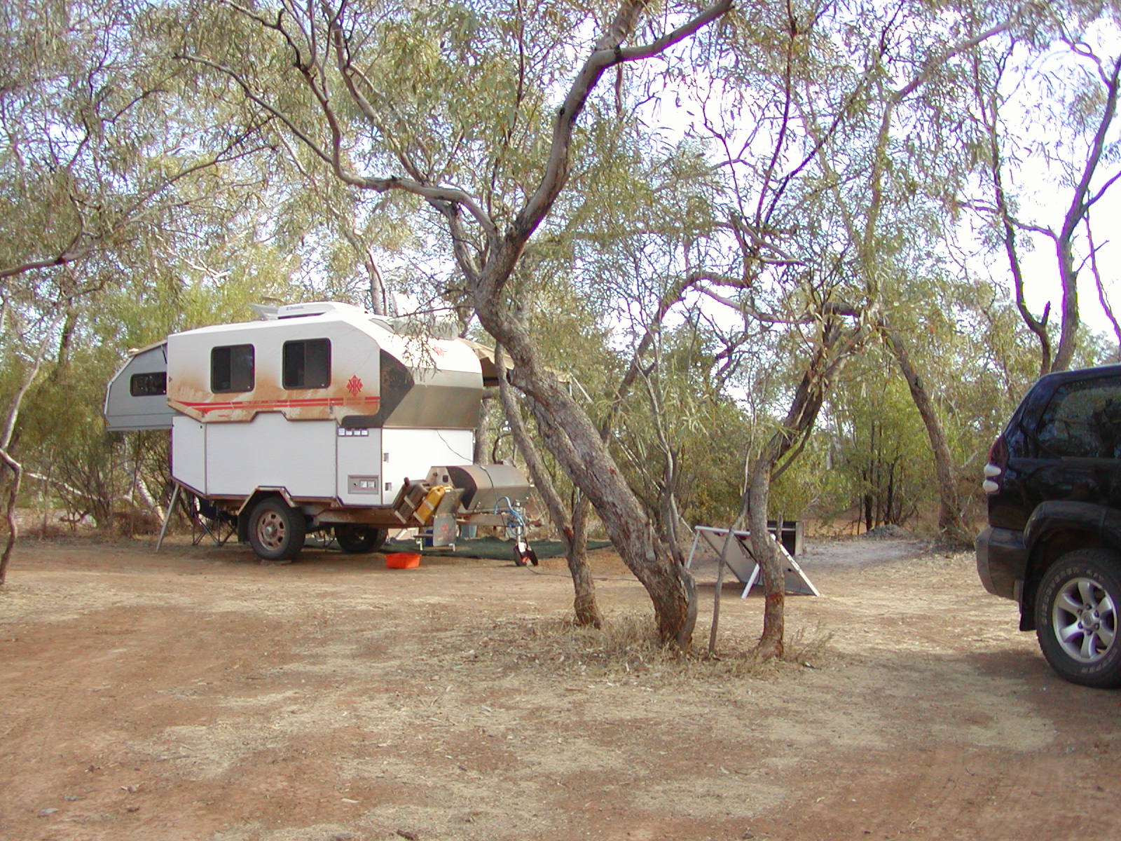
At last, there was a sand dune in the distance, plus a row of tress to break the monotony. The trees were the place of our campground which is on Gum Creek, a large brown waterhole, with Coolibah and Bauhinia trees. We’ve got a site with a fireplace, 5 metres from the creek, where I put my cray pot in, but the only things I’ve attracted each day has been these strange little water beetles, except this morning there was a fish in there! I let him go to grow up a bit for next time

 sand-dune-daimantina-np

The second day we drove to Hunters Gorge, 11kms further into the park. Camping is allowed there also, but it is more open and windier apparently. The Mundewerra Waterhole there is much bigger and deeper than Gum Creek, and good fishing and water activities can be done there. There are also large rocky hills to walk up. We also drove to the park headquarters and on the way there was a sign saying “Diamantina Channels”, where we travelled over many rivers, all lined with spectacular Coolibah trees (my favourite tree to date!), river red gums, acacias, hakeas and grevilleas (although we haven’t spotted the grevillea yet).

coolibah-trees-warracoota-waterhole-diamantina-np lake-constance-diamantina-np

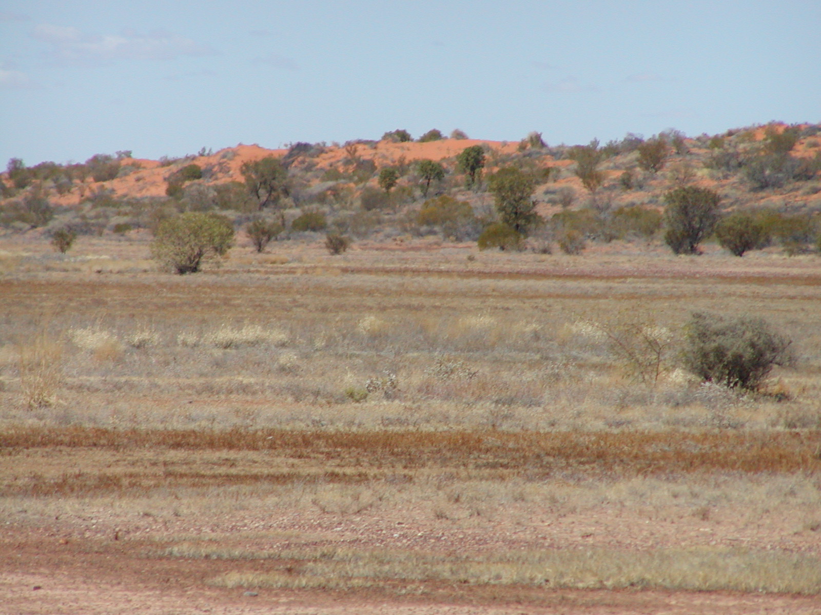
Yesterday we did the 100km Warracoota self-guided circuit drive, which took us over kilometres of claypans, then large sections of gibber plains, passed Mitchell grasslands, saw cattle yards, Lake Constance, which is one of the natural lakes, once used by past station managers for water sports such as water skiing. Nowadays, it is a refuge for water birds and on the banks, budgerigars, corellas, galahs and honeyeaters can be seen. On the way we wound our way passed many red sand dunes which were just like the ones in the Simpson Desert with shrubs, small trees and Spinifex growing in red sand. These dunes are now stationary (and have been for the last 8,000 to 12,000 years) and are parallel just like the Simpson dunes. The dunes were formed millions of years from sediment from the Diamantina River and the red colour comes from high iron content.

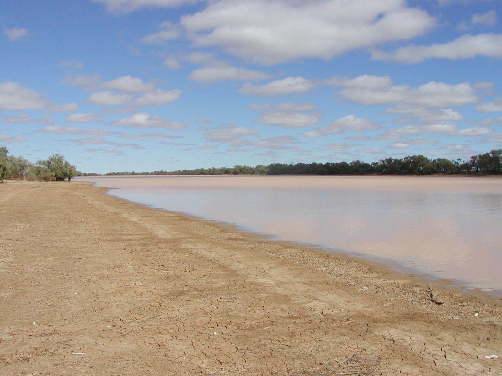
We had lunch at the Warracoota Waterhole, which has never been known to run dry, and it is much deeper and narrower than other waterholes in the park. We had a great day and learnt that every feature of the park had its own special use, in the past, for the indigenous Maiawali people, claypans for example, were used as drawing boards, sketching sand drawings to educate their young, gibber stones used for knapping (chipping flakes for stone tools) and the waterholes for fishing of course. Grasslands were used for hunting and the Mitchell grass seed was collected and ground for flour and dampers.

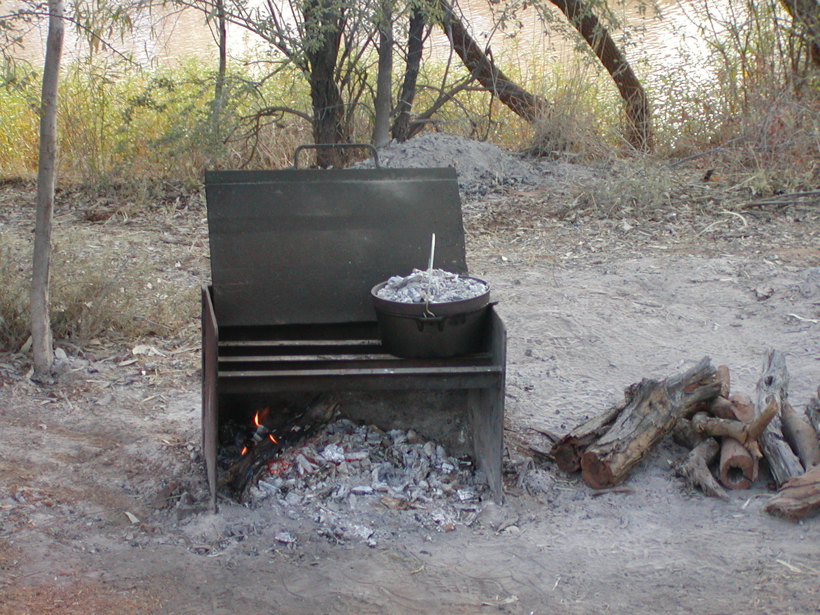
Talking of bread, I made a loaf after we got back from the drive and baked it in the camp oven with coals under the oven and on the lid. The result was a perfect loaf and we had some with cheese after dinner (lamb chops and spuds). We are looking forward to having this bread for lunch today.

bread-cooking-diamantina-np bread-in-camp-oven-diamantina-np

We’ll leave tomorrow, Saturday 25th August, and head to Welford NP, north of Quilpie. We’ll probably have to go to a town and get some water and supplies fairly soon.

Posted in 2007 | 2 Comments

GUMHOLE CREEK, DIAMANTINA NATIONAL PARK TO WINDORAH

A long and arduous journey of 375kms (5 hours), at least two thirds of which was through bulldust, sometimes deep. It feels like you are driving though water or mud, and have little control over direction. Not my favourite surface! These lovely places we find to camp are often spoiled by the long and difficult trek in and out. Russ has to concentrate every minute on the dirt roads. The car and van have been handling every surface, but we find it a little tiring.

Again, as we did in Burke Town, we thought Windorah would be quite a large place, where we could pick up supplies at a supermarket, but no such luck – just an overpriced general store, with frozen bread and frozen meat. It was a bonus to find there was a caravan park, as there wasn’t a listing for one in any of our books. Park where you like, and pay in the morning!

Once we were on the bitumen, the terrain improved as well as the road.Beautiful red sand dunes, Mulgas, Sheoaks, the same lovely white-trucked eucalypts characteristic of central Australia.Wherever there is sand, it seems the vegetation is lush and interesting, with kangaroos keeping up with us at 60kms an hour.

Arrived at after 1pm, set up, went to the pub for a counter lunch, filled up with petrol at a service station, where the owner was blind. “How much?” he asked. He completely trusted us with our reply, and entered EFTPOS by touch. I patted his cat, something I haven’t been able to do for a while (the cat loved it too!

Later in the afternoon two Major Mitchell cockatoos flew into a tree next to the camping ground and both proceeded to eat a small apple, apparently a pair of these Major Mitchell cockatoos are worth $10,000! It was great to see their pink crests and under wing colours.

major-mitchell-cockatoos

Posted in 2007 | 1 Comment

Burketown to Mt Isa

We arrived in Mt Isa (or The Isa to the locals), one day early, only to find that the only site left in the park is meant for overnight stops and is right on top of two other vans, but after being in the car for 7 hours, with Gregory Downs being the only place with fuel and food, we don’t mind what the site’s like!

The road had dried out a lot in the 24 hours, so no slipping and sliding through mud, although Russ had to concentrate 100% of the time, due to the roughness and different surfaces on the way.

We stopped at the Gregory Downs Pub at 10am and bought a couple of toasted ham sandwiches and some sandwiches to take with us for lunch, which we ate at a beautiful waterhole named Top Harris, down a little 4WD track. We are really appreciating the ability to get to these lovely places, otherwise you have to just pull over to the side of the road. There are no wayside stops at all.

top-harris-waterr-hole
177kms out of Mt Isa, we were pleased to come across bitumen – neither of us commented, just in case it ended over the next hill, or around the next bend, but it went all the way to town – bonus!!
Yesterday was catch-up time for washing, shopping etc., though all the shops are closed in Queensland on Sunday.

Today, the car is in for its 75,000km service, I’ve been to the Chiropractor and I’ve also had my hair cut.

Mt Isa is a large city, with the mines working 7 days, but there’s not a lot happening this weekend – I think everyone is recovering from last week’s famous rodeo.

Tomorrow we will start the trip south – possibly going to Diamantina Gate NP – we are trying to find out information about roads, camping etc., but are not having much luck to date.

Posted in 2007 | Leave a comment

KINGFISHER

On the recommendation of our neighbours at Lawn Hill, we took the “easy” road to Kingfisher. After opening 11 gates and taking three and a half hours to do 140kms, we arrived without punctures and everything intact. The camping area is treed with redgums, and has GREEN grass, with the river about 40 metres away. Lots of fresh water crocodiles, but the owners think it is safe to swim as they “haven’t seen a salty yet”.

Made some pita bread, as supplies of bread are getting low. Russ is very happy with the way the solar panels are charging the van. I still have frozen meat, with a half-full frig of vegies, cheese, ham, salami, bacon and eggs.

blue-wing-with-small-fish

Day 2

We bought a cray (or red claw) pot, so we’ll try our luck at catching some for dinner tomorrow. Tonight we are having Roast Lamb, as fires are allowed here. We found out today that Toni, the owner, will bake bread, so we put an order in for a loaf and four hours later, it was delivered to our camp, sliced and all!

I checked the cray pot to find that I had caught a Cheriban, which is like a huge prawn, or small fresh water cray. It was 30cm long and 4.5cm wide – hope that’s legal, because it was in a pan of boiling salted water and 6 minutes later, waiting for us to eat it.

camp-at-kingfisher-camp margs-cherebin

Day 3.

It rained all night, much to the surprise of the locals and our road out has been closed, so we have to head north to Burketown (185kms). It was a better road than the Lawn Hill-Kingfisher road, except for a long stretch of muddy roadworks, when our tyres filled with mud and we slid over the first third of a causeway! Slightly unnerving to say the least!! 3 hours later, with everything covered in red mud, many inches thick. While travelling, we both had the great idea to have the car serviced there and my back seen to by a chiropractor (instead of Mt.Isa), only to find one service station, a post office/general store and a pub and caravan park!! The population is 235, height above sea level, 15m, (hope there are no tsunamis), Situated 1988km NW of Rockhampton, 1732km NW Brisbane, via Longreach.

We’ll spend one night here, then have a long day tomorrow travelling to Mt Isa, via Gregory Downs.

Posted in 2007 | Leave a comment

LAWN HILL

Put the car in 4WD and headed up the hill from the creek bed from Gregory River, with me behind, taking photos! It looked easier driving up the hill than it did yesterday, driving down.

100kms of gravel road, first 45kms used by heavy vehicles, going to and from a copper mine, causing deep grooves in the gravel. Hard to get out of them and we encounted one road train; we had to pull over to the side and stop for several minutes afterwards, to allow the dust to settle. The next 55kms weren’t as bad, except for some sections with bad corrugations.

Arrived at Boodjamulla, (Lawn Hill National Park) after 2 hours. Strangely, we both felt a little bit let down as the camping area was not as good as last night. We had difficulty finding a suitable spot, with fence posts preventing access to the designated camping areas, so had to set up on the road, facing into the treed area. No fires allowed.

qld-trip-2007-4-148

The Ranger’s office is situated on the path to Lawn Creek, a stunning oasis, in a red/orange sandstone gorge, pandanus palms, and blue/green water, caused by the calcium content.Checked out the canoe rides, which we’ll do one day.There are several paths leading down to the very deep creek for swimming, but with my sore back and having to go in alone, I’m a little reluctant to go in.qld-trip-2007-4-106

We both had cold showers in the afternoon, which were refreshing on such a hot day. Temperature approximately 30 degrees.

Made friends with 2 couples, Ron, Ruth, John and Jill, who all came over for drinks (and to see the van, of course!)


Day 2

Set off early to The Cascades, Wild Dog Dreaming and Lower Gorge. All spectacular, with the sandstone cliffs towering along side, and brilliant white-trunked eucalypts, scattered amongst wattles and melaleucas. Visitors again tonight.

Next day we relaxed, did cryptic crosswords etc. trying to get my back to improve.

Day 4

Walked up to Indarra Falls, quite a hike, but worth every step, which formed the barrier between the upper gorge and the middle gorge (where we are camped). The falls are formed by Calcium Carbonate, that deposits in coral-like, rock hard formations called Tufa. Had a great swim there, then walked up to the look out, where we could see both the upper and the middle gorge.

qld-trip-2007-4-117

Next Day we went to Adels Grove for lunch, and to get the number of a chiropractor in Mt Isa, so I can make a booking on the 20th August, when Russ is getting the Prado serviced. We found out that there was a remedial masseur on site, so had my back pummelled after a good lunch. Adels Gorge is 10kms from Lawn Hill and has a beautifully grassed camping ground, supplies, fuel, restaurant and allows fires. The creek wasn’t as wide as at Lawn Hill, but still lovely.

Day 5

Went for our canoe ride today only to find that all were taken, with hours to wait. Every other day there have been plenty to spare! We’ll try again tomorrow morning, before we leave. Decided to drive to check out a camp site we’re book into next, at Miyumba; another section of Lawn Hill. This was a very small area, not on the creek, quite dry and dusty, so have decided to move up 140kms north to Kingfisher Camp, on the Nicholson River, South West of Burketown.

Headed out, without the canoe ride. Maybe next time.

Posted in 2007 | Leave a comment

Carisbrooke Station, Cloncurry, Gregory River, Lawn Hill, Kingfisher Camping Ground.

14th August, 2007

Over the last ten days we have travelled to Carisbrooke Station, Cloncurry, GregoryRiver, Lawn Hill and we have arrived at Kingfisher Camping Ground.

The road from Emerald was boring, but from Long Reach to Carisbrooke Station parts of the terrain improved.Brigaloe? Bush, Grevilleas, Wattles, Eucalypts, Banksias and Mitchell Grass made the trip interesting, although dry, flat plains and there wasvbulldust for long sections of the road.Daily we have been travelling between 350-450kms.

We saw a funny sign out of Emerald, saying “Drowsy Take A Rest”.  Dopey – Just Keep Smiling!”

Carisbrooke Station was once a sheep station and we camped at the shearing sheds. Nowadays, all they run are 1200 head of cattle.

A day trip from there was to Lark’s Quarry, only to find we had missed the last tour, but after another couple arrived, the Ranger took pity on us all and went ahead with the tour of the fossils some 3000 Dinosaur tracks, now completely enclosed by an eco-architecturally designed building to keep the fossils at 16 degrees. The fossils showed the smaller Coelurosaurs and Ornithipods were drinking at the waterhole (95 million years ago), when a huge Theropod came down to drink also. Realising his luck, the footprints show him making chase. Run-off from heavy rains caused the lake to rise, and a fresh layer of silt covered the mudflat where the stampede occurred, preserving the footprints for aeons to come.

The footprints were in clay and filled with silt, and over many years iron oxide filtered through and made a deposit between the iron and the silt. Larks Quarry Conservation Park is 110kms SW from Winton.


Travelling to Cloncurry, we were covering the same boring plains, until we came across Combo Waterhole on the Diamantina, the site that inspired Banjo Paterson to write Waltzing Matilda – beautiful place, with Coolibah trees, but unfortunately it had been taken over by one family camping there, although no camping was allowed.

The terrain improved approximately 50 kms from Cloncurry, with green tufts of grass, a large variety of small trees and the presence of many more water courses (although mostly dry), crossing the highway. We had a good stop at Cloncurry and have clocked up 5000 kms.
Gregory Downs 7/8/07
Arrived at Gregory Downs at 12pm and went to the one of two buildings in town – the Pub, where we had lunch. On route, the owner of the Burke and Wills roadhouse told us about a camping spot on the Gregory River, which we found and it was breathtaking. Most people camp under the bridge at Gregory Downs, but this campsite was down a little 4WD track. The caravan handled it perfectly and we were right on the river, amongst Mask Finches, Cicada Birds, Swamp Harriers, Petite Willy Wagtails and Crimson Finches. It reminded us of the waterholes at Kakadu, although a much smaller scale.


Posted in 2007 | Leave a comment

Longreach

4th August, 2007

We have again got internet access so we can update our journal.

From Cania Gorge we travelled to Emerald in the central Queensland gemfields, a journey through undulating country with interesting changes in vegetation. Much better than the drive to the coast which was flat and very dry with not many trees. Along the way we had to contend with 53m long road trains that hold the centre of the road, or so it seems, making them look even bigger. The roads were quite good but in some places they reverted to outback Qld standards with narrow bitumen and very irregular surfaces.

At Emerald we found a camp ground about 17 Km outside the town at lake Maraboon. A delightful place with plenty of trees on the shore of Fairbairn Dam (not sure of the spelling). Heaps of birds including many Rainbow Lorikeets that would eat out of your hand.We had to use our satellite phone to let our family know we were still travelling OK as we had had no mobile or Internet coverage for a number of days.

camp-at-lake-maraboonlorikeets-at-lake-maraboon

From Emerald we travelled to Longreach, again through interesting countryside. On this trip we had to overtake our first road trains but the drivers were very cooperative, keeping to the left to allow as much room as possible and acknowledged our “toots” of thanks with a headlight flash. We camped at Gunnerdoo Caravan Park as in “gunna do that one day” which is a very well run park with good facilities and as many trees as the dry region will support. They also have three spa pools which we enjoyed yesterday, in a warm sunny 29 degrees. (This was after rejecting “Nogoa Caravan Park”, which was exactly as the name suggests!!

Today we went to the Qantas museum which was excellent and well worth a visit. Our visit started with a film on the origins of Qantas which was very informative and well narrated by Michael Catin, whose mother was one of the original Longreach employees (as a junior typist). After that we walked through the displays that had many audio-visual presentations by ex-employees on their experiences. There was also a film on the restoration of the first Qantas 707 and displays of early planes and equipment. It was especially interesting to learn about the two founders of Qantas and how they got together. Apparently one of them was a pilot in the 1st world war and the other chose to fly with them because “his plane had the least bullet holes”. The first business they had together was to find airstrips between Darwin and Brisbane for the planes in the first air race from London to Australia. They did this in a T model Ford over tracks that were just one horse pad wide! An incredible effort, but on the way they met a minister who had travelled in a similar vehicle from Melbourne to set up a mission in the NT!

qantas-avro qantas-original-1922-hanger

After this we visited the Stockman’s Hall of Fame which was also a very enjoyable experience. A very well put together exhibition in a way that celebrates our early pioneers and the hardships they endured and their resourcefulness, all housed in an interesting and well designed building. The displays acknowledged the role and culture of the aboriginal population, explained the early European exploration and then detailed all aspects of the development of outback Australia. Again many audio-visual displays highlighted and explained aspects of life in early Australia. There were also many short stories on unsung heroes of this period that amplified our understanding of the hardships and battles the pioneers went through. We spent hours here with our tired feet and backs being the only reason that we curtailed our visit. Tomorrow we go to Carisbrook Station and visit the site of the only fossil record of a dinosaur stampede which should be an experience. After that we go to Lawn Hill via Cloncurry and Gregory Downs so you may not hear from use for a couple of weeks as we will be out of Internet access in the real outback.


hawkers-wagon-at-stockmans-hall-of-famelongreach-bus

Posted in 2007 | 5 Comments

Cania Gorge NP

31st July, 2007

We have finally arrived at Cania Gorge right next to the National Park, after leaving the beautiful sunsets of Eurimbula NP.

sunset-at-eurimbula-1

The ‘finally’ refers to our ‘short cut’, which took us over the steepest mountain we’ve every travelled, only to come across at sign 50kms down the track to say “road not suitable for caravans or trailers”).  We had to retrace our steps and do an extra 200kms.To add insult to injury, we are covered in sand fly bites, which are almost unbearable.

This morning we went to Monto to get some prescriptions and supplies, but have to return tomorrow, as one of my prescriptions has been taken off the register, so I’ll have to get another script.  Looks like we might have lunch in Monto tomorrow.

We have just returned from a four kilometre walk (half of which was steps), to Dripping Rock and The Overhang, through cool rainforest and the towering sandstone cliffs and caves. The ferns were delicate and varied, with elk horns growing off overhead rocks, tree ferns alongside grasstrees, with vines amongst the few long-standing cedars. During the entire walk, the sound of the Lewin’s Honeyeater, could be heard.  A truly spectacular place!

ferns-in-cania-gorge-np overhang-at-cania-gorge

In the caravan park, there is bird feeding time at 4.pm, so the sound of lorikeets, butcherbirds and currawongs fill the air. The owners of the park have five chickens, that freely roam the park and the forest – really free range – and they return at the same time every night. As I’m typing this, the sun has dropped, along with the temperature. On go the jeans, jumpers and shoes and it might be time to pack things away.

view-from-camp-at-cania-gorge walk-into-russell-gorge-cania-np

Posted in 2007 | 2 Comments

Last Day at Eurimbula NP

Last nights roast lamb was delicious and carefully attended to by Russ.\

waiting-for-dinner-at-bustard-beach

We work to some clouds and did not have any specific plans, but what a day it was! Nearby anglers gave us some yabbies for bait, so out came the rods and the whole catastrophe, and down to the beach, with some welcome cloud to give our skin a break. Within ten minutes (or so!) I had caught a beautiful whiting, followed by a decent sized bream. Russ was now throwing a line in and caught four very tiny flathead, which had to go back for next time. An hour and a half later, and two more bream, we were very happy with our morning’s work, and had used up all the bait.

lark-fully-afloat-at-bustard-beach off-we-go

Everyday there is an old army Lark that takes tourists from Agnes Water across the sands and water, to Eurimbula NP, and the photos here show its passage through the waters near us.

It will be a full moon tonight and the effect on the tides has been amazing. We have never seen the water in an inlet move as fast at low and high tides as this one does. It would be dangerous to swim at those times.

We are tidying up this afternoon and moving off early morning (so hopefully, we don’t meet anyone coming in). We are going to Cania Camping Resort to fill up with water and get some washing done.

Posted in 2007 | 1 Comment

Bustard Beach, Eurimbula NP

After discovering Middle Creek and Bustard Beach Eurimbula NP (pronounced the same as Merimbula, without the M), we packed up and moved to Bustard Beach. The narrow, sandy road reminded us of Frazer Island and our camp site is in view of the ocean and a large creek. The water flows incredibly fast out to sea with the change of tide, and comes in equally fast on its return.

camp-at-bustard-beach-eurimbula-nproad-to-eurimbula-np

We swam in the creek at low tide yesterday. It was very cold, but invigorating. Even Russ came in! Later that night we were advised not to swim there, because of sharks that get trapped in there at low tide as well as large stingrays! We were looking out for Stone Fish, but did not even consider that there might be anything else to worry about.

The caravan is working well without power, with our diesel hot water service and our solar panels, we are very well set up.

This afternoon, at the change of tide, we’ll try our luck fishing. Other campers have boats and one lot came back with forty whiting yesterday! If we don’t catch anything, we’ss be having roast lamb tonight, cooked in the coals, in our camp oven.

The birds are many and varied, with a pair of golden whistlers close to our site and a very striking honey eater we’ve yet to identify. The weather is perfect with approximately 24 degrees, a slight breeze and a beautiful blue sky, after a fairly cold night.

 sunset-at-bustard-beach

This may be the last posting for a while.

Posted in 2007 | 2 Comments