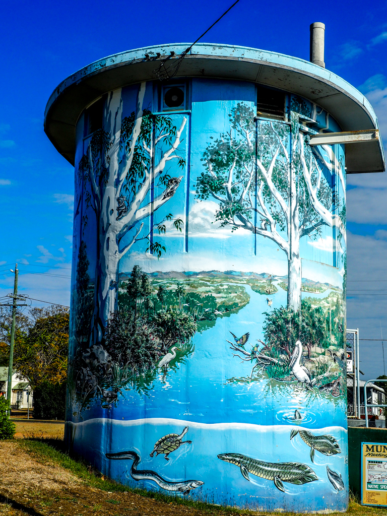
A short trip of 80 or so Km brings me to Brisbane, bit of a shock after a month mostly in the bush, but the roads are good and the GPS is a saviour. I have a number of towers to visit so I decided to do them all on Sunday, hopefully with less traffic. I am staying at Newmarket Gardens Caravan Park which is busy but well set out with reasonable size sites and a number of trees scattered through the park. I am under one and the shade is very welcome (29° C). If you need to camp in Brisbane I would recommend it and it’s not too far from the CBD. The first tower I visited was at Kallangur 33 Km north of the CBD. The name Kallangur originates from the Aboriginal word kalangoor, meaning a goodly or satisfactory place. The artwork on the water tower was a forest scene with trees and grass trees, reminiscent of places I had visited along the way. It was well very done but sun glare made it hard to get a really good photo. But the artists have captured a Queensland forest very well.
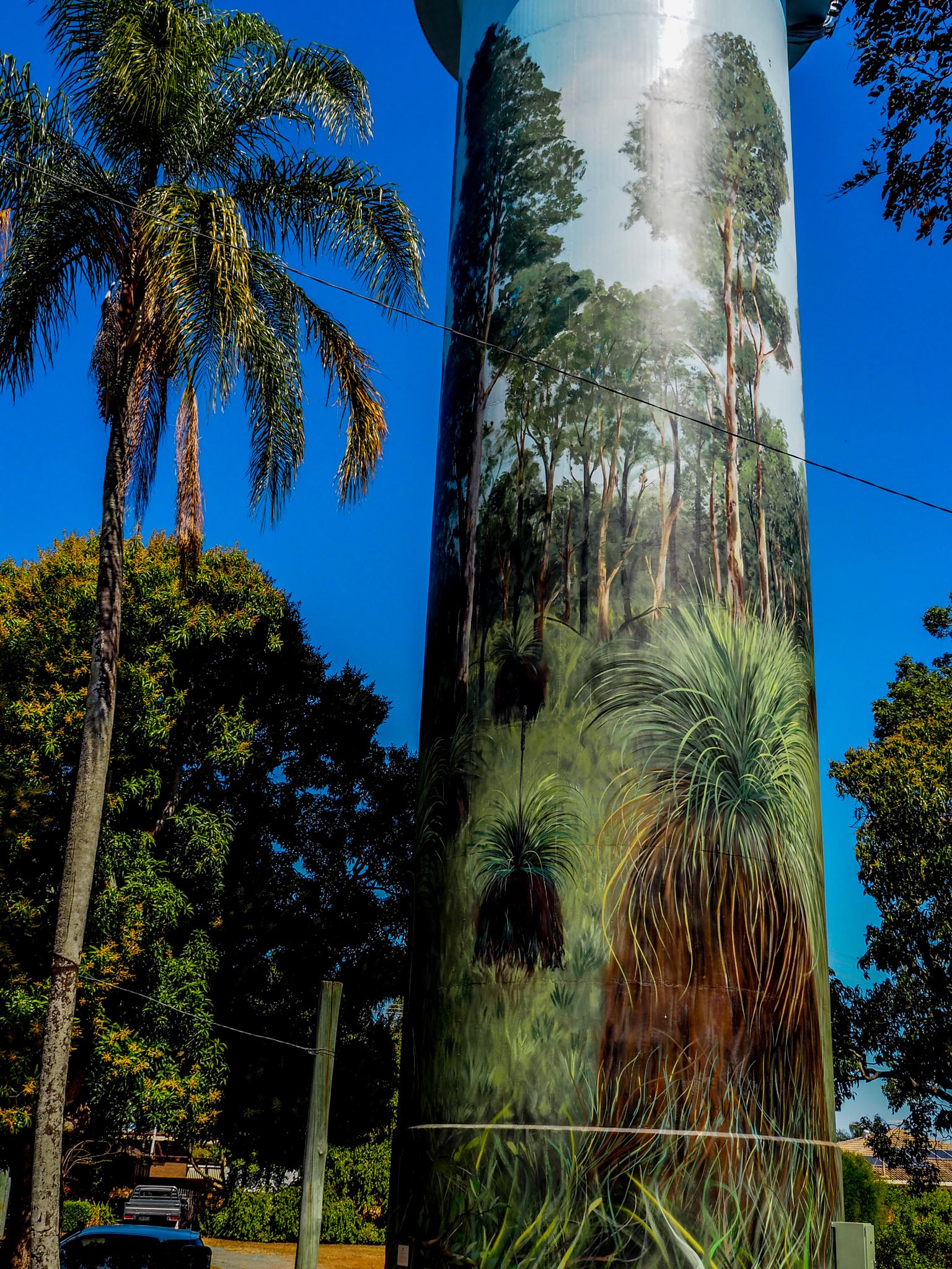
Kallangur Water Tower
There was a small memorial to Australian Defence Forces with statues of people dressed in clothing of all the different forces, there are several more statues that I couldn’t fit into the photo.

Kallangur Memorial Statues
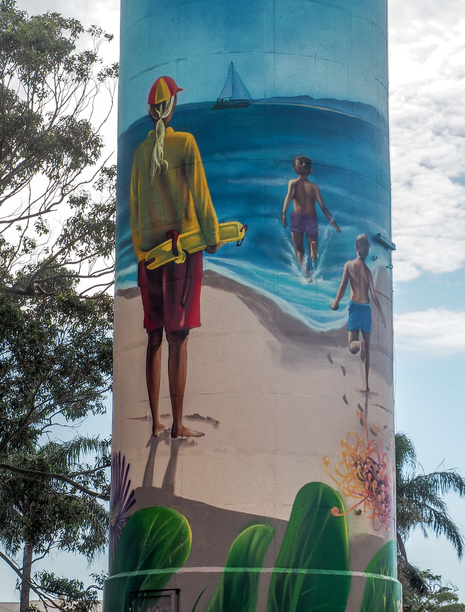
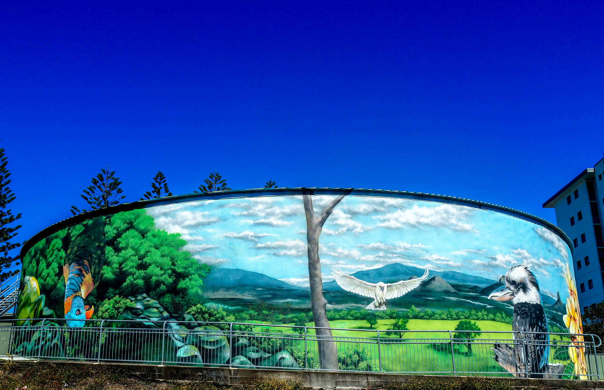
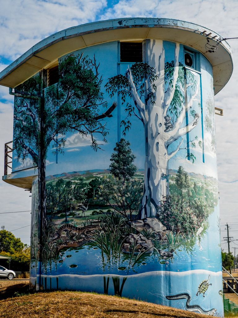
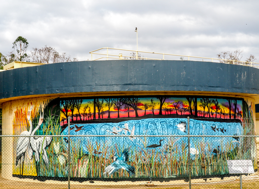
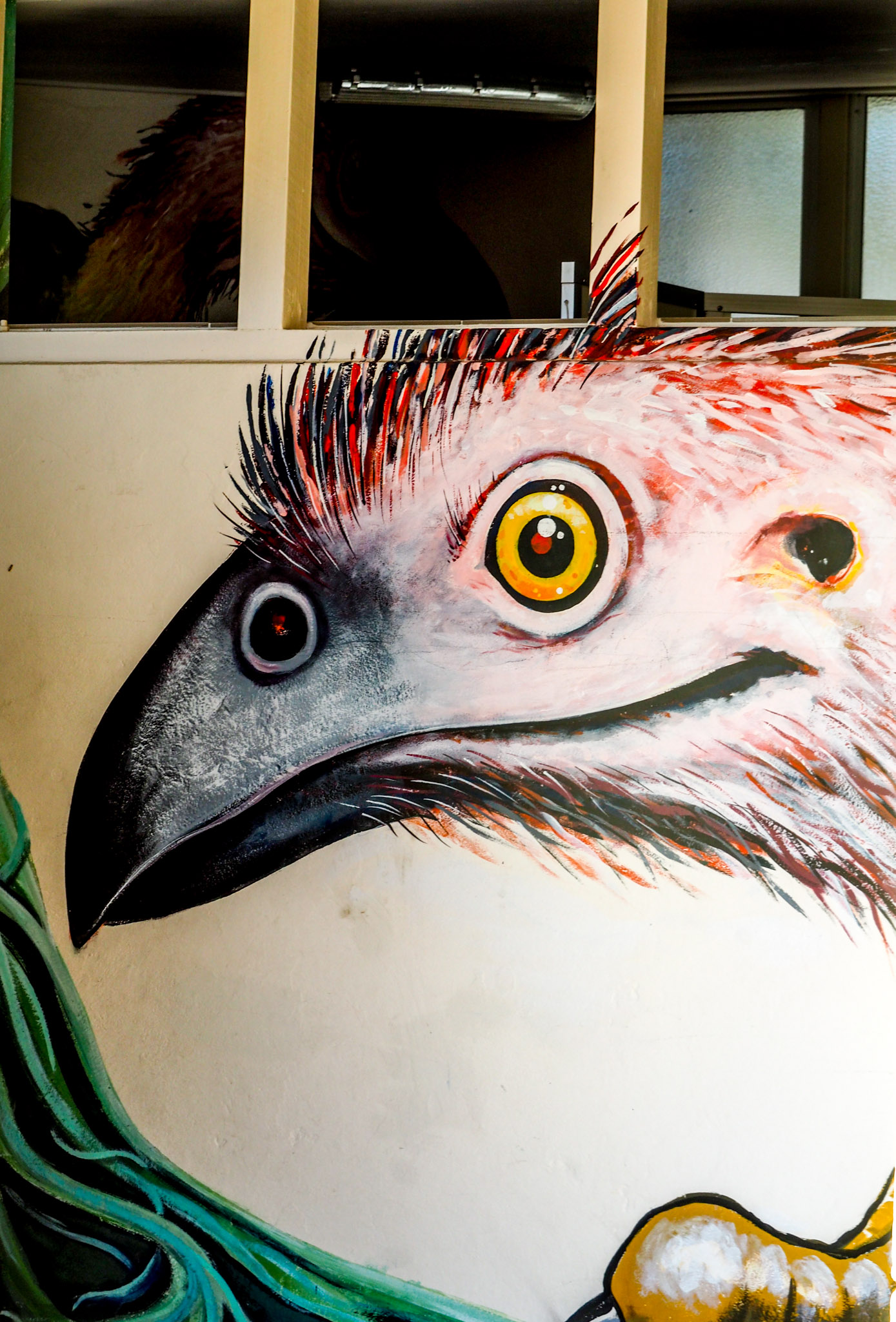
From here it was off to Ferny Hills about 20 Km NW of the CBD. Here the water tower is a squat one surrounded on two sides by houses and there were trees as well, so getting a full view into a photo was not possible on most sides. The artwork was excellent and detailed.

Ferny Hills Water Tower
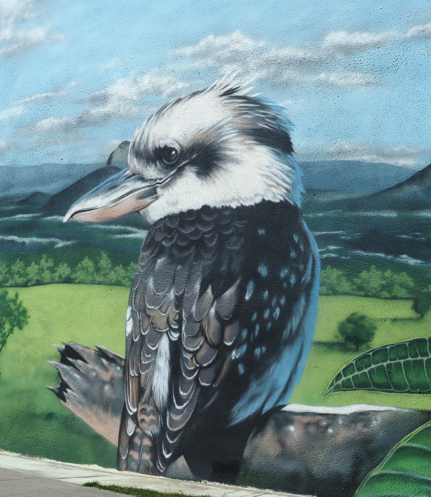
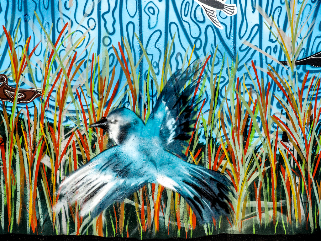
Here are some of the animals and birds on this tower.

Ferny Hills Water Tower Possum

Ferny Hills Water Tower Butcher BirdThe Blue Winged Kookaburra is a bit blue, artistic licence I guess.

Ferny Hills Water Tower Blue Winged Kookaburra and Green Tree Frog
I can’t find a parrot to match this painting, the closest is a Musk Lorikeet, but it’s a good painting.

Ferny Hills Water Tower Parrot
Back at the caravan park I took some photos of the artwork on the toilet block. The ones on the mens toilet looked like they wanted to scare men from going in.

Newmarket Gardens Caravan Park Spider
Newmarket Gardens Caravan Park Emu
In contrast the artwork on the ladies toilet is much more inviting.
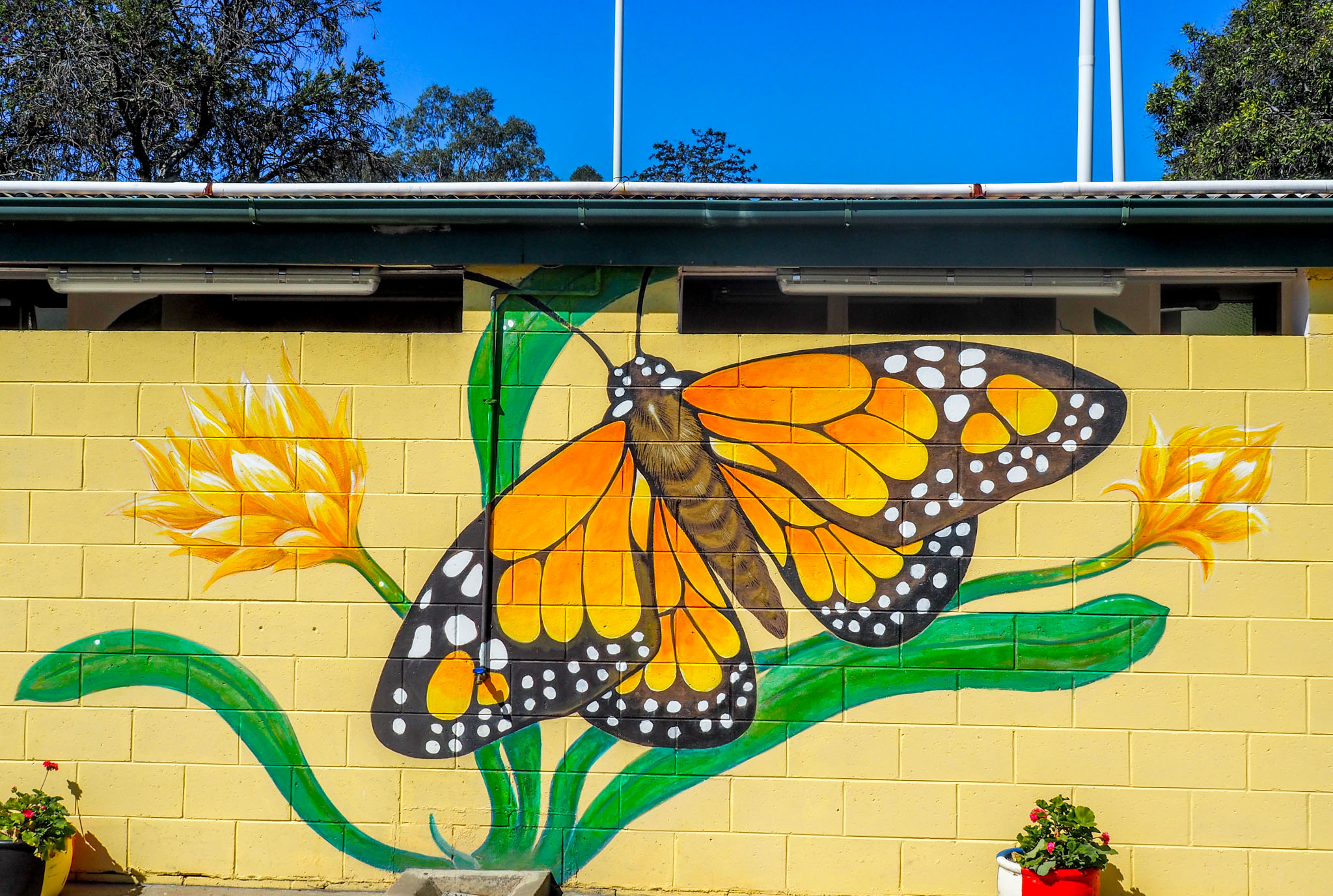
Newmarket Gardens Caravan Park Butterfly
Newmarket Gardens Caravan Park Flowers – Ladies Side
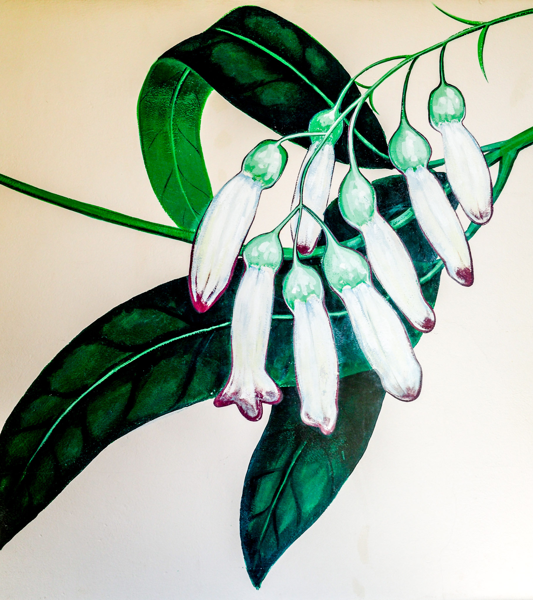
Another couple from around the toilet block:

Newmarket Gardens Caravan Park Flowers – Ladies Side #2
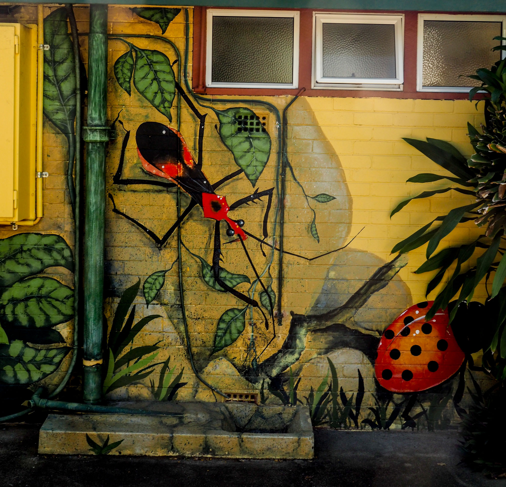
Newmarket Gardens Caravan Park Ant & Ladybird
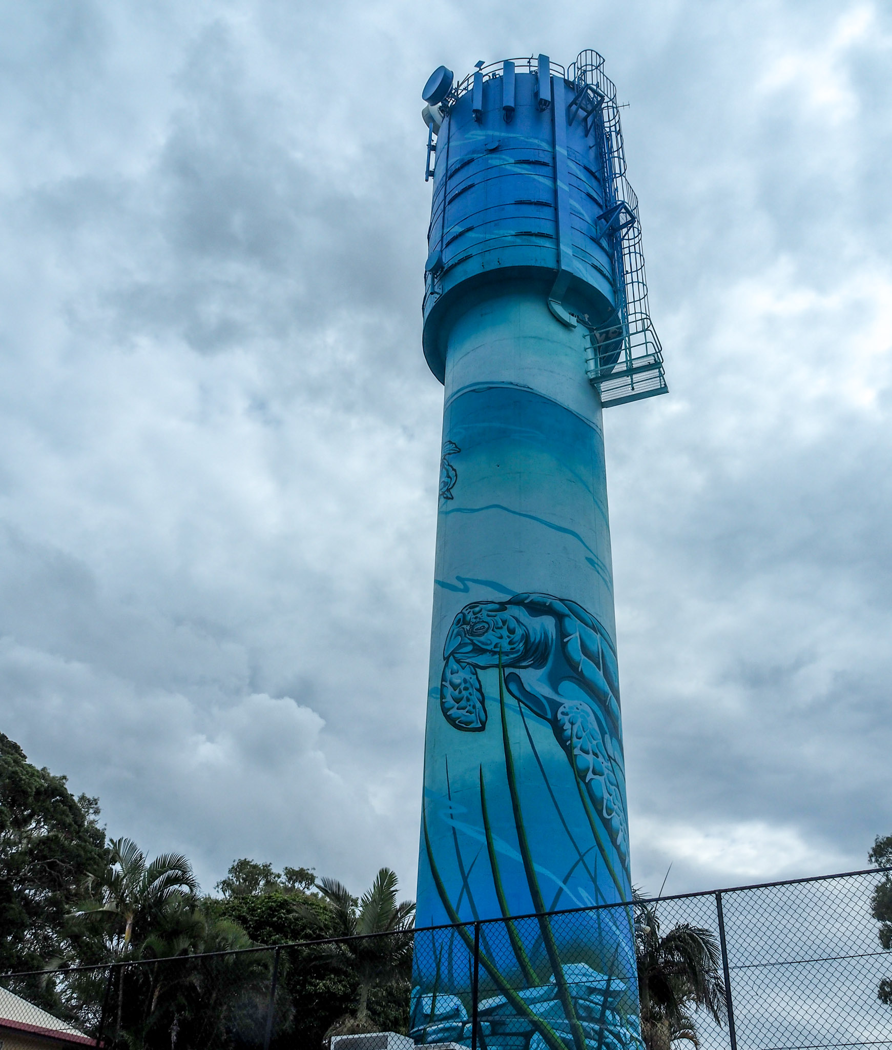
So later in the afternoon I headed off about 40 Km south to Logan to see a water tower decorated in aboriginal dot art style. I had two GPS programmed but still managed to circle the CBD once and cross the river three times before I got to Logan. There are a number of motorways that go right into the city but if you miss an on ramp you have to drive around a bit, but the motorways are good as are the arterial roads. The tower was excellent but inside a temporary construction style fence, not sure why, and this with big trees made photography difficult. There was also dappled shade on the tower.
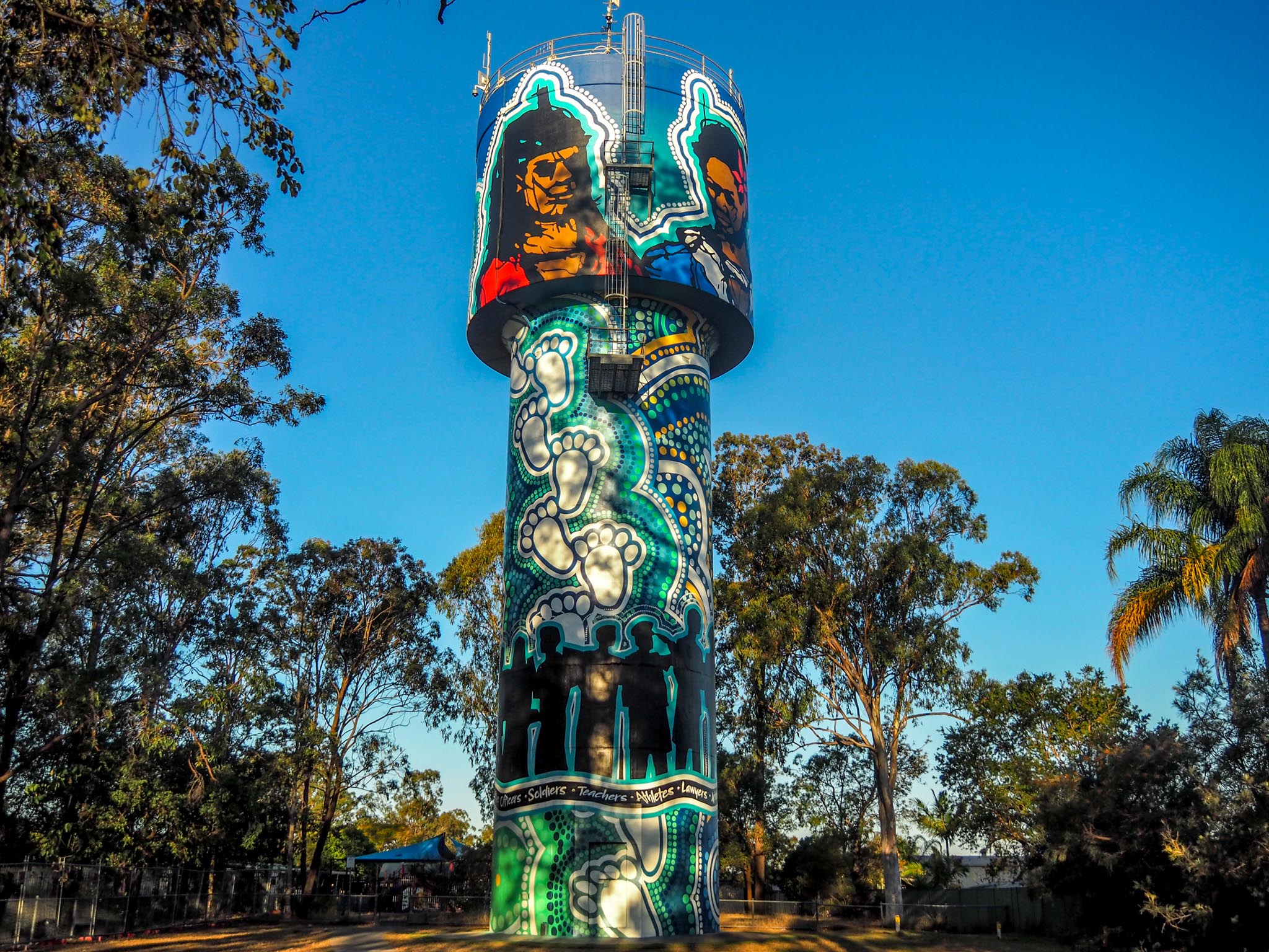
Chester Park Water Tower
You can see the dappled shade on the tower in the photo.

Chester Park Water Tower Two Faces on The Top
The view from the back missed the shade and you can see how good the artwork looks without the shade.

Chester Park Water Tower Rear Face

Chester park Water Tower Side View
I think the Chester Park tower may be the one I have liked best so far. From here I drove a couple of Km to wineglass water tower and got there as the sun was setting. It is an amazing structure that holds a megalitre of water and weighs 400 tonnes.
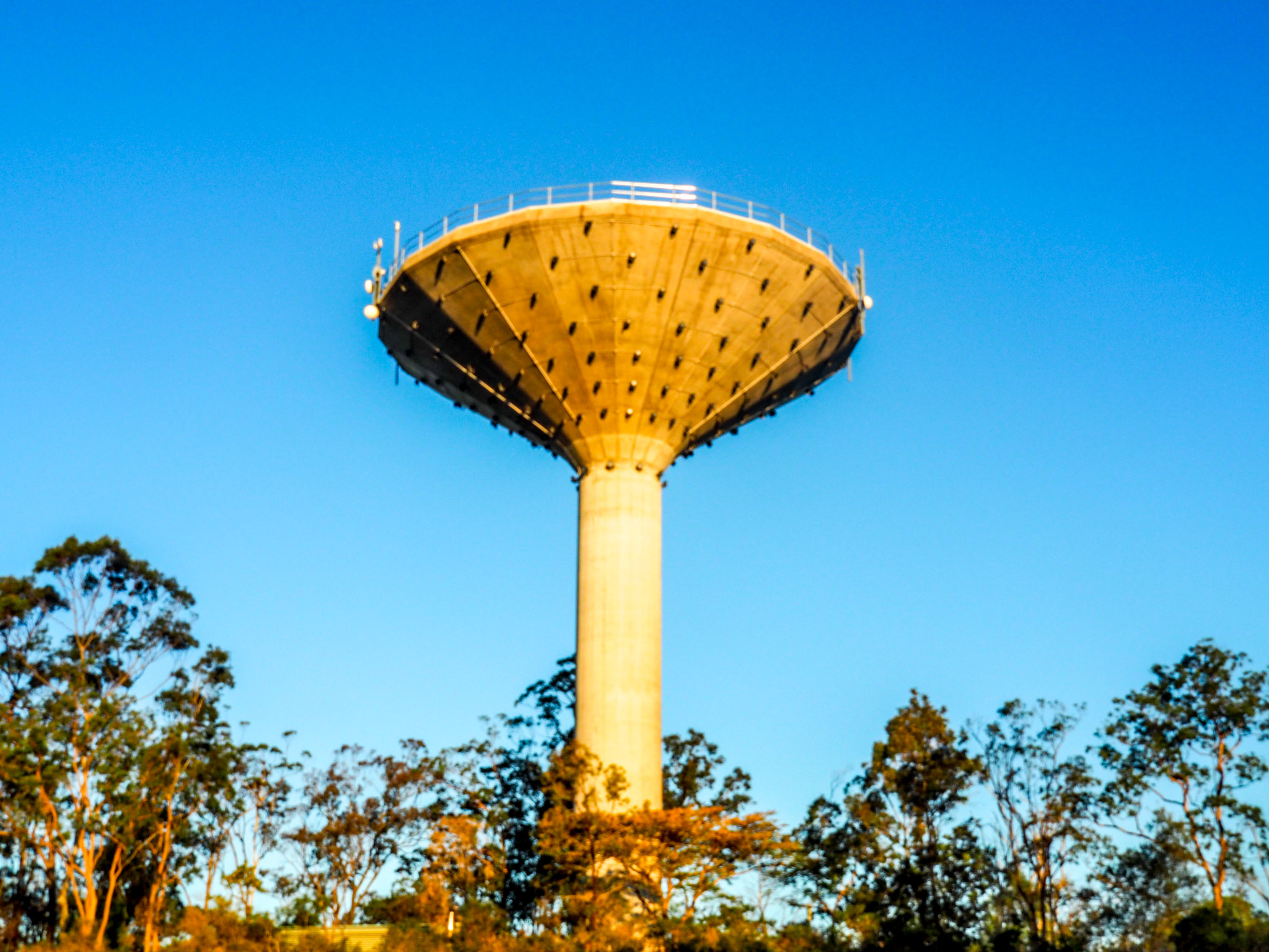
Wineglass Water Tower at Sunset
The black dots on the tower are lights that come on every night. Logan Council publish a webpage that gives the times the lights are on and the colour they will be. They change colours to celebrate and event or sporting team in the council area. They were to be green and gold on Sunday to celebrate Park Ridge Pirates Grand Final. the lights operate from 5.30 until 10.30 and the tower can be seen on the top of the hill from many kilometres away. I had to wait an hour until it was dark enough to see the lights well enough to photograph. This meant a trip back through the city in the dark guided only by GPS, I was not looking forward to that, but it was worth seeing the tower. Ever so often they switch back to the normal violet colour, which looks the best in my opinion.

Wineglass Water Tower Violet
On a normal night the violet tower would have violet lights on the flared section, not green and gold.

Wineglass Water Tower Green & Gold
Later in the night the green would cover the tower. There were three power poles near the tower with artwork on them, two of birds and one of a Numbat, they were all well done.

Wineglass Water Tower Powerpole Robin

Wineglass Water Tower Powerpole LBB
For none birdwatchers LBB is an acronym for “Little Brown Bird”, often used when the LBBs are in the treetops and can’t be identified.

Wineglass Water Tower Powerpole Numbat
So at six I set off home, this time I paid close attention to the GPS instructions and all the road signs, as there are multiple off ramps and I had to use about half a dozen of them on the journey. At one stage there was an interchange between two motorways that was different to both GPSs, so I just headed where I thought I should go with both GPSs off the road, but eventually the three of us were singing in unison. The main issue is that the road signs refer to suburbs that I don’t know, for example, I am staying in Ashgrove, but the signs refer to Newmarket which I now know is the next suburb. It was good to get home.
Tomorrow I’m off to Crows Nest near Toowoomba and will meet up with my cousin and his wife, Neville and Noreen, whom I haven’t seen for many, many years, so that will be good. Then I start heading down to the NSW north coast.