Uluru #1

Remember to click on the photos to get a larger view.

Early start from Kulgera leaving at 7 am, easy drive on bitumen all the way, everything sounds so quiet.  You pass Central Mt Connor on the way near Curtain Springs, many unfamiliar with Uluru think that this is Uluru.

When you see Uluru it is just as amazing as the first time, such a massive interesting rock.  Once I had set up I had to visit and took my first panorama with my new camera.

I took one of the other side but I forgot that you have to move in the direction set in the camera or change the direction, so I couldn’t stitch it together.  I may try again today.  As you travel around the rock you just keep taking photos but I won’t post them all.

As you approach the rock this is what faces you.  Toward the top right you may see a couple of white flashes, evidence that birds are nesting in hollows in the rock.

The photo on the right shows a crevice in the rock and you can see a bush growing half way up and at the top, they must be very tough plants.  There is a walk to Mutitjula waterhole which is a short walk through lovely small red gums and other small trees and grasses.

When Marg and I were here 25 odd years ago we were lucky to see water running down the rock from a rainstorm, it was a waterfall.There are rails around the water and a viewing platform so you can’t get back to include some vegetation.  This is the only waterfall around the rock.  It has a legend relating to the woman who later turned into the Rainbow Serpent, she was sad because her nephew had been speared in the leg, so she threw sand over her head in sadness, making the waterhole.  Finally my first view of the rock.

A lot of the country around Yularu is covered with Desert Oaks (Casuarinas).  The young ones have a very strange shape looking like a folded BBQ umbrella.  The older trees then take on the appearance of a normal tree.  You can see both in this photo.

Now off to the Olgas for a walk in the Valley of the Winds.

Posted in 2018 | Leave a comment

Coward Springs to Kulgera

Off early today (10/8) with around 400 Km to follow yesterdays similar distance drive. The Oodnadatta Track is in reasonable condition, but the dust is horrendous, I had to clean out the van to get rid of the dust, for the first time. The first stop was at William Creek for a refuel, the only change since we were here in the 1980s is that the pub has a wooden floor rather than just dirt.


Then it was on to Oodnadatta through very flat and barren landscape, the only break was a line of trees that indicated acreek and then you were in it with lots of hardy trees looking very healthy despite the drought.


Along the way you could see the remains of the old Ghan track that generally follows the road. Every now and then were the ruins of a fettler’s houses and a high water tank for the steam engines. The photo gives you an idea of how desolate the country is, and not just in drought.


The next landmark is the Algebuckina Bridge on the old Ghan railway, the railway closed in 1980 with the last trip from Maree to Oodnadatta. It is a massive bridge over what is usually a beautiful waterhole on the Neales River, but it is dry at the moment. The bridge took 352 men to build, and consists of 19 x 31 metre spans, it was opened in 1892. In 1926 it was strengthened to take heavier trains.


Then on to Oodnadatta, home of the famous Pink Roadhouse. The roadhouse was run by Adam Pate and his wife, but Adam tragically died some years ago in an off-road racing accident. He was a real pioneer, in 1986 we met him at the roadhouse and he marked up our maps to show roads through the Simpson Desert. Our maps were the latest available but 20-30 years out of date. Another thing he did was to erect tens of signs through the area marking features or roads that were otherwise unmarked. The photos below show the Pink Roadhouse, which looks the same as it did in 1986, and an example of one of his signs.


The painted desert is a series of hills, the Ackaringa Hills, consisting of rock of different colours. Mt Batterbee is a prime example.


But the hills around Mt Batterbee are all coloured and some are of strange shapes.


Along the roads all the way you see knarled old Mulga a characteristic tree of the outback, tough and very hard timber, they survive the worst conditions. There are 35 different types/species and they are acacias, strange as acacias are often short lived, but some Mulgas live for many many years. I love them and their timber, great for wood-turning.


Tomorrow I am off the Kulgera on the Stuart Highway and then on to Uluru or Connor Springs Station about 100 Km from Uluru. The wind is still blowing and tonight it is at its strongest, a veritable howling gale. When you are towing it increases the fuel consumption by 5-6 litres/100 Km, and at $2.10 per litre it sure costs. I will be glad when it stops, but it does have benefits, on dusty roads it blows the dust away from vehicles you may be behind or approaching vehicles. So it’s not all bad.

The trip to Kulgera was uneventful but through some good looking country, trees and more saltbush and grasses. It was good to get on the Stuart Highway and bitumen, it is so quite. The country along the Stuart is much better tahn on the Oodnadatta Track, lots otrees and large bushes and plenty of dry grass. I’m at Kulgera now but sadly no 3G, but I will go over to the pub and try and use their WiFi.

Posted in 2018 | 3 Comments

Flinders Ranges to Coward Springs

I said goodbye to Nadine this morning (9/8). It was a sad farewell, we both welled up, we have had such a good time together. Now I miss Marg even more because Deen bought back memories of the times Marg and I spent camping together, great times and sadly only great memories.

On the way to Coward Springs on the Oodnadatta Track I went through Parachilna gorge which becomes a real gorge after about 15 Km. Beautiful scenery with high mountains, ancient red gums and rugged rock faces. The road was quite rough so it was good we didn’t take Deen’s mini all the way through it.


On to Leigh Creek for supplies and a big disappointment, the Bakery in Copley 5 Km away had closed permanently. I was hanging out for a pie for lunch, they made fantastic pastries. Anyway at Lyndhurst the roadhouse sold home made steak and mushroom pies, and it was excellent. Just before Maree I passed Lake Eyre South. I have been here 3 times before and never seen it empty, the first time was in the early 1980s, but it was empty this time, which is its normal state. It is 12 m below sea level and cores a massive area of around 5000 sq Kms. I put the drone up in the wind, but even then it was hard to capture the size.

I was going to stop at Marree, but it was early so I pushed on to Coward Springs. This used to be a station on the old Ghan line and had a hotel, a station building, a station masters residence (4 rooms), and an engine drivers cabin (2 rooms). The quaint hierarchical distinction between residence and cabin is confirmed by the original drawings, too much for an engine driver to have a residence! Only the engine driver house remains and it is now a museum containing lots of info on the history of the springs and its development.

The spring is really a bore tapped into the great artesian basin (the basin is under 1/5th of Australia) and it has created wetlands some 1700 hectares in area, a massive wetland in such a dry area. There is open water, smaphire areas and reedbed areas. There are 99 different plant species and 126 different birds have been observed. The hotel closed in 1965 and this photo is of the hotel in 1915, I may be old, but no I didn’t take it!


The campground is well set out and only $12.50 p.p. per night. There is no power, drop toilets and limited drinking water, but you can have fires. The camp-sites are tucked in among old sheoaks. They have also built a spa that is on top of the bore, which gives the spa effect


After tea I went for a short walk and saw my first desert sunset for quite a while, it was beautiful.


Off to Oodnadatta and Arkberinga Station near the Painted Desert.

Posted in 2018 | 5 Comments

Flinders Ranges #5

Pack up day today as we both leave Wilpena Pound tomorrow.  I will be heading for Maree on the Oodnadatta Track and Deen is going to Clare for one or two nights.  After that she will head for the Barossa and then Dimboola then home.  I have enjoyed her company a lot, she reminds me of Marg a lot, practical, competent camper, good cook and caring as well.  I am sad to see her go.

So today we went for a drive toward Hawker to visit a couple of lookouts we skipped on the way here.  The views along this section of the Hawker-Wilpena Road are just stunning, photos don’t do them justice.  Deen took a panorama with her iPhone as I hadn’t worked out how to do this on my new camera.  The panorama looks great if you enlarge it by clicking on the photo.


The skies were quite stormy at times today and it was still very windy way from Wilpena Pound, but I put the drone up anyway and got one photo before the message came up on the control screen that it was too windy and I should land it.  It would not take any more photos.


My blogs will be published less frequently after here as 3G coverage maybe not available at every stop and I may not reply to comments and emails for a few days.

Posted in 2018 | Leave a comment

Flinders Ranges #4

Remember that a click on the photos gives you a much larger and better picture.

Some people liked the photo of Aroona valley but could not gauge the scale.  To Clarify, the  valley and is about 12 Km long, the bluff is probably 5 Km away.  The mountains in the far distance maybe 40 Km away.


While at the Blinman Pub yesterday we bought a Tawny port that came in a typical bush container.

We enjoyed some last night with a custard tart from the Blinman Bakery, both were very enjoyable.  Maybe the port helped us with the cryptic crosswords, as we got 3 Age cryptics out completely.

Last night while we were warming by our fire, the clouds opened up enough for the sun to strike the mountain opposite the campground.  At Deen’s suggestion I braved the chill and put the drone up to capture this photo.  The sky also shows how stormy it has been.


It rained overnight and the wind was still icy in the morning, but the rain cleared so we went to Apealinna ruins.  This was a cattle run started 1856 by Joseph Wills who managed to get everyone offside as his boundaries were disputed.  He didn’t fit in with the graziers and landed gentry in the area.  He carried on a dispute for 13 years and managed to get imprisoned for 4 years for shooting a shepherd on trumped up evidence.  His gun was dusty, the bullet could not have reached the shepherd and the shepherd was uninjured.  Such was the pull of those who opposed his claims.


The rock work building his cottage was fairly rough with untrimmed rocks of many different sizes held together with mud, but it is still standing after 162 years.  In 1859 copper was discovered and mining started.  As Wills had the only permanent water the miners built a small settlement on the opposite side of the creek, which upset Wills no end.  More furious letter writing was to no avail, as the mining company had contacts in government and managed to have 5 square miles excised from Wills lease, and made public land, it sounds really unfair.  The mine Managers house was professionally built and is nearly intact except for the thatched roof.  The rock work is much more even and rocks were trimmed to fit.  The mortar had lime in it to strengthen the mud.  It was a 3 room house.


Some small one room miners huts were nearby, but nearly all broken down and of very rough construction.  In 1871 Wills and his wife and 3 children left the property as they were behind in their rent only having just survived the bad 1860s drought.

There are two picnic tables near the ruins so we parked the car near one table as a wind break and cooked some sausages to be had in rolls for lunch.  We used Deen’s portable fire BBQ to cook the sausages and it worked very well.  You can tell it is cold as we well rugged up, but we enjoyed ourselves.


On the way to Appealinna we stopped at Hucks Lookout for a magnificent view of the ranges.


We saw similar, but less spectacular, views on the drive back from Blinman yesterday on Flinders Ranges Road.


Sadly tomorrow is our last day in the Flinders, I head north and Deen heads south.

Posted in 2018 | 2 Comments

Flinders Ranges #3

Sunday was going to be sunny, appropriately, but still windy, so we decided to drive through Bunyeroo and Brachina Gorges.  It was a wonderful drive with fantastic vistas, beautiful rocky cliffs, lovely massive old red gums and rock strewn creeks.  How could you not enjoy it.  The view into Bunyeroo gorge was eye popping.

The road through the gorge was rough and stoney but easy to drive.  Then onto Brachina Gorge where a similar road took you through much higher cliffs and a wider gorge.  I did put the drone up in the wind and was able to get a reasonable photo.  The ground level photo is of a different part of the gorge.


In the early 1980s we bush camped in Brachina Gorge with Jim and Jenny Ellis and their children, before there were any facilities, so we re-visited our camp site.  It was now set out with 5 defined sites, a drop toilet and not much else, but it was good to see it again.

This photo is from our campsite and we all climbed the mountain in the photo.  Nigel, a fireman ran up and down in 2 hours as part of his training for a charity round Australia run.  He flashed a mirror to us from the top to confirm his achievement.

You can just see the top af a hill to the left of the mountain, Jim and Peter Ellis and I spent hours trying to catch wild goats running up and down this hill.  You could get very close, but they always skipped away at the last minute, I think they were having fun.  Goats were in their peak at that time and since the 1980s 100,000 goats have been removed from the Flinders as part of Operation Bounceback, this is an amazing number and the bush is recovering as a result.  Possums and Quolls have been introduced recently.

Deen and I had lunch in Brachina Gorge near our campsite.


There is Aroona Valley nearby which runs into Brachina Gorge.  The Haywards settled here in 1851 and started a sheep station.  Mr Hayward started with 40 pounds capital and as a result of gross overstocking left for England a rich man with 40,000 pounds only a few years later.  He employed a ships carpenter to build the main house and a second 2 bedroom house with a cellar, only the rock foundations remain.  In fact by 1889 the houses were already in ruin despite their solid construction,

The photo is for the second house foundations and the cellar.  The view down the valley is very good so I put the drone up again in the wind, the highest I have sent it up yet (I couldn’t see it!) and took a photo down the valley.

The view from the house ruins was also good.  I guess if you are the first settler you can name mountains.  In the range you can see a bluff which is Haywards Bluff, the next peak is South Mt Hayward, and the next Mt Hayward, perhaps he took it a bit to far.  The range is the Heysen range named after the painter Hans Heysen who was the first artist to capture the colours and grandeur of the Flinders.

A pug and pine house was built in 1925 in the flats below the old house and Heysen first stayed here in 1926, and he subsequently visited many times.  Most of the pug is gone except for a small section to the right of the fireplace, it looks like rendering and is made using fire baked limestone that becomes lime.


On the way back to Wilpena Pound we visited the ruins of Youngoona Hut, an outstation of Aroona.  Shepherds used to stay here to muster stock 4 times a year.  The timber walls have long since decayed but the 2 stone and mud chimneys still stand, well one of them.

We had rain and wind late afternoon and night so no fire, we sat in my caravan and did cryptic crosswords.  Monday was overcast and cold so Deen drove us to Blinman for a counter lunch, about 60 Km away at the top of the Flinders.  It is an excellent bitumen road all the way.  Blinman is an old mining village with some lovely old buildings including the memorial hall dating from 1896.  The pub is a classic bush pub and the walls of the bar are covered with countless business cards.


We then headed down Parachilna Gorge road toward Parachilna, a dirt road, in Deens Mini.  After about 10 Km we decided that the clouds looked too threatening and the road was already a bit wet so we turned around and headed for home.  The gorge drive was pretty with lots of Mallee Gums in places.


On the way back we had to stop and photograph the view toward Wilpena Pound, but the photos never do the scene justice.

By the way if you click on the photo you will get a much larger view which does do the Flinders better justice.

Posted in 2018 | Leave a comment

Flinders Ranges #2

We enjoyed a walk into Sacred Canyon where there are aboriginal engravings.  The canyon is relatively short at around 250 metres and it has high rock walls.   The person in the photo is not a Yeti, it is me at the top of one of two dry waterfalls that you have to scramble up.

There are beautiful large red gums in the creek hat flows through the canyon making it a very attractive place.


Near the end of the canyon is a rock shelter that the aborigines used to inhabit and make time to do the engravings.

The engravings are hard to see except for the circles that represent springs.  At the top right there is an engraving of a kangaroos footprint and an emus footprint.  There are other engravings that do not show in the photo as they are very faint.

Today I started with scrambled eggs for breakfast on sourdough toast and Deen had sourdough toast with blood orange marmalade I made last year, it was all delicious.  Later today we will drive through Bunyeroo Gorge and visit the ruins of Aroona Station.


Posted in 2018 | 4 Comments

Flinders Ranges #1

We headed for Morgan from Wyerfeld, a 467 Km trip, but we left by 8 am so arrived at Morgan at about 3 pm.  On setting up I found the caravan 240V charger had blown up, so Deen did some googling and found a place in Wakerie that had a suitable replacement.  So off on a 100 Km round trip which involved 2 ferry crossings of the Murray, a first for Deen in her mini.

Once back at camp I had to work quickly to unwire and remove the old charger and fit the new one before it got dark, but a friendly neighbour helped by holding a torch.  We chatted while I worked, he had a Kimberley Karavan like the one we sold in 2013.  All good so we are back in business.

From Morgan it was off to the Flinders Ranges for 5 days, but we just extended for another two.  It is a great campground with power sites, tap water at each site, a fireplace and stoney gravel on the sites so when it rained, and it did, the first in 19 months, the sites were not muddy.  It is still very windy but I put the drone up to take photos of our camp and the campground.


As you can see it is a beautiful campground with lots of trees.  In the distance we have the backdrop of the ranges.


Today we walked around Wilpena Pound Station a working sheep station for 135 years starting in 1851.  The area was “Waste Land” and 2 English doctors financed Wilpena and two other runs, but the managers had to generate big returns so the stocking rates were the highest ever seen in Australia, and of course the country suffered.

The first building was the Bookkeepers Hut and Buggy shed made from pine logs and pug.  The builders had to gather limestone and roast in a red gum fire to make it into lime suitable for pugging between the logs.  The is the oldest remaining building on site and dates from 1853.

The next building was the blacksmiths with a reasonable sized forge, massive anvil and lots of other tools.


The blacksmith was obviously an important person – shoeing horses, repairing wagons, making gates, making tools, etc. so he had his own cottage, which is more substantial than the bookkeepers.


Then we walked to the store house, another stone construction with a galvanised iron covered portico.


Next on our tour were the stables, again a stone construction.  When all these buildings were first built they had native grass thatched roofs but this was replaced with galvanised iron in the 1880s.  The stables seem very small for such a large station.

Now off to the homestead which was built in 1859-1860, a stone building with a surrounding verandah, it is now used as park headquarters.  There was a massive rud gum behind the homestead which was close to the biggest I have seen.


Now we will head for sacred canyon, the site of some rock engravings and for a picnic lunch.


Posted in 2018 | Leave a comment

Wimmera Silo Art and Wyperfeld National Park

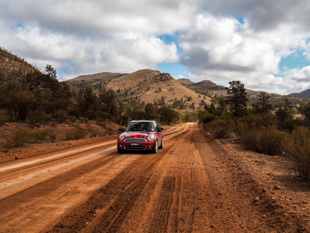
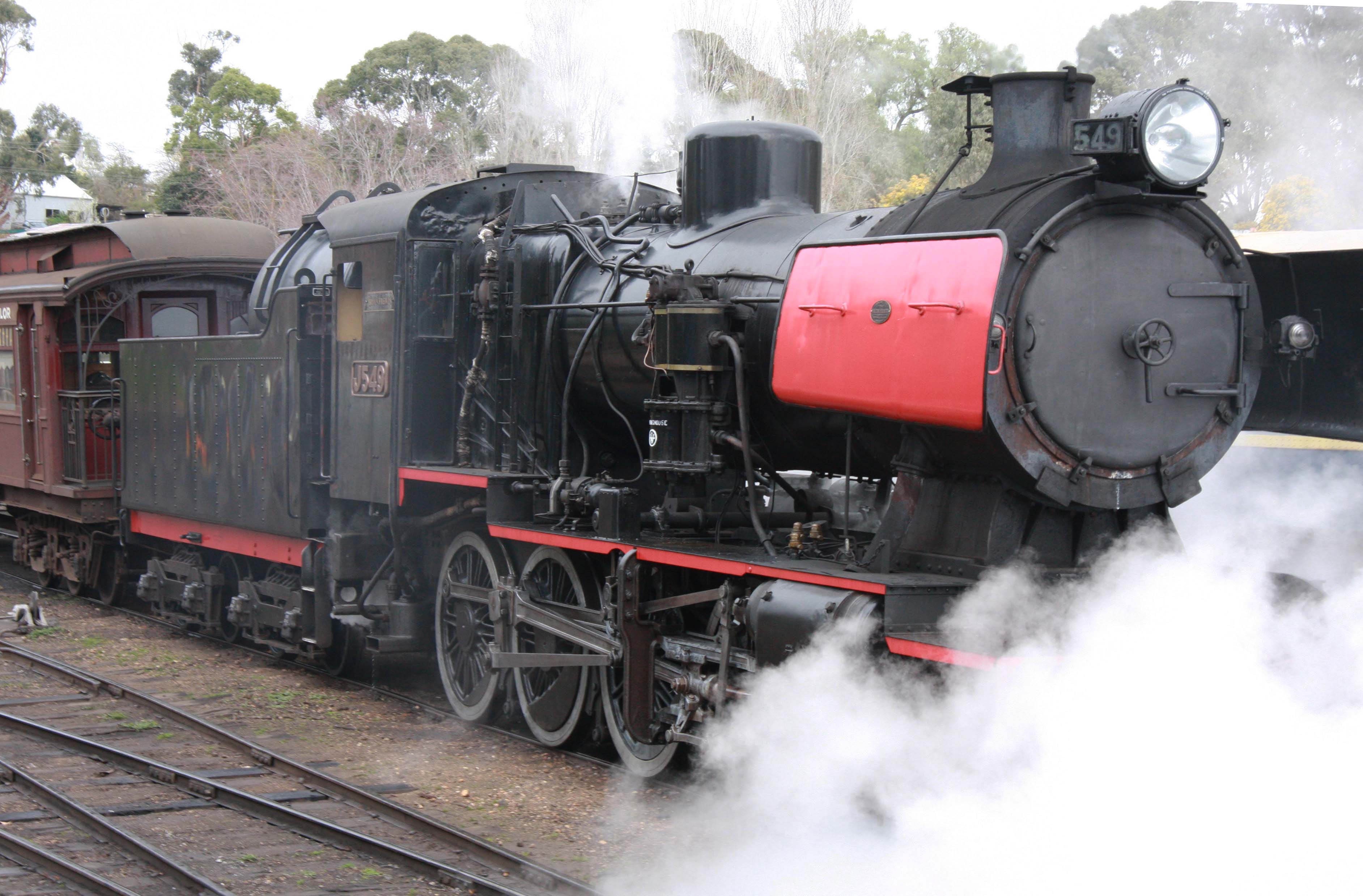
After sorting out some health issues, at last I am travelling again after a long break. This trip I have my daughter Nadine with me for the first 2 weeks and we are heading through Victoria to see the Silo Art sites in the Wimmera. After that we will be going to Wyperfeld National Park for a few days and then onto the Flinders Ranges for a week or so. We will then split up with Nadine returning to Melbourne via Victor Harbour visiting a friend and maybe Kangaroo Island on the way. I will head up the Oodnadatta Track to Central Australia.

Our first night was in Rapanyup at the Lions Memorial Park where $10 gets you a power site, hot shower, toilets and a free BBQ with picnic tables, excellent value. We visited the silo site here to see the artwork.


The silo art trail is spread out over 200 Km and exists in 5 towns in the Wimmera – Rapanyup, Sheep Hills, Brim, Rosebery, Lascelles, and Patchewollock.  They are in easy driving distance of each other and could be all viewed on the one day.

The two paintings in Rapanyup are the work of a Russian mural artist Julia Volchkova and depict a local netballer and Aussie rules player emphasising the importance of sport and community to a small country town.

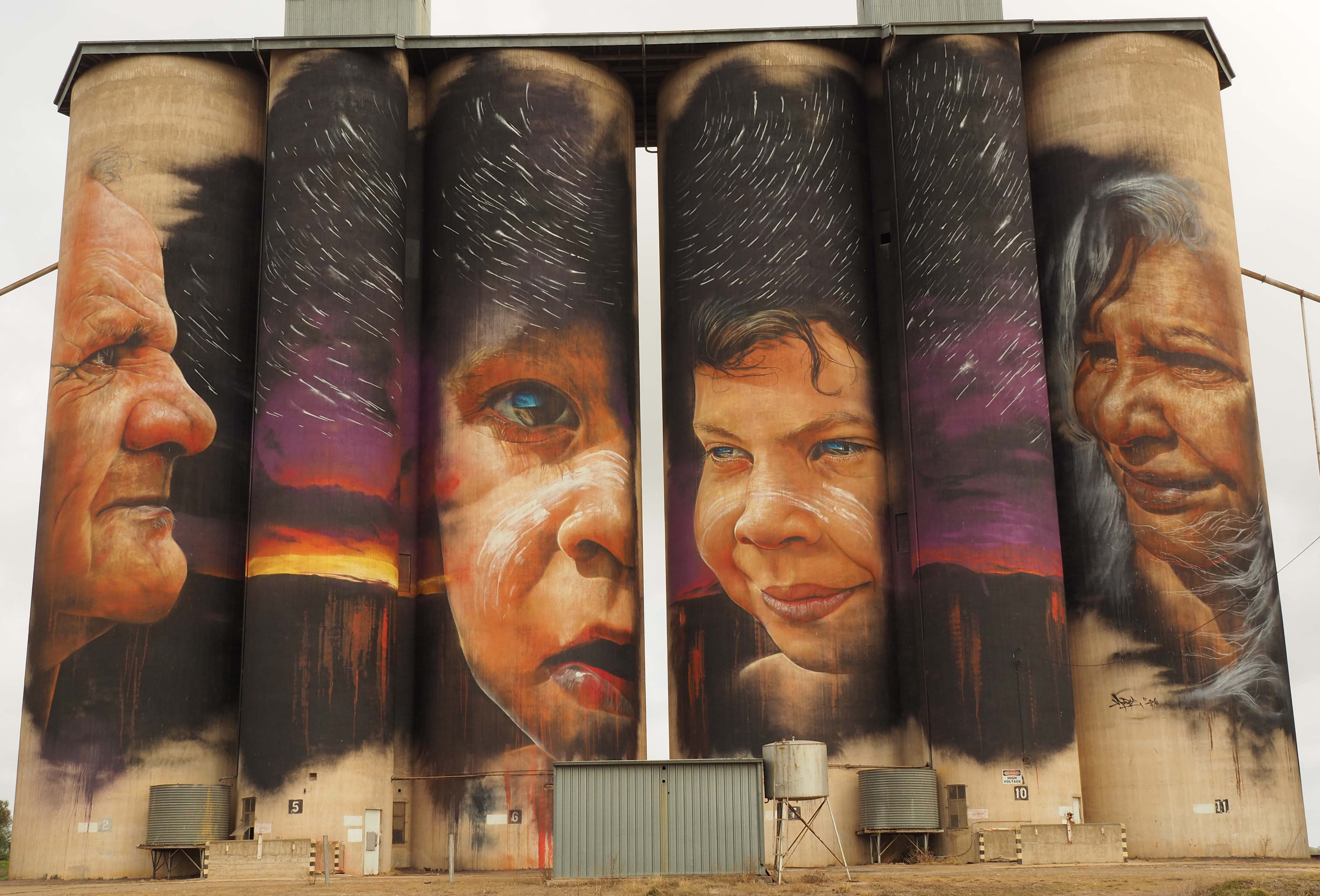
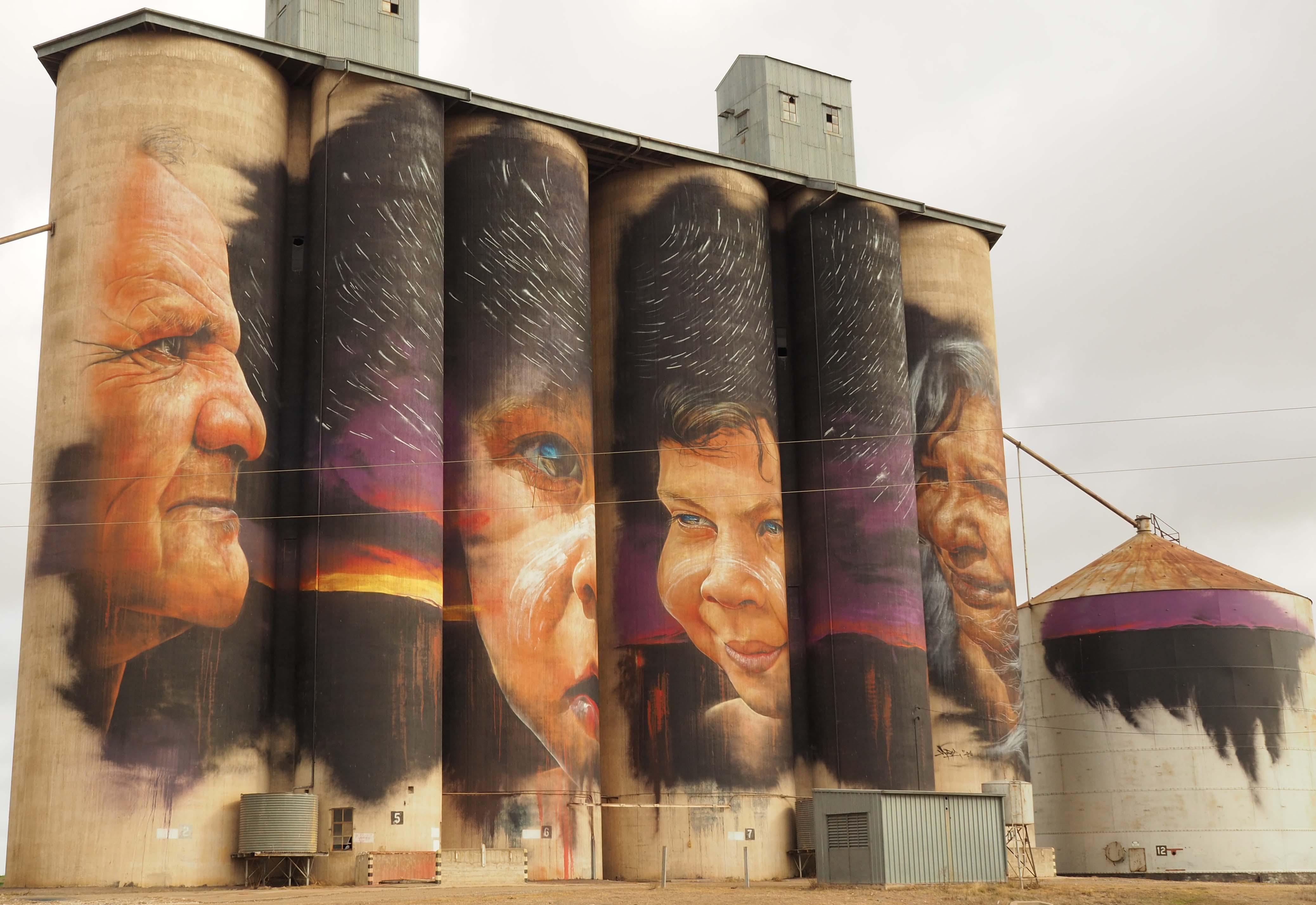
The next silo is in Sheep Hills, a one house town with an empty pub. The art on the silo here depicts two local aboriginal elders and two children and was painted by a Melbourne artist Adnate who has painted other large scale murals in Australia and overseas.


The next silos were at Brim and are the first silos painted in Victoria.  It is a small town and like Rapanyup has a council run caravan park.  Here the silos are of four farmers representing the difficulties the local community face with economic pressures and the effects of climate change.  They were painted by Guido van Helten who was born in Canberra and a driver in the development of the large scale art movement.


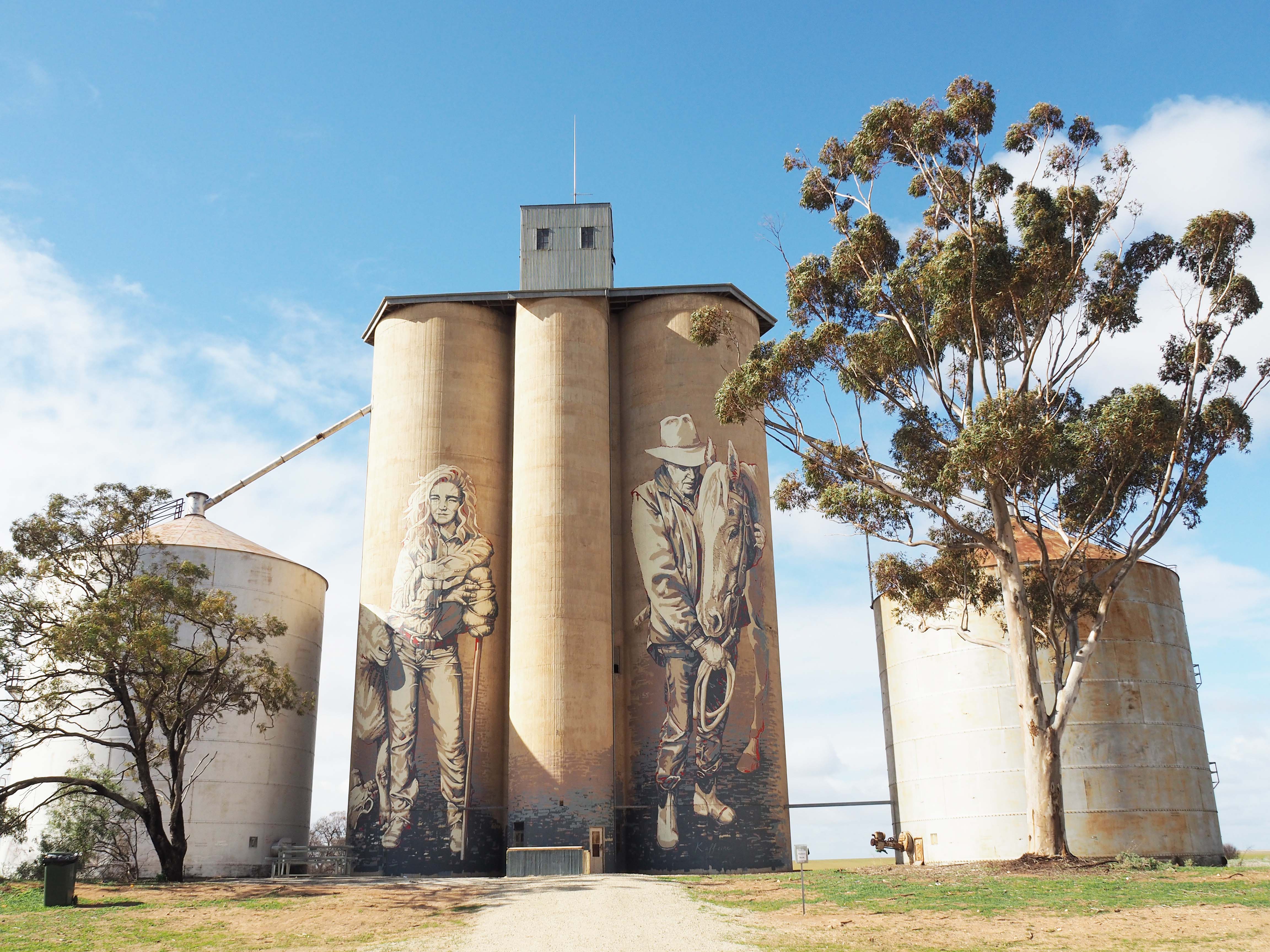
The next silos are located at Rosebery another small town where the silos were painted by a Melbourne artist Kaff-eine, clearly an adopted name.  They depict a local sheep farmer portraying the grit and determination that farmers need to survive droughts and other difficulties.  The other silo shows the close connection between a farmer and his horse.


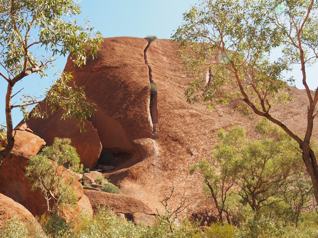
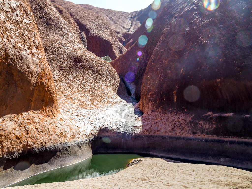
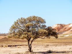
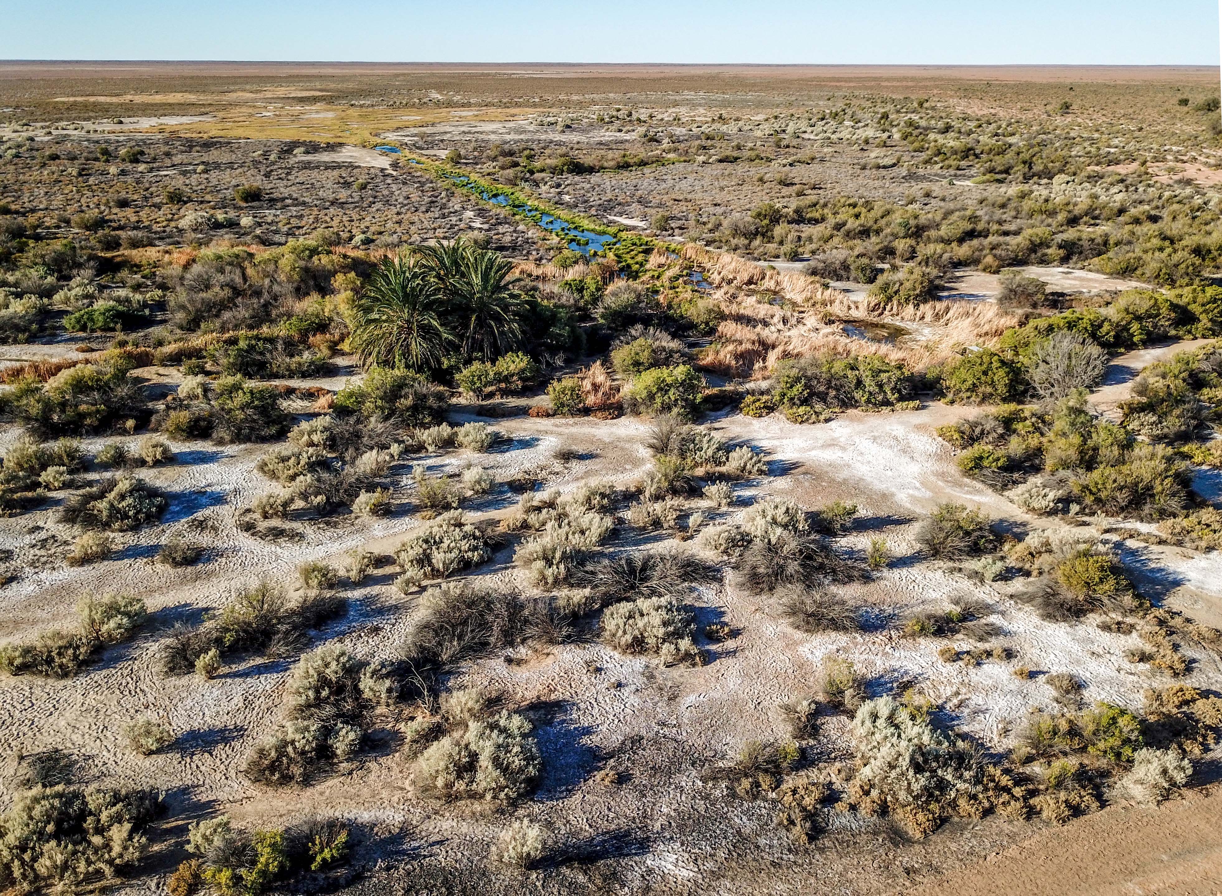
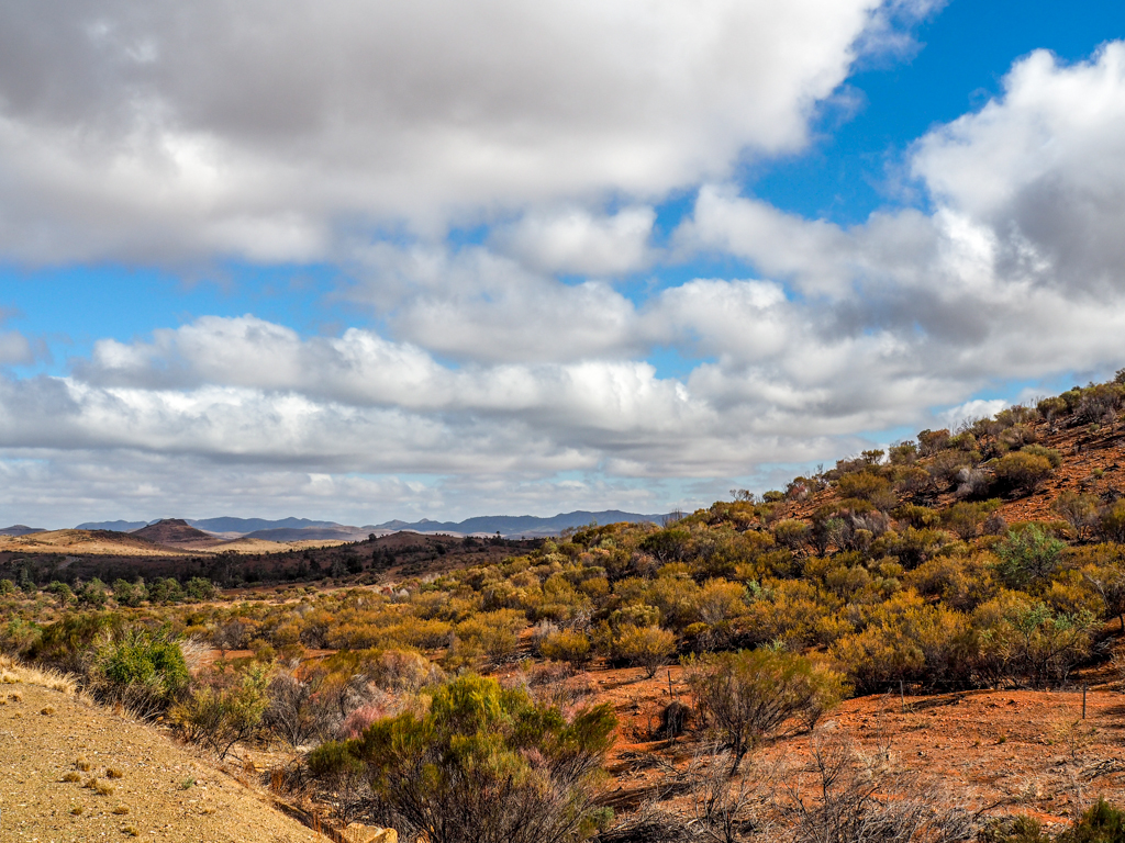
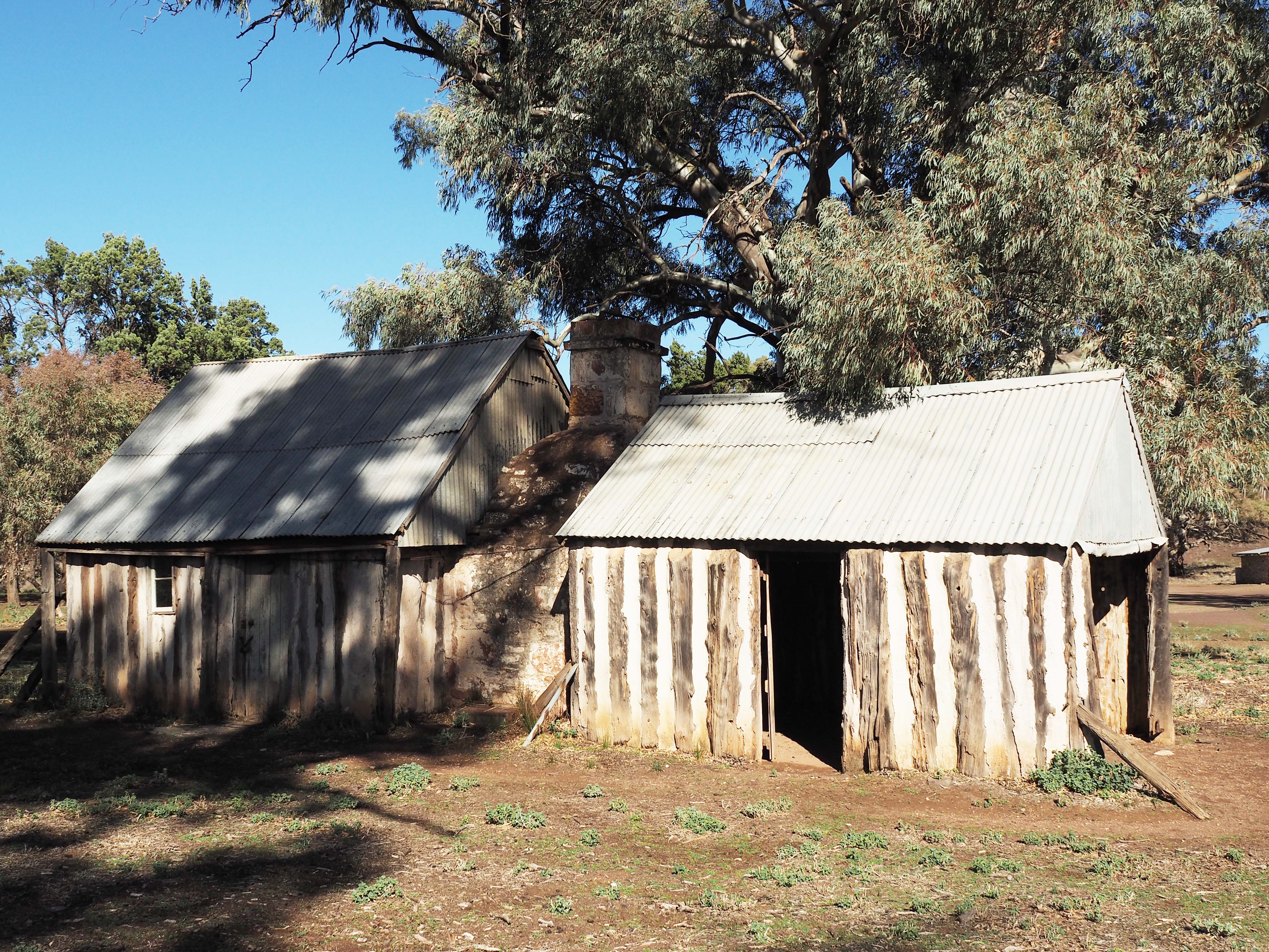
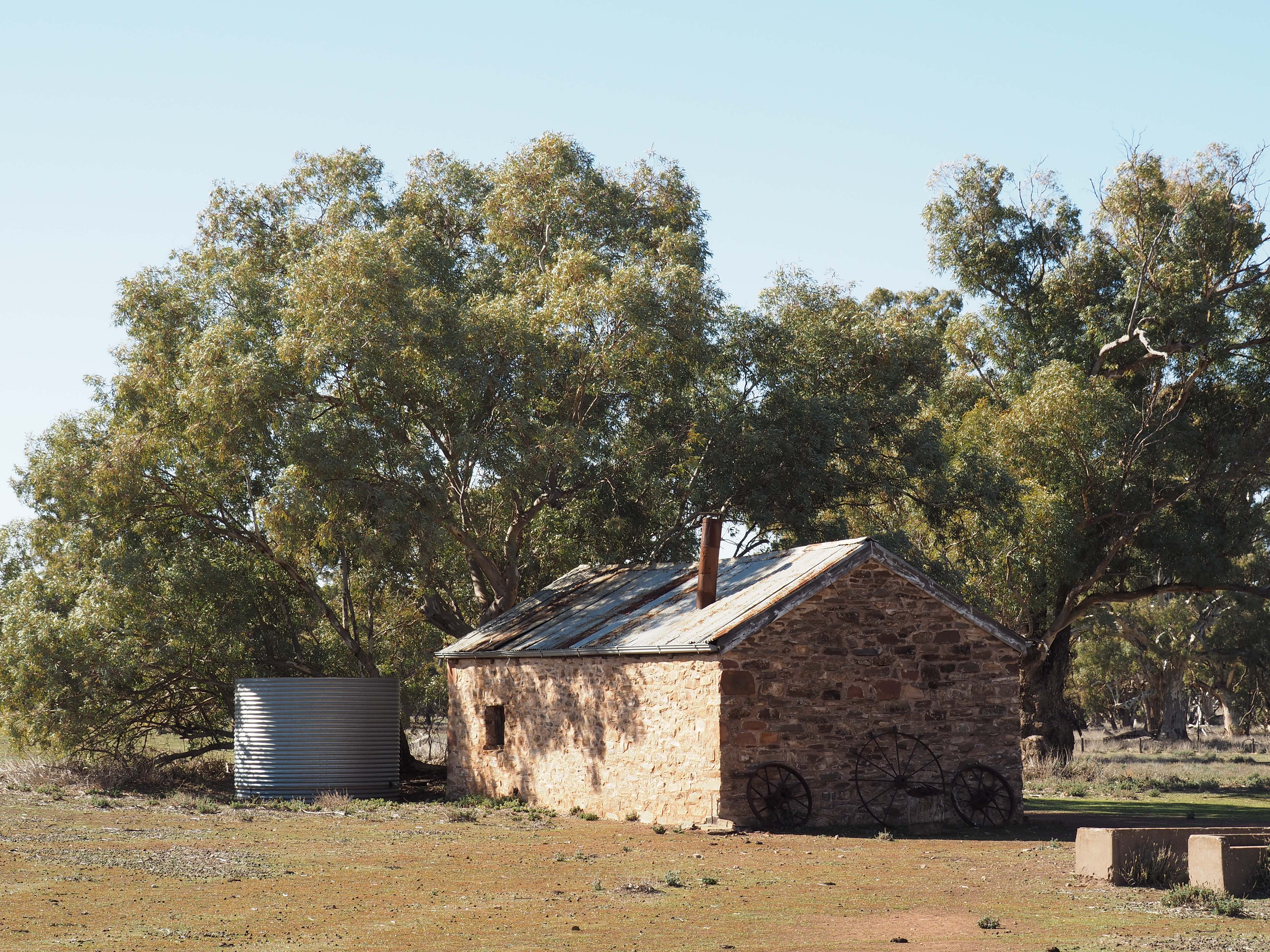
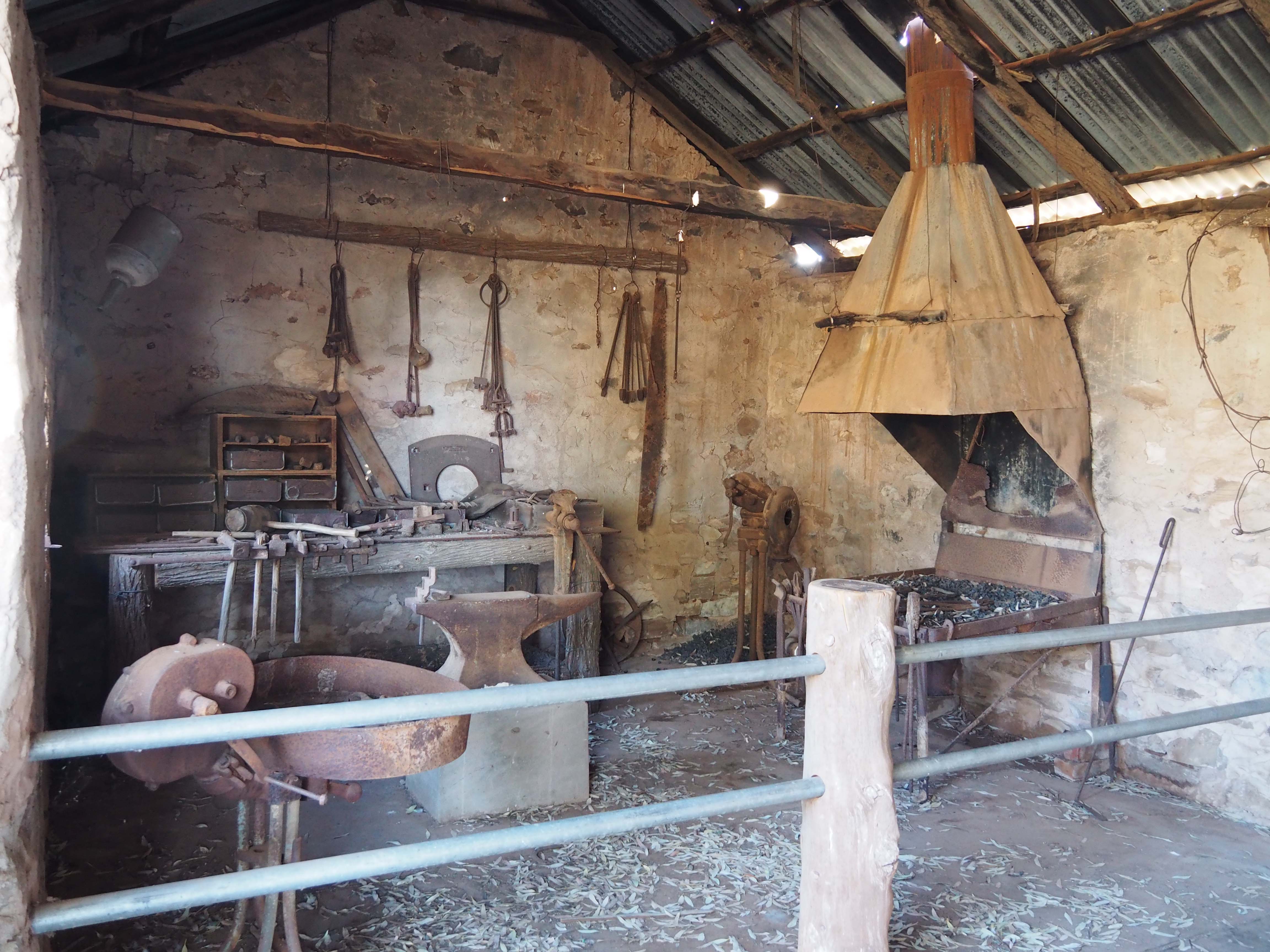
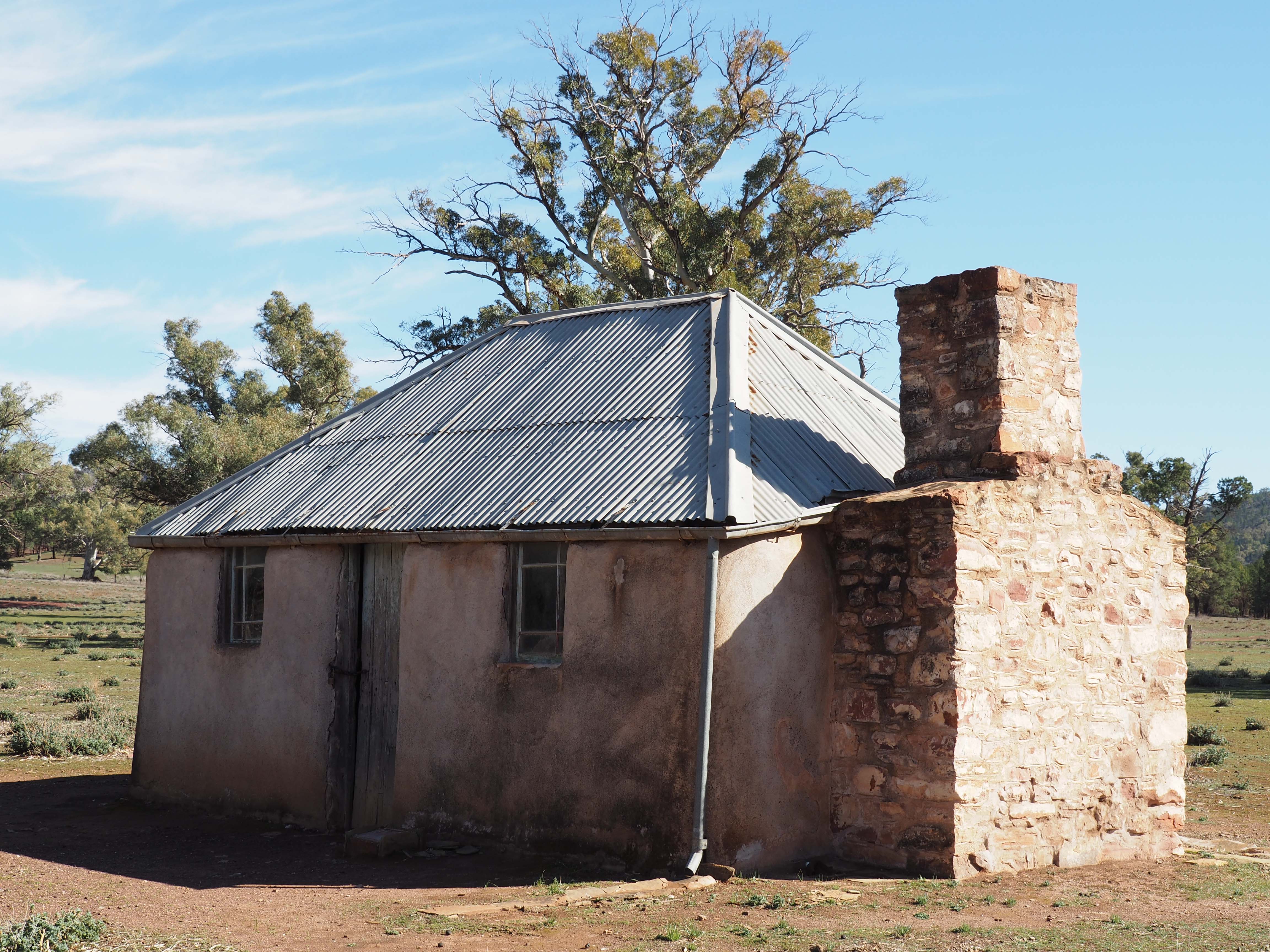
From Rosebery we travelled to Wyperfeld national Park, which is near Hopetoun a medium small town to the south of the park.  Wyperfeld is covered with Mallee scrub with other trees in places and lots of small shrubs growing in mostly sandy soil.  It would be a picture in spring with trees and shrubs and small native plants in flower.  The camping area is very large with fire rings and picnic tables scattered through the area plus a number of composting toilets, which were new and not smelly.  The wind has been horrendous so I have not been able to use the drone except on the last day at Wyperfeld so I took photos of our camp and the campground.


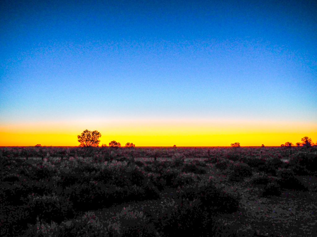
The sky at night was stunning with myriads of stars and on the first night we were able to see 6 planets, picked out with the aid of an app, Sky Guide.  It is an excellent app, you point your iphone to the area of interest and it gives the names of the major objects and you can tap an object and it will give more info.  It also shows the stars and planets below the horizon so you know when and where they will rise.  The planets we saw were Mars, Venus, Jupiter, Saturn, Neptune, and the moon (we took a liberty counting the moon, but it is round and it does orbit!).  We also enjoyed some beautiful sunsets.


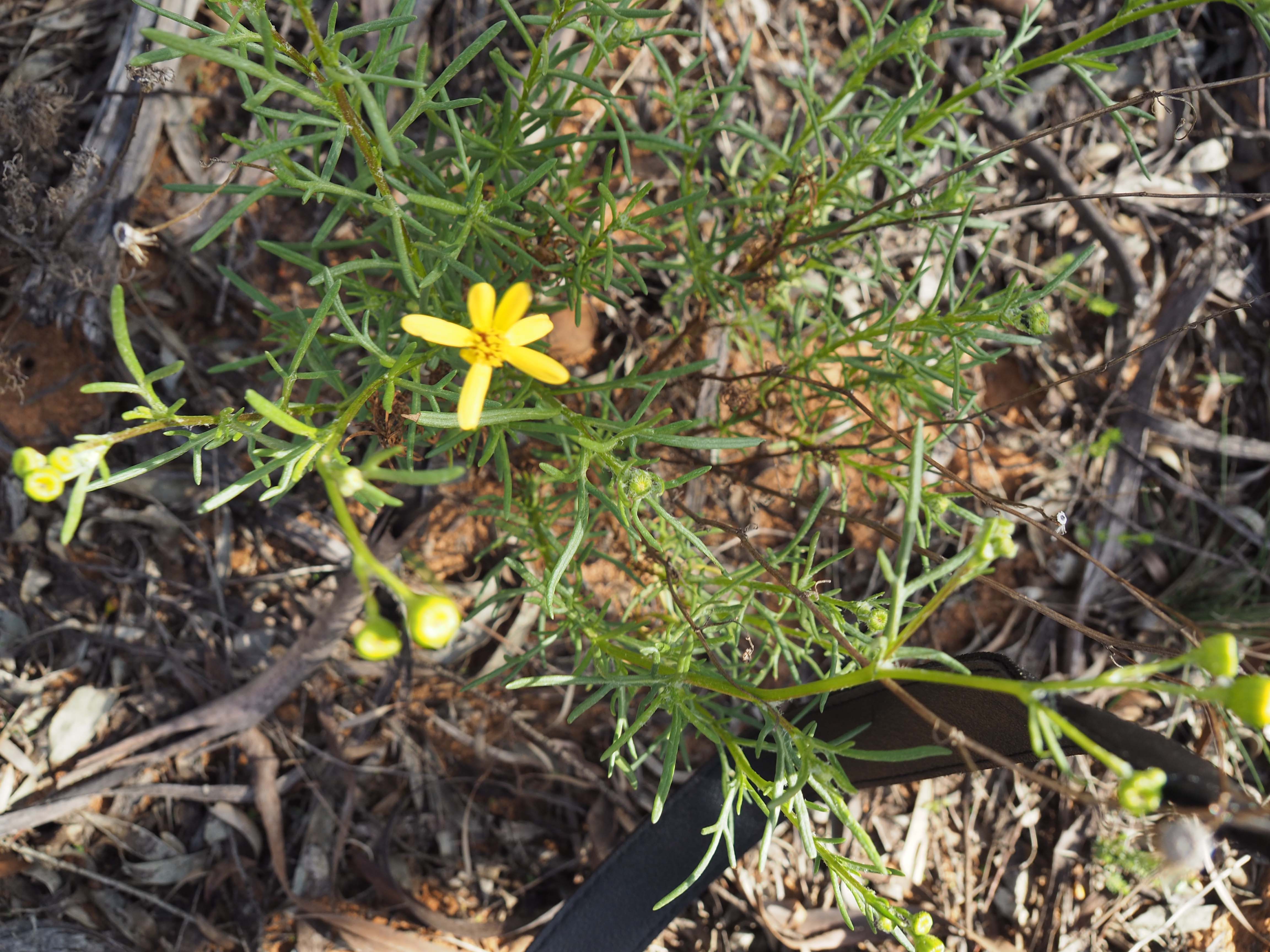
Nadine had a sore achilles tendon so we couldn’t do most of the walks as they were 6 Km or more, but we did a 1.5 Km walk to a Mallee Fowl mound.  The male Mallee Fowl builds the mound and adds and removes material to maintain a constant temperature during hot days and cold nights.  The female bird lays up to 30 eggs.  The bush surrounding the mound is typical of the park.  We spotted one flower on the walk, my blog would not be complete without a flower photo.


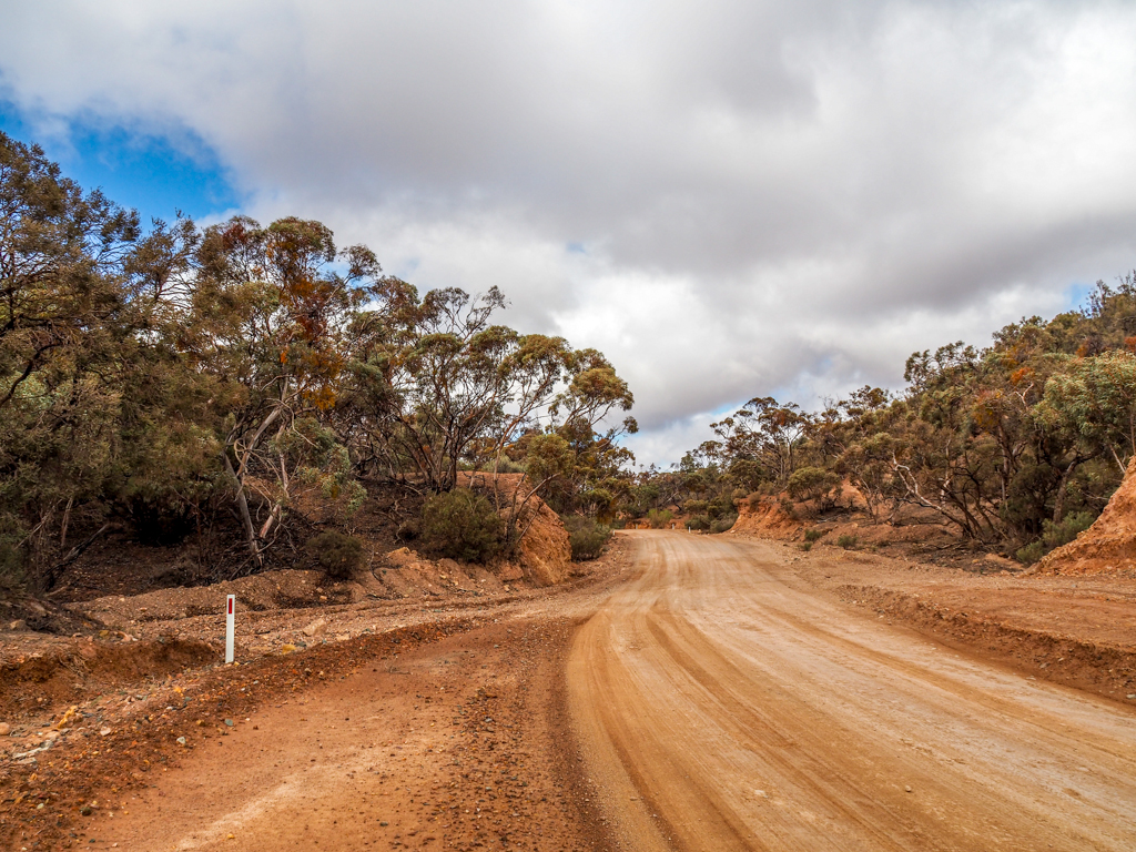
From Wyperfeld we drove to Patchewollock to the east of the park via Dattuck track.  This track carried a warning of deep sand and they weren’t joking, probably the hardest sand driving I have done, and I have done a fair bit.  The deep sand was OK but their were deep short dips in the deep sand usually on the approach side of the dune so you couldn’t slow down or you would be bogged.  The car bounced violently over these but we managed to keep going, several times only just, so there was a lot of breath holding.  Most times just the front wheels became air born but on one all wheels were off the ground.  Exciting stuff, needless to say we didn’t stop for photos.

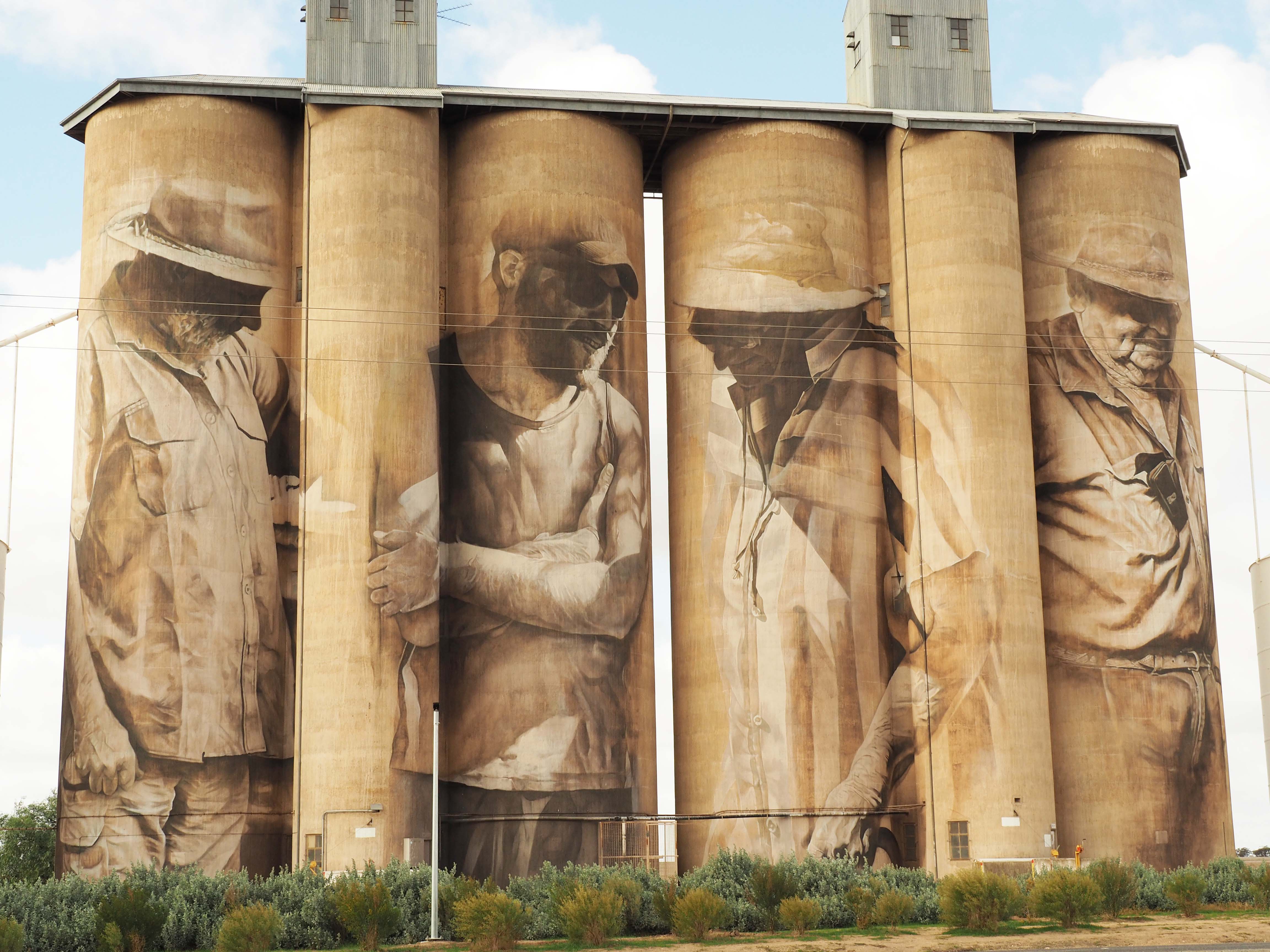
Patchewollock is a small town with the only businesses being a community store and an hotel.  There seems to be a strong community spirit, typical of these small towns battling for survival.  The silos here were painted by Brisbane artist Finten Magee and depicts Nick “Noodle” Hulland whom the artist befriended while getting to know the area.  Hulland typifies the no-nonsense hard-working attitude that is needed to survive in this area.  The photos look like I took them from the side but they are straight on, the artist painted them with the farmer looking to the side.


We then travelled to Lascelles, a one pub town, no shops.  There is a small community run caravan park here and a well set up picnic area and a spotless free gas BBQ.  The silo was painted by Melbourne artist Rone who watered down his paint and used a muted monochrome pallette to match the raw concrete colours.  The painting is of farmer Geoff Horman, a fourth generation local.

We returned to Wyperfeld via Hopetoun and started to pack for our trip to the Flinders.


Posted in 2018 | 4 Comments

Maldon

After my time with Deen on the Murray I went to Maldon for 4 days before heading home on Friday.  It was very cold with temperatures down to 2 or 3 overnight, also the first rain since leaving home 9 weeks ago.  Not only out of shorts but a jumper as well.  Mt Tarrengower gave great views over Maldon and the surrounding country.

20170905-4338 View over Maldon from Mt Tarrengower


Also toured the old town and imagined what it was like in its heyday, and visited the Beehive Mine chimney and railway station.

20170905-4345 Beehive Chimney Maldon Med

20170905-4341 Maldon Station #1 Med


Next day I took a steam train to Castlemaine for the day, it was a relaxing trip and great to hear the toot of the steam engine.  The first class carriage was set up like a lounge with leather club chairs and a bar.

20170906-4347 Maldon to Castlemaine Steam Train Med20170906-0664 Pullman Carriage Maldon Train Med


The Castlemaine station was grander than the Maldon station but in the same style.

20170906-0661 Castlemaine Station Med


I walked around town, visited an antique market and visited the Burke and Wills monument built on the highest part of Castlemaine in 1862 less than a year after they died, such was their renown.

20170907-4353 Castlemaine Burke & Wills Monument Med


I enjoyed a very pleasant lunch with Marg’s brother Barry and his wife Cas in Kyneton on the penultimate day of my holiday, it was a good way to finish my travels.   Now I have to try and clean the red dirt off the caravan and car.

Posted in 2017 | 2 Comments