Yarram – Heesco Town

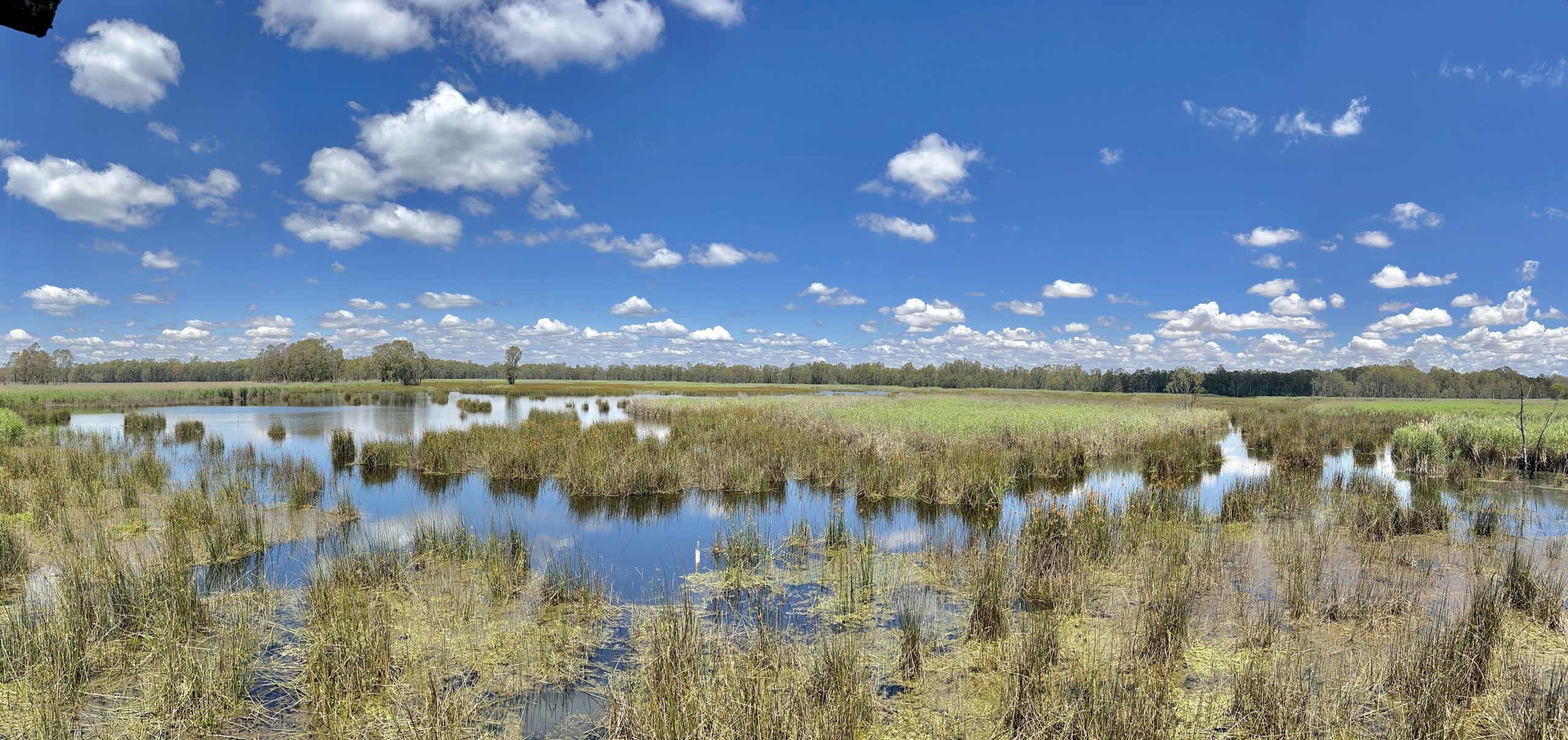
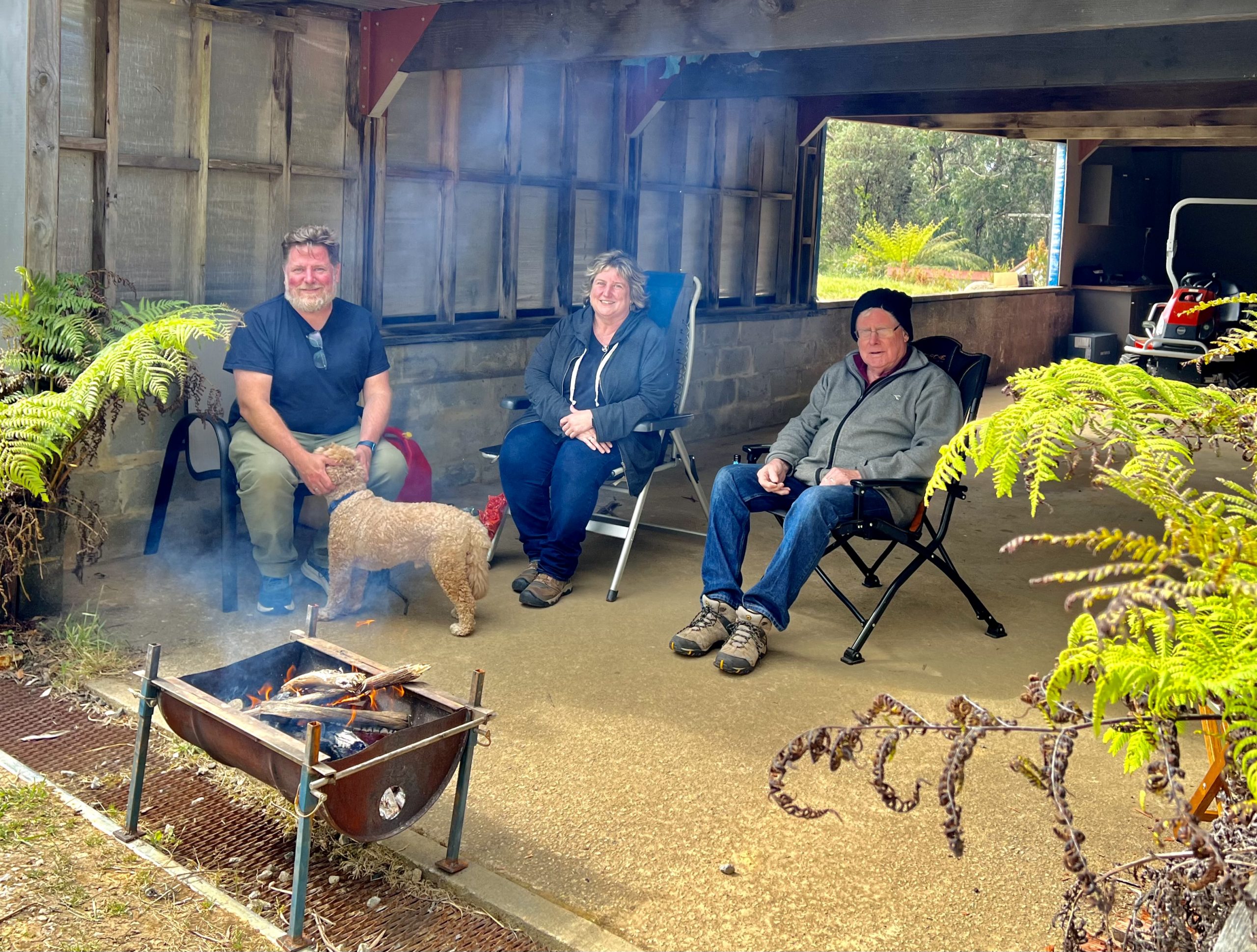
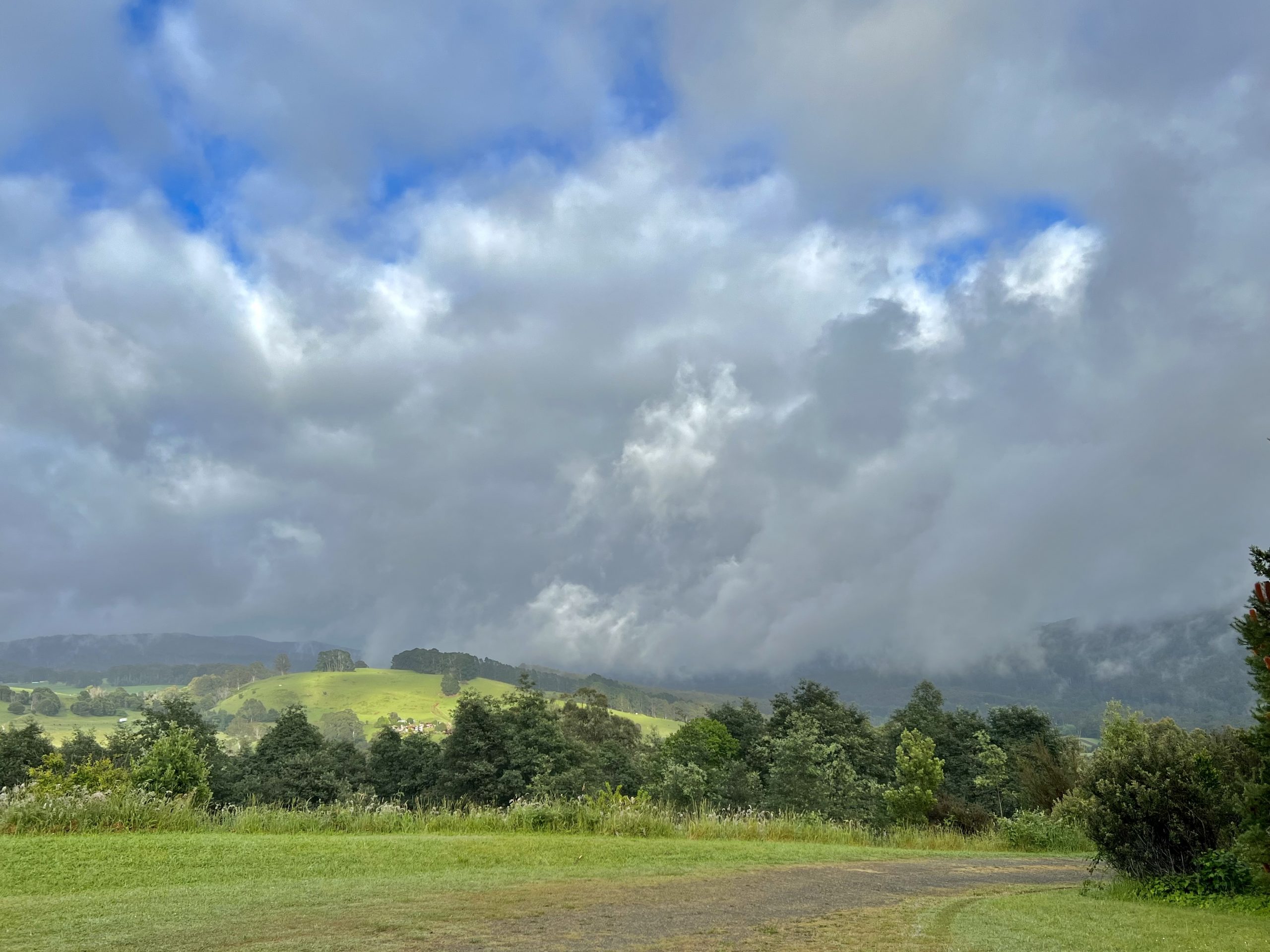
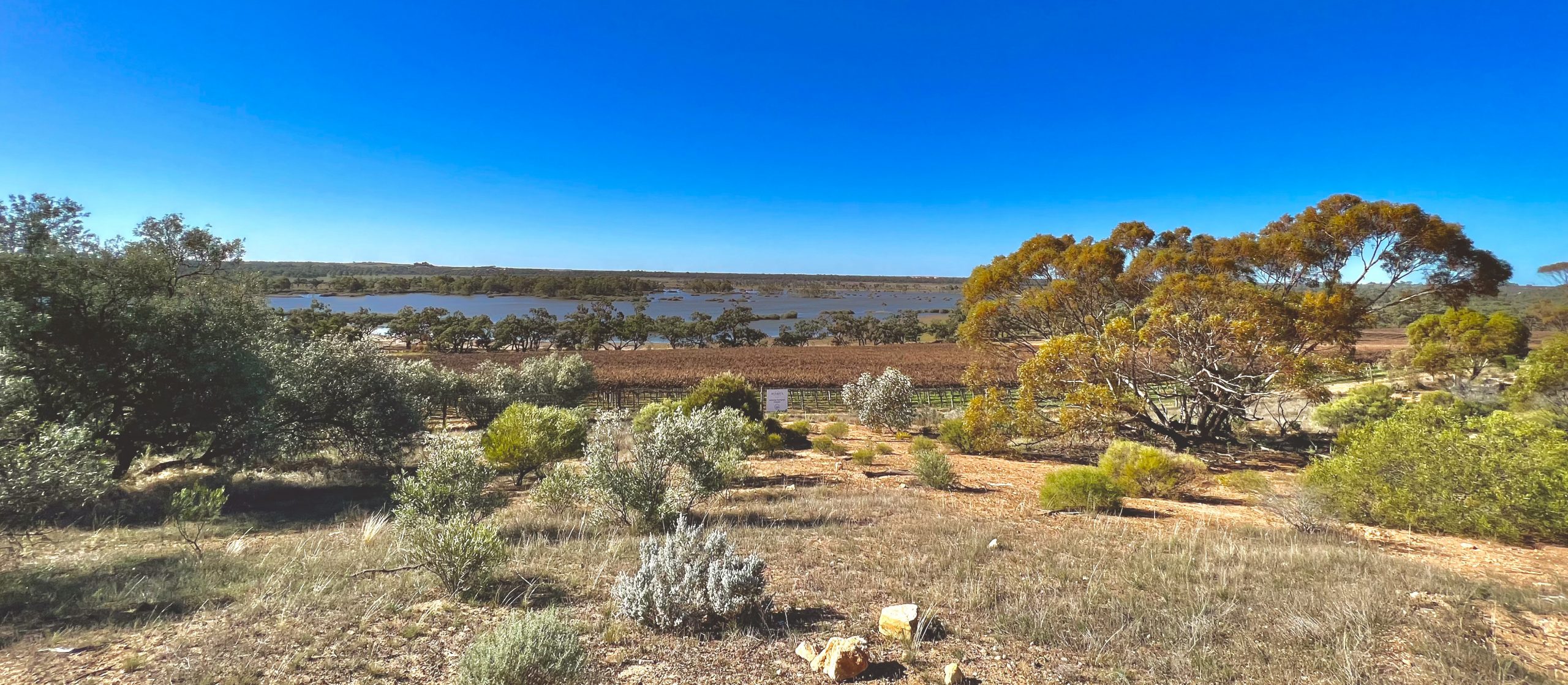
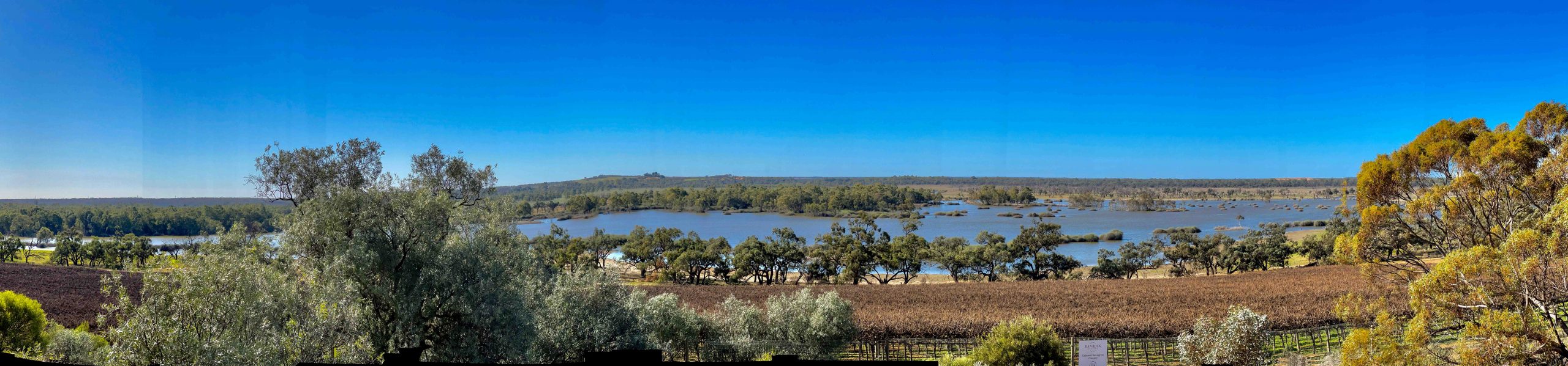
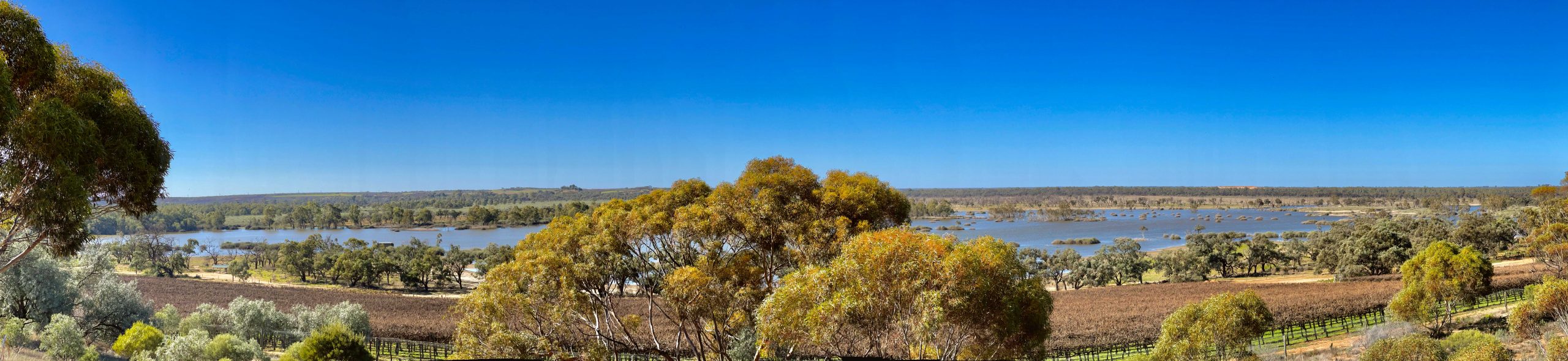
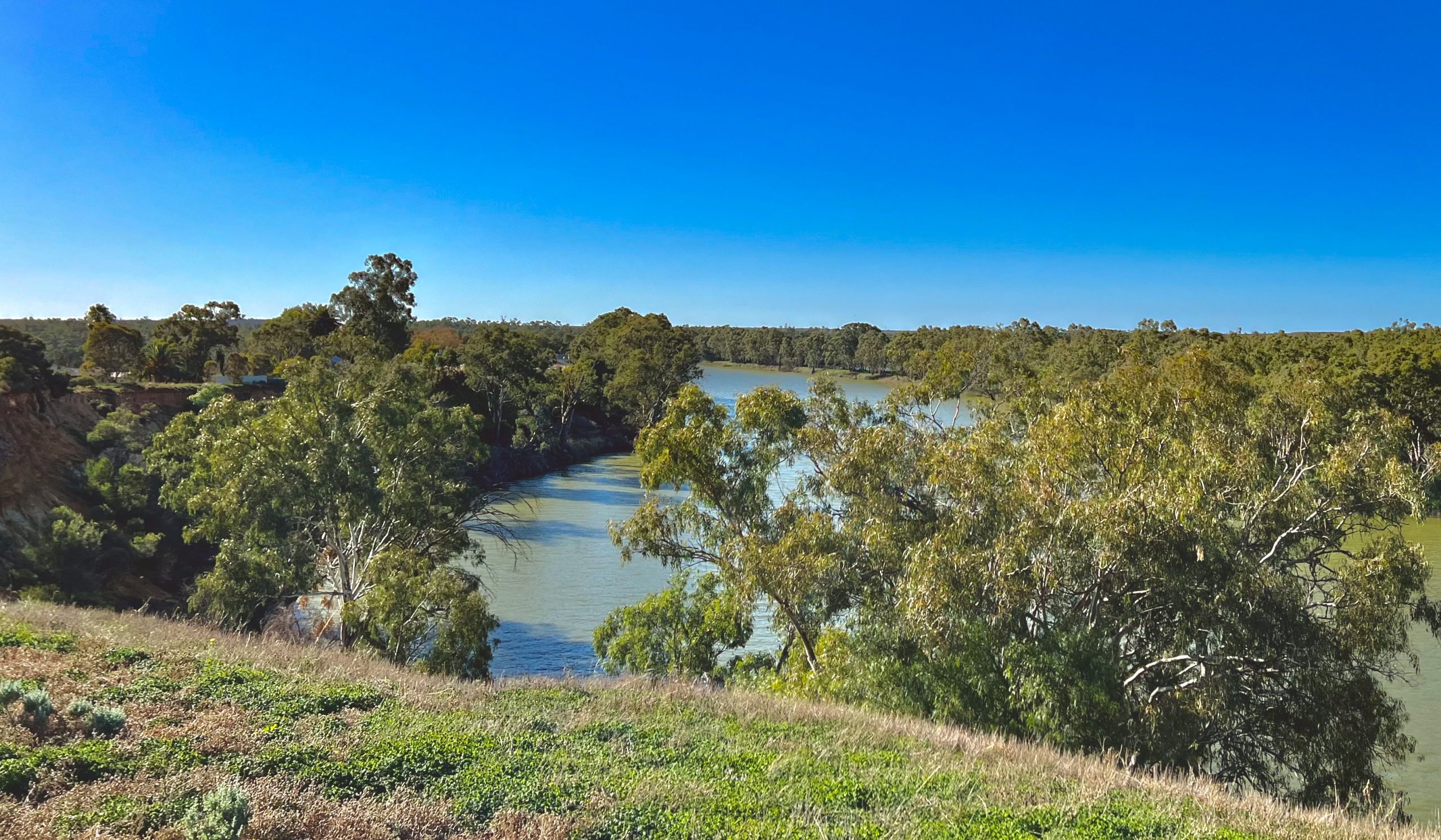
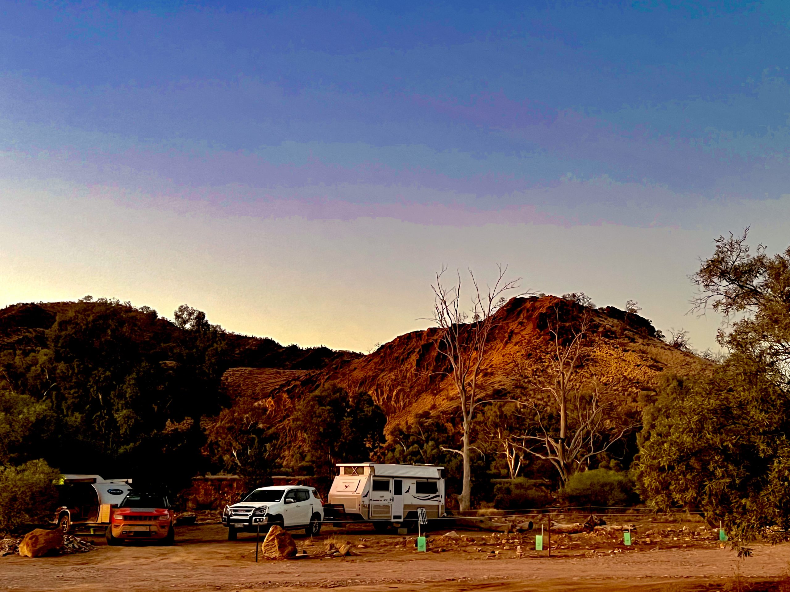
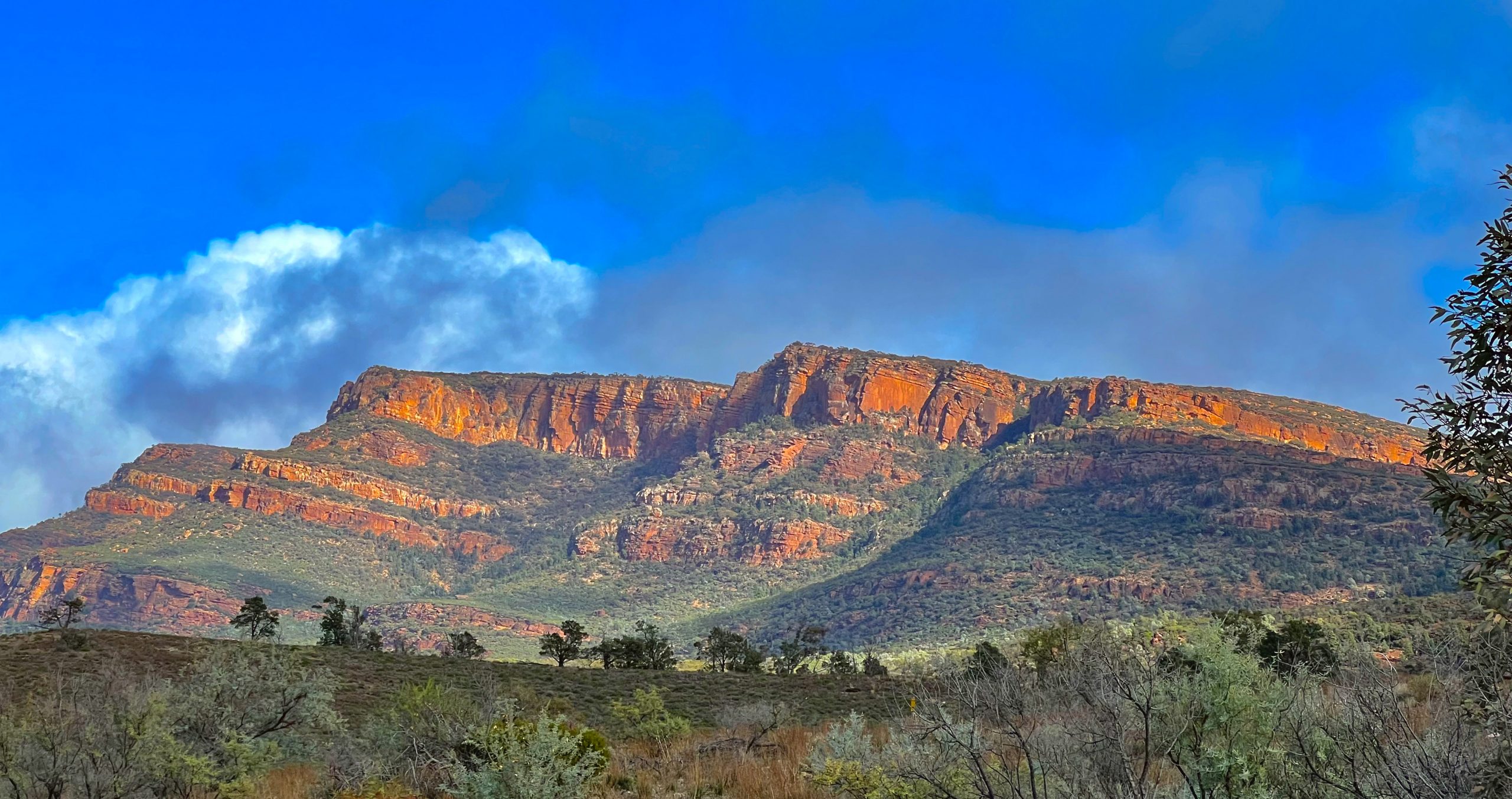
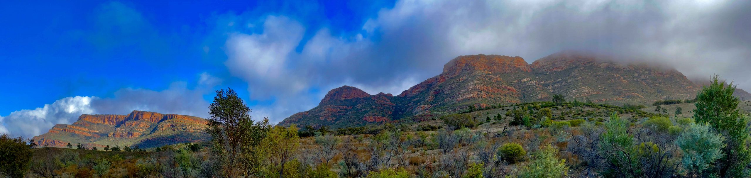
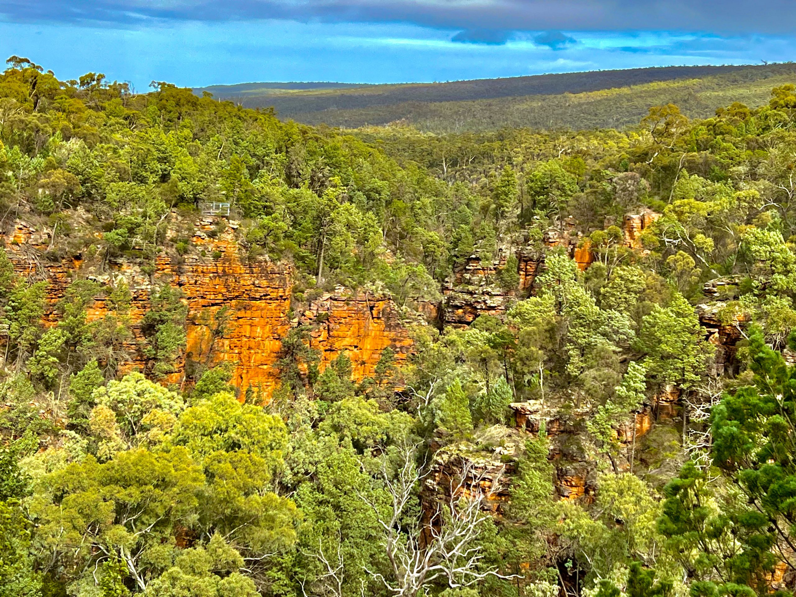
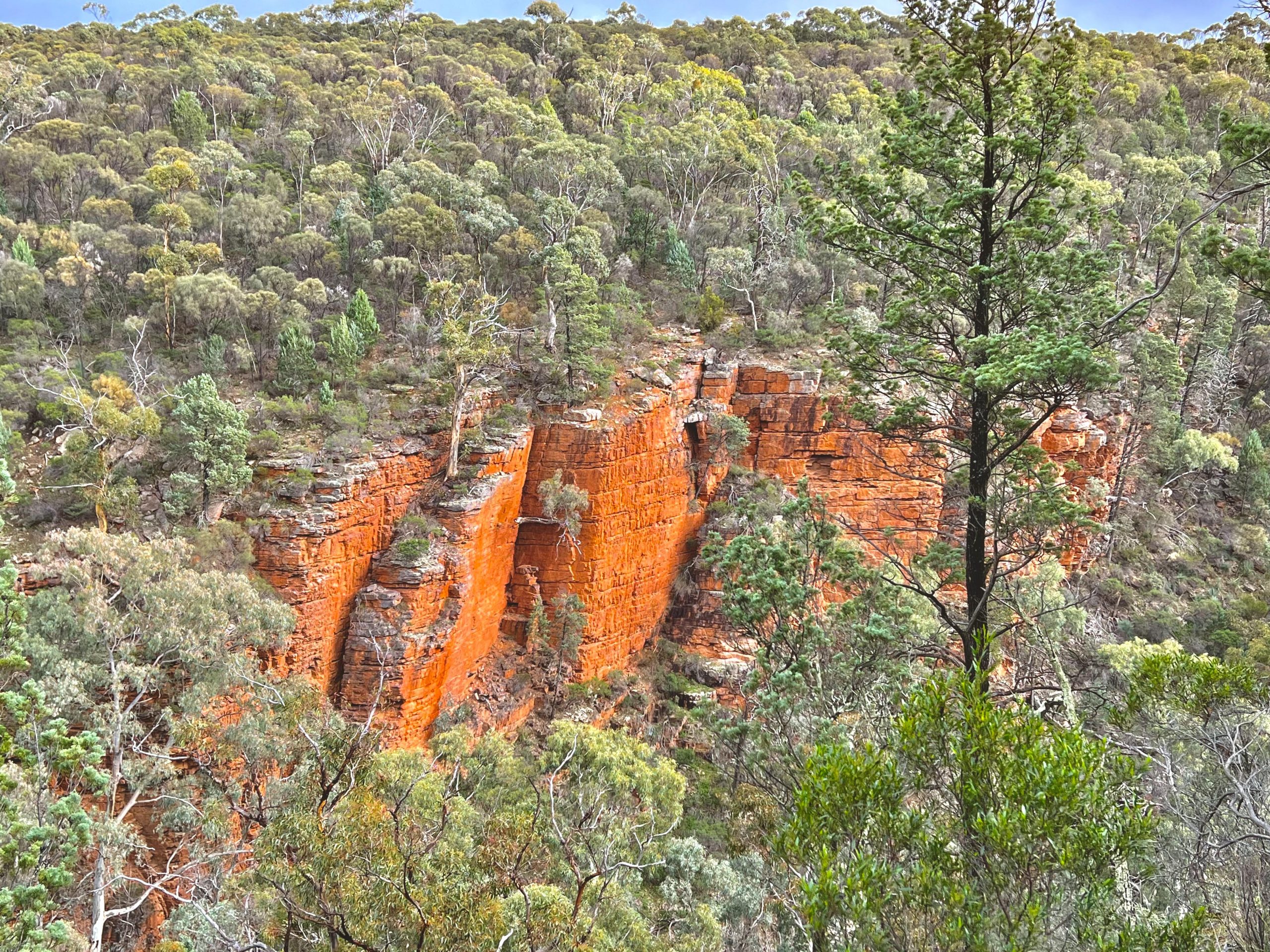
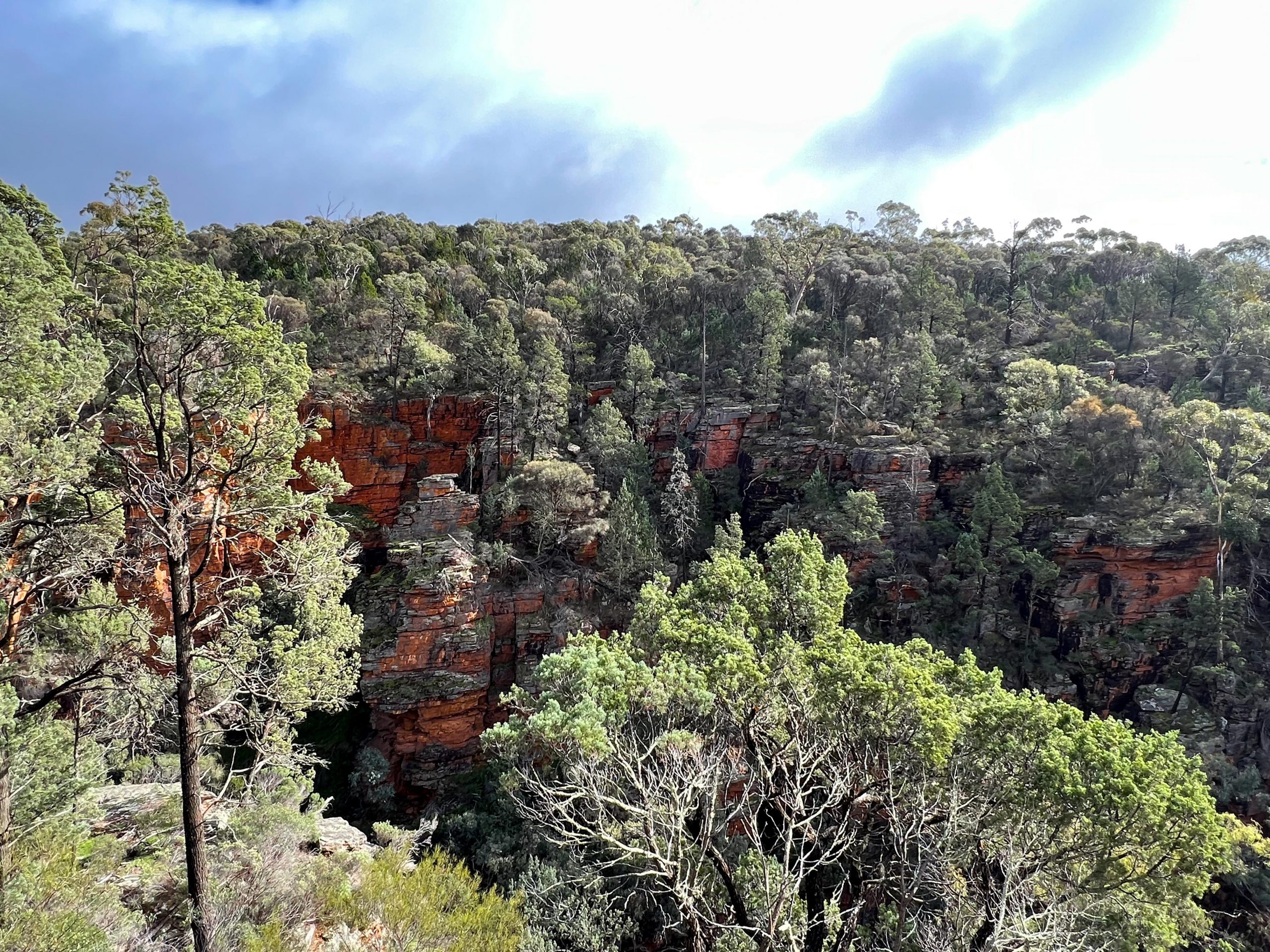
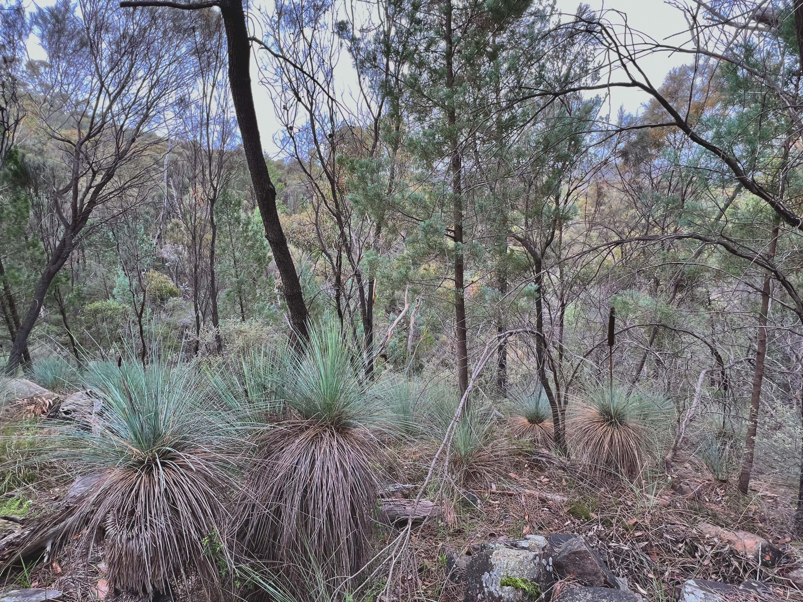
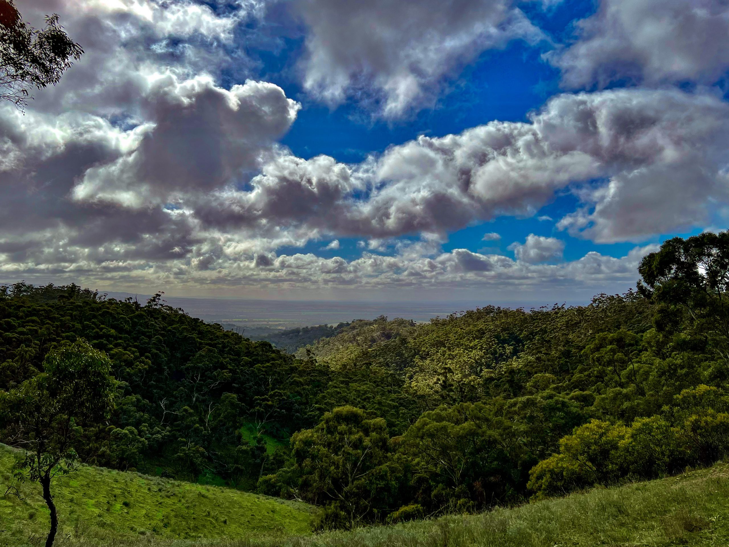
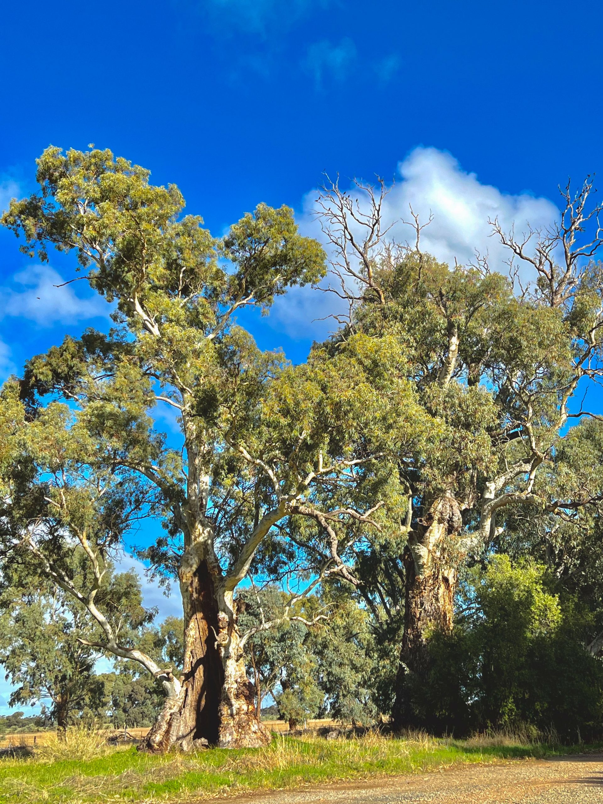
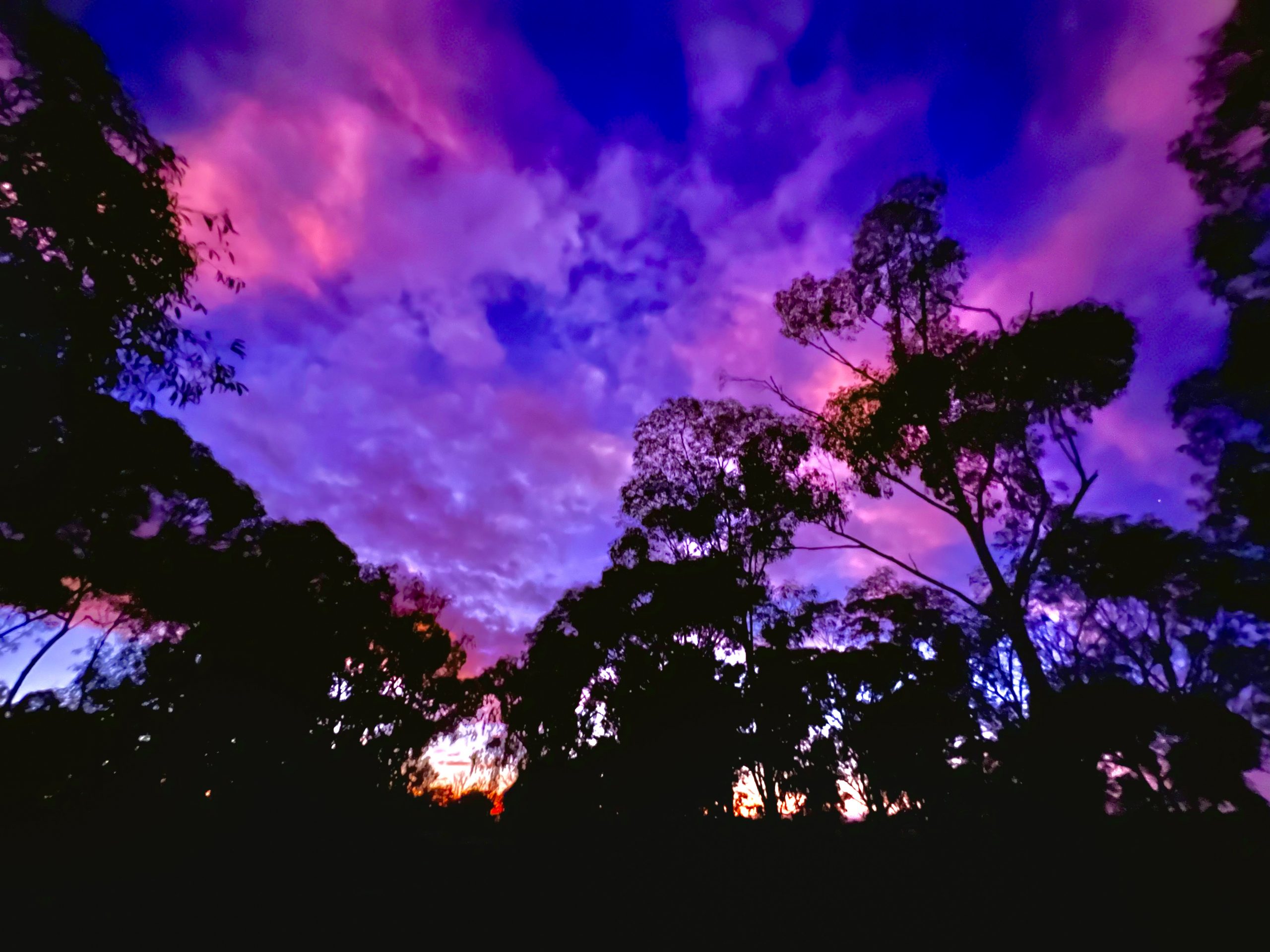
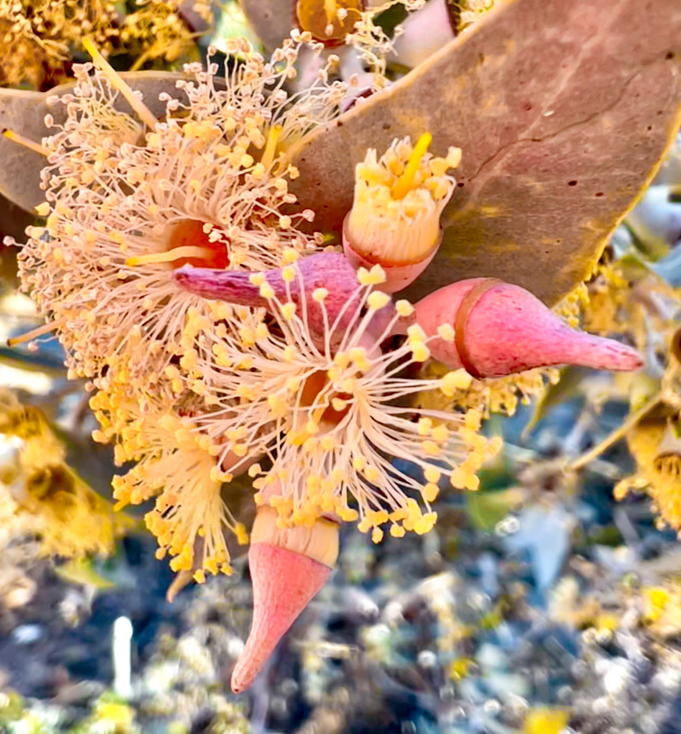
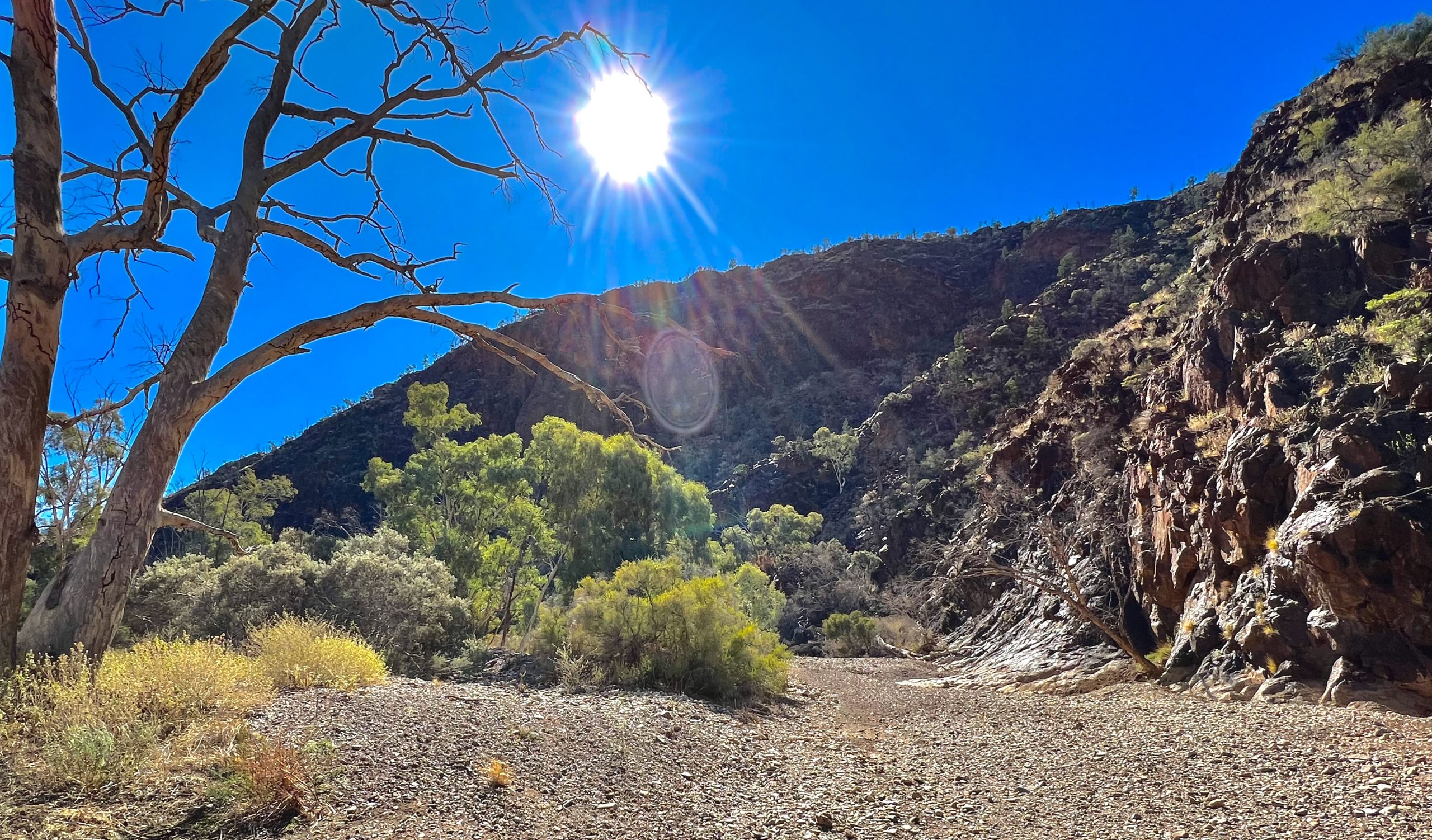
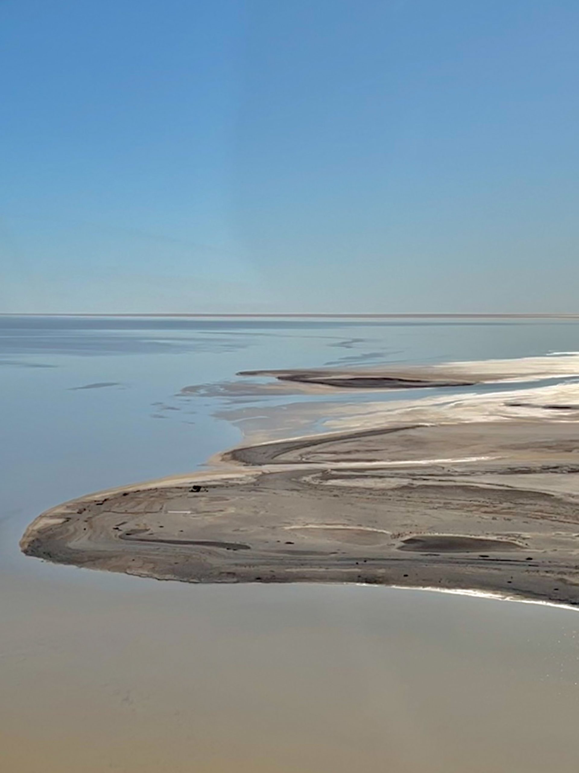
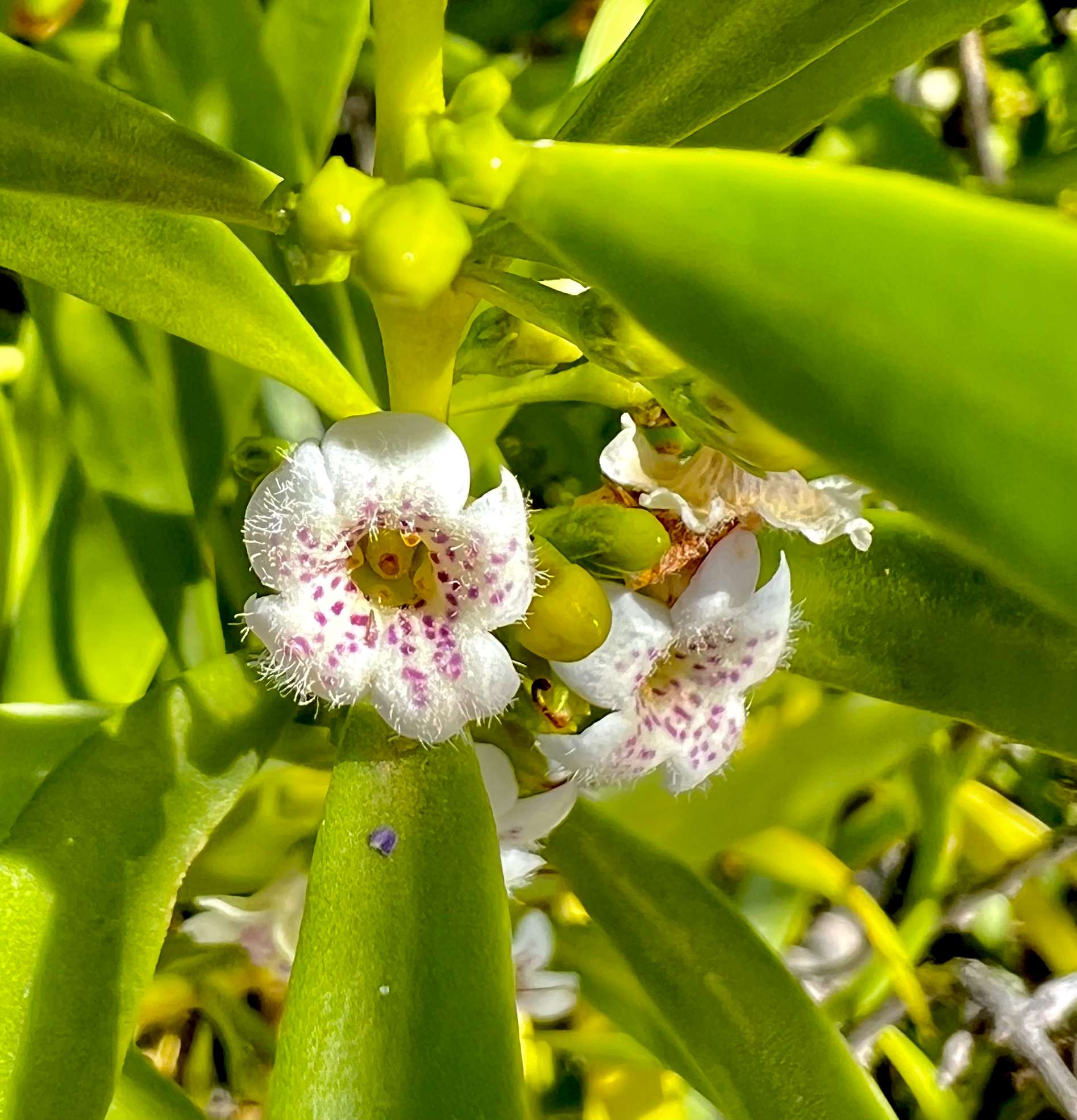
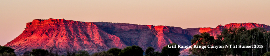
After leaving the farm it was a leisurely drive to Yarram through the Gippsland hills. Lots of lovely views from good, but very windy roads, until I reached the Princes freeway. After that it was reasonably flat country until I got into the hills on the approach to Yarram when I travelled through some green hills and lovely forests.

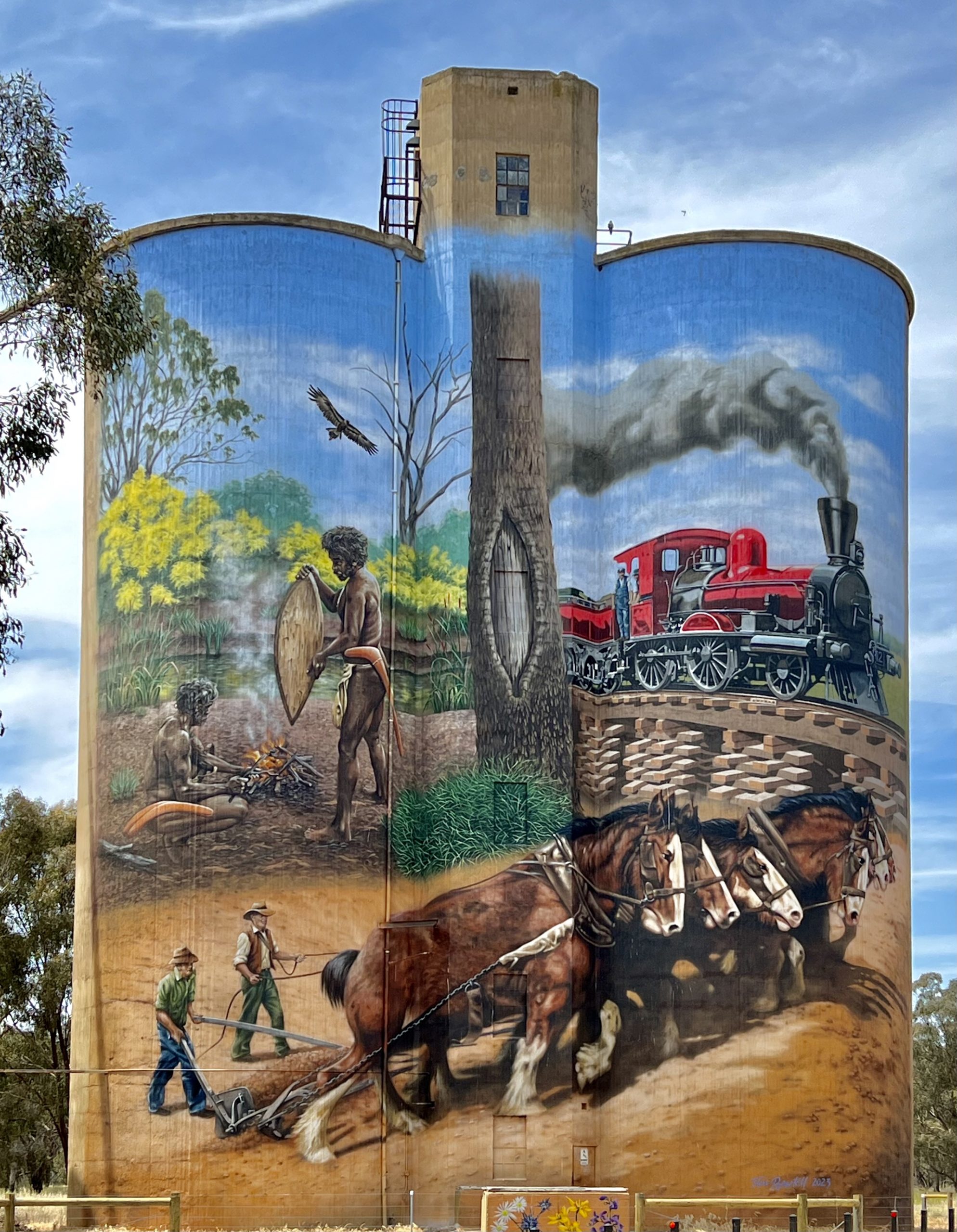
After setting up, I went off to see the street art in Yarram of which there are heaps. Between 2020-2023 Heesco, one of the best street artists in my opinion, painted 25 prominent murals in Yarram. The project was dubbed “Heesco Town” and it was a collaborative effort between local residents, business owners and Heesco. The idea was to help establish a tourist destination in the area long suffering due to the effects of bushfires followed by COVID.

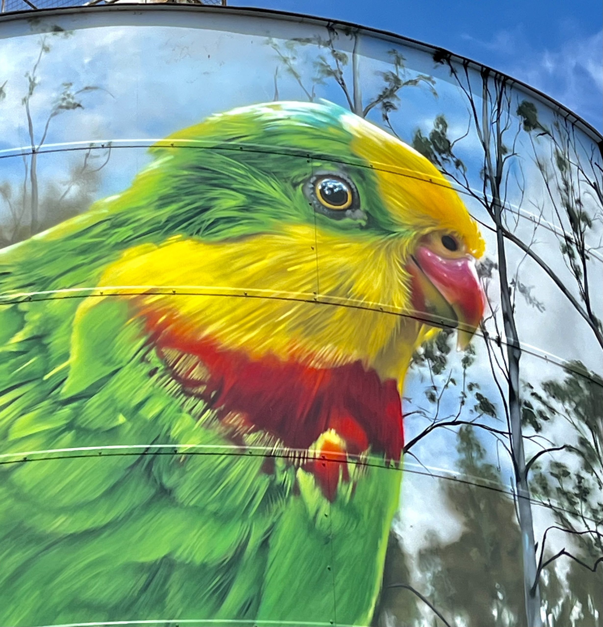
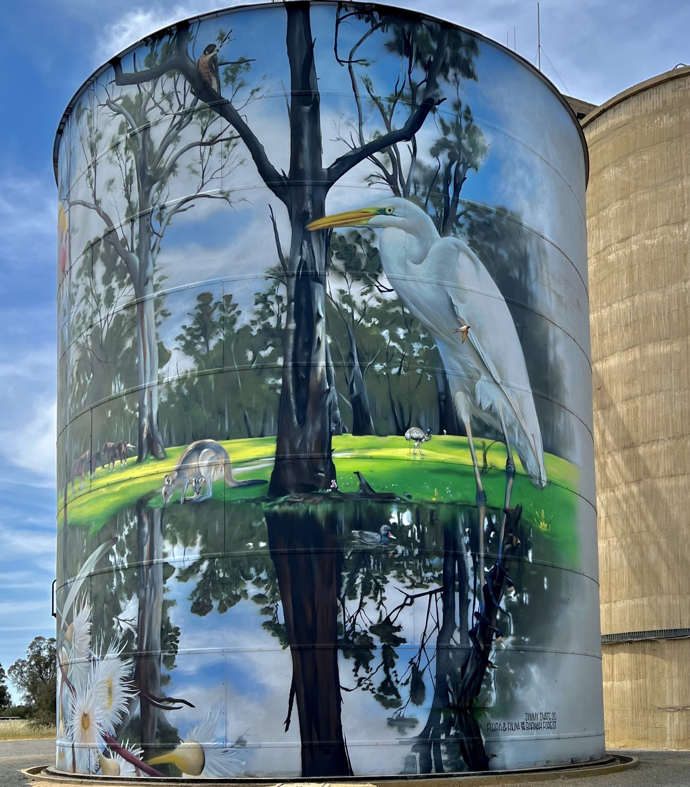
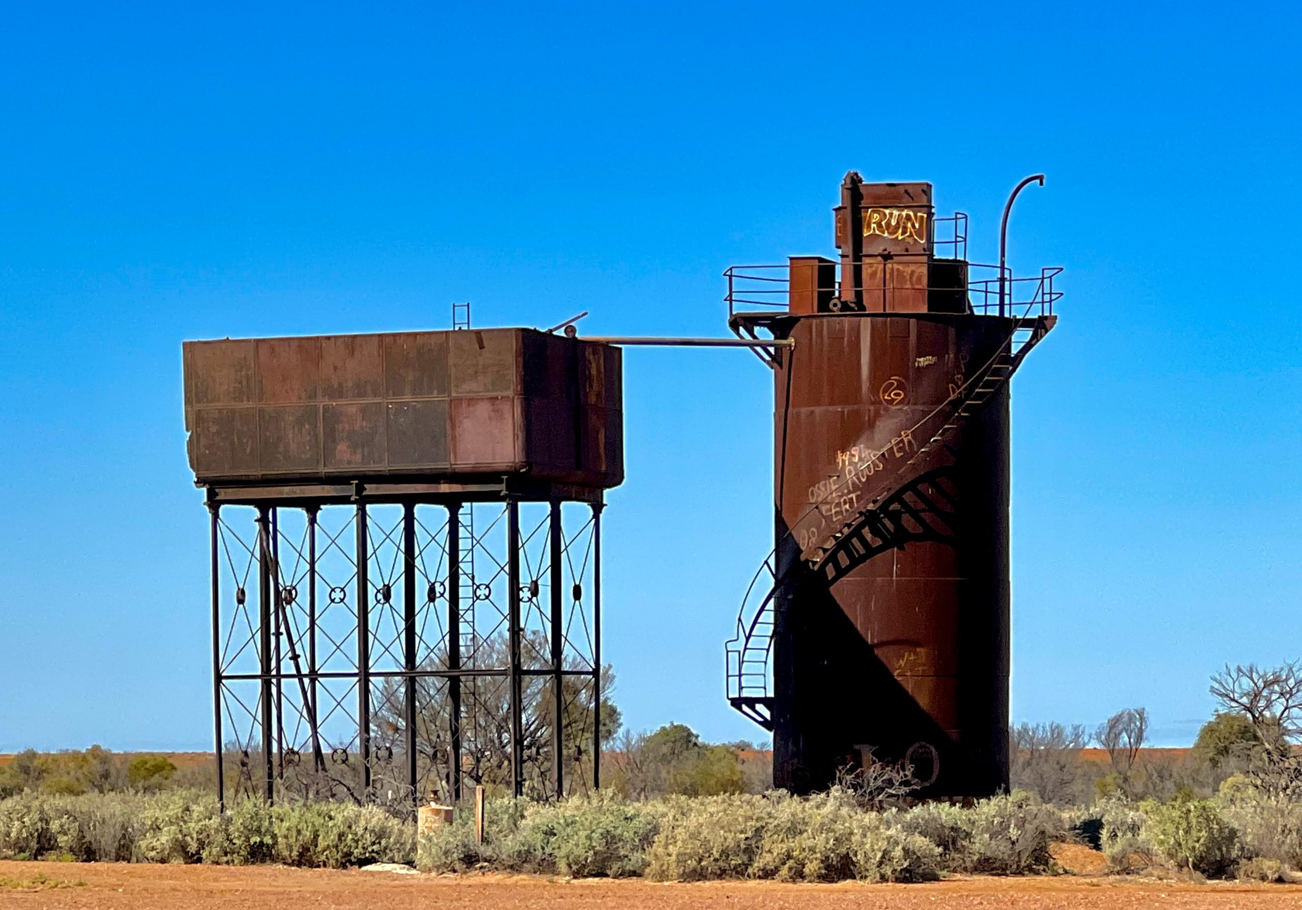
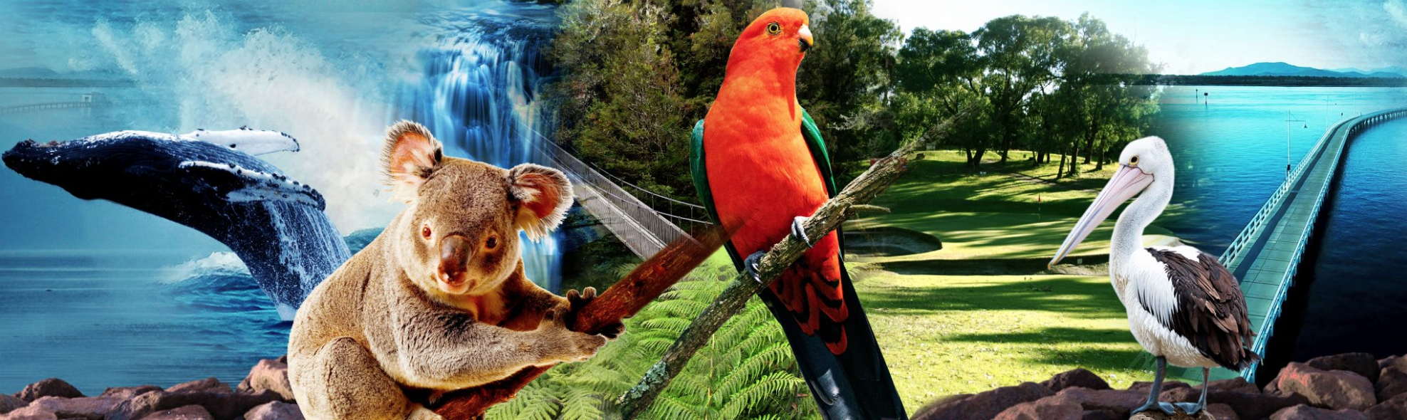
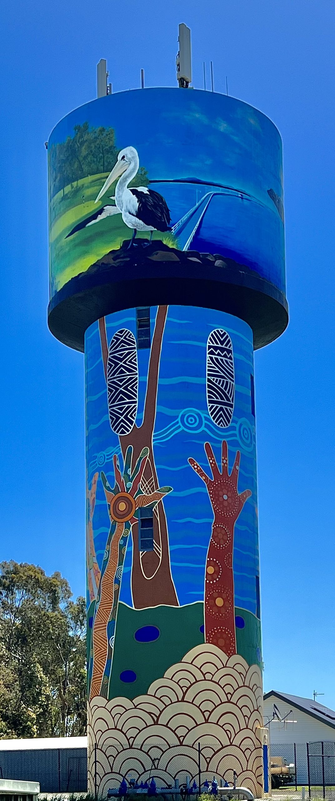
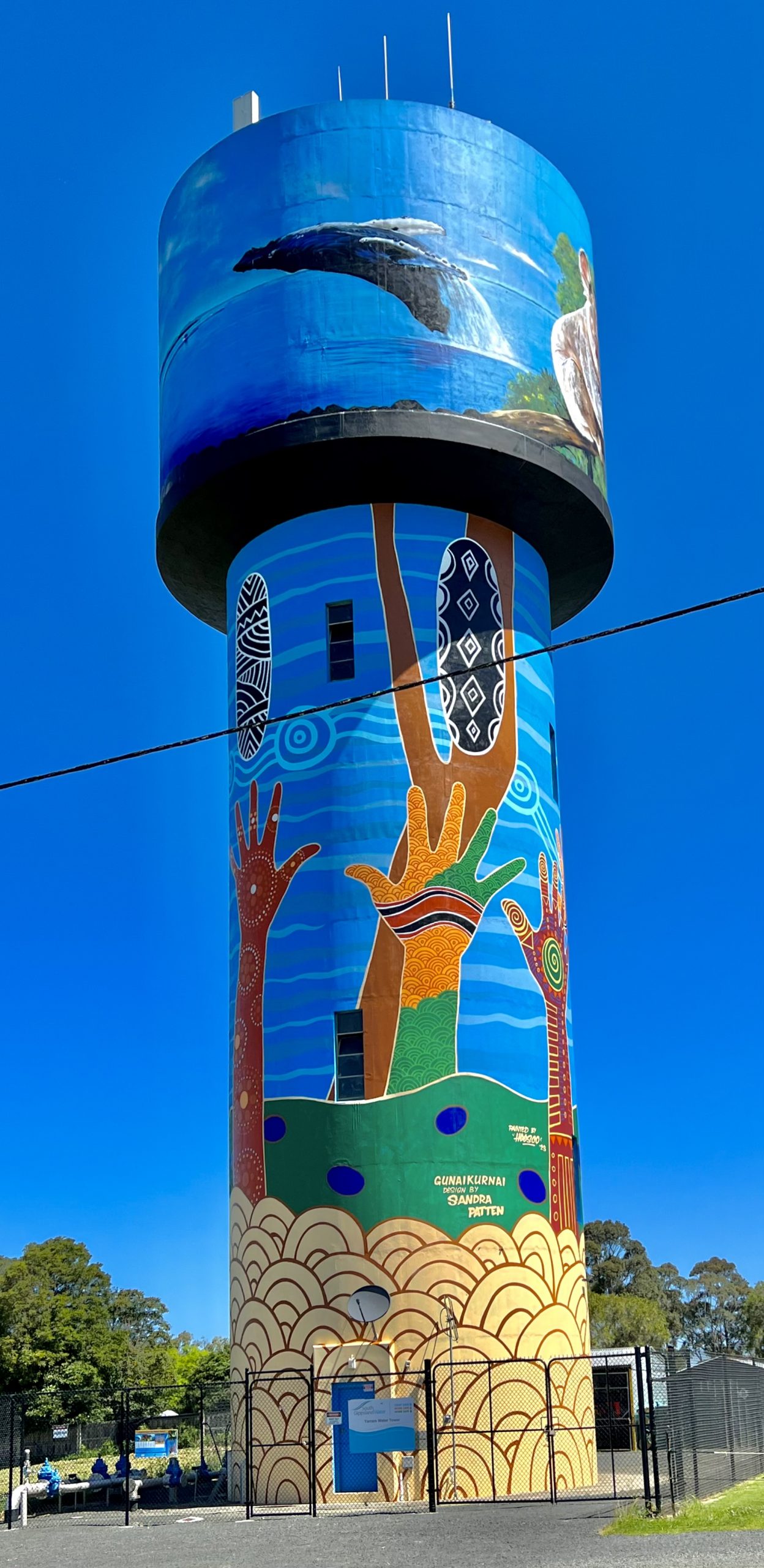
My first stop was to the water tower where the tank section depicted local fauna and tourist attractions such as Agnes Falls, the 90 mile beach and the long jetty at Port Welshpool. Because of houses and fences around the tower it was impossible to capture all the top section so I include the graphic below from the Yarram heescotown.com website.

You can see part of this image on the tower below:

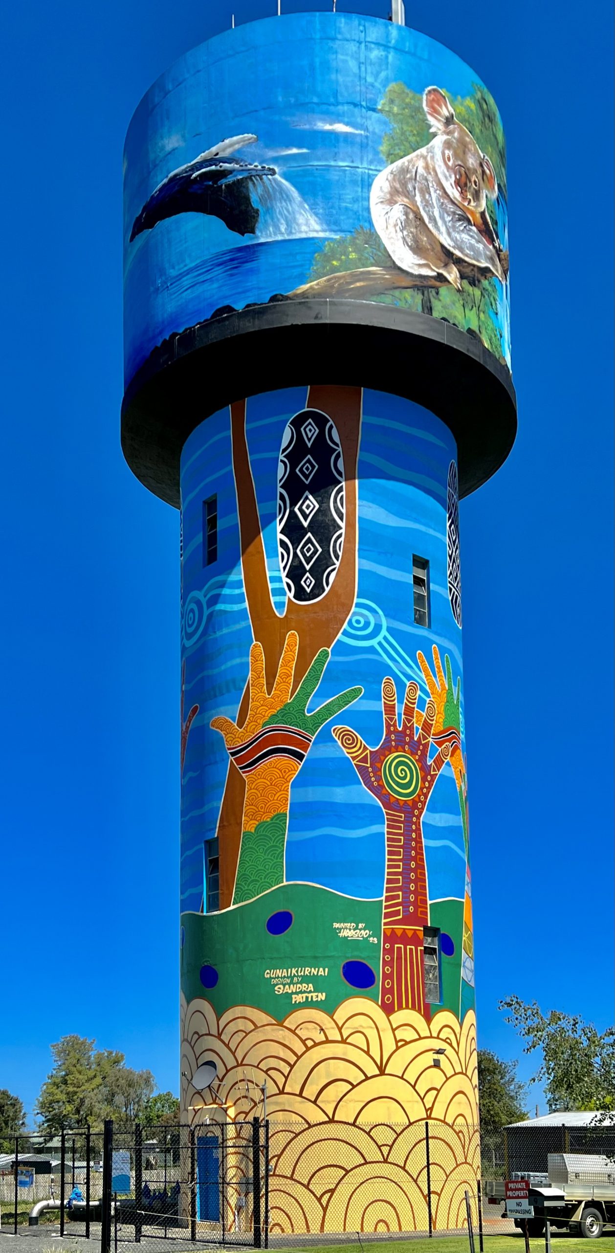
The hands are in the colours of the Aboriginal and Torres Strait Islander flags, and the oval shapes are the five Shields of the aboriginal groups around Yarram. Heesco painted the silo but the design was by Sandra Pattern, a Gunaikurnai elder.

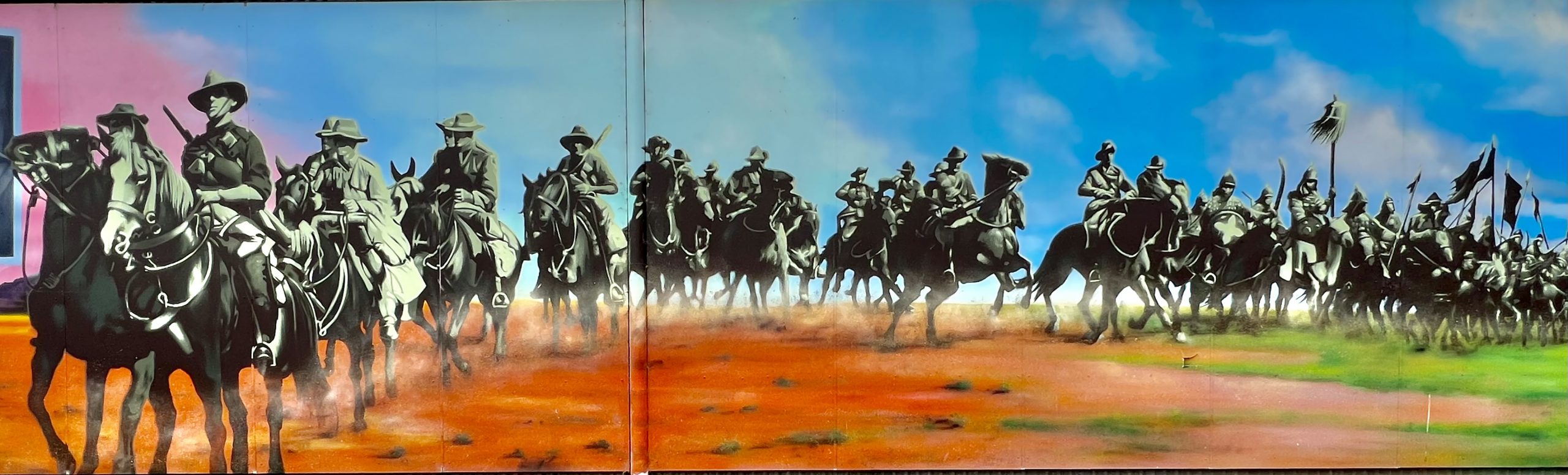
The local gym has a mural of the Australian Light Horse Soldiers riding like they did towards Beersheba where they made the famous charge to overrun the Ottoman garrison in world war one. This was the last cavalry charge in war.

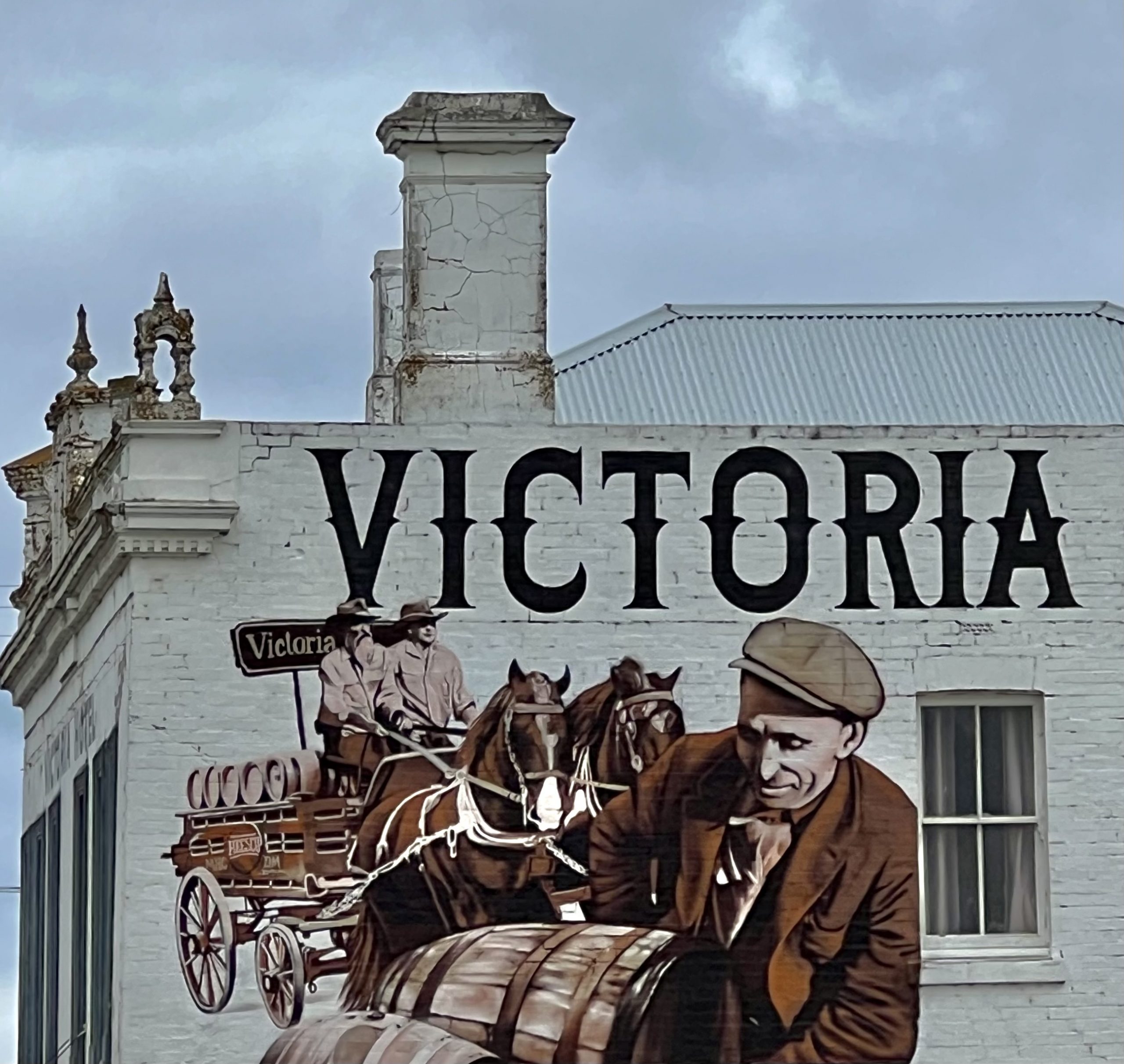
The hotel in the nearby town of Alberton has a painting of a man handling beer barrels and a horse drawn dray full of barrels. A roof over the beer garden next to the pub made photography difficult.

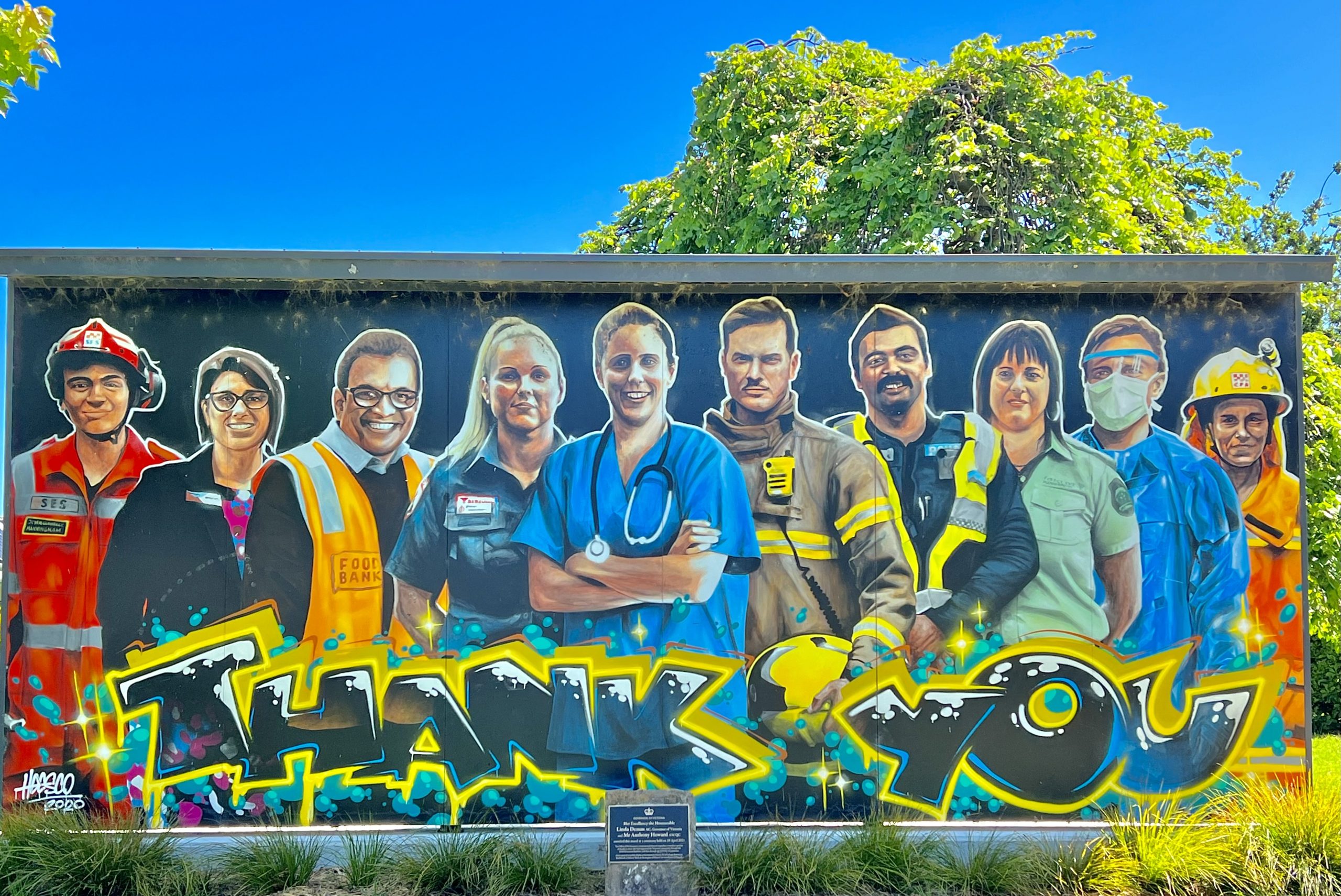
In the memorial park in the centre of Yarram is a canvas mural in tribute to emergency workers, who were so important through the bushfires and COVID outbreak. The mural was displayed in Canberra before being installed in Yarram.

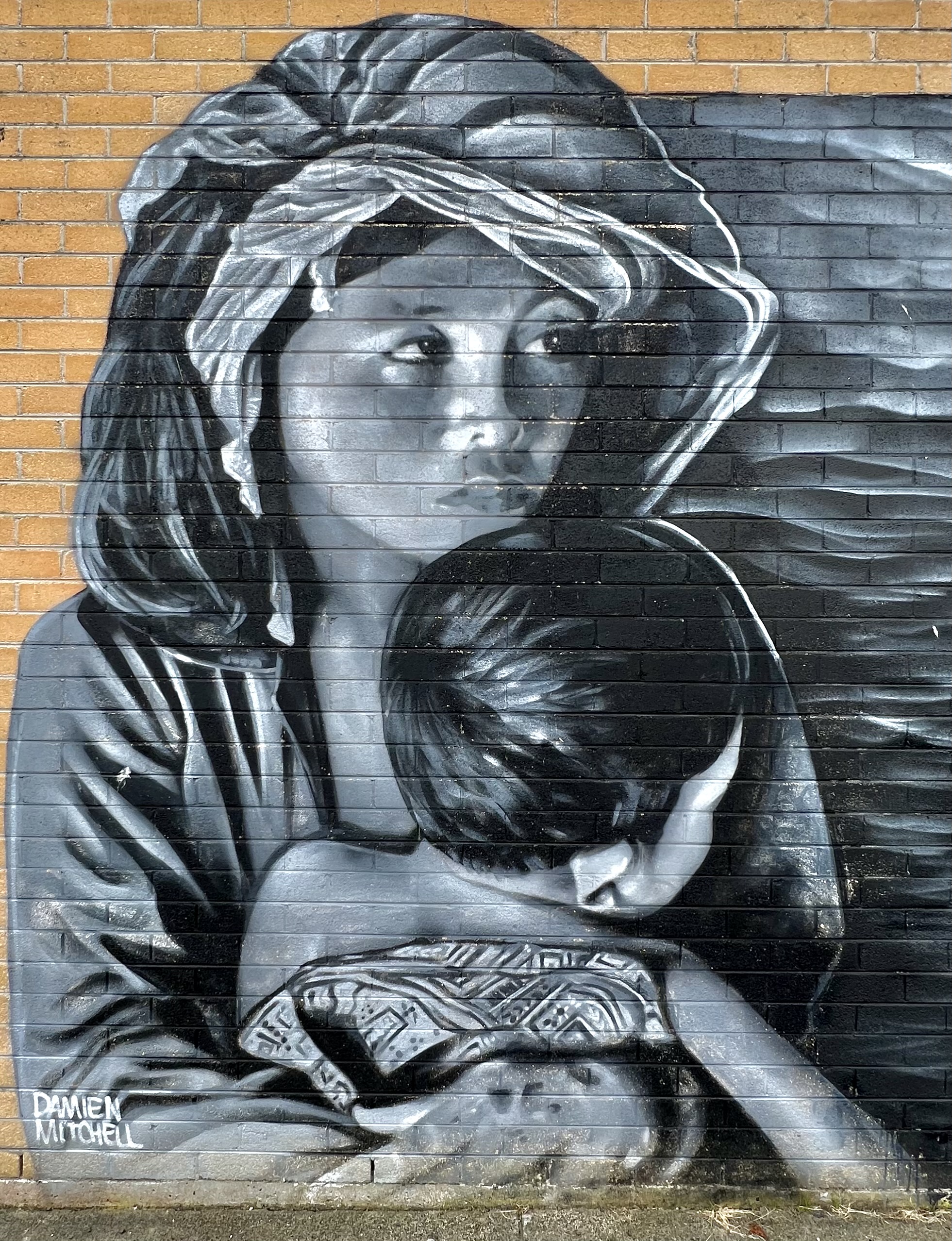
There were two good murals in a narrow alleyway but it was impossible to take a photo of them that looked any good so I just photographed a couple of people that were in one of the murals.

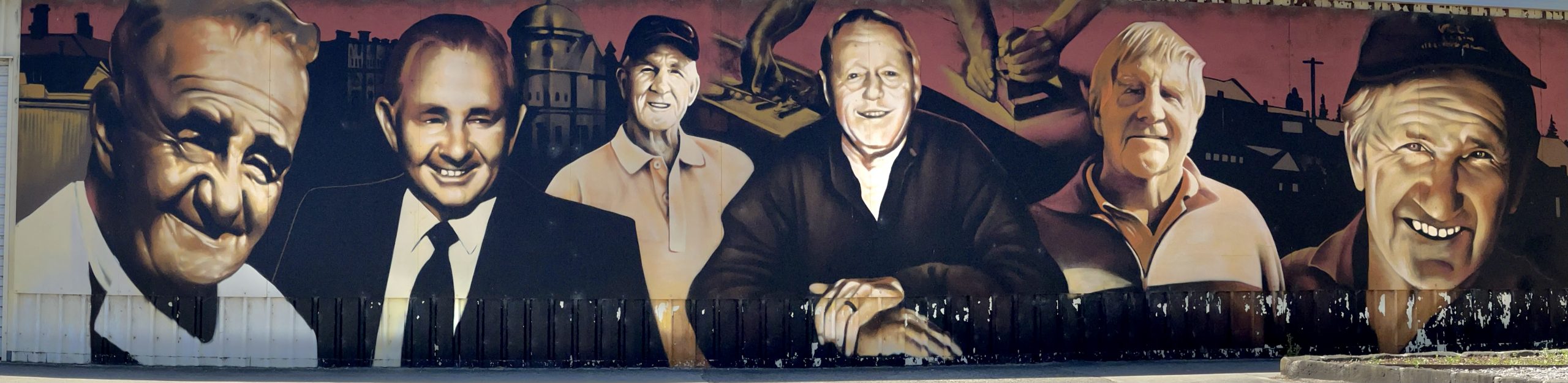
The men’s shed has paintings of men who worked in the Scammell’s construction business including members of the Scammell family. The firm built many of the buildings in the commercial part of Yarram and was a very important business in the area for many years.

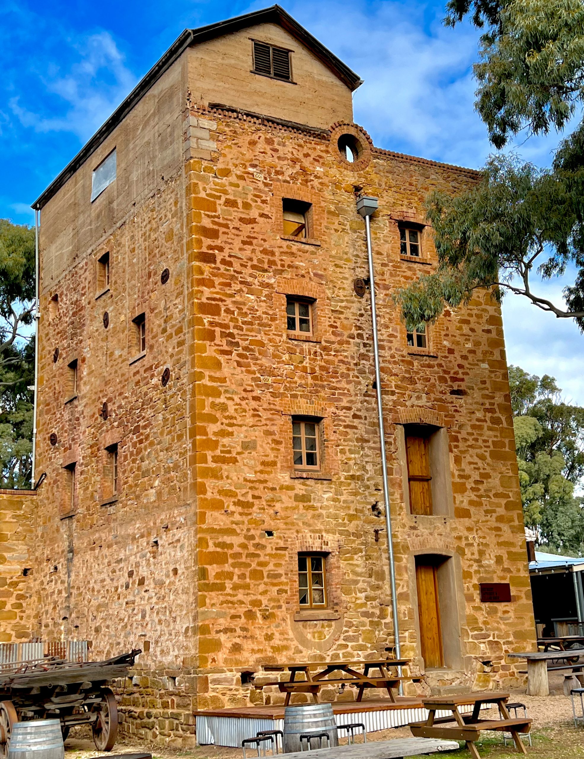
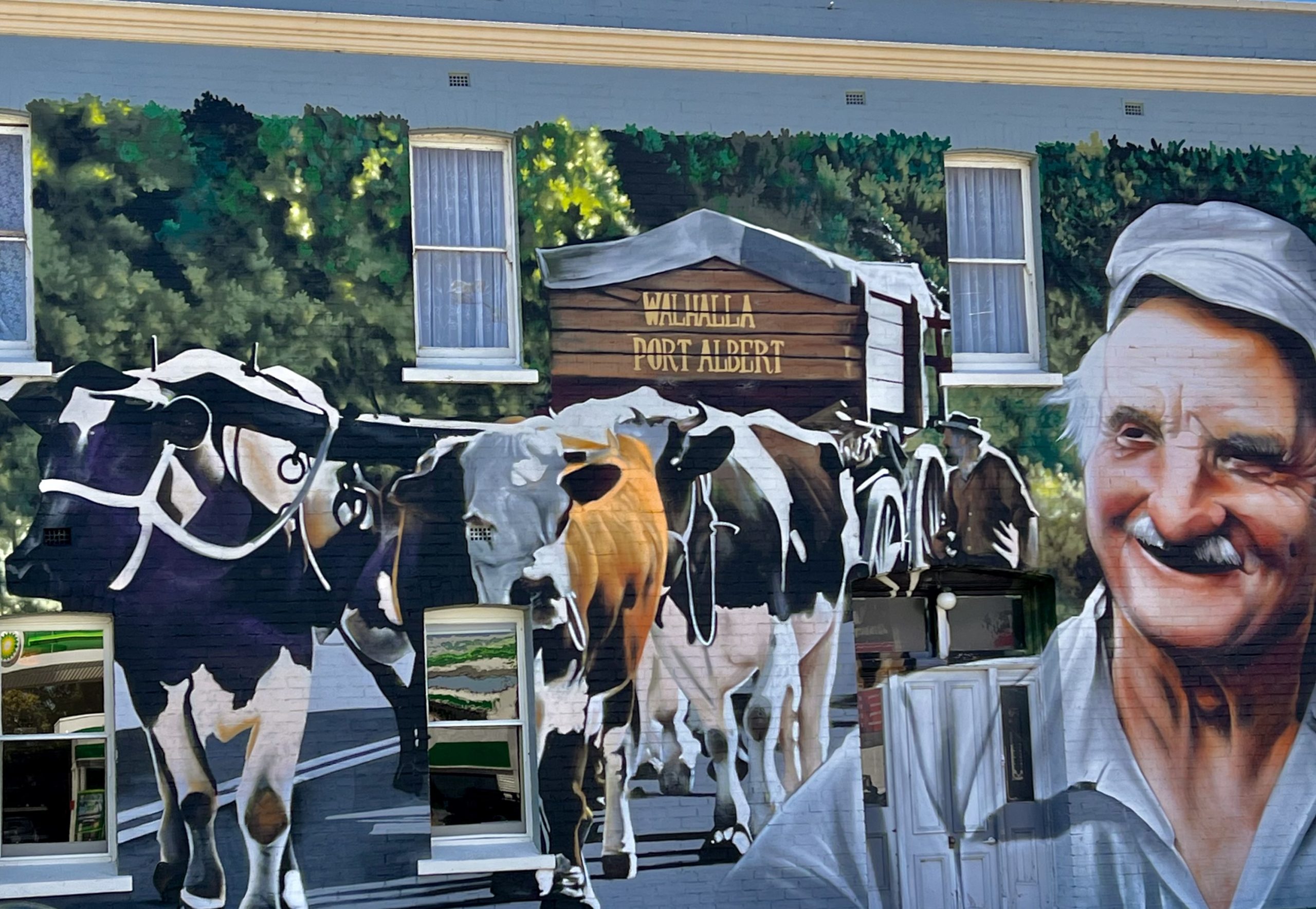
The Coffee Palace is the oldest brick building in Yarram (1888) and the mural on the wall is of Ralph Vale an early pioneer in the district and a bullock team driver. Ralph drove his bullock team from Walhalla to Port Albert when an old man for the 150th anniversary of Port Albert. He even made boots for the bullocks out of old car tyres to protect their hooves on the bitumen roads. A parked car and a parking sign made photography difficult.

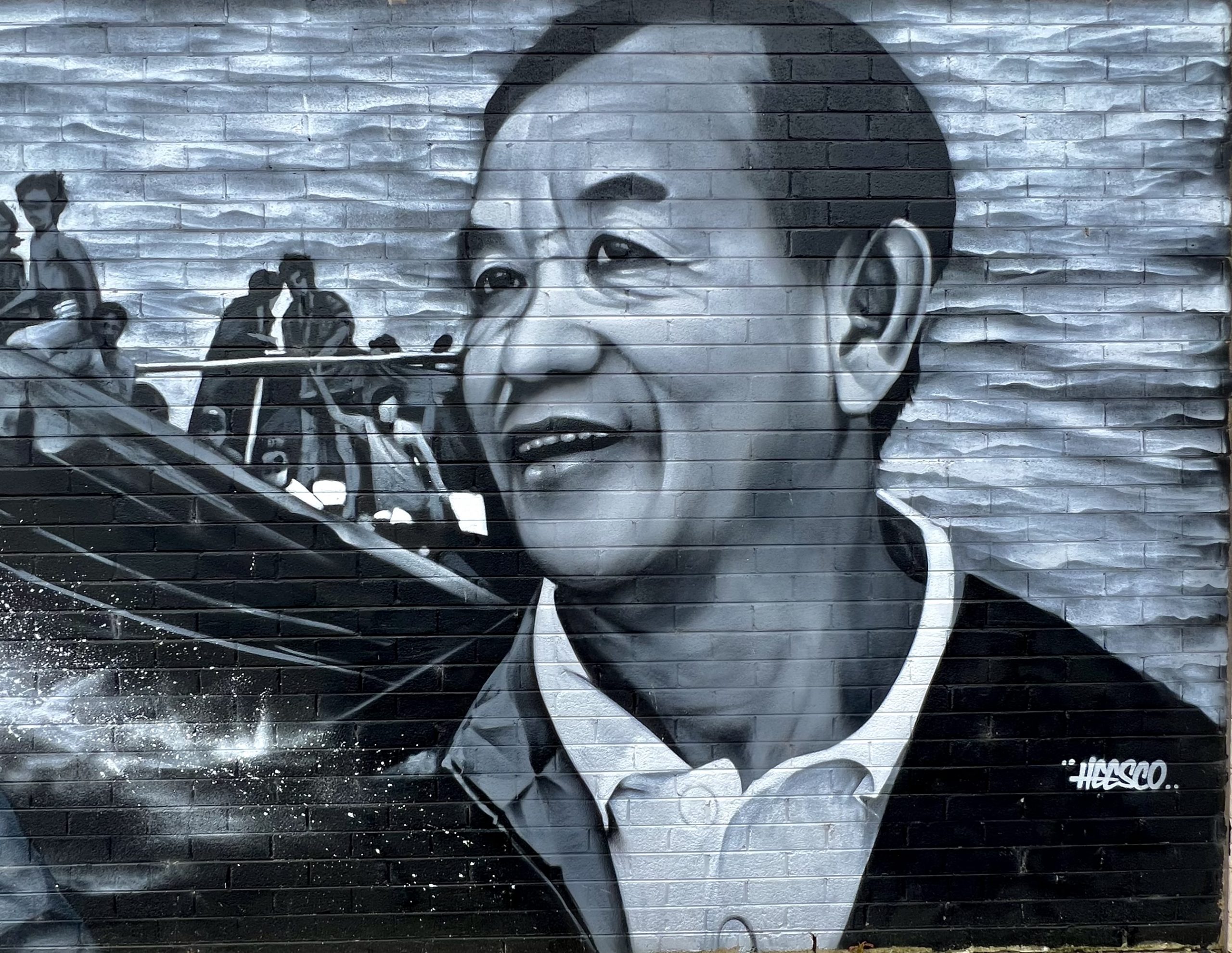
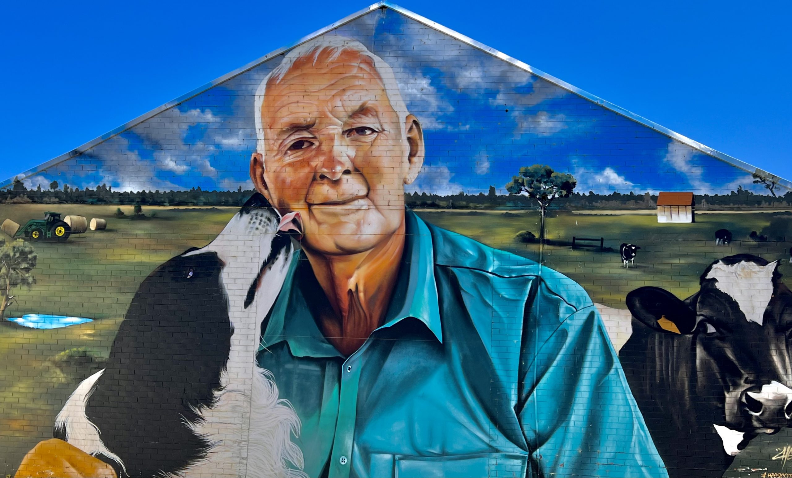
The final mural I will include is the one on MG Trading store which is of Bill McKenzie who working at the business for over 50 years. As Heesco was getting towards finishing the mural Bill visited and commented “It’s getting better”, but it turns out that Bill is actually delighted with the finished product.

There are a lot more murals around Yarram but these few will give you a taste of Yarram’s street art. The other thing that is good down here is the fish and chips on the wharf at Port Albert. They are still excellent and well worth a visit. It is takeaway but you can eat the takeaway on the wharf outside or inside, which I chose as it was freezing and blowing a gale outside.

So off home tomorrow, it’s too cold for me to be outside with such a cold wind but I have enjoyed the break.

Posted in 2023 | 9 Comments

Morning Glory – Camp 51 # 2

Barry and Rhonda arrived on Wednesday and we had a good time around the campfire, Deen had bought 1/2 a cubic metre of red gum firewood so we had plenty to keep us warm, although the nights were not too cold. The next day we went for a picnic together at Reed Bed Wetlands near Mathoura. It was a beautiful spot with a 200 metre boardwalk out to a dual level bird hide with great views over the wetlands. Every five or so metres along the boardwalk was a round sign giving info on the birds we could see here. If you spun the sign around a few times a speaker would broadcast the sound of the illustrated bird. Here are a couple of examples, the one on the left is a Great Egret.

There were a few birds about on the wetland but it was quite relaxing sitting watching for activity which included a two foot long fat catfish.

It was great to catch up with everyone who had arrived while we were out and we spent most of the time sitting around chatting about what was going on in all our lives. On Saturday we all went to the Barmah pub for lunch which was good quality pub grub, it was a scorching hot day so we all enjoyed the air conditioning. After lunch Pete & Barb headed home and the rest of us went into the National Park and enjoyed exploring what we could, as most of the park is still closed with flooding. For example the waterhole near the cattle yards was full, I’ve never seen it with more than a puddle in it, or dry!

The group photo below was taken in the camping area which has only one of three toilet blocks open as the others are still full of water.

On Sunday most of us headed off with only Davo and Cheryl staying until Monday. We were going to stay, but Cam & Mel have just bought a new farm so we wanted to call in as Cam could meet us there on Sunday. The property has plenty of potential with wonderful views but needs lots of work as the previous owners had let things slide. The three of us did enjoy sitting around the fire together for the first time for a while, but the wind was freezing. Cam took the tractor out of the shed so we were able to get some relief from the wind. Davo and Adam may recognise the fire bucket.

Deen and I camped there for the night to awake to a brisk morning with mist on the hills. The view is from the top of the drive near the house. The view in the other direction is even better, but I had to walk to see that one!

After our goodbyes Deen headed home to collect her precious PJ, Cam headed home to be with Cooper in his exam week (Mel is in Aruba on an assignment), and I headed for Yarram to check out the street and silo art. More on that to come. I think I will head home on Thursday as the weather outlook is for mild weather but the chill wind makes being outdoors not enjoyable.

Posted in 2023 | Leave a comment

Morning Glory – Camp 51 #1

Deen and I arrived at Morning Glory on the Friday of Melbourne Cup weekend for a 10 day stay that included meeting up with our friends for the 51st time at cup weekend. We were booked in the camp here for our 50th year but Morning Glory was flooded. Here are a couple of photos, the first is of the toilet block near our camp showing the camping area flooded. The second is of the road into Morning Glory with the resort ute parked in the edge of the flood waiting for supplies coming down the road in a small boat.

Our camp sites were right on the edge of the Murray so we could face out from the camp away from the many cup weekend campers. Our friends were not to arrive until the following Wednesday and Thursday so Deen and I set off to Katamatite to see a Jimmy D’Vate silo and it was worth the trip, he paints so precisely and does birds really well, he is my favourite silo artist. I was hoping that the nearby concrete silos had been painted since my last trip but they were not even started.

The detailing of the feathers of the parrot are just so good.

The image of the Barmah wetlands is similarly excellent with the reflections in the water adding an extra dimension.

From here we headed to Katamatite to see the silo art there. The artwork was OK but the artist appeared to have been unable to allow for the change of curve on the silos so the train has an unusual bend that detracted from the whole image in my opinion, but the rest of the artwork is good

We had our regulation BBQ picnic at a picnic area in Katamatite where the eagle sculpture, made out of discarded farm equipment pieces, was remarkable and very good. The eagle is carrying a rabbit to feed two baby eagles in the nest.

Over the weekend we drove to Cape Horn Winery where the place was really buzzing. It is now owned by the people who own Morning Glory and they have developed it from a small operation into a major tourist attraction. The wine is till excellent but at least twice as expensive as it used to be – $35 for a bottle of chardonnay. The winery is of a big U bend in the Murray, hence the Cap Horn name.

It was a very hot day so we stayed in the very large covered area and enjoyed wood-fired pizzas, but most people were out on the lawns enjoying the beautiful weather and the music.

Other than these excursions we drove around a bit checking the car trial detail we had written for last year and enjoyed a picnic in the Barmah forest.

Posted in 2023 | Leave a comment

Cobdogla & Green Lake

It’s a bit sad to be heading home, but needs must as Deen has already missed 5 weeks of earning money so for her a holiday carries that extra cost. She is also missing her little cat, PJ, who is in a cattery, but they do send Deen a photo every couple of days. After an uneventful trip from Wilmington we set up camp at the Cobdogla Caravan Park which backs onto a lagoon which filled during the recent Murray flooding. Cobdogla is a small village that is surrounding by grape growing blocks that used to be 10 acres, but may now be amalgamated into bigger holdings. A guy I worked with, Ronnie Duncan, purchased a block at Cobdogla and used to make a red wine that would blow your head off. Marg and I shared a bottle and were both very drunk after finishing it, such was its potency.

Cobdogla lagoon
Sunset over Cobdogla Lagoon

The caravan park had been saved from flooding, as had the village, by a large levee constructed by the local council. It was a massive piece of earthwork that makes you wonder where all the earth came from. The flood came about 2/3 up the levee which has been partially removed to allow access to the lagoon.

After setting up we visited Glossop Winery for a wine tasting. They have table wines but their specialty is fortified wines and their Topaque (Tokay) was excellent. They also had a very good sparkling Durif which I am drinking while I type up this blog. Next day our activity was to visit the Banrock Station Wetlands and Cafe. Banrock have regenerated the wetlands and now regulate the water flow to the wetlands to simulate what would have happened when the Murray was a “free” river. The wetland did suffer in the recent flood so the extensive boardwalk was closed as it had been damaged. However the 3 Km walk through the bush was an enjoyable one. Here are some photos taken on the walk.

The most noticeable thing on the walk was how healthy and green all the native bushes were and there were a few in flower, but you had to look hard.

The cafe overlooks the wetlands and this is the view you get from the wide deck where we sat to have lunch.

The Banrock Cafe have a set menu for $40 which includes two starters, two salads and two mains and all were excellent. The starters were olive bread, olive oil and Dukkah and a home made croquette fish finger, all of which were excellent except the Dukkah was a bit salty to my taste. Both salads were excellent as well, one was pearl couscous with roquette with dried figs and apricot and flaked almonds. The other salad was roast potato and pumpkin with roquette and burrata (made from mozzarella & cream) mixed through it.

The first main was pan fried Mulloway with cauliflower puree and capers and the other main was red wine and honey glazed chorizo with roasted sweet potato and crumbled Feta cheese. To go with this we had tastings of five different wines, three whites and two reds which were all very drinkable but non outstanding. The one thing we forgot to do was to take photos of the food! We would definitely recommend a visit to Banrock Station if you are travelling in this area of Australia.

On the way home we crossed the Murray and stopped for a photo.

That evening we couldn’t resist another sunset photo, this time at Cobdogla with Venus making an appearance.

Next day we moved to Green Lake (near Sea Lake) and on the way we passed the Walpeup silos which were being painted.

Green Lake is a great camping spot which has power and water available at some sites in a casual setting around the lake. We enjoyed our last campfire and took a couple of photos late in the day.

We had purchased two small lamb roasts from the butcher at Burra, who is renowned for their saltbush lamb. We scrounged up some veggies and cooked the roast in my oven style BBQ. We hit a sweet spot and everything was cooked perfectly – meat, spuds, beetroot, onion and capsicum – all baked and delicious and enjoyed with some excellent wines. It was a marvellous end to a truely wonderful holiday. All that’s left now is the drive home tomorrow. In this holiday we have travelled over 7,000 Km in just over 5 weeks and visited some wonderful places that will stay in our memories for a long time. We are so lucky to be living in Australia and able to easily visit such memorable places. So that’s it for now, if you have subscribed you will get an email the next time I am travelling and publishing a blog, thanks for following, I hope you enjoyed the trip as much as I did.

Posted in 2023 | 4 Comments

Gammon Ranges & Wilmington

I took a couple of additional photos of our camp at Weetootla Gorge before we moved on, one at sunset and another at dawn, I just love the colours you get in the sky.

On the way to Wilmington we travelled through 130 Km of dirt roads and roadworks so our cars and vans have copious layers of mud. When we stopped to gather some firewood I used my spade to remove about 10 Kg of mud off the steps of Deens camper. We drove down through the Flinders Ranges National Park and stopped for a photo at Rawson’s Bluff which was in full sun while the range had low cloud above it.

At Wilmington we stayed at Stoney Creek Bush Caravan Park a nice bushy park, not too crowded, and the manager makes delicious pizzas which we devoured for dinner. The next day we headed for Mt Remarkable National Park and Alligator Gorge for a picnic lunch and look around. It is a lovely park we walked to the two gorge lookouts before our BBQ lunch.

The bush along the walk was dotted with grass trees and a number of wildflowers, I think that the wildflowers here would be a wonderful display in spring.

Here is a view across the country from the road down from the top. It was a day of mixed weather as the clouds show, but we were lucky that we didn’t get any rain while we were walking and picnicking.

In the valleys around Mt Remarkable, one of the highest peaks in the Flinders, there are many massive and beautiful River Red Gums that farmers have left in their paddocks, rather than clear felling as is usually done.

On the way back to camp we passed through Melrose, another small town, where there was the Jacka Brothers Brewery, unfortunately not open until later in the day, but the old brewery building was worth a photo.

The next day we moved on to Cobdogla, a small town on the Murray about 35 Km from Renmark. I did wake a bit early and managed another dawn photo from our camp, it was cloudy and very chilly, but worth the effort.

We will be staying at Cobdogla for two nights before moving back to Green Lake near Sea Lake and then home. Tomorrow we will visit Banrock Winery Cafe and wetlands.

Posted in 2023 | 2 Comments

Gammon Ranges and Arkaroola

The camping area at Weetootla Gorge was being developed and re-arranged and some seedling trees planted so in a few years it should be really attractive, at the moment it is a bit bare, but we are happy with our campsite which has a table and fireplace.  The long-drop toilet is new and not at all smelly so that was appreciated and drinking water is available from a tank next to the toilet.  Hot showers can be had at the ranger’s station about 6 Km drive away.

On the way into camp on the main Arkaroola Road we passed Balcanoona Creek that runs through Weetootla Gorge and the cliff that abuts it were impressive.

We headed for Arkaroola the next day which is about 30 Km away.  It is a sanctuary established privately in the 1940s.  The area is very rugged, and all the driving tracks are quite narrow, rough and stony.  The rugged hills, of which there are many, have their own rugged beauty. This hill is the backdrop to the caravan park.

We headed off to Stubbs water hole along a windy, twisty and stony track only about 6 Km but it took about 30 minutes such was the status of the track.  Fortunately, only one vehicle came toward us in the other direction and that was in a spot we could slowly pass as there were very few passing spots.  Stubbs water hole was dry but still as good spot for a break and a BBQ lunch.  We took the phone tripod but forgot to take a photo of us having lunch.  There were numerous caves in the rock faces around the waterhole and some artwork, but we thought it too fresh to be original aboriginal artwork. Here are some photos.

On the way back to camp we realised that the road into camp is quite attractive and provides a good view of the Gammon Ranges. and the start of the gorge.

It is hard to get a good photo of the range as it runs for such a long distance so it looks a bit insignificant in a photo. This is the range that runs north east from the gorge.

In places the road into camp which is 5 Km long, is quite rough as it crosses Balcanoona Creek a number of times, and the creek is very rocky. The river red gums that follow the creek are massive and wonderful trees.

On Monday we walked up Weetootla Gorge for a 2.2 Km return walk.  They had markers every 200 metres which we thought was a great idea, also lots of labels on native plants and trees and signs with photos and descriptions of native flora and their uses in the first 400 metres of the walk.  There were a few wildflowers in bloom.

The sides of the gorge tower above you as you walk along a meandering path that is reasonably smooth for a change.

It is interesting that the creeks in the gorges in the Flinders and Gammon Ranges are very rocky and have lots of trees and bushes growing in them whereas the creeks in the gorges of the MacDonnell Ranges are wide and sandy and have only a few big trees growing and then mostly at the sides of the creek. This maybe related to the intensity of the rain when it does fall.

On Tuesday we headed off to Wilmington for a couple of days where we will visit Mt Remarkable National Park and Alligator Gorge.

If you would like to be notified when I publish a new blog just enter your email address in the box below and click subscribe.  You will not be bombarded with advertising material.

Posted in 2023 | Leave a comment

William Creek to Gammon Ranges

Around 9.30 in the morning we boarded a small six-seater plane for a flight one hour over Lake Eyre.  The one hour duration flight worked perfectly because the leg-room was so tight you couldnot have endured longer, still it was a good experience.  The Lake is about 50 Km from William Creek and we flew over part of Anna Creek Station on the way.  The pilot gave us excellent commentary for the whole flight and corrected one fact that I quoted in the last post.  Google advised that Anna Creek was 8000 square Km, whereas it is actually 23,000 sq Km so it is roughly 8 times the size of Kings Ranch which is the largest in the US. 

Interestingly the maximum allowed herd size for Anna Creek is 18,000 head, Kings Ranch on 1/8th the area carries over 100,000 head such is the difference in the land and water availability.  Anna Creek just mustered their cattle and rounded up 15,000 head.  The muster is done with two gyrocopters and a number of people on motor bikes.

The plane flew mainly at 1500 feet and in the first photo you can see three parallel sand-dunes.  In the Simpson Desert, the largest parallel sand-dune desert in the world, there are over 1140 sand-dunes starting on the western side at around 3 feet and gradually getting bigger until the last dune, Big Red at 130 feet.  You will notice more greenery on the dunes which is because the rain soaks into the dunes and saves the moisture, whereas on the plains the mainly clay surface is impenetrable and most of the water lies on the surface and evaporates.

We also flew over the dry Breakfast Creek.

As we got closer to Lake Eyre the earth started to change colour to a darker shade and then to black.  The black is created by magnesium that is left in the ground after the water of the lakes has leached out all the iron oxide (the mineral that makes most of central Australia the classic red colour).  In places the flats were white from the lake salt which averages about a foot thick.

This area of Australia has many mound springs, and some are located in Lake Eyre and we flew over a couple, here is one.

We were then over the lake and the following photos are of the lake and an island in the centre of it.  In some places there are lines of pink salt along the edge of the water making a attractive patterns.  The water reached Lake Eyre nearly 4 weeks ago coming from rains earlier in the year in western Queensland.  The river that feeds Lake Eyre from the north is the Warburton River and Cooper Creek plus the Georgina and Diamantina Rivers feed water into the Warburton.  The Neales and Macumba Rivers feed into the lake from the west from rains in central Australia.  For the lake to fill all these three rivers need to be flowing into the lake, this has only occurred 3 times since European settlement, the last being in 1974.  This year it is only the Warburton that is running so the lake will not fill but will cover nearly all the lakes area. 

Lake Eyre (Kati Thanda) actually consists of two lakes, Lake Eyre North (8 430 km²) and Lake Eyre South (1 260 km²), connected by Goyder Channel which has a length of 15 km and 100 metres wide at its narrowest.  The lake’s basin covers more than 1 million km², or 1/6th of the continent, mainly in Queensland, South Australia and the Northern Territory and is one of the world’s largest closed basins. At its lowest Lake Eyre is 11 metres below sea level.

The water from Queensland flows toward Lake Eyre at about 8 Km/Day but in a couple of weeks ago it was slowed to 2 Km/Day by strong winds and once the winds dropped the flow sped up to 20 Km/Day because of the massive backup of water.

When the plane turned for home we crossed over the shoreline again this time the ground was raised above the lake so there were no flats.

We flew over the Oodnadatta track and passed a couple of clay-pans.

After the flight we packed up and headed for Coward Springs for an overnight stop, it was only 70 odd Km away, but we wanted to stay there.  So we headed down the Oodnadatta track again with the old Ghan railway still running parallel to the Oodnadatta Track, and we passed an old railway bridge.  The line closed in 1980 when it was moved about 200 Km to the west to avoid the many creeks and a couple of rivers that crossed its path and caused regular wash-aways. Here is a photo of the bridge we passed taken from the plane as we flew over.

Along the old Ghan track were regular Fettlers Cottages where the men who maintained the track lived.  You also pass many raised water tanks that stored bore water for the steam engines.  Some of this water contained lots of minerals so distillation towers were built to distil the bore water into pure water for the steam engines.

Coward springs is a delightful basic camping area which has been established near wetlands that were created when a bore put down to supply water for the Ghan flooded the area.  So there are lots of trees and bushes in the park. This is our camp at Dawn.

Coward Springs used to be a major stopover on the Ghan and the Engine Drivers Cottage still remains.

The people that run the park grow and harvest dates and we had a cone of excellent home-made date ice-cream.  Not many flowers in bloom here but I managed to find one tiny one about 4 mm across. The park also has a natural spa fed directly with water from the artesian basin.

After Coward Springs we continued our journey down the Oodnadatta Track and passed Lake Eyre South, still a part of Lake Eyre but separated from the main Lake by the Goyder channel.  This part of the lake fills last but shallow water was evident, not that you can see much from a ground level shot.

We re-fuelled at Marree where the Birdsville track commences.  Afghans were employed on building the Ghan railway and an Afghan village was established on the outskirts of Maree.  This is a photo of their first mosque established in the 1860s taken off the information sign.  There is also a Ghan Diesel loco at the old Maree station.

From here the old Oodnadatta Track is bitumen and renamed the Outback Highway, we were quite happy to be off the tack which had very badly corrugated sections in most of the floodways’ and at the many cattle grids.  After stocking up at Leigh Creek South we headed for the Gammon Ranges and Weetootla Gorge.  On the way we stopped to gather some firewood because firewood collection in the National Park is not allowed. We used a battery chainsaw which are great for camping.  One we entered the Gammon Ranges the road wound through Italowie Gorge. As you can see, the road was very picturesque.

We found a nice campsite in the camping area and set up camp and relaxed.

If you would like to be notified when I publish a new blog just enter your email address in the box below and click subscribe.  You will not be bombarded with advertising material.

Posted in 2023 | 2 Comments

Ross River to William Creek

One our last evening at Ross River a Black Cockatoo visited the campground, it was a long way off but I was able to get a photo.

Next day we checked the road situation, and it seemed that the roads would be OK to at least Oodnadatta and hopefully beyond that with another day for the roads to dry out.  So we stopped at Kulgara Roadhouse after an easy 400 Km drive on bitumen.  We feel a bit sad to be heading south as we have really enjoyed our time in Central Australia, and it’s not cold.  The lack of good Internet has been an ongoing issue and will be for the next few days at least.

After Kulgara it was off to Oodnadatta as the Oodnadatta Track was open to William Creek.  We had planned to go through the Painted Desert but that road was closed for people towing.  At Oodnadatta we visited the famous Pink Roadhouse with their sign pointing to many locations.  The old sign had the arrows arrayed in the direction of the destinations, the new one is one dimensional and lacks a bit of character as a result.

Deen checked the road conditions and found the road to William Creek had been closed so it seemed we were stuck in Oodnadatta.  We had travelled 400 km that day already, but we were up for another 200.  The lady behind the counter heard us talking and said they have just opened the road, we asked her to check with her manager as the phone app still had it closed.  Sure enough it was confirmed so we headed off to William Creek.  The road was OK but had lots of dips and the corrugations in those were horrendous.  So we arrived after an 8-1/2 hour drive, set up, had tea at the pub and went to bed.  By the way the pub looks just the same as it did in 1986 when we first visited before crossing the Simpson Desert, although I am sure it had a dirt floor then.

We did get a beautiful sunset at William Creek.

The road to Maree from William Creek was only open to 4WD and the roads to the Gammon Ranges (our next stop) were closed so we thought we would stay an extra day at William Creek to give the roads a chance to dry out. So we headed off to Strangways Springs.  This is an abandoned telegraph station on the telegraph line opened in the 1870s.  At that time they had to have repeaters every 300 Km to relay the messages as the signal strength dropped over those long distances.  The settlement had been quite extensive and operated from 1872 until 1896 when it was moved to William Creek. 

It was explorer Stuart on his expeditions north from Adelaide trying to cross the continent who discovered the mound springs that made settling in this area possible.  The mound springs are on the edge of the artesian basin that lies under 22% of Australia.  The water moves into the aquifer from the great dividing ranges at the rate of 1 to 3 metres a year so some of the water in the basin is over 1 million years old.  The pressure that is created by the height difference of the ranges to the centre of Australia causes the water to come to the surface at mound springs in South Australia.  Sadly the draw-down of water from the basin has caused these springs to stop flowing. The mounds of these springs is caused by the dissolved calcium on the water that creates limestone and builds the mounds that can be 8-10 feet high. Here are some that were at Strangways.

The one below is still active with a little seepage making its way to the surface. In this photo you can see the rocky limestone deposits.

The area is quite barren and was also the centre of operations for Strangways Station until the Telegraph Station was set up when it moved to Anna Creek, which is the largest cattle station in the world at 8,000 square kilometres. It is 2-1/2 times as big as the largest cattle ranch in the US, the King Ranch in Texas.

The buildings were all in ruins except the buttressed water tank which had been reconstructed.

The managers house had been partly rebuilt but was still mainly a ruin.

A panorama of the ruins of the wool-shed, stock yards and the blacksmith shop at Strangways

There were a few very small wild flowers growing in these harsh conditions which I managed to capture.

There was one wooden telegraph pole remaining from the 1860s, clearly a very durable lump of timber that came from the Flinders Ranges. The other photo shows a couple of tiny plants that have popped up after the rains that changed our travel plans.

Deen did notice a finch in a tree and it seemed it as building a nest, it was darting about very quickly but I managed to capture a glimpse of the red beak.

There were only a couple of trees in the area surrounding the carpark but one of them was big enough for us to fit under so we had a BBQ lunch in the shade after just about drowning ourselves in Aerogard.

So that is William Creek and surrounds. The road to Lake Eyre has been closed for a year so we couldn’t do that but we do fly over it tomorrow. After that it’s off to the Gammon Ranges where we will be out of mobile coverage for the next 4 days.

If you would like to receive an email each time I publish a blog , just fill in your email address and click subscribe.

Posted in 2023 | Leave a comment

East MacDonnells – Trephina Gorge

On our last day at Ross River we visited Trephina Gorge which we walked down and climbed the rim to a high point to get a different perspective of the gorge.  Deen also took a selfie of us both with the gorge in the background.

Approach to Trephina Gorge
The sheer Quartzite cliff typical of Trephina Gorge

Trephina Gorge has a 90° bend about 200 metres down the gorge. Another feature of the gorge is the wonderful red gums growing on the floor of the gorge and among the rocks.

The bend in Trephina Gorge
Trephina Gorge after the bend
Looking down and back to the entrance of Trephina Gorge and the range beyond

There was some aboriginal artwork under an overhang as well.

After that we called in to see a massive ghost gum, a beautiful tree in such a harsh environment. Red gums have a similar white trunk but it is speckled with patches of grey bark whereas the ghost gum is pure white.

Then Deen drove 4 Km down a goat track to John Hayes waterhole, a really rough road with lots of rocks, sometimes it was hard to distinguish the road from the creek as both were strewn with rocks.  At times the road did go along the creek bed anyway.  The effort was worth is as it was a beautiful waterhole. There is no information on who John Hayes was.

Approaching John Hayes waterhole

In the photo above the rough path is in the centre bottom of the photo, this is similar to the road.

John Hayes waterhole

To finish our time here we decided to have dinner at the Ross River Pub which was a delicious cottage pie and veggies.  Tuesday we head back to Alice Springs on the start of our journey home.   We heard that the Oodnadatta track has been closed between William Creek and Maree so that may give us some grief if it’s still closed when we need to go on it.

Now at Kulgara set up for the night and on checking the road it is OK to William Creek, we just to hope they don’t get rain tomorrow. It’s a bit ironical that Maree received no rain for the entire month of May by June 5th they had received 9 mm on the 3rd and 1 mm on the 4th.

If you have enjoyed this blog you can subscribe by entering your email in the box below and clicking Subscribe.

Posted in 2023 | 5 Comments

East MacDonnells – Artlunga

The next day we visited the old mining village of Artlunga.  It had been in ruins but about 30 years ago a number of the buildings were rebuilt using the original stones.  The most preserved section was the government works area that managed the ore stamper and cyanide separation of the gold from the rock.  This operation was started in 1898 and continued until 1913 when mining petered out.  Interestingly the police station was 1 Km from the main concentration of buildings. The small single cell gaol was built after the superintendent complained to the powers that be that the constable had to chain a prisoner to his bed as this was the only way to stop him escaping.

Artlunga Police Station & Gaol

You will notice on the photo of the gaol below a small flap in the door so they could check on the prisoner.  The single window on the other end was about the same size and the cell was about 6 feet by 8 feet, not a nice place to be confined in a hot climate.

Artlunga Gaol

The managers house had two rooms and originally verandas front and back like the police station. The assayer was the next most important person, and his house was the next biggest but only one room.  All the other houses were smaller and all single rooms except for the Post Office. The smal stone building on the bottom right is the remains of a miners house, very small.

The building with the curved roof was the gold room and offices.  This is where the miner’s gold was weighed and bought.  This building was the second gold room constructed as the miners complained that the first building on vibrated so much from the gold stamper that they were not getting the correct weight for their gold. The ruin in the photo next to this building is of the Post Office.

The boiler and steam engine were imported from Cornwall, not sure of the origin of the stamper.

We also visited Crossroads Cemetery where there were about six graves but no marking except for Jack Woodford’s grave which was surrounded by a stone wall and had a fancy headstone.

From there we went on to Jokers Mine where there were a few stone house ruins and then onto Jokers Gorge where the rocks in the gorge were much larger than you would expect for a relatively small gorge.

Despite the very dry nature of the country we did pass a couple of wildflowers.

We also managed to snap a flock of Budgies, hard to do as they fly and move so quickly.

On the way back we stopped at a high point to take a photo of the country ahead, it was such a bright green, very unusual for this part of Australia, it reflects good rains earlier in the year.

We also stopped to gather some firewood at a creek crossing so we could have a campfire and cook some potatoes and steak, which Deen marinated.  It was a delicious and so good to sit around a fire again.

The sky was unusually stormy and we did get a little rain in fact the Oodnadatta track was closed for a day and today it is open but from Maree to William Creek only to 4WD. We have had to change our plans as the Painted Desert Road is not open for towing so we will get to Coward Springs turning off the Stuart Highway at Marla and staying at Oodnadatta for a night. There is a chance of more rain at Maree tomorrow so we may have to change our plans yet again. We want to get to William Creek as we have a flight over Lake Eyre booked and don’t want to miss that.

If you would like to receive an email each time I publish a blog, enter your email address in the box below and click Subscribe.

Posted in 2023 | 2 Comments