Around 9.30 in the morning we boarded a small six-seater plane for a flight one hour over Lake Eyre. The one hour duration flight worked perfectly because the leg-room was so tight you couldnot have endured longer, still it was a good experience. The Lake is about 50 Km from William Creek and we flew over part of Anna Creek Station on the way. The pilot gave us excellent commentary for the whole flight and corrected one fact that I quoted in the last post. Google advised that Anna Creek was 8000 square Km, whereas it is actually 23,000 sq Km so it is roughly 8 times the size of Kings Ranch which is the largest in the US.
Interestingly the maximum allowed herd size for Anna Creek is 18,000 head, Kings Ranch on 1/8th the area carries over 100,000 head such is the difference in the land and water availability. Anna Creek just mustered their cattle and rounded up 15,000 head. The muster is done with two gyrocopters and a number of people on motor bikes.
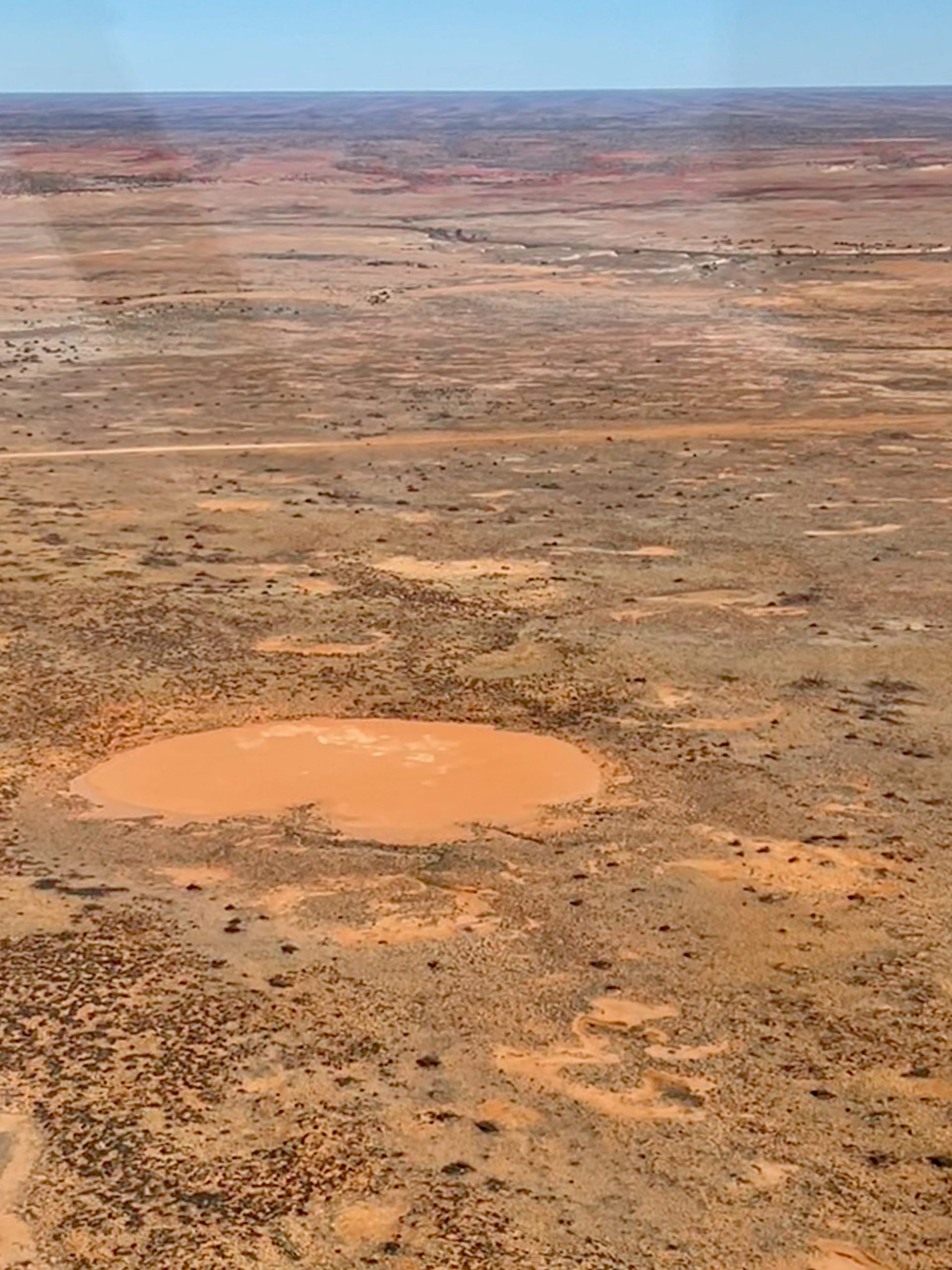
The plane flew mainly at 1500 feet and in the first photo you can see three parallel sand-dunes. In the Simpson Desert, the largest parallel sand-dune desert in the world, there are over 1140 sand-dunes starting on the western side at around 3 feet and gradually getting bigger until the last dune, Big Red at 130 feet. You will notice more greenery on the dunes which is because the rain soaks into the dunes and saves the moisture, whereas on the plains the mainly clay surface is impenetrable and most of the water lies on the surface and evaporates.
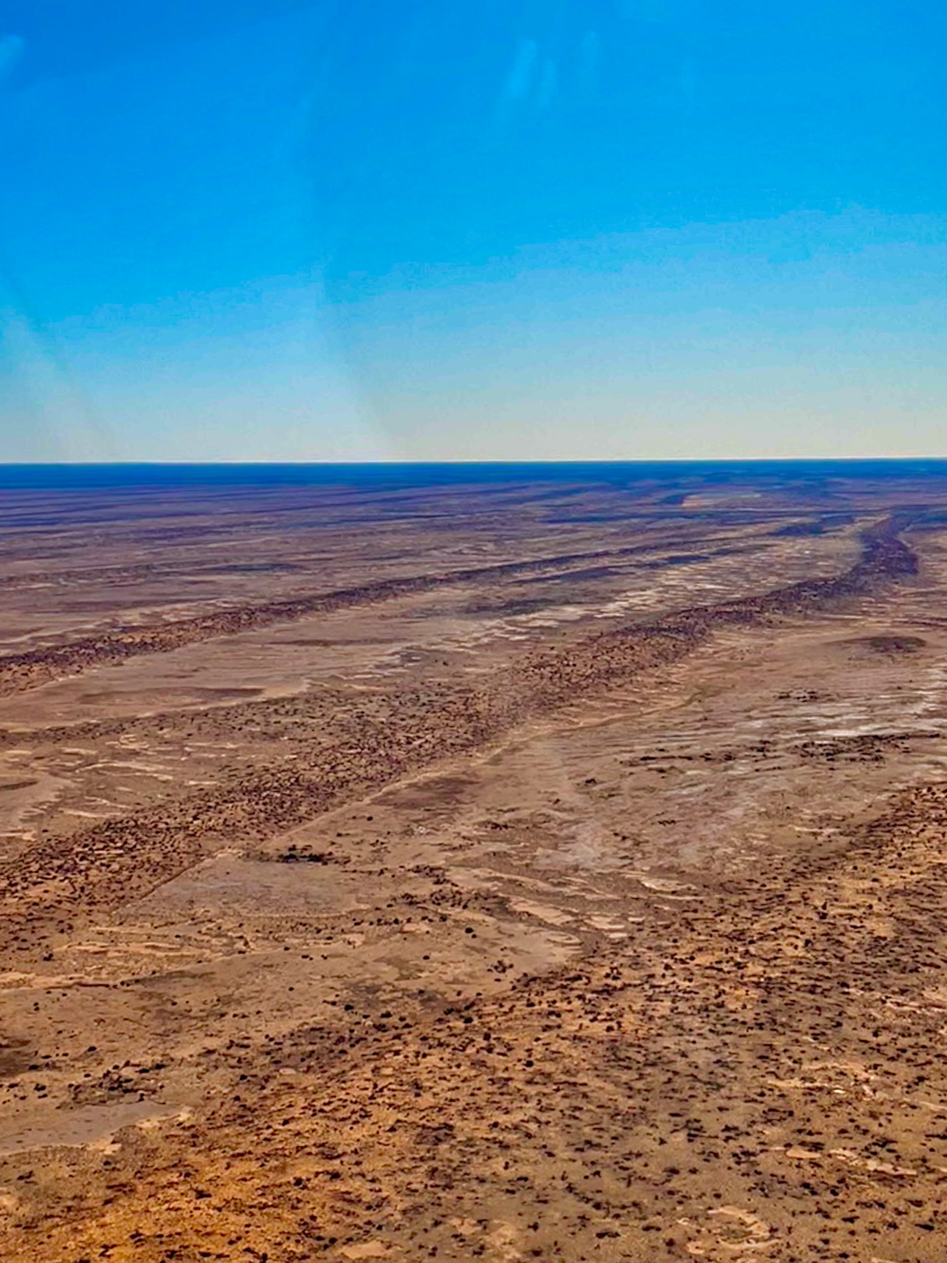
We also flew over the dry Breakfast Creek.
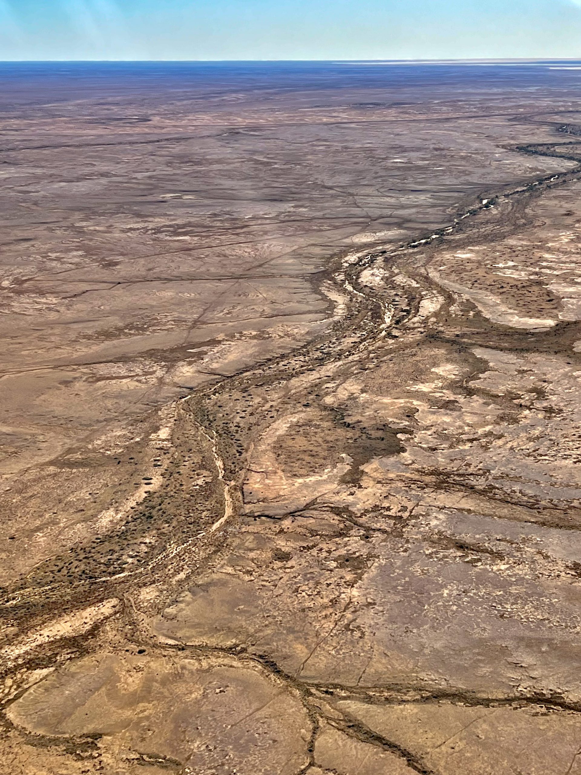
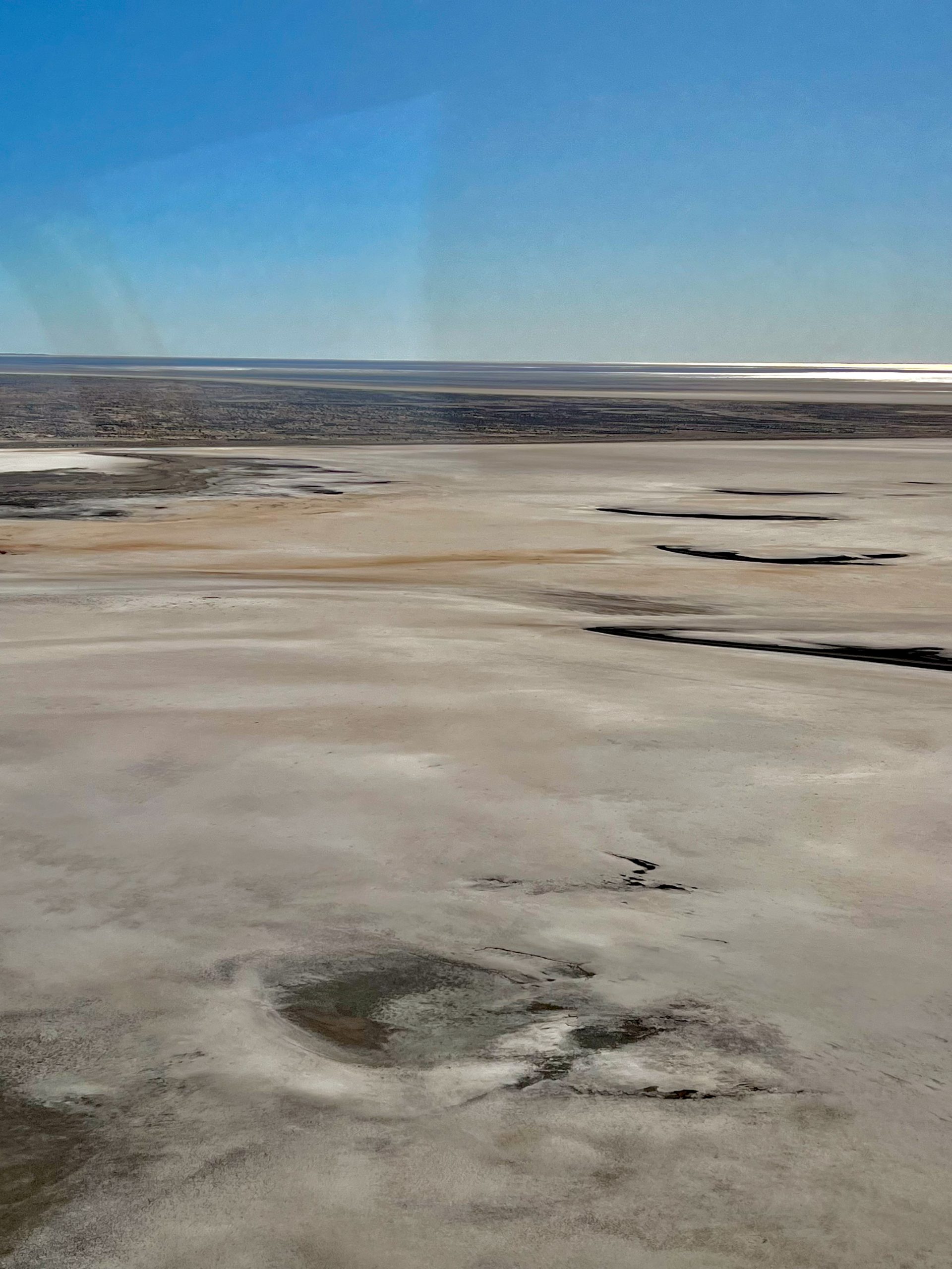
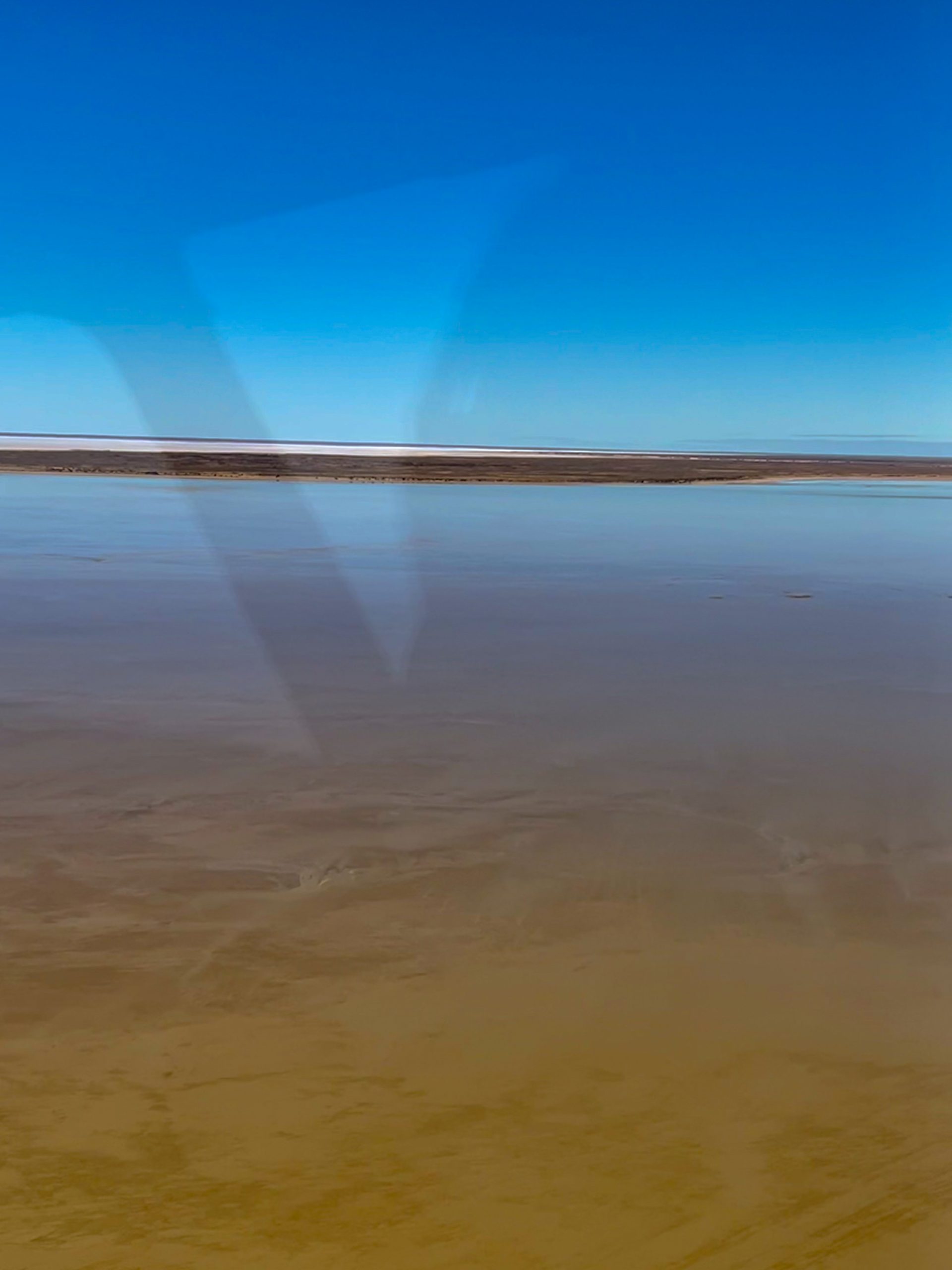
As we got closer to Lake Eyre the earth started to change colour to a darker shade and then to black. The black is created by magnesium that is left in the ground after the water of the lakes has leached out all the iron oxide (the mineral that makes most of central Australia the classic red colour). In places the flats were white from the lake salt which averages about a foot thick.

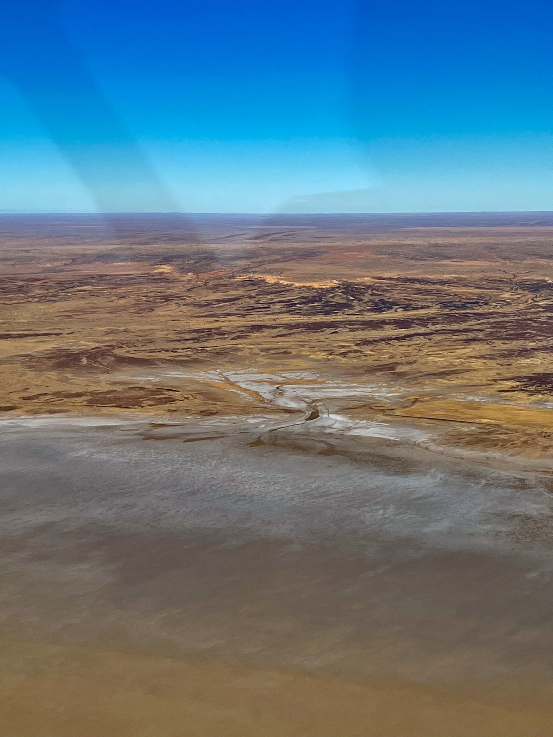
This area of Australia has many mound springs, and some are located in Lake Eyre and we flew over a couple, here is one.
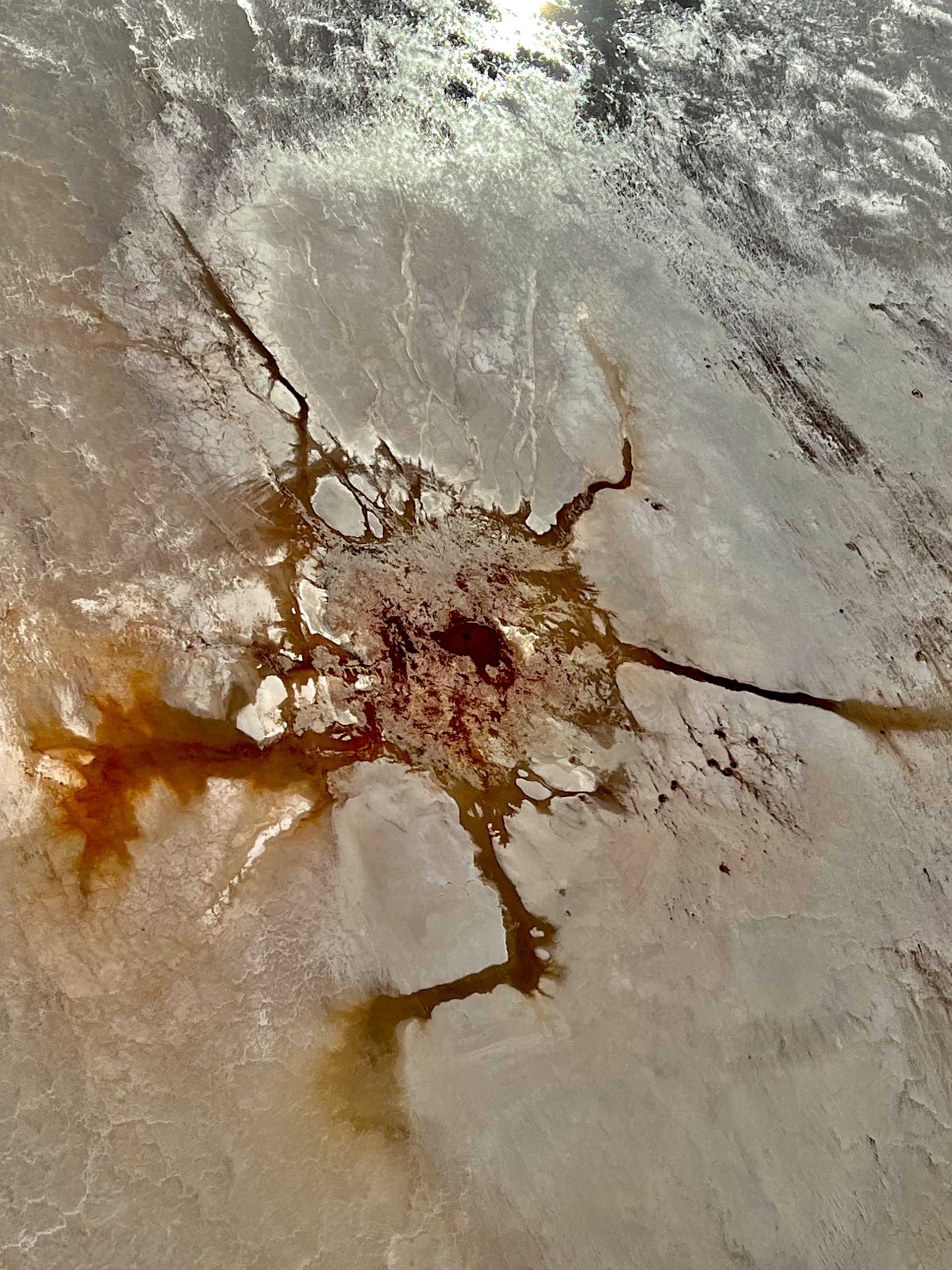
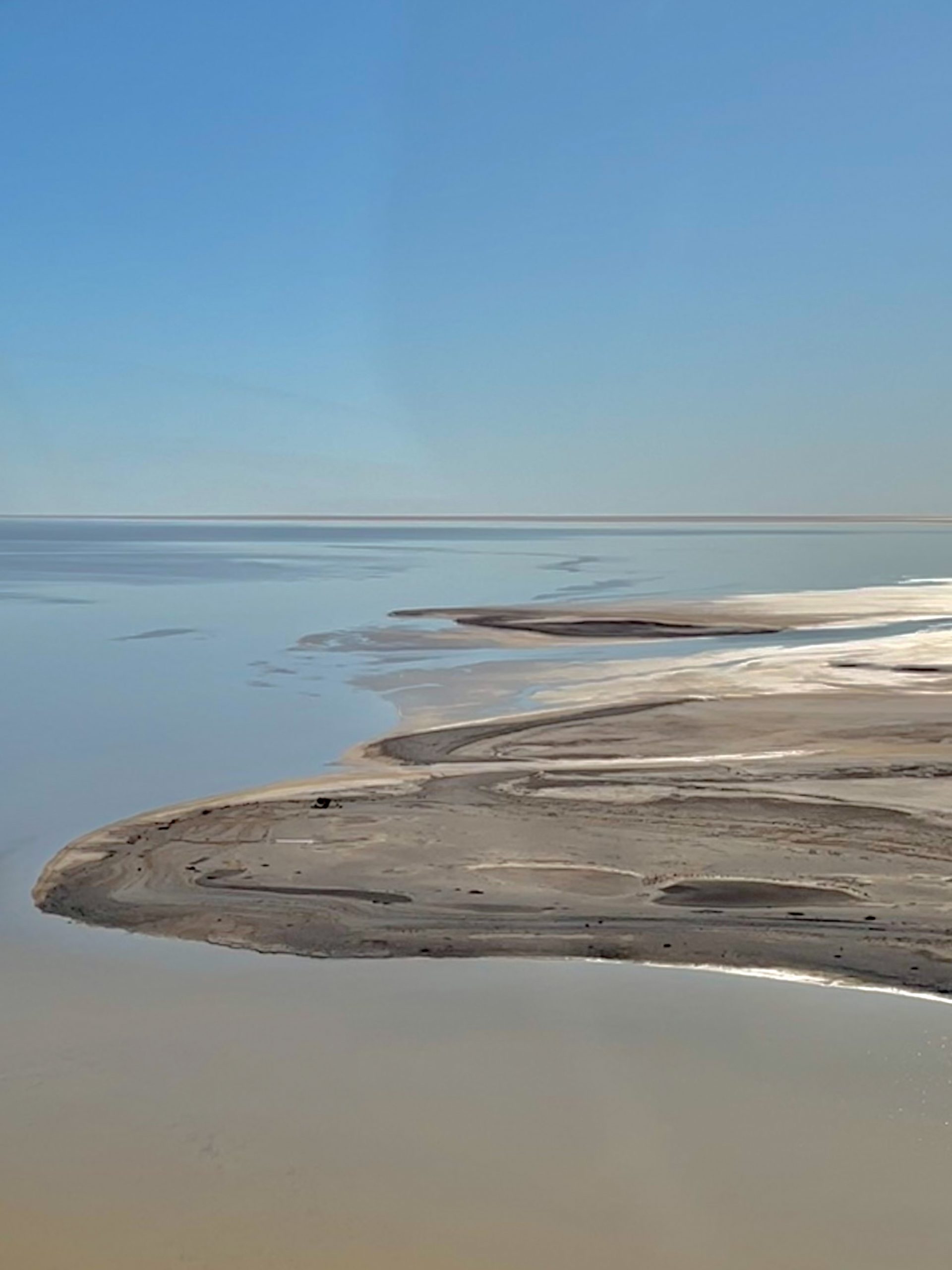
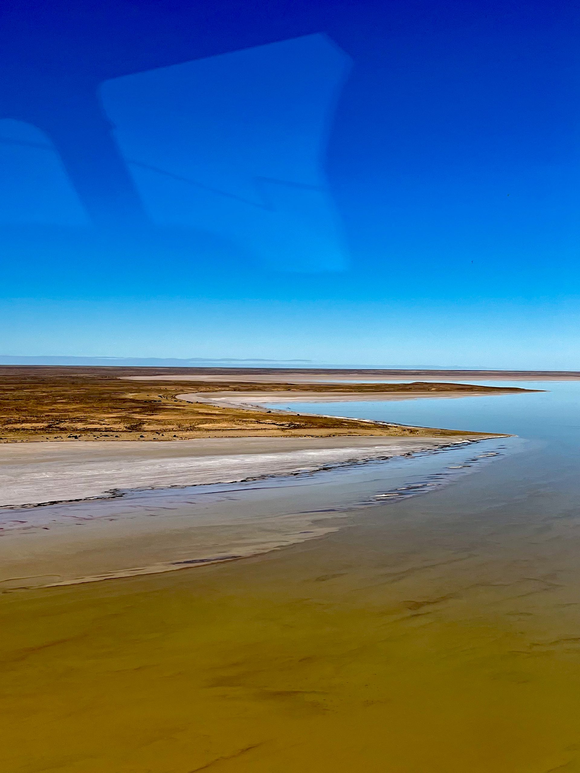
We were then over the lake and the following photos are of the lake and an island in the centre of it. In some places there are lines of pink salt along the edge of the water making a attractive patterns. The water reached Lake Eyre nearly 4 weeks ago coming from rains earlier in the year in western Queensland. The river that feeds Lake Eyre from the north is the Warburton River and Cooper Creek plus the Georgina and Diamantina Rivers feed water into the Warburton. The Neales and Macumba Rivers feed into the lake from the west from rains in central Australia. For the lake to fill all these three rivers need to be flowing into the lake, this has only occurred 3 times since European settlement, the last being in 1974. This year it is only the Warburton that is running so the lake will not fill but will cover nearly all the lakes area.
Lake Eyre (Kati Thanda) actually consists of two lakes, Lake Eyre North (8 430 km²) and Lake Eyre South (1 260 km²), connected by Goyder Channel which has a length of 15 km and 100 metres wide at its narrowest. The lake’s basin covers more than 1 million km², or 1/6th of the continent, mainly in Queensland, South Australia and the Northern Territory and is one of the world’s largest closed basins. At its lowest Lake Eyre is 11 metres below sea level.
The water from Queensland flows toward Lake Eyre at about 8 Km/Day but in a couple of weeks ago it was slowed to 2 Km/Day by strong winds and once the winds dropped the flow sped up to 20 Km/Day because of the massive backup of water.
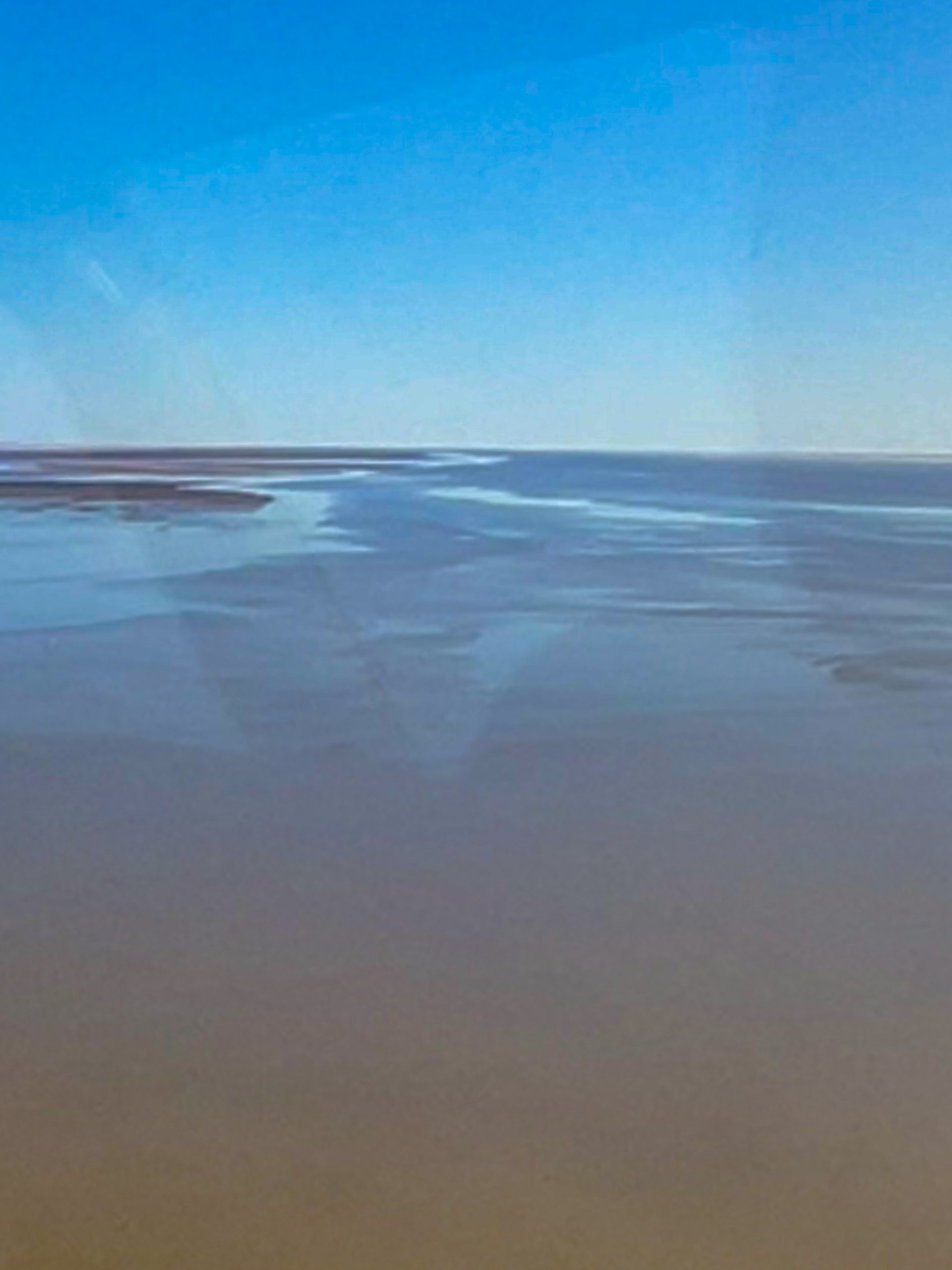
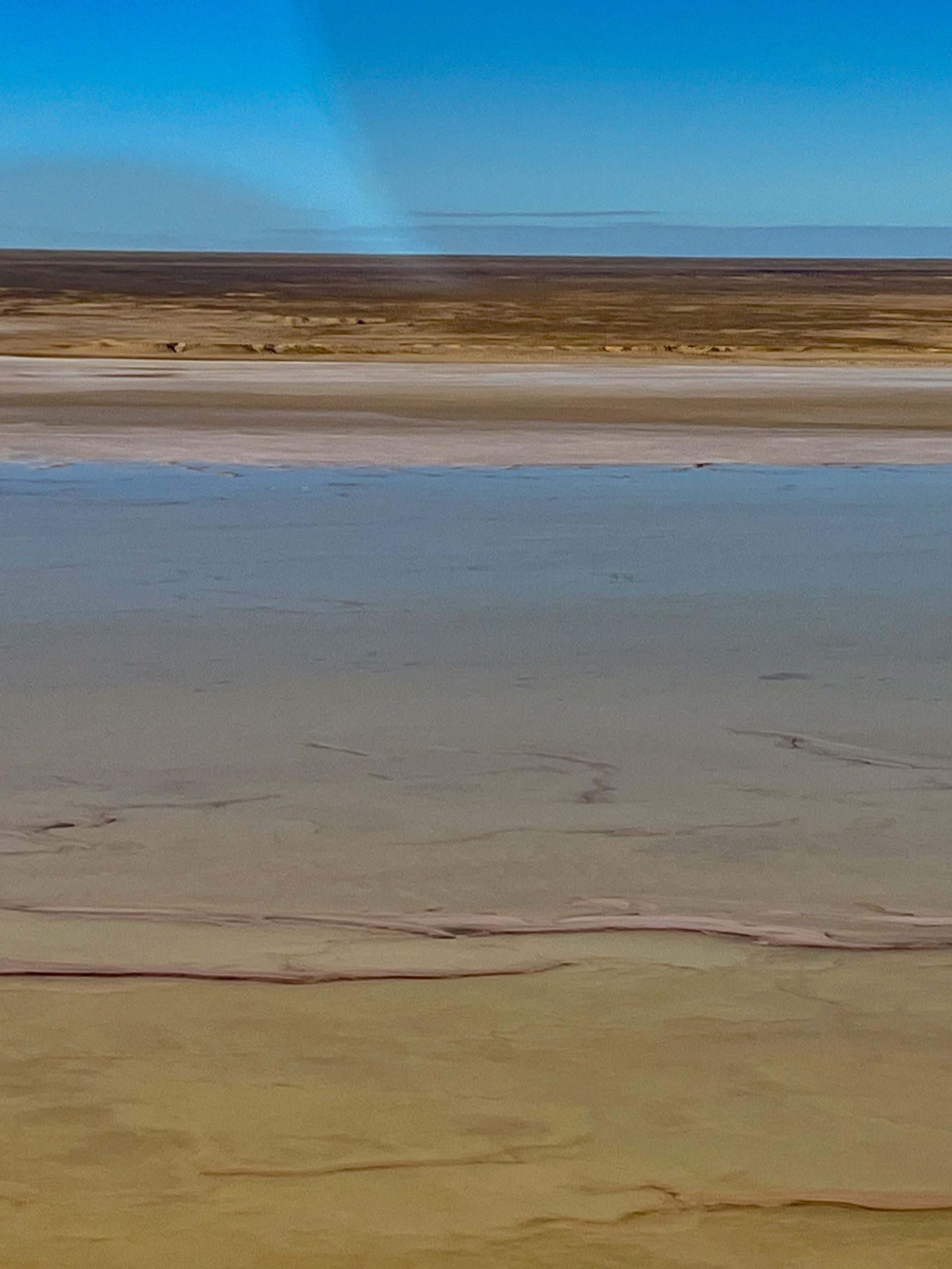
When the plane turned for home we crossed over the shoreline again this time the ground was raised above the lake so there were no flats.

We flew over the Oodnadatta track and passed a couple of clay-pans.

After the flight we packed up and headed for Coward Springs for an overnight stop, it was only 70 odd Km away, but we wanted to stay there. So we headed down the Oodnadatta track again with the old Ghan railway still running parallel to the Oodnadatta Track, and we passed an old railway bridge. The line closed in 1980 when it was moved about 200 Km to the west to avoid the many creeks and a couple of rivers that crossed its path and caused regular wash-aways. Here is a photo of the bridge we passed taken from the plane as we flew over.

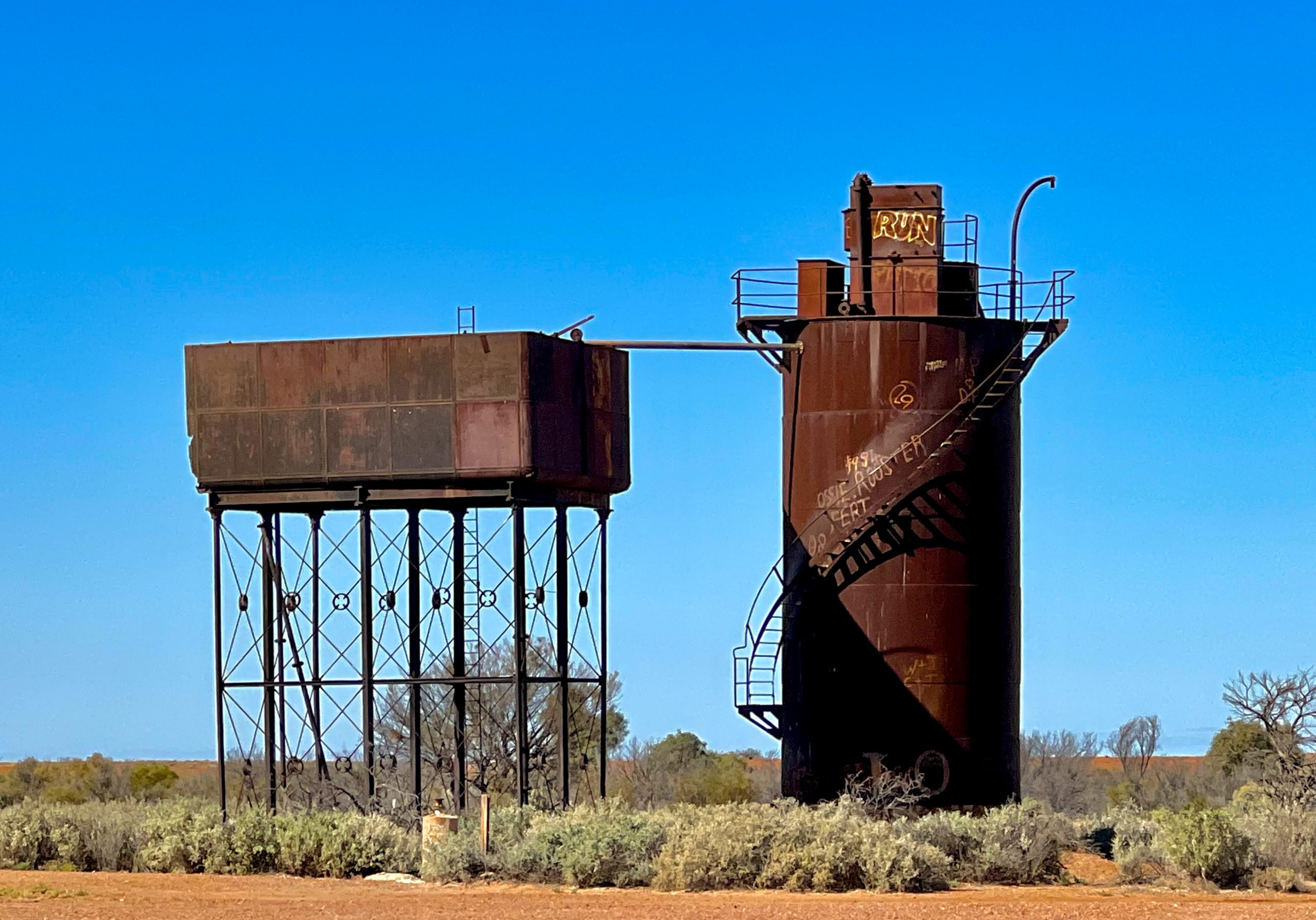
Along the old Ghan track were regular Fettlers Cottages where the men who maintained the track lived. You also pass many raised water tanks that stored bore water for the steam engines. Some of this water contained lots of minerals so distillation towers were built to distil the bore water into pure water for the steam engines.
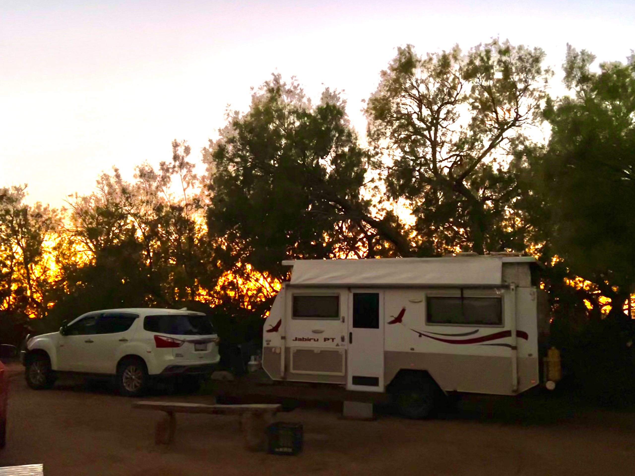
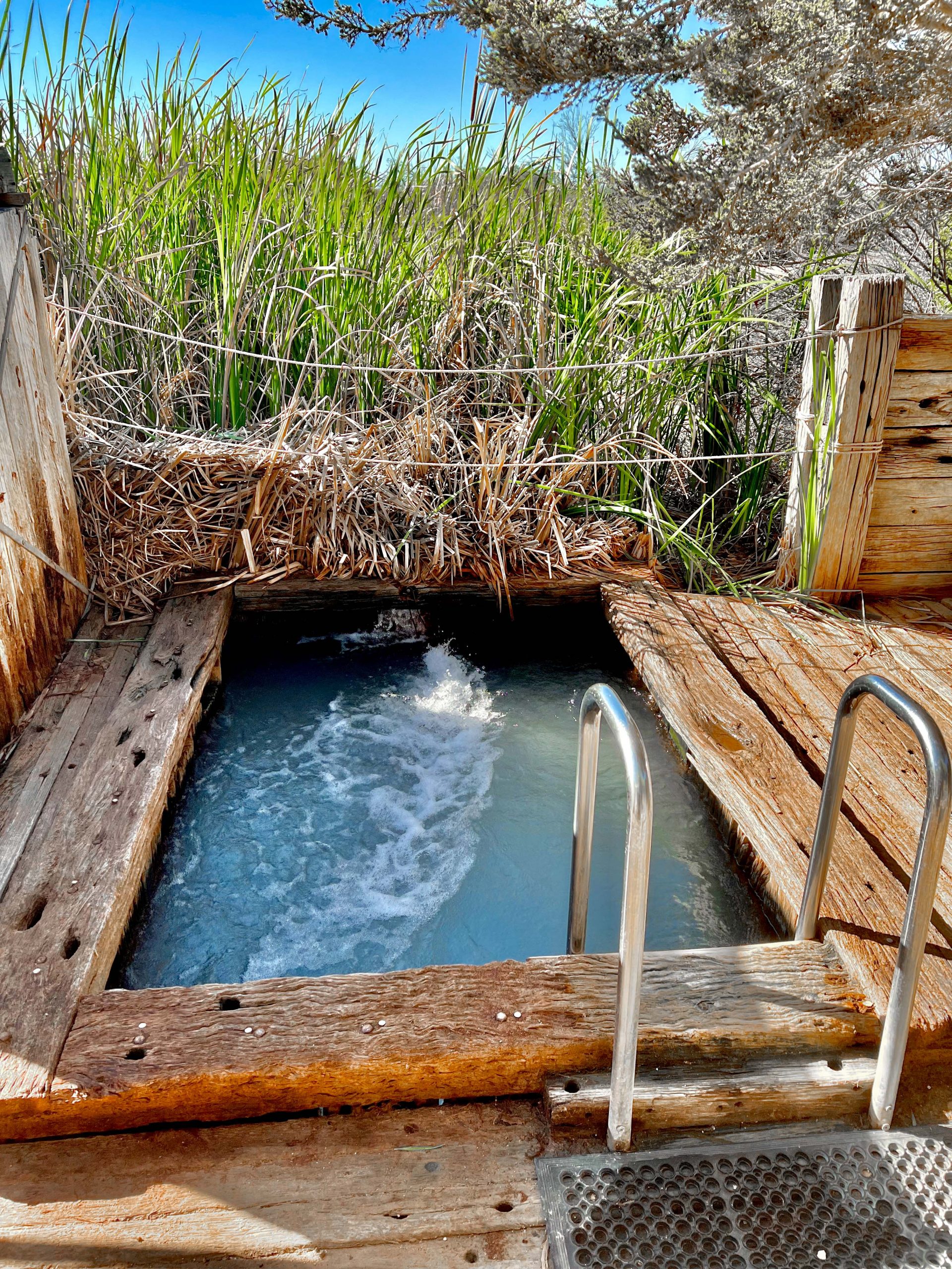
Coward springs is a delightful basic camping area which has been established near wetlands that were created when a bore put down to supply water for the Ghan flooded the area. So there are lots of trees and bushes in the park. This is our camp at Dawn.
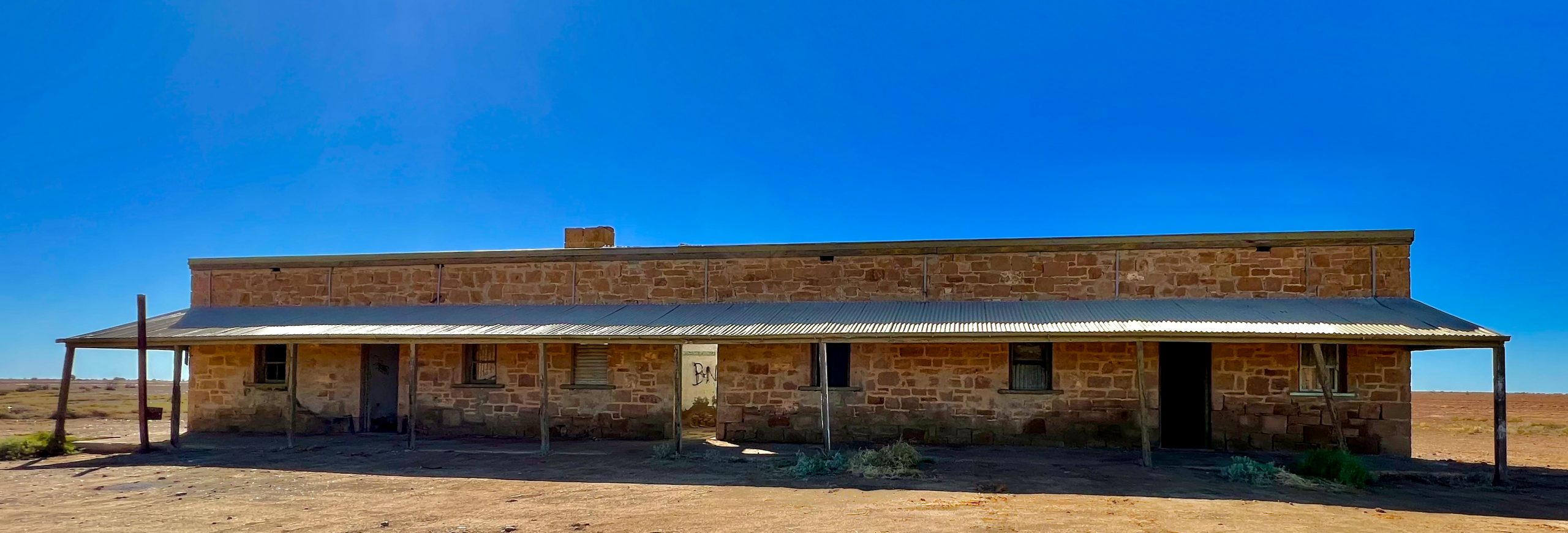
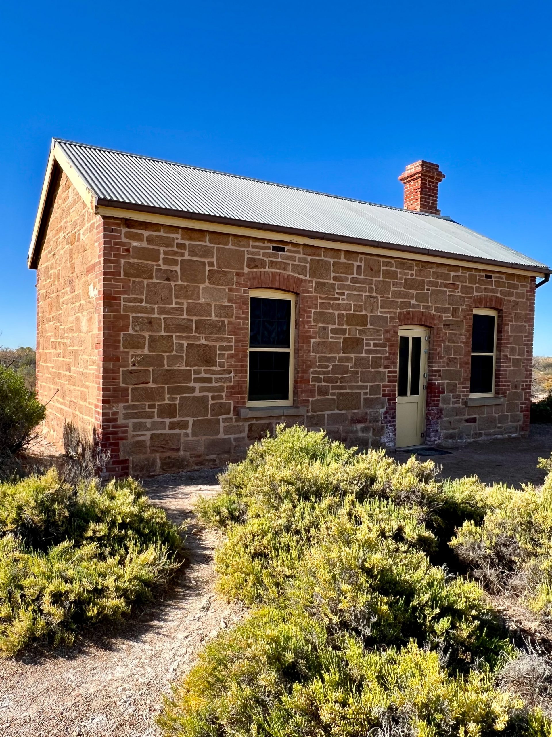
Coward Springs used to be a major stopover on the Ghan and the Engine Drivers Cottage still remains.

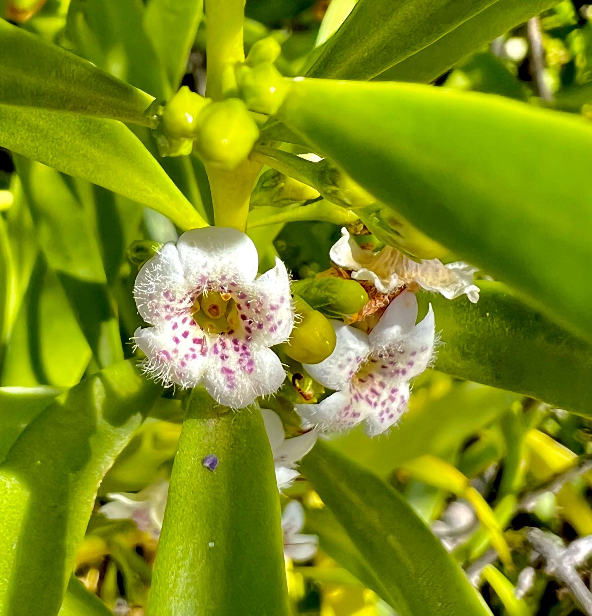
The people that run the park grow and harvest dates and we had a cone of excellent home-made date ice-cream. Not many flowers in bloom here but I managed to find one tiny one about 4 mm across. The park also has a natural spa fed directly with water from the artesian basin.
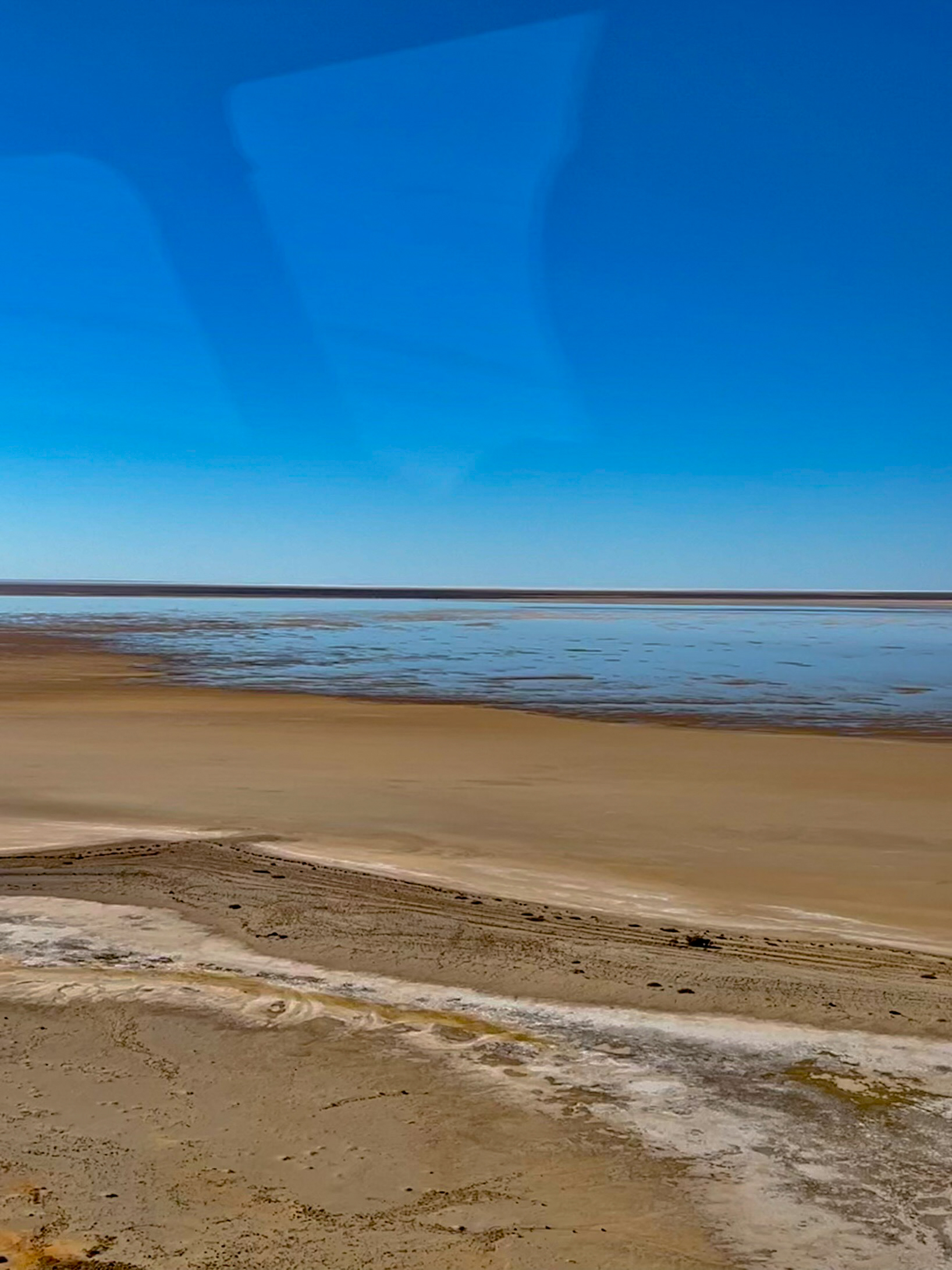
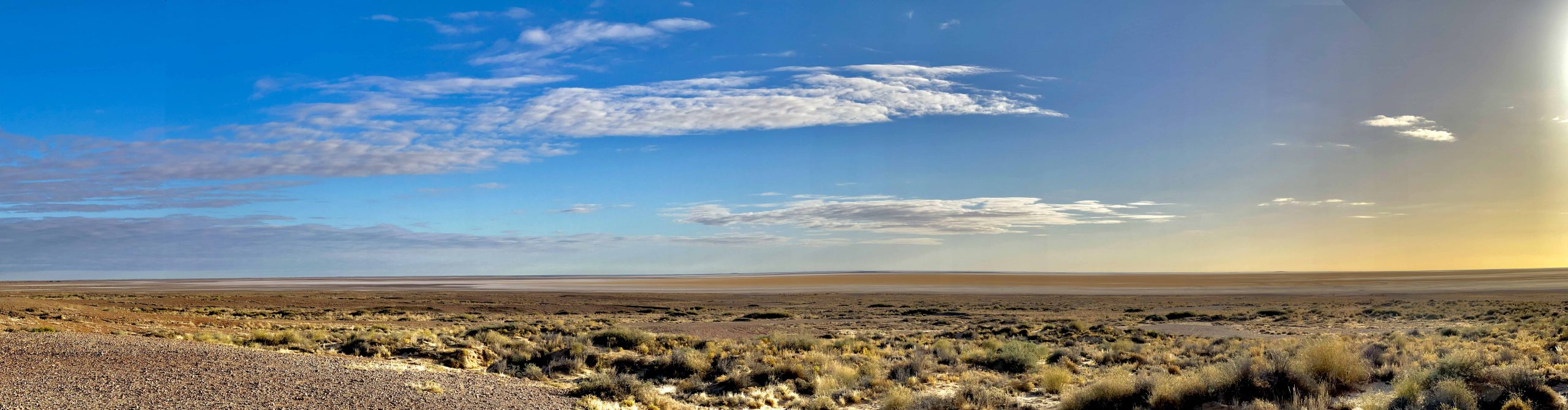
After Coward Springs we continued our journey down the Oodnadatta Track and passed Lake Eyre South, still a part of Lake Eyre but separated from the main Lake by the Goyder channel. This part of the lake fills last but shallow water was evident, not that you can see much from a ground level shot.
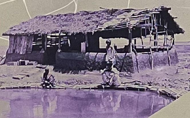
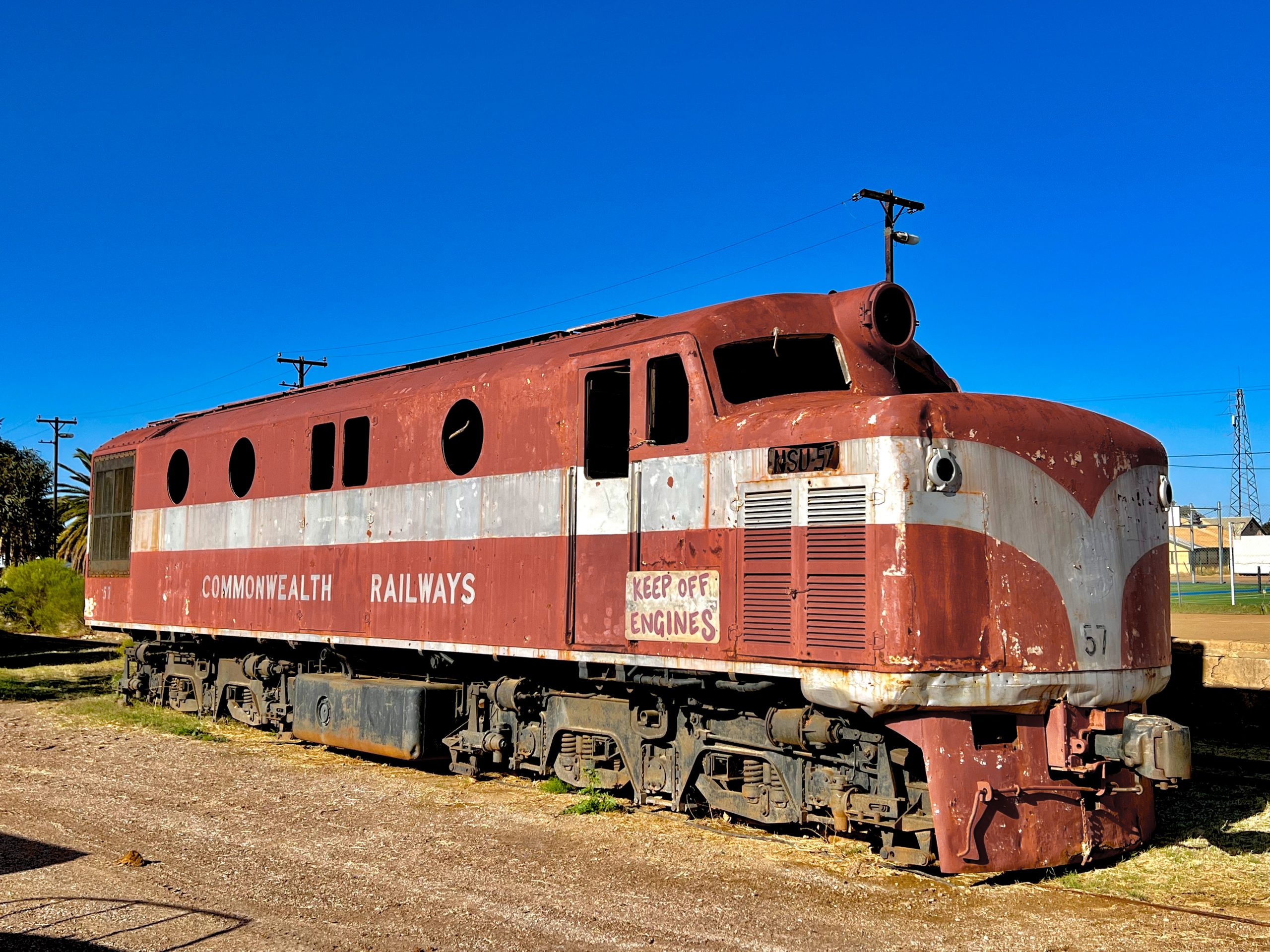
We re-fuelled at Marree where the Birdsville track commences. Afghans were employed on building the Ghan railway and an Afghan village was established on the outskirts of Maree. This is a photo of their first mosque established in the 1860s taken off the information sign. There is also a Ghan Diesel loco at the old Maree station.
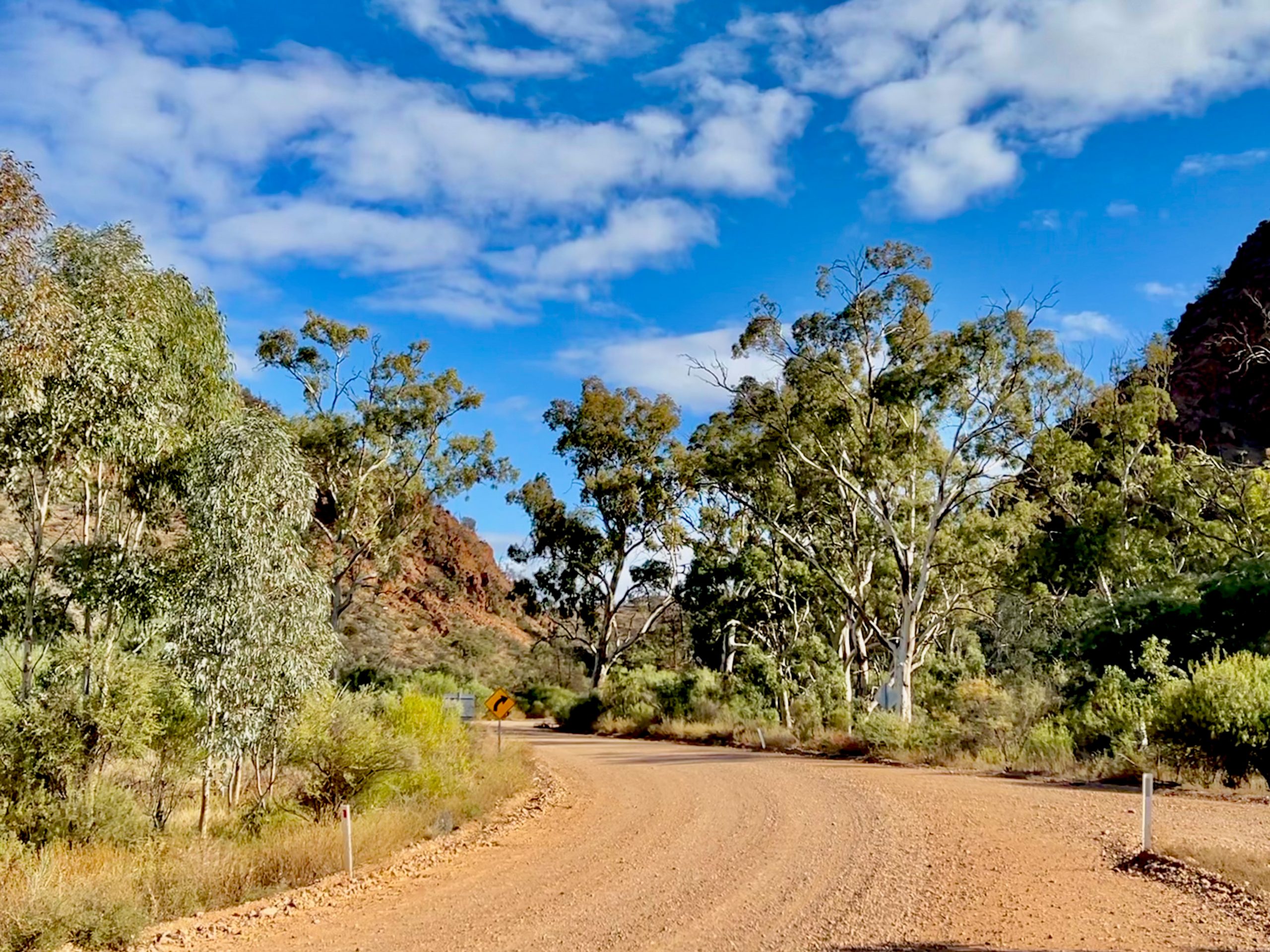
From here the old Oodnadatta Track is bitumen and renamed the Outback Highway, we were quite happy to be off the tack which had very badly corrugated sections in most of the floodways’ and at the many cattle grids. After stocking up at Leigh Creek South we headed for the Gammon Ranges and Weetootla Gorge. On the way we stopped to gather some firewood because firewood collection in the National Park is not allowed. We used a battery chainsaw which are great for camping. One we entered the Gammon Ranges the road wound through Italowie Gorge. As you can see, the road was very picturesque.
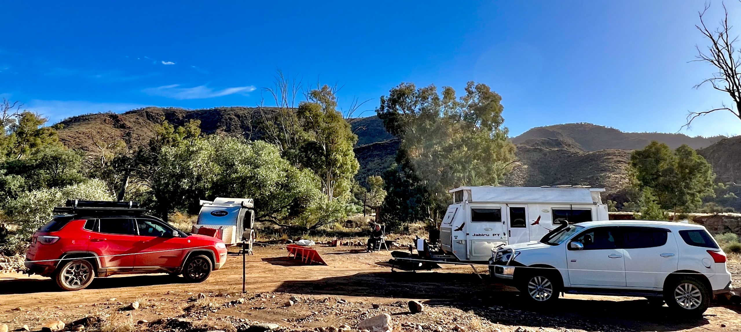
We found a nice campsite in the camping area and set up camp and relaxed.
If you would like to be notified when I publish a new blog just enter your email address in the box below and click subscribe. You will not be bombarded with advertising material.
Hey Russ and Deen
What a wonderful trip you are having once again and we feel very lucky to be sharing your adventures with you. The photos are amazing and really give a great sense of the area and the size of the lake. Look forward to the next installment. ???
Thanks Rhon we have had a great holiday together, it is so good to have Deen along as company. We are heading back home over this next week so are getting our winter gear ready to don. xxoo