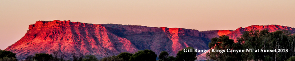
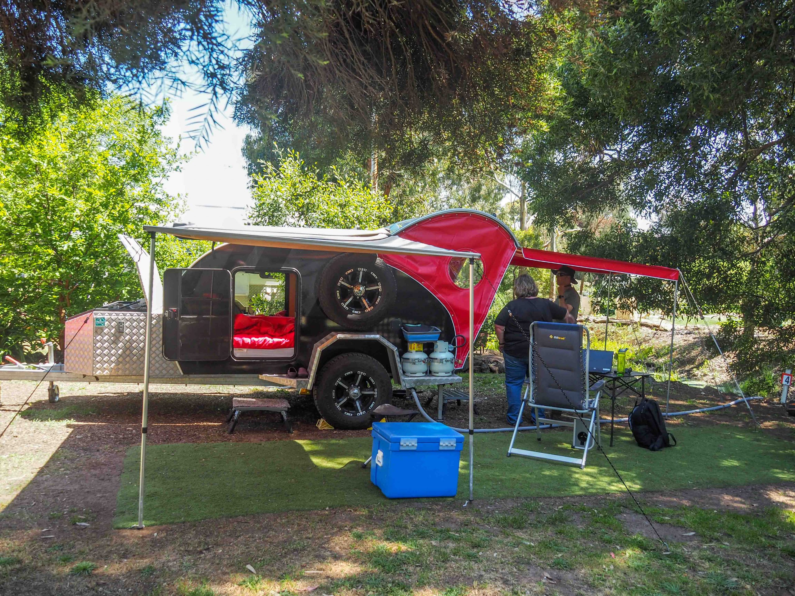
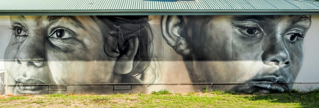
Sadly we had to cancel our planned trip to the Eyre Peninsula for the third time, I’m now on first name basis with the people at Lincoln National Park and they do the refund applications for me now. The SA COVID testing regime was just too onerous for us given the limited time we had to make the trip, but we will get there one day. So the hastily redrawn plans have us staying 3 days at Broken Creek Bush Camp near Benalla in Northern Victoria. It is a very relaxed camp with sites well spaced and basic facilities. It is Deen’s second trip with her new van and it is still performing very well.
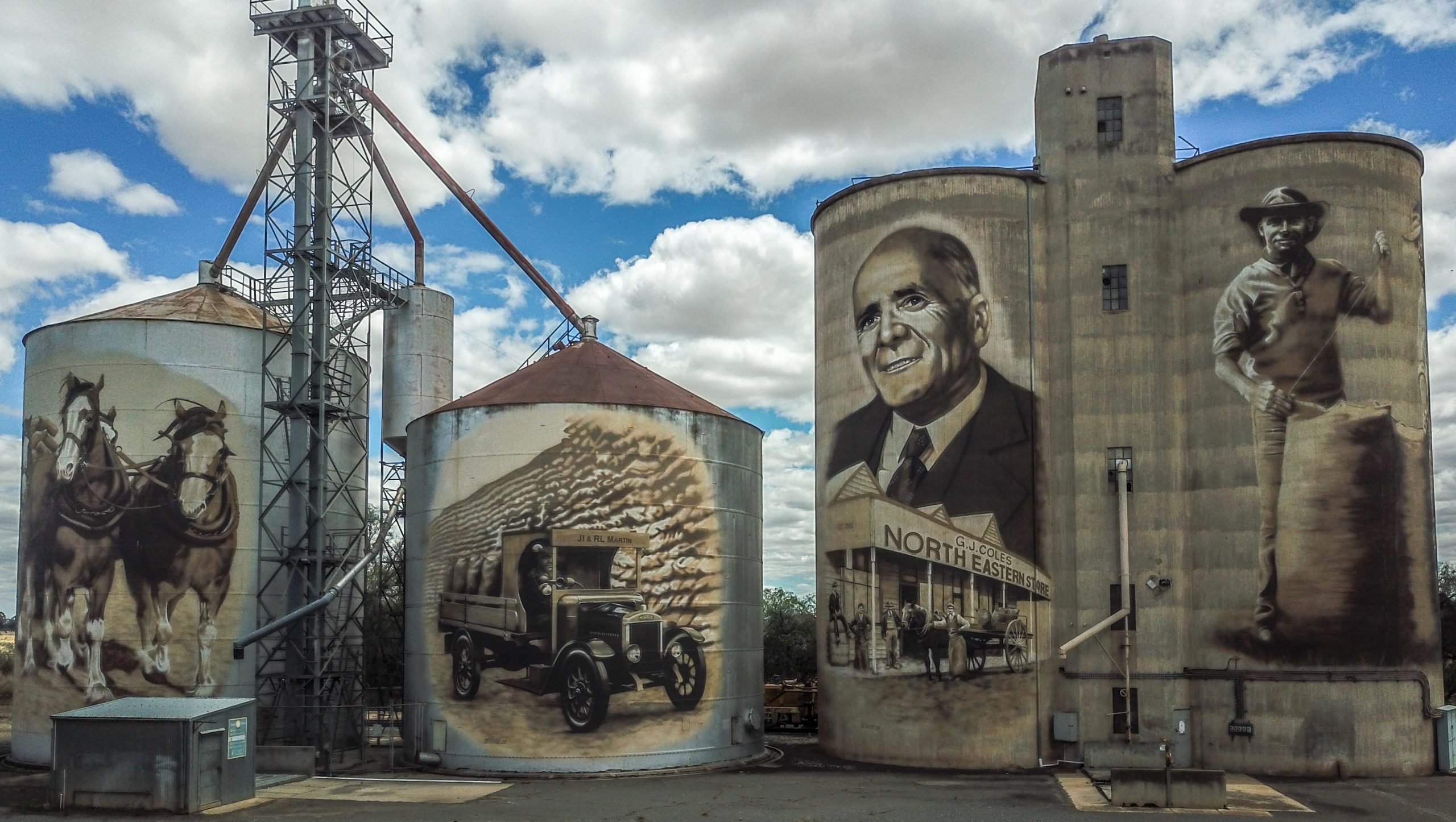
You can see that it is very dry and also has the requisite fire place which we have used every night, firewood was $15 for a load delivered by front end loader. The host also cooks wood fired pizzas on Saturday night so we have one on order for tonight. Yesterday we went for a drive to see some of the silos in the area which I had visited already but it was good to do it again. The first was at St James a small village about 20 Km north of Benalla. I used the drone this time to give a different perspective
From there it was further north to Tungamah an even smaller village about 50 Km north of Benalla. Taking the photos in bright sun proved difficult as it was very hard to see the photo on the iPhone that controls the drone, even with the screen brightness at max.
Our next stop was Devenish where the silos had a military theme commeratting the contribution of people in the area to our armed forces.
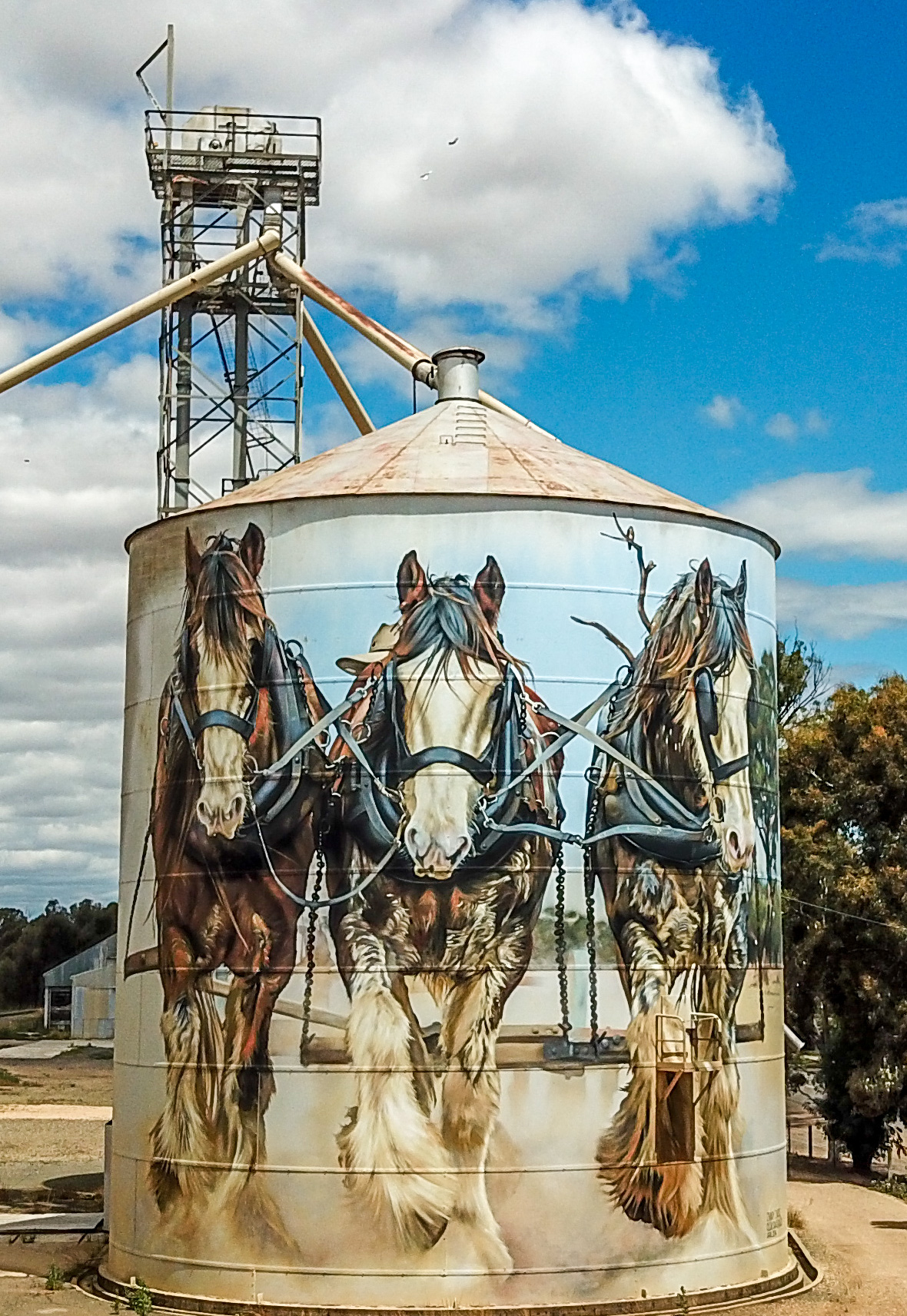
The last silos on this excursion were at Goorambat another small village which is well organised and they have opened a cafe in town since the silos were painted. They have also set up a second viewing area for the second set of two silos. I liked these silos the best, the draught horses look like they are galloping toward you as you drive into town.
The other two silos are about 50 metres behind this one and I especially like the owl painting.
The evenings at Broken Creek did get cool so a fire was needed to keep us warm. Deen took this panorama photo one night.
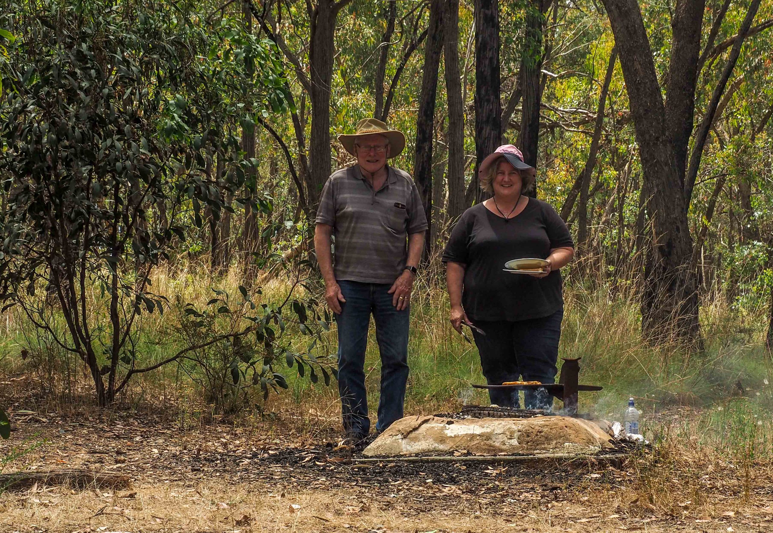
There’s not a lot to do around Benalla but we did find Reef’s Hill State Park about 5 Km East of Benalla. It was a scrubby dry box forest with many small twisted eucalypts growing on a native grass forest floor. We found a fire BBQ and picnic table and enjoyed a peaceful couple of hours over lunch.
Tomorrow we head off to the King River Valley for a week.
We met up at Dunkeld for our 49th Cup weekend camp and enjoyed a few days of relaxation in the company of good friends. We stayed at the Dunkeld Caravan Park where Deen set up her new camper for the first time and found the setup much easier than the Gidget she had owned previously. As usual lots of fellow campers wanted a guided tour of the new camper.
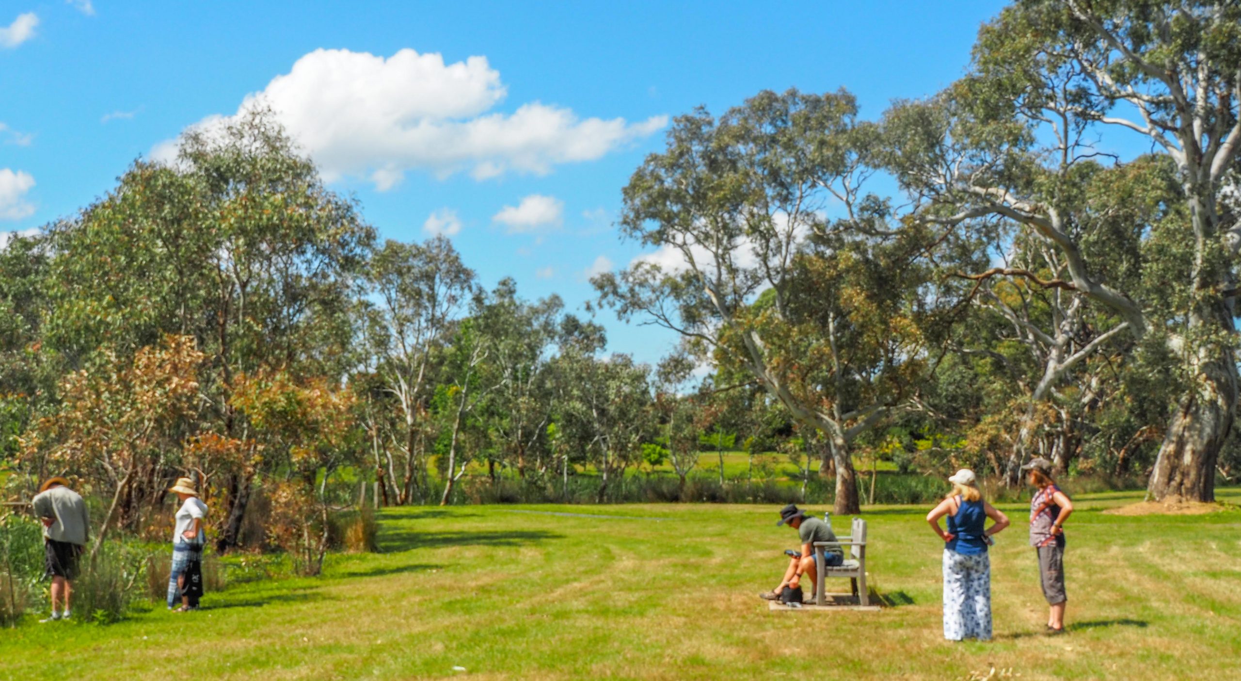
A lot of time at the camp was spent just sitting around chatting and relaxing
Peter G brought lots of fire wood as usual so we had a camp fire every evening and lots of good conversation. It was great to have Davo, Cheryl, Shelby and Maddie with us again plus Adam and Julie, Pete and Barb with Deen and I making up the numbers. Deen took a few photos around the fire without a flash, which proved a bit difficult.
Shelby, Adam and Julie around the fire
Deen also managed to catch one of me
And another of Maddie, Julie and Adam
Lots of our conversation was about where we would go for our 50th camp next year. It’s hard to believe that the camping group started by Eric in 1973 is still going strong, and that is something worth celebrating. Deen is doing some investigation into Morning Glory, a camping resort on the Murray near Echuca which may be suitable.
Within a short walk of camp was the Dunkeld Arboretum where there are some magnificent old Red Gums. We enjoyed the walk and watching Pete try out his new drone, he managed to have only one crash!. There is an old saw mill dating back to the 30’s in the Arboretum and it was interesting old building and equipment now run by volunteers.
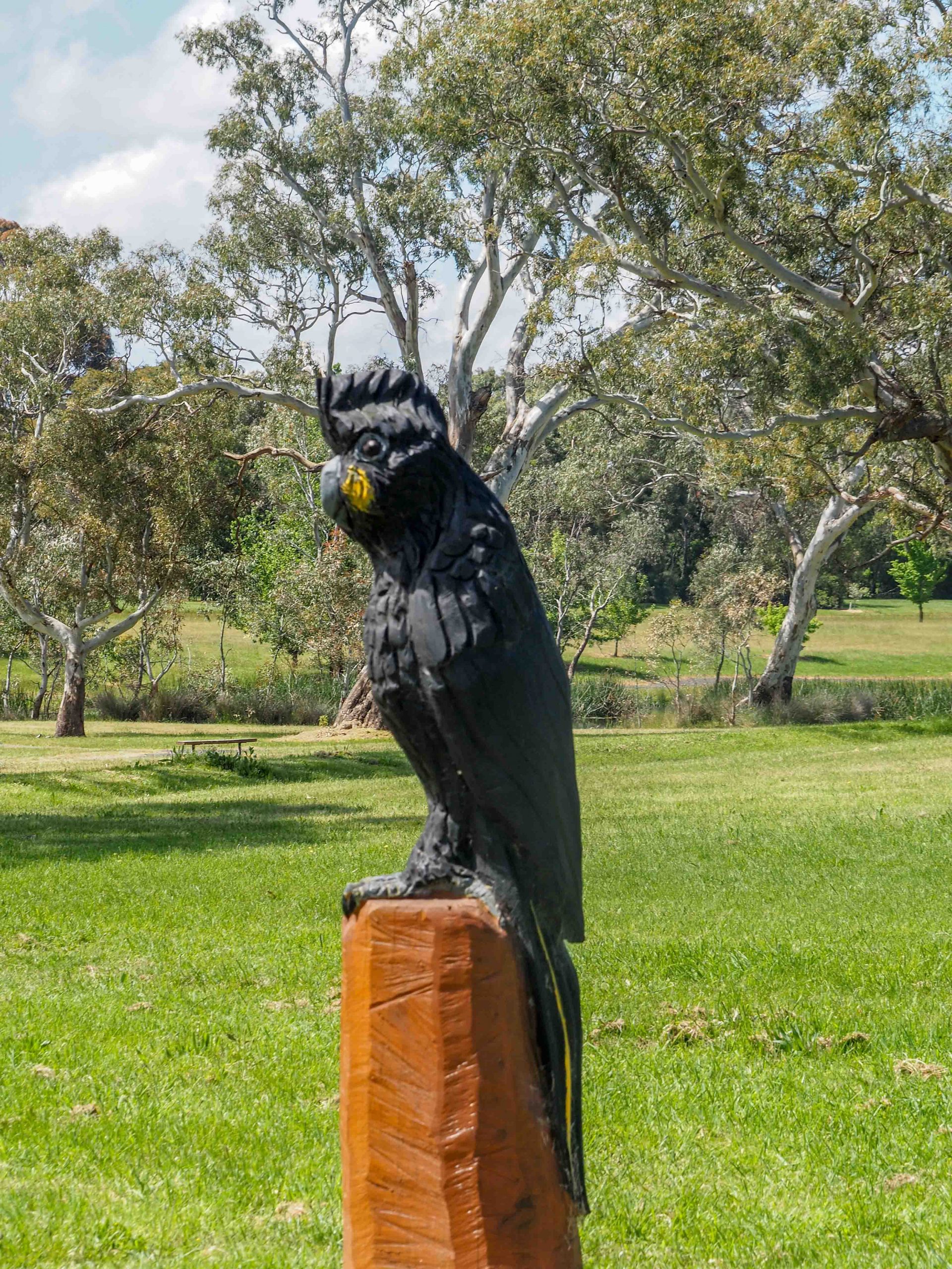
A lady from the local community had used a chainsaw to carve some sculptures, I liked the black cockatoo the best.
On Saturday we all headed off to Cavendish and enjoyed a wonderful lunch at the Bunyip Hotel, excellent food and well worth a visit. Everyone except Deen and I went home Sunday so, after they had left, we headed off into the National Park for a very enjoyable BBQ in the camping area at Jimmy’s crossing. After lunch we had a drive around the park ending up at Mafeking where 10,000 people lived mining for there gold fortune in the early 1900’s, now just bush with no evidence of mining except the abandoned shafts.
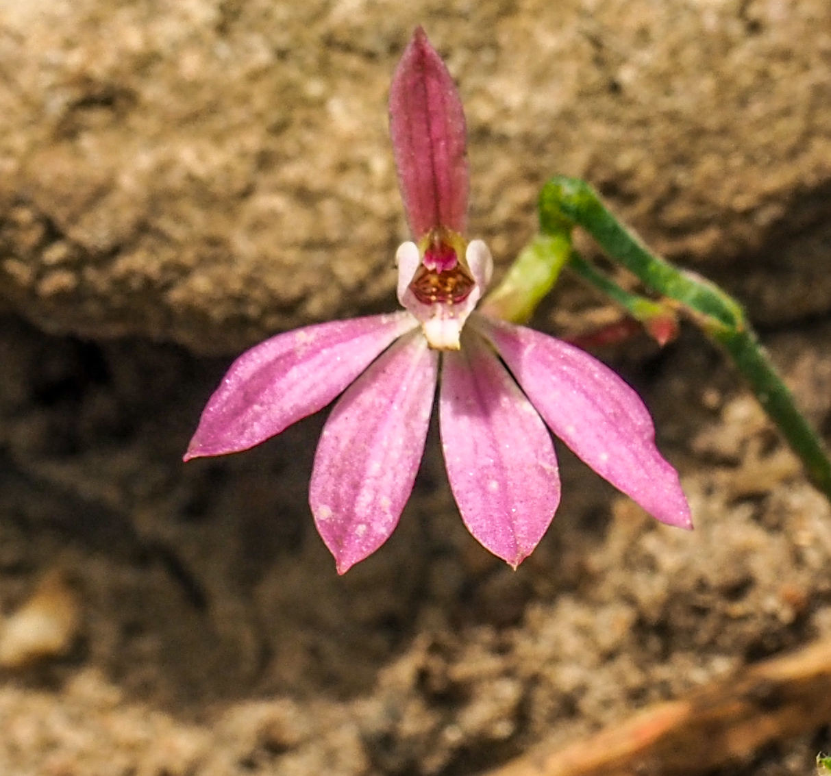
After Deen left on Monday I went back into the National Park and enjoyed a delightful walk up Little Pickaninny. The bush was filled with a wonderful array of small native bushes, many in flower, and even a few orchids.
Along the way i met up with an echidna snuggled into a hollow, I stayed still for awhile and eventually the echidna moved off and gave me an opportunity to capture a photo.
The view from the top of Little Pickaninny was well worth the walk.
I also visited Freshwater Lake for a BBQ.
I had to run a couple of U3A Cryptic crossword Zoom sessions on Tuesday and Wednesday so I spent those days around camp relaxing before returning home on Thursday to Mt Eliza.
The country changed a little as I approached Morgan, which is on the Murray, the plains were dotted with saltbush rather than dead grass or no grass. The dusty green-blue of saltbush was a welcome change from dull brown that I had been travelling through since I arrived in SA. I crossed the Murray on a ferry at Waikerie, a largish town of nearly 3,000 people. The name ‘Waikerie’ is said to mean ‘many wings’, after the giant rainmoth ‘Wei kari’, the name given to the moth by the indigenous peoples of the area. The silos I was to visit were visible from the ferry so easy to find and plenty of parking available on the roadside. The silos have been painted by two different artists, one semi-abstract and the other lifelike. Both artists used enamel paints, exclusively on the semi-abstract silo whereas the other silo was mainly painted with aerosol spray cans. The work took 16 weeks to complete and used nearly 500 litres of paint. Sorry about the car in the foreground, I could have picked a better place to park.
Waikerie Silos
I think the left hand abstract silo is well painted but I find the colours a bit subdued, I think silos look better with more vibrant colours, unless the artist uses sepia tones or just black and white. The theme for both is a healthy riverscape so on the left-hand silos there are fish, turtles and cockatoos that are prevalent in the area.
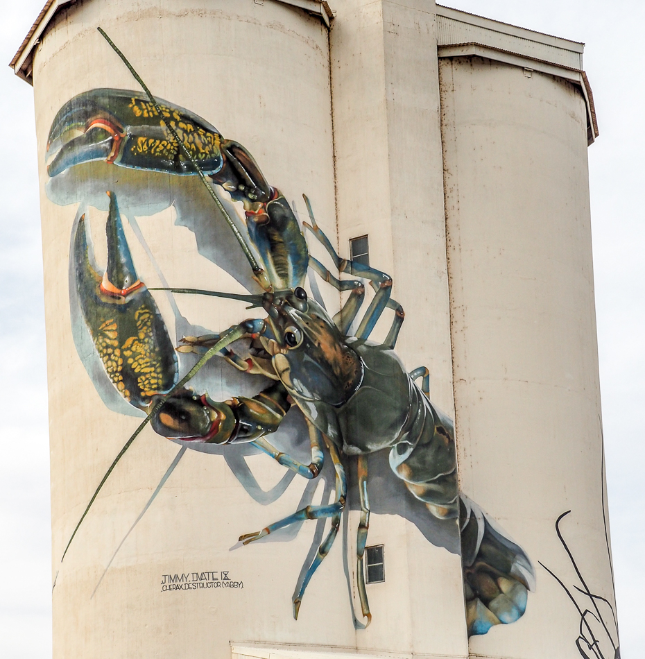
Waikerie Yabby
The Yabby is fantastic, such detail and beautiful colouring, perfect shadows, so lifelike, one of the best paintings I have seen on a silo.
Waikerie Silos Rear View
This photo is of the back of the silos. At the bottom right of the left-hand silo you can see some moths, these are the Rainmoths after which Waikerie was named. The parrot is the endangered Regents Parrot painted above the river a brown rock bank, characteristic of so many of the bends in the Murray in SA.
Waikerie Silo Regents Parrot
I think this is a wonderful artwork, when you think about the scale of the painting and the detail achieved, the artist has done such a brilliant piece of work.
The next silo I visited was at Paringa, which is near Renmark, about 50 Km from where I am camped. I found it a bit disappointing, but it did celebrate significant people in the area, but it was not to my taste.
Paringa Silos
The silo on the right features Charles Chaffey, one of the Chaffey brothers, who instigated the irrigation of the riverland area, which had an enormous impact on agriculture in Australia. The silo on the left is of Sister Balfour-Ogilvy who was one of the nurses machine gunned by the Japanese in what is known as the Banka Straits Massacre. Of the 22 nurses only sister Bullwinkle famously survived by lying in the water, wounded and motionless with the other dead nurses. She visited my kinder when I was a kid, she seemed to me a very formidable person, much like Miss Hugo a teacher at Ashy State School.
Sister Balfour-Ogilvy, Japanese Massacre Survivor
After Paringa I headed off for lunch and ended up in Berri at the Berri Hotel Bistro right on the Murray with a landscaped grassed river bank and wonderful red gums as the outlook. I enjoyed excellent fish and chips, I have yet to have any inferior fish and chips in all the many trips I have made to SA. The most memorable was at Peterborough many years ago, when Marg and I enjoyed King George Whiting in a pub bistro, perfectly prepared and presented, and that’s 100s of Ks from the coast. It is strange that the people who enjoy “pie floaters” (pies floating in pea soup) also want and enjoy excellent fish and chips. On the way home I visited a mural and sculpture in Berri on an abutment of a bridge over the Murray.
Aboriginal Warrior at Berri
You had to walk a short way to the mural and this sculpture was at the start of the walk. The tonings of the mural under the bridge were subdued, but interesting abstract shapes and yabbies.
Berri Bridge Mural
There was also another steel sculpture panel next to the bridge abutment that was well done.
Sculpture at Berri Bridge Abutment
I was going to do some travelling in Victoria but that is now off the agenda, so it will be a quick trip home for me tomorrow. I decided to put the drone up one last time at the caravan park to show how the Murray twists around in this part of its journey to the coast.
Murray at Kingston on Murray
The water at the bottom of the photo is the Murray at the caravan park, in the middle of the photo you can see a fine line of water leading to a patch of water on the right, that is the Murray going back on itself. Then at the top you can see some more water on the left of the photo which is another bend in the Murray. It is a real zig-zag with each zig and zag being a few kilometers long. It is a wonderful river and I love it.
So I’ll sign off and see you next time I go travelling.
I was a bit sorry to leave Stansbury, I had a very relaxing time there and it was very interesting to be able to watch a silo being painted from the beginning. This is the photo I took on my first day at Stansbury.
Stansbury Tower Day 1
As a drove away from Stansbury I took this photo, which will give you an idea of the amazing progress the two artists had made in just eight days, actually just seven days and an hour or so on day eight.
Stansbury Tower Day 8
Finishing the artwork will require some finer detail but I expect that they should be finished in a week to ten days, depending on the weather.
I headed up and across the peninsula to Kadina where there was a relatively small water tower in the middle of town. It took me some time to get to the tower because there were many one way streets in town that were not on my GPS, just as well I have a small caravan. The GPS kept sending me to streets I couldn’t enter. There were only two images on the tower, the first is a Maypole girl holding some grain, as grain was and is the main driver of the economy on the Yorke peninsula. She is also holding a piece of copper as copper mining was also big on the Yorke peninsula (this area is called the Copper Coast)
Kadina Water Tower
The other image was of a steam train, reflecting the important role that rail played in the transport of grain to the ports on the Yorke peninsula, and poppies for remembrance (the railway line ran next to the carpark).
Kadina Water Tower
The Kadina water tower was in a busy car park, but there was reserved parking for RV’s and caravans, just as well, because the car park was chockers. From Kadina I headed for Snowtown, the town famous for the bodies in 44 gallon drums, I made sure the streets were clear before I got out of the car! The now disused water tower was another small one with the fireman’s face a stand out, it depicts a volunteer with over 25 years service with the CFS. This side faced the road.
Snowtown Water Tower Road side
The other side had a young footballer on the top section of the tower but this was not as good as the fireman.
Snowtown Water Tower Railway side
My Journey now is taking me away from the Yorke peninsula and east across through the windy roads of the Clare valley and up through Burra and then onto flat country as I head toward the Riverland. The drive through to Clare and Burra was more interesting with undulating countryside and a lot more trees, but the travelling was a bit slower with lots of bends. The next stop, this time for silos, was Farrell Flat, which was the last artwork to see before I reached the Riverland around Renmark and Loxton.
The town is a ghost town, I was the only thing moving, apart from the trees in the strong wind! The only operating business in town was an old dilapidated pub, a couple of old and closed shops made up what passes as the commercial centre of Farrell Flat. The group of silos are at the end of the main street.
Farrell Flat Silo Art
It is interesting that they have chosen to paint a passenger train but, apparently, the artwork depicts the last train that ran on the line in the 1990s. The rail line was between Rosebery and Peterborough with the latter being a major railway hub and service centre.
Driving through the flat wheat growing parts of SA is not a highlight. The countryside is an unrelenting dull brown, flat, few if any trees, average to poor quality roads and a lot of the small towns you pass through lack any shops and anything of interest. There is an overall appearance of tiredness and neglect, except in the larger towns as such Clare, Burra, Kadina and Yorketown. The wind on this day was extremely strong and the fuel consumption went up significantly. At Kadina I had to take a step back to keep balance in a particularly strong gust, while I was taking photos.
When I get to the Riverland I will be staying at Kingston on Murray, so called because there is another Kingston in SA, Kingston SE, which is located on the south coast near the Victorian border.
I had a home day today as I had a Zoom session with my Cryptic Crossword group. However I did visit the Stansbury water tower to check progress.
Stansbury Water Tower Day 3
I had an interesting talk to one of the two artists, they work off paintings they have made and loaded onto their mobile phones. He showed me a painting of the green seaweed on his phone that is under the crab and he was going to add a yellowy colour to the seaweed to highlight parts and make it lighter. The painting on his phone was just of the seaweed, there is a separate one of the crab. So it is all freehand artwork using their eyes to transfer a phone image onto the water tower. These two artists had just finished the Edithburgh water tower, which had excellent detail, the Stansbury one is going to be more simple. They were using airless spray guns for this more detailed work, spray guns that have an inbuilt small piston pump to spray the paint out in a fine mist.
Next day I was off the Yorketown for supplies and to check out the water tower there, it was good but not to my taste.
Yorketown Water Tower
While in Yorketown I learned of a water tank with artwork on the road to Port Moorowie, only a few Ks south east of Yorketown. The water tank was not in use and it was literally in the middle of nowhere on Boothill Station Road.
Moorowie Water Tank
However the artwork on the tank was very good with a horse team facing the road I drove down.
Moorowie Water Tank Horse Team
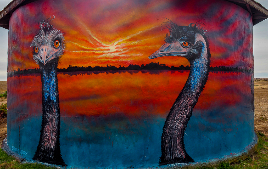
A little further round the tank were two emus, I love emus and the wild look they get in their eyes, and these two were perfect.
Emus on Moorowie Water Tank
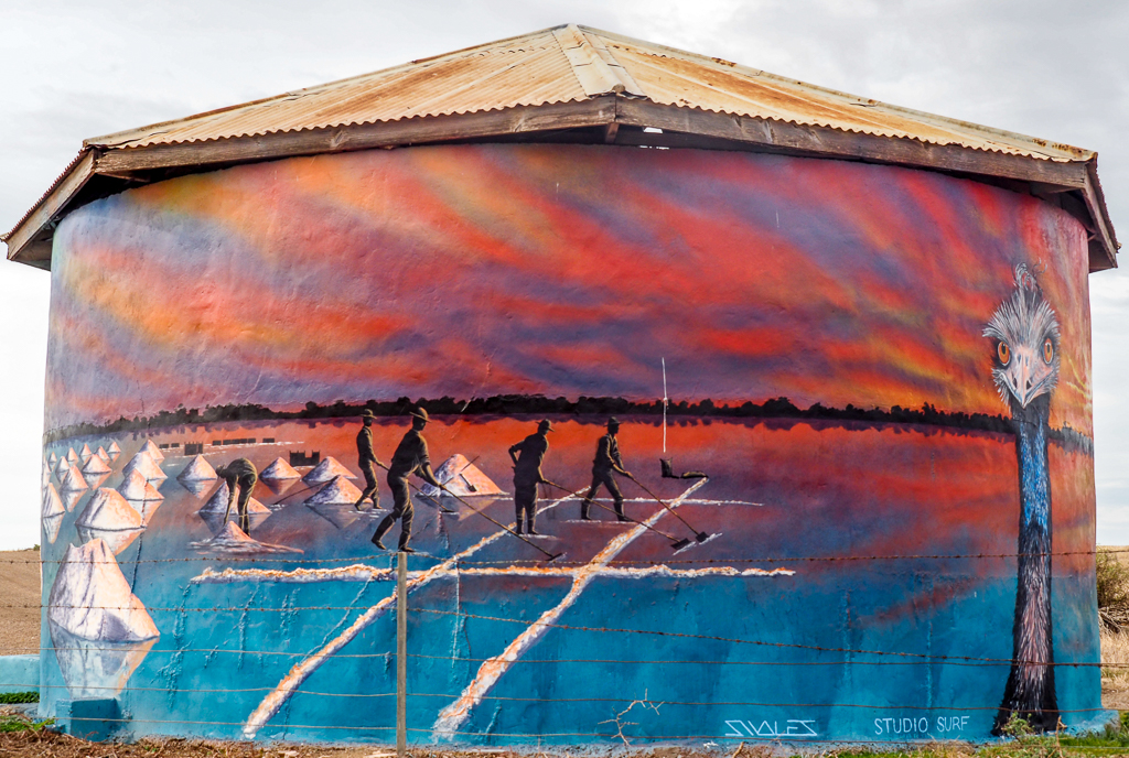
Facing the intersecting road was a painting of men harvesting salt from a dry salt lake. Salt harvesting was quite an industry in this area in the last two centuries. In this century the salt lakes have become a tourist attraction, not sure why, and there are signs on every corner pointing to the different lakes, and there are many. Some do get a beautiful pink colour, but not my idea of a touring highlight.
Salt Harvesting on Moorowie Water Tank
This tank was on private property so I had to negotiate getting over a barbed wire fence twice to get the photos, which I did with great care and not much dexterity, gingerly would be the word. On the way home I called in at Port Vincent and had a meal of the most excellent fish and chips from the Kiosk in Port Vincent. Garfish, chips salad and potato cakes that they battered and cooked to order, delicious, and eaten at a table on the foreshore. If you are down this way make sure to call in and have some. On the way back I checked progress on the Stansbury water tower and there was the start of a pelican on the back of the tower.
Pelican on Stansbury Water Tower Day 4
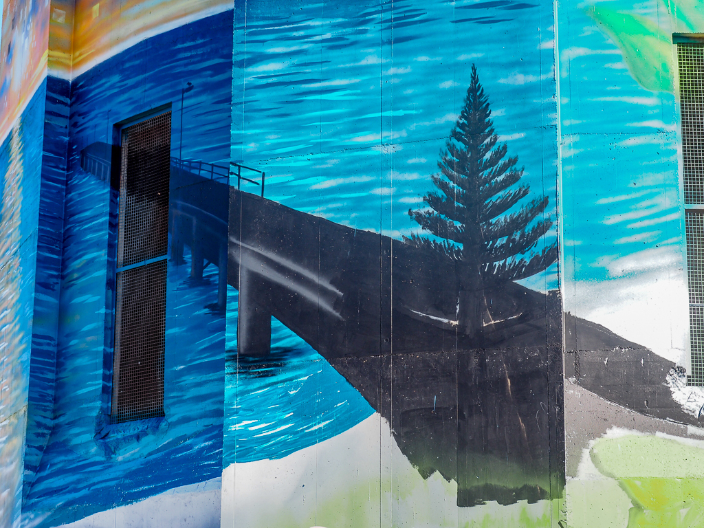
On day 5 a jetty and pine tree had appeared on the tower.
Stansbury Water Tower Day 5
It’s now Saturday and I head off to Innes National park which is right at the bottom of the Yorke Peninsula about 100 Km away. Marg and I camped here many years ago when it was undeveloped and the only campground was a barren footy ground sized area with not trees. All that has changed, the park has a number of campgrounds all good and the one we had stayed at, Pondalowie, now has trees and bushes with campsites in between and the sites are suitable for caravans. I will stay there next visit. A bitumen road takes you through the park to a number of viewing points over seascapes and to an old gypsum mining town. I took my portable BBQ and set it up and cooked a couple of sausages from the local butcher for lunch, a very peaceful spot in a campground.
Russ Tending the BBQ
I visited the Cape Spencer Lighthouse which guards a reef where a ship the Ethel came to grief, you can see a few spars of the Ethel on the beach. The first ship to see the Ethel in distress was the Ferret which alerted authorities, and then 16 years later it was wrecked on the same reef.
Cape Spencer Lighthouse & Althorpe island
Innes National park takes its name from Inneston a town set up by a gypsum mining company that operated from 1914 to 1930. We all will remember Bellco chalk at school when we were kids and the boxes that contained the precious stuff. This chalk was made at Innestown for many years. It was named after a Mr Bell a director of the gypsum mining company, this photo is of the buildings where the chalk was made.
Bellco Chalk Buildings at Old Innestown
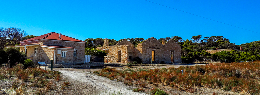
Some of the buildings at inneston have been restored and can be hired for accommodation, this photo shows a couple of ruined buildings and a restored building.
Old Inneston
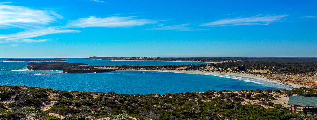
From West Cape there are wonderful views over the park and up and down the coast.
View from West Cape Innes National park
I enjoyed my visit to Innes national park and would come back and stay here. On the way home I checked the Stansbury water tower and we now have dolphins on the tank part of the tower.
Dolphins on Stansbury Water Tower Day 6
Just nearby I was able to buy a dozen oysters so I had half of them mornay (read grated cheese) for tea, they were yummy, so fresh and tasted of the sea.
Tomorrow will be the last day here, sadly, I have enjoyed my stay at Stansbury, it has been very relaxing. I debated staying on a couple of days but decided against it so my next blog may be a few days away.
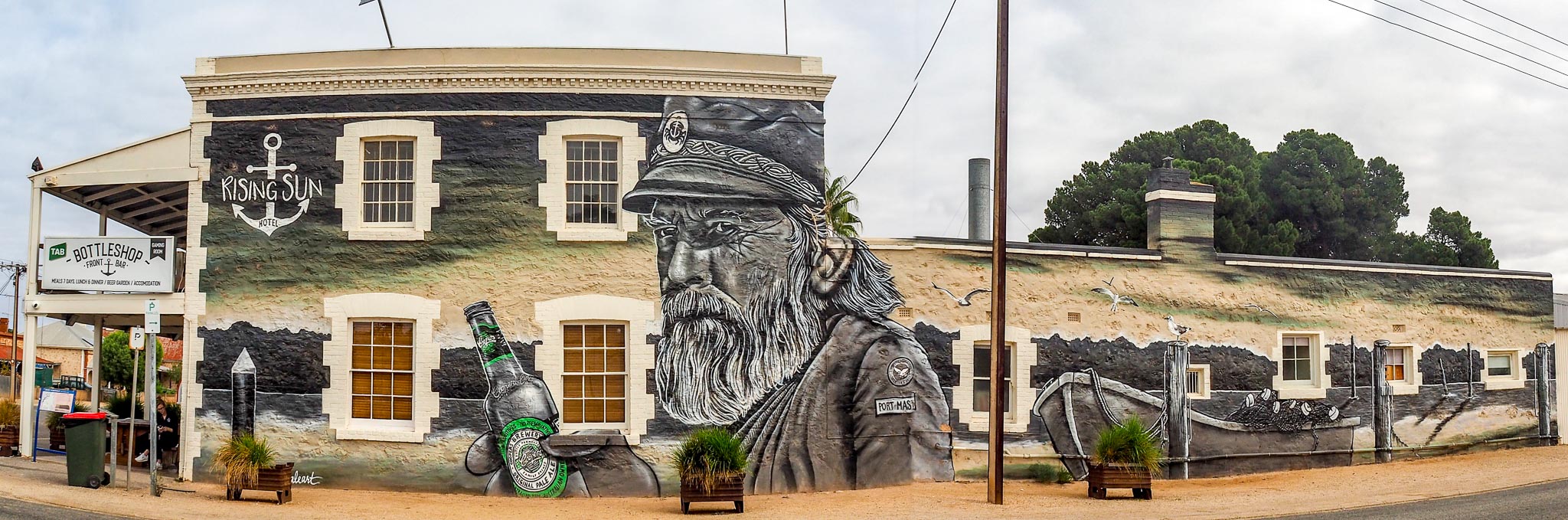
To me, the most redeeming feature of Port Wakefield is that there are three highways leading out of town! The artwork on the pub is excellent and there are a number of very attractive old stone buildings but most of the town is a collection of shacks. The town is on the shore of Gulf of St Vincent but the shore is all mangroves with a 4 metre wide gutter along the edge. They have built a very attractive small picnic area on the shore so maybe in a few years it could be worth a visit. I was one of the few campers who stayed two nights, probably says it all. I had expected street art rather than a painting on the wall of one pub. Click on the photo to get a bigger view.
Rising Sun Hotel Mural Port Wakefield
The focus of the painting is the Port Master which is painted in fine detail.
Port Master, Rising Sun Hotel, Port Wakefield
On the Port Wakefield Road to Adelaide about 50 Km south of town is a collection of protest sculptures constructed by a local farmer in protest to a government decision to build a dump nearby, the best is of a cockroach. I didn’t visit here and I did have a photo of the cockroach but the person who took the photo asked me to remove it, despite the fact that I had acknowledged the origin of the photo. So sadly you will just have to imagine a four metre cockroach!
I didn’t mind pulling out of Port Wakefield and the further down the Yorke Peninsula I travelled the more interesting the landscape became, lovely Mallee scrub along the verges, a bit of undulating country and a few hills. The only thing common with the country I’d travelled was the relentless brownness, everywhere is so dry and the only green is the trees. Made me homesick for Victoria, so green in comparison.
I’m camped at a lovely seaside caravan park in Stansbury about half way down the Yorke Peninsula on Gulf of St Vincent. The park is less than half full and very quiet toward the back where I am located. I booked for a week and will have a look around the peninsula. On the way here I called in at Port Vincent to check out the water tower which had been finished only the day before. The artist was just leaving so I had a chat, he was heading of to Melbourne to do some more murals, this was his first water tower.
Port Vincent Water Tower – East Side
Not bad for a first off! The “back” of the tower was good as well.
Port Vincent Water Tower – West Side
According to the info I found on the Internet, the Stanbury water tower should have been finished but, instead, the artists only started on Monday, the day I visited. The guy I spoke to (the other was 30 feet up in the air) thought they would be finished in two weeks, it will be really interesting for me to see how it progresses. Here is yesterday’s photo, there is a black outline of a big crab on top of some brown graffiti. Hard to pick but the white paint is on the outline of the crab.
Stansbury Water Tower Day 1
On re-visiting on Day 2, most of the top parts of the tower were painted and the crab was easier to see. The guy on the high-lift has a spray gun about a metre long and he can spray up to 2 metres away from the surface from the end of the gun. So he can cover a lot of the tower without having to reposition the high-lift (except for up and down).
Stansbury Water Tower Day 2
It will be so interesting to watch progress. After a very casual start to the day I set off at about 11 to see the area around Stansbury and a couple of towers. The first was at Coobowie about 20 Km down the coast, another very small town of about 200 people. The “tower” was a tank but very well painted with a coastal theme.
Coobowie Water Tank East side
It was good to have a camera with a fold out screen as I had to take these shots over over my head to keep the fence out of frame.
Coobowie Water Tank West side
The tanks is about 3 metres high and 9 metres in diameter. The name “Coobowie” is Aboriginal for “Wild fowl water”.
Coobowie Water Tank North side
About 5 Km beyond Coobowie is another small town of Edithburgh, a little bigger with a population of around 450 people, it even has two pubs. There are 200 lakes in the area that were mined for salt and at the time of that mining, Edithburgh was the third busiest port in South Australia.
The water tower is out of town on a flat brown plain, it was quite windy but I decided to put the drone up to avoid getting the fence in the photos and also so I didn’t have to climb over a fence with barbed wire on top!
Edithburgh Water Tower – South Side from Drone
You can just see me at the car with the door open to shade the phone, it is hard to see what is coming back from the drone camera when the phone is in the bright sun. To run the drone you connect your phone to the drone controller and the phone screen displays the picture the drone camera will take. The phone also displays other drone controls and drone settings. The drone controller itself has the two joysticks you use to maneuver the drone plus some other controls. In this photo I like the dolphin in the tank part of the tower.
Edithburgh Water Tower – East Side from Drone
The lighthouse on the tank section of the tower is of the light on Troubridge Island which is about 8 Km off the coast of Edithburgh. Obviously the sea is an important part of the history of Edithburgh, which named after the wife of a eminently forgettable pommy 19th century SA governor.
Edithburgh Water Tower – North Side
Back to Stansbury where I noticed a mural on the side wall of the Blue Lime cafe. A blue car seems to be there all the time so I had to manoeuvre (thank heaven for spell check) two photos together as the panorama function on the camera would leave the car in the photo. Click on the photo to get a larger view.
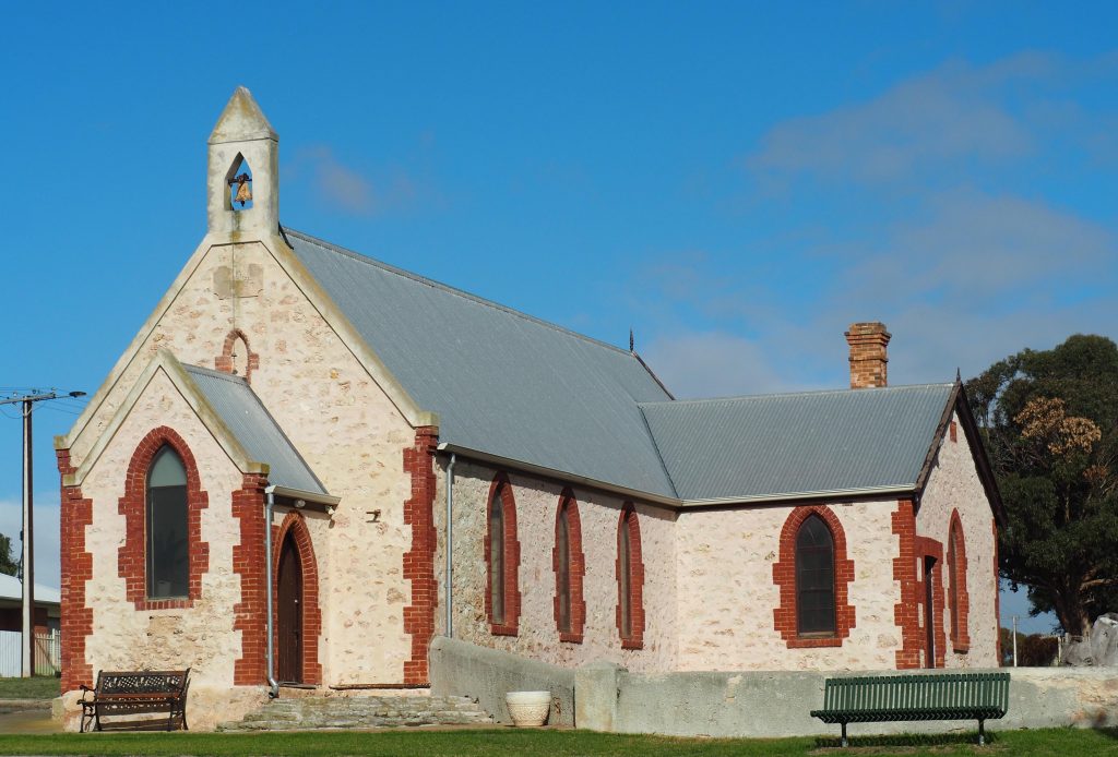
Today I headed down the shore of Lake Albert to Narrung where there is an Aboriginal village which was the tidiest country town I have ever seen. I was lucky to meet and chat with an Aboriginal man who had lived there for 40 years. He was one of the stolen generation and very proud of his town and how well run it is now, it used to be a bit wild. He pointed out the church to me, a leftover from the mission days, which appears on the left of one of our $50 notes. Next to the church on the $50 note is an image of David Unaipon who was raised in here when it was a mission.
Raukkan Church
David Unaipon (also written as Ngunaitponi) was born at the Point McLeay Mission, now known as Raukkan, on the Lower Murray, on 28 September 1872. David was a writer, inventor, public speaker and preacher. He was a proud Ngarrindjeri man, well known as a spokesperson for improving the conditions and rights for Aboriginal and Torres Strait Islander people. He also made many significant contributions to science and literature. Here is the image of the $50 note:
David Unaipon from Raukkan
The painting on the wall of an old shop on the main street is excellent.
Mural at Raukkan
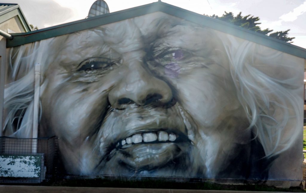
The other painting was on the wall of a shed at the rear of the shop, also very good.
Aboriginal Children at Raukkan
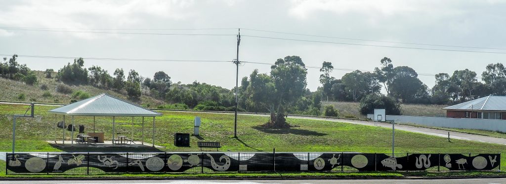
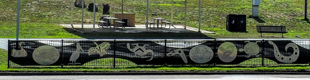
Near the shop is a clear area with a rotunda and a banner has been painted on the fence depicting birds and animals.
Banner at Raukkan
Closer up of part of the Banner at Raukkan
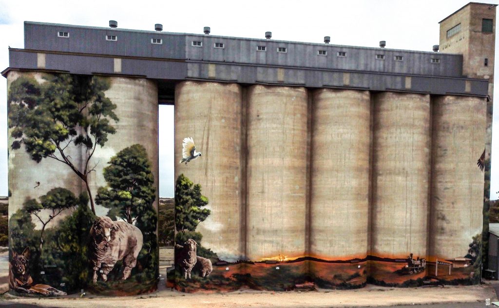
I wasn’t unhappy to leave Meningie, the country around is flat, brown with no trees and the wind was freezing, so it with glad heart I was off to Karoonda in the wheat growing districts of SA. The country became more interesting with lots of Mallee and Cyprus scrub along the roadside and a few hills to break the flatness. Karoonda is a small town with a big group of silos that have been painted relatively recently. At night they project artwork by local artists onto the silos so a return visit may be worthwhile sometime. It was cold and blowy but I put the drone up to get a shot of all seven painted silos.
Karoonda Silos from Drone
On the right hand end there were a couple of eagles painted and the big one was stunning, it really looks like it is flying away from the silo.
Karoonda Silo Eagle
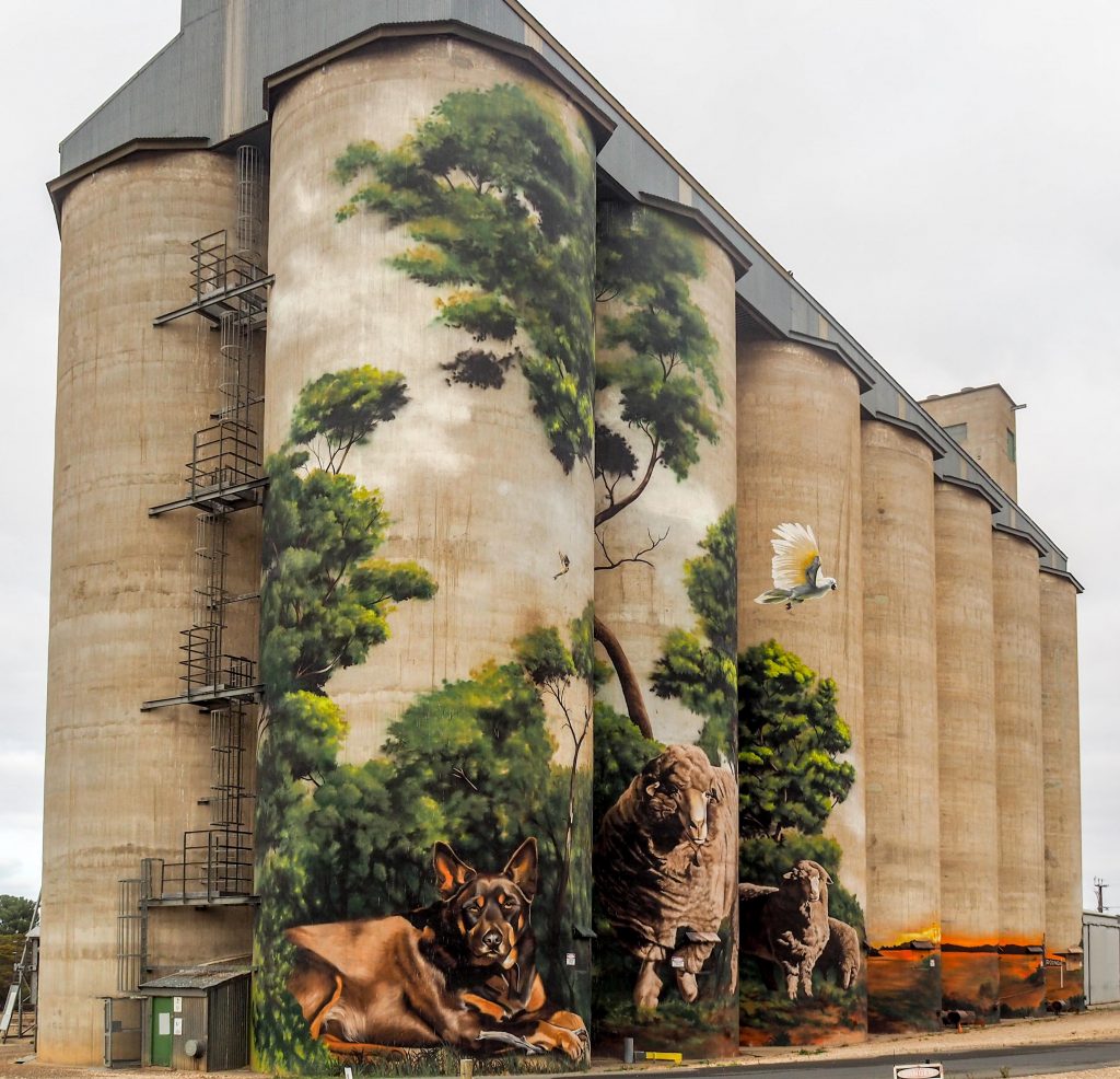
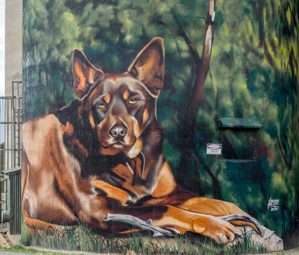
At the other end of the silos there was a Kelpie and some sheep.
Karoonda Silos
The Kelpie was very lifelike, given the large scale of the painting.
Karoonda Kelpie
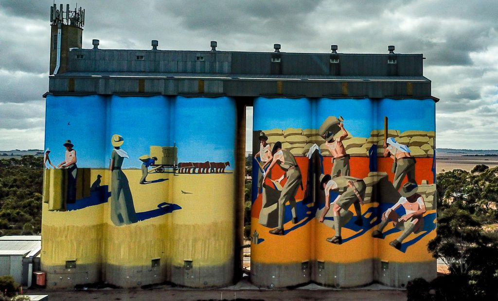
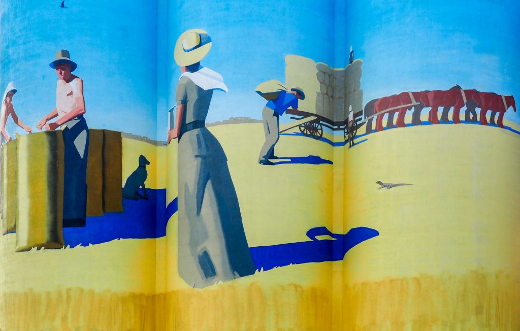
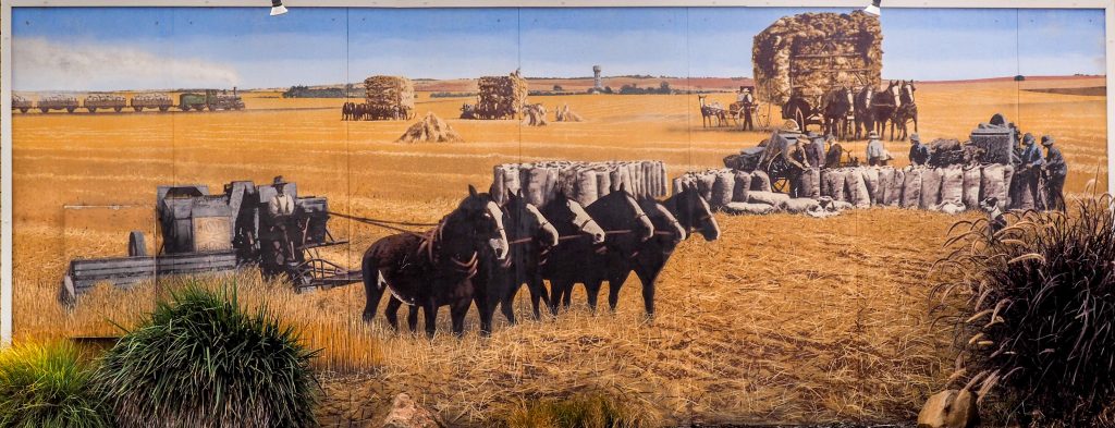
I was happy with Karoonda, it was well worth a visit, so I was quite contented heading off for Owen, still in the wheat growing area but on the other side of the top of the Barossa Valley. A much more interesting drive though hills and lots of towns on quite windy roads, but an enjoyable drive. The silos at Owen were only painted in March this year and the scenes reflect old grain growing activities of the area. Again the drone went up to get above the ground level obstructions and take in the whole silo group.
Owen Silos
The artwork was more abstract than most silos, not so much to my taste.
Loading the wagon – Owen Silos
The other group of silos had a team of men filling wheat bags and loading the bags onto transport.
Wheat Bagging and Loading – Owen Silos
The motel in Owen also had artwork on the end of a building, it was of a harvesting scene with horses pulling the harvester with bagging and other activities in the background.
Harvesting with horses at Owen
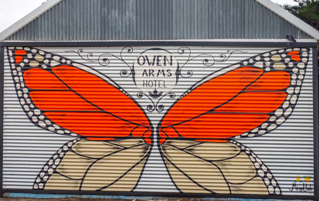
At the back of the pub there were a couple of outbuildings with artwork on them.
Owen Arms Hotel Outbuilding Butterfly
And another next door.
Owen Bee with You
I’m now in Port Wakefield and I spent the afternoon cancelling credit cards and sorting out things after I was hacked. They only got $500 before we were able to close the accounts and I should get that back from the bank. I spent a lot of time on the phone to three different banks, setting new passwords, and checking just what happened. I cannot access my bank accounts at the moment so with an advance from Deen I will be to continue on my way. Another day at Port Wakefield and then onto the Yorke Peninsula.
I set off for SA on Thursday in wet and cold weather, I was pleased I had packed up most things and coupled the caravan up the night before. I was going to stop at Goroke for the night but decided to put in a biggish day and head for Meningie about 425 Km away by the roundabout way I was going to travel. When it’s wet and cold you may as well drive. My first stop after 200 Km was Goroke near Horsham which has some newly painted silos. They were excellent and the rain stopped long enough to get good photos.
Goroke Silos
There was a third silo by itself to the right of these two silos.
Goroke Magpie Silo
I thought the Kookaburra was excellent and loved the old post on which he was sitting.
Kookaburra at Goroke
From Goroke I headed west for Kaniva on the Western highway near the SA border. The silos were just off the main drag but the weather was worse, drizzle with a freezing strong wind. I took the photos as fast as I could but I did put the drone up for one shot.
Kaniva Silo from a Drone
From Kaniva it was off to Coonalpyn in SA which, like Kaniva, Coonalpyn is on the main highway that runs between Melbourne and Adelaide. At least it had stopped raining by the time I arrived there. Coonalpyn is a small town with a cafe as the only shop located opposite the silos. There was a constant flow of people taking photos of the silos, more than any other silo I had visited on this trip. The first view I got was from the south from the car park.
Coonalpyn Silo from the South
The silo artwork is of children from the area, representing the future. I put the drone up but only managed one shot before the battery went flat and I had to bring the drone straight down. I had spare charged batteries in the car but it was too cold to make that trip so you have to make do with this photo.
Coonalpyn Silos from a Drone
I did walk up to the northern end of the silos for another shot.
Coonalpyn Silos from the North East
Coonalpyn were the last silos for the day but I was pleased with my day of “siloing”, they were all wonderful in their own way. So I headed on to Meningie feeling happy with the day. Meningie is on the shores of Lake Albert which is next to Lake Alexandrina, the lake at the end of the Murray River. It is a massive lake and the caravan park is right on the shore, but a bit busy for my liking. Tomorrow I will visit some street art and check out the area.
I’m camped at Nelson as far south west as you can get in Victoria and it’s freezing, but I’m snug inside the heated caravan. Mt Gambier is only 35 Km from Nelson so I headed into town to get some supplies, there is only a small shop and pub in Nelson. The Blue lake is the main feature at Mt Gambier so I put the drone up. It was quite windy so this is the best I could do in putting photos together as the drone doesn’t have a panorama setting. The blue lake doesn’t fit in one shot at 150 m high, the maximum I was allowed to fly in this area. The lake still has a blue tinge but it was a cold, overcast bleak day.
Blue Lake Mt Gambier from a Drone
The volcano that created the crater lake last erupted only 4,600 years ago, relatively recently. The lake is formed because the bottom of the crater is below the water table. The photo below was taken at ground level.
Blue Lake Mt Gambier Panorama from a Lookout
Mt Gambier is one of a 100 Km long chain of extinct volcanos that run from Mt Burr down to Mt Schank halfway between Nelson and Mt Gambier. Mt Schank is above the water table so does not contain a lake, I am told, because it was much to cold, and with a howling gale, for me to undertake the 1-1/2 hour walk to the top. The volcanos in this area exploded when the molten rock rose toward the surface and hit the water laden limestone. This caused a massive pressure and blew apart the limestone allowing the molten rock to flow to the surface.
Mt Schank extinct Volcano near Mt Gambier
From here I headed for Allendale East where there is a mural on a school hall. It is a small town, so small that my two GPS couldn’t find it. The mural was excellent with amazing detail for such a large painting.
Mural at Allendale East School
There was also a kids game mural on another building that I liked.
Game mural at Allendale East School
These murals inspired the kids to paint their own, which they did on the school hall.
Allendale East School Hall Mural Painted by the Kids
And they did another on the toilet block.
Allendale East Toilet Block Mural Painted by the Kids
Today is my birthday so I made up a hamburger roll and headed to Pritchards campground in Lower Glenelg National Park for a picnic lunch. Deen and I camped here a couple of Christmases ago and Marg and I picniced here a number of times, so it was full of good memories. It is a beautiful spot, a bit noisy at the start as a group of school kids were setting off down river on kayaks.
Kayakers on Glenelg River
Once the noise subsided all the little birds came out including a beautiful blue wren. He hopped around and on my table and gave me an opportunity to catch him on the camera.
Blue Wren at Lower Glenelg National Park
After lunch I put up the drone and disturbed the peace, it was windy up high and the drone had trouble staying level but I was able to level the photos in Lightroom. The campground is on the left of the river and has plenty of trees as you can see. Most sites have their own fireplace and some have picnic tables. The campground is divided into two parts and sites 10 to 20 are in a separate area toward the top of the photo and are more open. National Parks have planted bushes and trees which are starting to separate some sites, 16 to 20 are the best in that section.
Pritchards Campground and Glenelg River in Lower Glenelg NP
There is a jetty and a boat ramp at Pritchards and the boat ramp is 50 – 100 metres from the campground so that means less noise for campers in the early morning.
Pritchards Campground Jetty
So that’s Nelson and surrounds, great spot for a quiet holiday. Tomorrow I’m off to Goroke and then into the ‘wilds’ of SA, if there is such a thing.
The first thing I need to do is correct a mistake I made in my last post about Palm Sugar. I was thinking about Palm Oil, not Palm Sugar, it is the production of Palm Oil is the cause of massive rainforest clearing, not Palm Sugar. Palm Sugar production is a sustainable industry, here is a quote I spotted on the Internet: “The Food and Agriculture Organization (FAO) of the World Bank reported that palms can produce high yields of sugar for up to 100 years of production. The report found that coconut palm sugar is, therefore, a sustainable industry, with a minimal environmental impact when harvested using traditional techniques.” So I will investigate Palm Sugar salad dressing recipes after all.
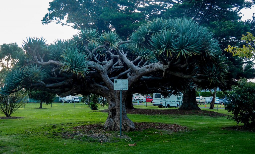
Last night I went for a walk in the Koroit Botanic Gardens, they are very small but there are some magnificent trees. One of them is this Dragon Blood tree that is on the National Tree Heritage Register as a tree of national significance, as the sign right in the middle attests, very sensitively placed!
Dragon Blood Tree at Koroit
On Saturday I went into Port Fairy which is only 15 Km away. If you are planning a visit to this area, Koroit is a great place to stay, 13 Km from Warrnambool, 15 Km from Port Fairy, and about 60 Km from Budj Bim and Mt Arapiles National Parks plus Tower Hill on your doorstep.
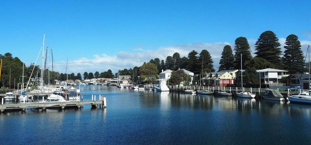
Sadly the Wharf area at Port Fairy has been gentrified and no longer can you buy fish and chips wrapped in paper from an old wharf building by the river. The restaurant that has replaced the old buildings serves good food, but without the joy of sitting in the sun pulling chips from a packet and rolling them around your mouth because they are too hot, because you can’t wait. There are still working fishing boats moored along the river but most boats are pleasure boats. All that said, it is still a pretty place for a walk and a meal, but not as atmospheric.
Moyne River Wharf Area Port Fairy
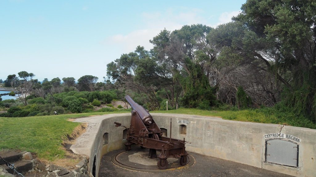
I walked around to Flagstaff Hill on the other side of the river where they build a defence bunker in 1861 in fear of the Russians. The 30 pound canons were upgraded to 80 pounders in the 1880s. The canon collection here is the biggest collection after the Queenscliff collection, also assembled because of the Russian threat.
Canon on Flagstaff Hill Port Fairy
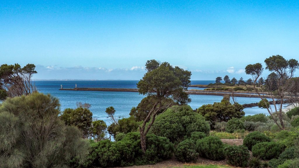
From Flagstaff Hill you look down on the entrance to the Moyne river which has a groyne on each side that make it easier for boats to enter and leave the river. In this photo you can just faintly see the coast around Warrnambool across the other side of the bay.
Moyne River Entrance at Port Fairy
Sunday’s trip was to Budj Bim National Park which preserves some natural volcanic features and bushland. The wetlands around Budj Bim had lots of volcanic channels that the Aborigines managed with weirs to control the water flow to Lake Condah. At Lake Condah the Aborigines farmed eels for more than 6,500 years and they lived in stone huts, permanent structures that they could build because the eels provided a food source all year round. They smoked the eels and traded them with adjacent tribes.
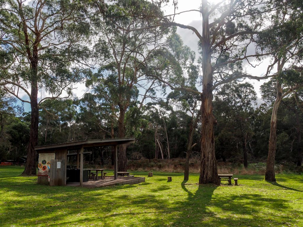
The picnic area at Budj Bim had a couple of shelters which I headed straight for, the wind was very chilly. Sitting there eating lunch brought back lovely memories of all the picnics Marg and I enjoyed together in many National Parks and other places over the years. I haven’t done many picnics since she died, except when I holiday with Deen, but after today I may start doing them again.
Budj Bim NP Picnic Area
A short drive from here brings you to Surprise Lake, a big surprise in the undulating mostly flat land you drive through. It is a small volcanic crater.
Surprise lake
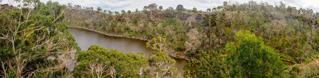
A walk of about 1 Km brings you to a high point overlooking the lake, the walk goes on for another couple of Ks but it had been an uphill walk most of the way so I decided to head back, but the lake view gave another perspective and a view of the country beyond.
Surprise Lake and Surrounding Country
After the walk I drove to Natural Bridge, which is in a lava channel. As the lava flows it splashes and forms levee banks beside the molten lava and in places where the flow is particularly turbulent, the banks close together and form a roof, Natural Bridge is one of these. You walk along the channel to get to the bridge and the lava walls are 9 metres high in places.
Laval Channel Walk
You can see the narrow path near the centre of the photo. In the picture of the bridge you can see the narrow exit gap in the middle of the photo. The person framed in the gap gives an indication of the height of the bridge. You have to walk down 30 steps to the bottom so I took the photo from the top, the steps were quite steep with no handrails.
Natural Bridge
Entrance to Natural Bridge
A drive through lots of tracks in the park and farmlands took me back to camp. Tomorrow I’m off to Nelson on the border with SA.