The first thing I need to do is correct a mistake I made in my last post about Palm Sugar. I was thinking about Palm Oil, not Palm Sugar, it is the production of Palm Oil is the cause of massive rainforest clearing, not Palm Sugar. Palm Sugar production is a sustainable industry, here is a quote I spotted on the Internet: “The Food and Agriculture Organization (FAO) of the World Bank reported that palms can produce high yields of sugar for up to 100 years of production. The report found that coconut palm sugar is, therefore, a sustainable industry, with a minimal environmental impact when harvested using traditional techniques.” So I will investigate Palm Sugar salad dressing recipes after all.
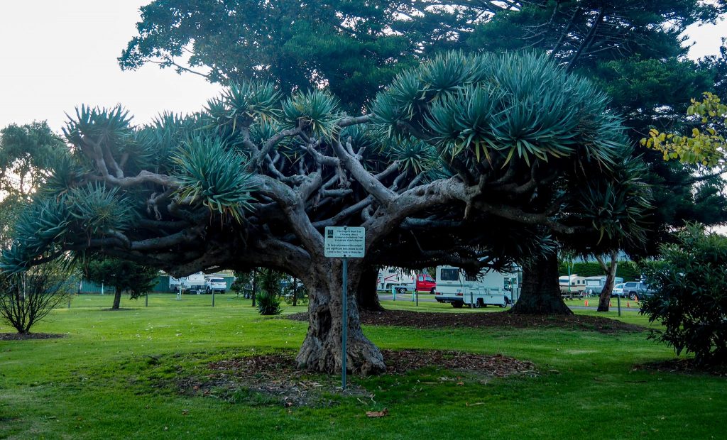
Last night I went for a walk in the Koroit Botanic Gardens, they are very small but there are some magnificent trees. One of them is this Dragon Blood tree that is on the National Tree Heritage Register as a tree of national significance, as the sign right in the middle attests, very sensitively placed!
On Saturday I went into Port Fairy which is only 15 Km away. If you are planning a visit to this area, Koroit is a great place to stay, 13 Km from Warrnambool, 15 Km from Port Fairy, and about 60 Km from Budj Bim and Mt Arapiles National Parks plus Tower Hill on your doorstep.
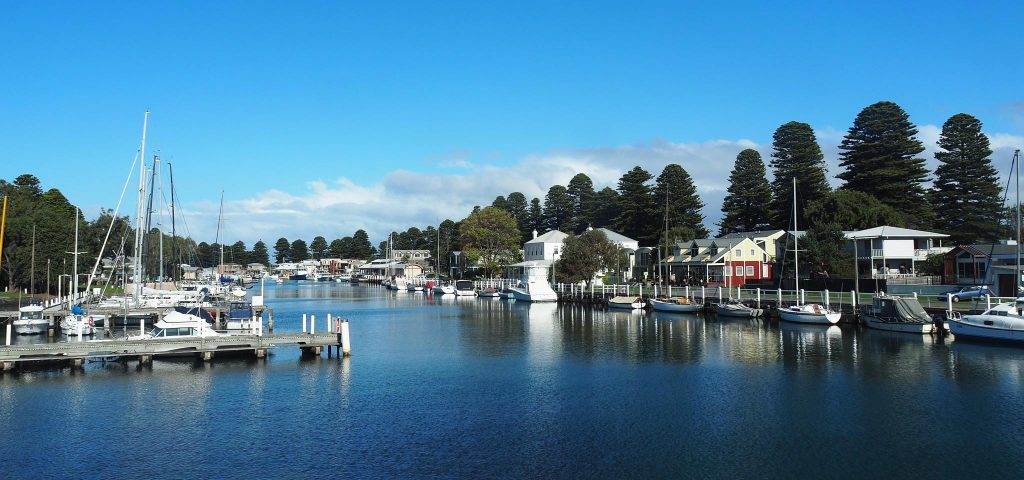
Sadly the Wharf area at Port Fairy has been gentrified and no longer can you buy fish and chips wrapped in paper from an old wharf building by the river. The restaurant that has replaced the old buildings serves good food, but without the joy of sitting in the sun pulling chips from a packet and rolling them around your mouth because they are too hot, because you can’t wait. There are still working fishing boats moored along the river but most boats are pleasure boats. All that said, it is still a pretty place for a walk and a meal, but not as atmospheric.
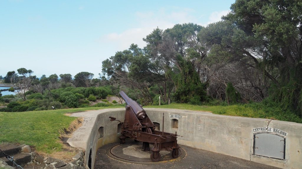
I walked around to Flagstaff Hill on the other side of the river where they build a defence bunker in 1861 in fear of the Russians. The 30 pound canons were upgraded to 80 pounders in the 1880s. The canon collection here is the biggest collection after the Queenscliff collection, also assembled because of the Russian threat.
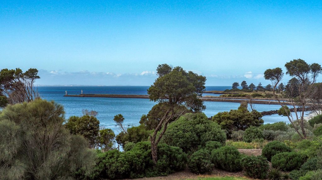
From Flagstaff Hill you look down on the entrance to the Moyne river which has a groyne on each side that make it easier for boats to enter and leave the river. In this photo you can just faintly see the coast around Warrnambool across the other side of the bay.
Sunday’s trip was to Budj Bim National Park which preserves some natural volcanic features and bushland. The wetlands around Budj Bim had lots of volcanic channels that the Aborigines managed with weirs to control the water flow to Lake Condah. At Lake Condah the Aborigines farmed eels for more than 6,500 years and they lived in stone huts, permanent structures that they could build because the eels provided a food source all year round. They smoked the eels and traded them with adjacent tribes.
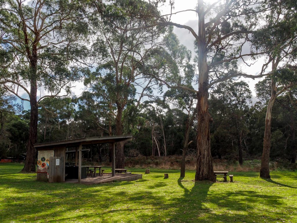
The picnic area at Budj Bim had a couple of shelters which I headed straight for, the wind was very chilly. Sitting there eating lunch brought back lovely memories of all the picnics Marg and I enjoyed together in many National Parks and other places over the years. I haven’t done many picnics since she died, except when I holiday with Deen, but after today I may start doing them again.
A short drive from here brings you to Surprise Lake, a big surprise in the undulating mostly flat land you drive through. It is a small volcanic crater.
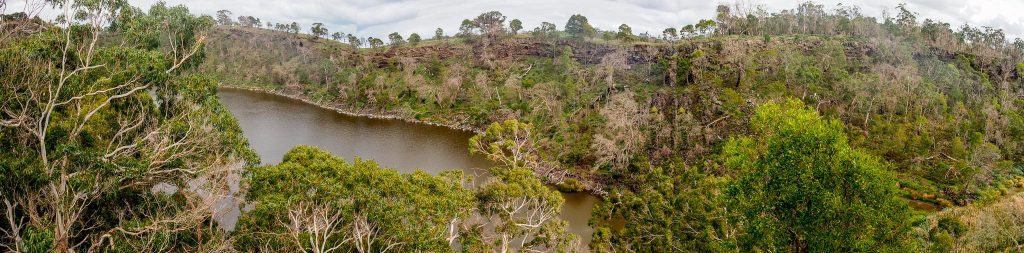
A walk of about 1 Km brings you to a high point overlooking the lake, the walk goes on for another couple of Ks but it had been an uphill walk most of the way so I decided to head back, but the lake view gave another perspective and a view of the country beyond.

After the walk I drove to Natural Bridge, which is in a lava channel. As the lava flows it splashes and forms levee banks beside the molten lava and in places where the flow is particularly turbulent, the banks close together and form a roof, Natural Bridge is one of these. You walk along the channel to get to the bridge and the lava walls are 9 metres high in places.

You can see the narrow path near the centre of the photo. In the picture of the bridge you can see the narrow exit gap in the middle of the photo. The person framed in the gap gives an indication of the height of the bridge. You have to walk down 30 steps to the bottom so I took the photo from the top, the steps were quite steep with no handrails.

A drive through lots of tracks in the park and farmlands took me back to camp. Tomorrow I’m off to Nelson on the border with SA.
Amazing photos Russ. I very much enjoy reading your blog. Love Marns
Thanks Marns I enjoy putting it together and feedback like yours keeps me going Love Russ
Well, given that you are 9 hours ahead of me, I’m hoping that I’ll be first to wish you a very happy birthday Russ. Shame you are also (roughly) 19,000 km distant as well!
Thanks Janice, you were the first! It is a pity we are that far apart today is a perfect autumn day blue skies, sunny and 18°C, perfect for a lunch at a winery or a lunch in a national park which is what I will be doing.