Nelson

That’s Nelson the place not Nelson the man!  I had an enjoyable drive from Goolwa to Nelson around Lakes Alexandrina and Albert and along the Coorong.  Lake Alexandrina was named after Princess Alexandrina who later became Queen Victoria.  The drive along the Coorong was very enjoyable with views over the water alternating with coastal bush alongside the road.  I’m staying in Kywong Caravan Park in Nelson right next to Glenelg River National Park.  Nelson is in South-West Victoria on the coast near the SA border.  Glenelg River National Park is a great park with a number of wonderful campsites right on the river, some even have septic toilets, all have fireplaces and picnic tables.  Great pace for canoeing, kayaking, and fishing either from a boat or off the jetties that are at most campsites.  I had a picnic at Pritchards camping area and enjoyed conversing with a couple of grey nomads camping there.

20161126-glenelg-river-at-pritchards-camp-med 20161126-glenelg-river-glenelg-np-med

On another day I went to Port Macdonnell in SA, the home base of the largest lobster fishing fleet in Australia and enjoyed a meal of calamari at Periwinkles Cafe, Marg and I went there once before for lunch and the wind nearly blew us back to Nelson, 30 Km away.  Also visited Picininni  Ponds, which are water filled sink holes in limestone rock, beautiful crystal clear water, craggy limestone walls and lots of water plants.  They are very popular with divers.  Unfortunately the ripples stop the photo showing the clarity of the water.

20161125-picininni-ponds-med

Tomorrow I start the journey home so this will be my last blog until next trip.  Thank you for your many comments and positive feedback.  You have helped me get through what has been a very emotional and nostalgic trip, my first camping trip without Margie in a very long time.  To say that I missed her would be an understatement, but you all have helped.  Thank you.

Posted in 2016 | 8 Comments

The Coorong

I had a day long cruise of the Murray from Goolwa to the mouth and then along the Coorong for quite a few kilometres.  Above Goolwa is Lake Alexandrina which is massive – 580 square kilometres.  It used to be sea water but a series of barrages was finished in 1940 and the Lake became fresh water and is used for irrigation.  Barrages are like a weir, but because they separate sea and fresh water they are called barrages.  One of the barrages is 3 Km long all built with pick and shovel.  At the moment there is 89,000 mega-litres per day flowing into and out of the lake, that’s 89 olympic swimming pools per day.  Over 100,000 mega-litres per day is called a flood.

20161123-loading-firewood-onto-oscar-w-at-goolwa-med

When Marg and I were here in 2011 there were about 6 gates open in the barrages, this time there were around 30 open in the main Goolwa barrage and lots open in the four other barrages that seal off creeks and inlets.  So there is much more water this time, in fact when the Spirit of Coorong was in the Murray mouth the water was measured at 36 feet deep.  The mouth has moved 6-8 Km over the last 1000 years and about 1 km since the 1970s.  It closed for the first time in 1981 and they now dredge sand to keep it open when the Murray flow is low.

20161123-nz-fur-seal-at-goolwa-med20161123-murray-mouth-med


The white line in the water at the Murray mouth is where the water of the Coorong meets the water from the Murray.

20161123-murray-meets-coorong-med

There was heaps of bird life to enjoy plus NZ fur seals around the Goolwa barrage.  There were a lot of migratory birds including sandpipers the size of sparrows that have just flown in from Siberia, quite amazing.  We had to use a lock to get through the barrage as there is a 30 cm difference in the levels across the barrage.  During the drought that broke in 2010, the lake was at least a metre below the sea level and water seepage through the dunes caused the lake to become slightly salty.  Later on in the drought much of the lake dried up and only the channels held water.  To stop acidification of the dry lake bed they used crop dusting planes to spread 600 tonnes of lime on the exposed bed to drop the acid level.  As a last resort they were going to flood the lake with sea water, but fortunately the drought broke.

The water in the lake and Murray is quite brown and when you pass the last open barrage you can see a distinct line where the fresh water meets the salt water of the Coorong (4 times as salty as the sea, but that should change with all the water flowing down the Murray).  This line shows clearly in the photo of pelicans below.  The Coorong is 130 Km long and ranges up to a kilometre wide.  The line of sand dunes between the Coorong and the ocean is narrow at places, 100-200 metres and very wide up to 4 km wide.

20161123-coorong-pelicans-and-meeting-of-salt-and-fresh-water-med

We landed in a couple of places and walked across the dunes.  The first stop took us across to the ocean and Goolwa beach, where the pipis usually are.  However because of the amount of fresh water entering the ocean most of them have moved 50-70 Km down the beach.  The commercial fishers have to travel up to 70 Km now each day to catch them, and they use the traditional foot wiggle to find the pipis, or cockles as they are called here.  The amount they are allowed to catch as a group changes according to pipi numbers, but is usually around 450-500 tonne per year.  The pipis are retailing at $20 per Kg.  The commercial fishers also use nets from shore to catch Mulloway.  Our guide was part aboriginal and was able to show us some bush food plants along the walk.  We also saw a fresh water small lake in the dunes.

20161123-coorong-fresh-water-lake-med 20161123-coorong-dunes-med

Before lunch we were served a starter of a dozen pipis cooked in garlic, onions, hoisin and chilli sauces, with cream and wine, they were delicious.  Lunch came in a prepared box of salad with macaroni salad, coleslaw, 3 cuts of cold meat, chopped chicken, hard boiled egg, tomato and lettuce, plus a roll, cheese and biscuits and a chocolate mint.  The only thing missing was a glass of wine!

After lunch we stopped at Cattle Point in the National Park and walked through the dunes to an aboriginal midden of pipi shells.  The midden was massive and clearly had been occupied for millennia.  The midden was at least 200 m in each direction and reported to be 2 m deep, how many pipis is that!  And the aborigines had to walk 2 Km to the beach to gather them.  There were also some buried human remains on the site so we had to be guided on where we could walk and sometimes it was in single file.  Because of the plentiful supply of game, fish and pipis the aborigines, Ngarrindjeri, were not nomadic.  The guide also dug a small well about 30 cm deep in a depression in the sand which quickly partly filled with water.  I drank a little and it tasted fresh and pure, but you had to be careful not to stir up the sand though.

20161123-coorong-midden-at-cattle-point-med 20161123-fresh-water-well-med

We then returned to Goolwa after a very enjoyable well run day.  I pack up tomorrow and move to Nelson and maybe Glenelg National Park.

Posted in 2016 | 2 Comments

Goolwa

I had an interesting chat with a guy who has been a volunteer on the Paddle Steamer Oscar W for 30 odd years.  They have restored the rotting hulk to working order and now run cruises on Lake Alexandrina from Goolwa.  The Oscar W also attend festivals and shows on the Murray and this weekend are at Mannum for a steam festival.  The boat was built in Echuca and worked the Murray for many years.  We have dined at the Oscar W restaurant in the old port at Echuca, and I had wondered who was Oscar W, but it wasn’t a who it was an it.

The steamer has a steel plate upper body and 3″ thick by 8″ wide red gum planks below water.  Using steel is an advantage as it keeps the red gum bottom constantly under the water, compared to all wood boats that when empty float higher and the planks can dry out, they shrink and the caulking falls out.  When the boat is filled it then sinks!  At Yanga National Park I read that the homestead had been built in part using ballast from bricks used as ballast on paddle steamers, and I wondered why they would need ballast sailing on calm inland waters.  Clearly it was to keep all the red gum planks wet and the joints closed.  So a puzzle for me has been solved!

The Oscar W burns 1 tonne of firewood an hour and has a top speed of 18 Km/hr.   Apart from volunteers working on maintaining and sailing the boat they have another group of volunteers who go out onto farms and forests and gather and split firewood.

One time recently when the Oscar W was heading up the Murray, the current was so strong they had to have a speed boat pull the front of the boat around when they turned so that they didn’t float sideways down the river out of control.  Another time when they and another steamer were returning from a festival at Meningie across Lake Alexandrina, the head wind was so strong they could only achieve one Km/hr at full power.  The other paddle steamer lost all headway against the wind and was blown aground and stayed there for a few weeks.

the-oscar-w-med

Unfortunately, no more cruises are scheduled until December so I won’t be able to enjoy a cruise on the Oscar W.

On Sunday I went to the Goolwa market before going on the Cockle Train for a return trip to Victor Harbour. The market was crowded as you would expect with a good range of things for sale.  It is located on the wharf as is the train station so it was all very convenient.  The railway opened in 1854 and was the first line in SA and the first in Australia using iron rails.  Until 1884 trains were pulled by horses that were changed at stations as required, it would have been a slow trip.

The train is called the Cockle Train because it used to bring fishermen to Goolwa on the way to catch cockles on the ocean beach.  The cockles were very prolific and large at Goolwa.  There are bag limits for amateur fishermen (300 per day and min. 3.5 cm across) and a closed season from June to October, but at the moment the beach is closed to cockle gathering due to contamination by E-coli probably from Murray floodwaters.
20161120-goolwa-market-med

The steam train arrived and they had to add a couple of carriages which was interesting to watch.

20161120-cockle-train-med

There was plenty of room on the train and good views over Lake Alexandrina and the ocean along the way to Victor Harbour.  There was a commentary from time to time but I think they must have borrowed the PA and announcer from Richmond Station, so it was unintelligible.

20161120-lake-alexandrina-from-the-train-med 20161120-view-of-the-bluff-at-victor-harbour-med

There was a sea breeze at Victor Harbour so it was quite pleasant sitting in a park by the beach eating lunch (home made ham and tomato roll for you gourmands) waiting for the return trip.  I didn’t feel like walking around, but I may return to Victor Harbour for another visit.

I have always said you need to take a good tool kit when camping and now I know why.  I have a pair of stilsons in my tool box (like very large multigrips) and I have never used them while camping.  But tonight I felt like pickled onions and cheese for tea and when you feel like pickled onions, you have to have them.  Couldn’t get the lid off, I tried everything to no avail, then I remembered the stilsons, immediate success; and they were just as good as I imagined, the pickled onions that is.  So remember when you go camping take a good tool kit, or go without pickled onions.

There is a horse tram in Victor Harbour on a pier in Encounter Bay.  It is named Encounter Bay because Mathew Flinders met Captain Baudin, a french explorer, in the bay on April 8th (our wedding date) in 1802.  Mathew Flinders was mapping the complete coastline of Australia at the time.  The ride on the tram was interesting and relaxing, the tram travels at a walking pace.  The tramway used to take freight to ships anchored off Granite Island and closed in the 1950s.  New trams were built and the rails replaced and the passenger service opened in 1986 to celebrate South Australia’s 150 year anniversary.

20161122-hirse-drawn-tram-med 20161121-victor-harbour-tram-med

The pier is over 600 metres long and it takes the tram about 10 minutes to cross the pier.  The tram then winds around the edge of Granite Island for another 300 metres to where the port used to be located.

20161122-victoria-pier-victor-harbour-med  20161122-granite-island-and-the-bluff-med

After the tram trip I went to Newlands Head Conservation Park for a BBQ lunch.  Marg and I had visited here for a picnic a few years ago so it bought back good memories.

20161122-bbq-at-newland-head-med

As you can see in the background the gum trees are wonderful old twisted veterans, much like me!  Tomorrow is my last day at Goolwa and I go on a cruise on Lake Alexandrina and the Coorong.  The cruise includes morning and afternoon tea and lunch, so that will be good.

Posted in 2016 | 4 Comments

Loxton – Goolwa

Before I left Menindee is took a photo of my camp, which was quite idyllic under trees and right on the water.  I was up early and took a photo of Copi Hollow (the lake) at Dawn when the water was dead calm.

20161116 Early Morning at Menindee Med

Copi Hollow was where I camped and Burke and Wills passed through Copi Hollow when they left Menindee.

20161115 Camp at Menindee Med

20161115 Sign at Depot Camp Menindee Med

20161115 Depot Camp Menindee Med

It was a long drive Wednesday from Menindee to Loxton, around 540 Km.  Stopped at a caravan park half of which was closed because of floodwater from the Murray, but the sunset over the river was very picturesque.

20161116 Sunset on the Murray at Loxton Med

I have booked into a caravan park on Hindmarsh Island near the Murray mouth for a week, so it will be a time to relax.  Hindmarsh Island was the centre of a controversy a few years ago over the building of a bridge from Goolwa to the island.  Aboriginal women protested about building the bridge because of secret womens business.

Today I went for a walk in the Nurragi conservation reserve, which is a linear reserve that follows an old railway reservation for 12 Km.  The sign is on the old Nurragi Siding.20161118-nurragi-siding-sign-med

It preserves remnant vegetation of which only 2% remains in the area, the rest has been cleared.  I had enjoyable walks in several places along the reserve which would be great in spring when the wildflowers were out.  But even now there were quite a few flowers to see.

20161118-red-flower-at-nurragi-med 20161118-pink-daisy-at-nurragi-med

Along the way there were a number of Callistemons and some had a native creeper on them called snotty-gobble, how’s that for a name!

20161118-snotty-gobble-creeper-med 20161118-blue-flowers-at-nurragi-med

After the walks I went to Flying Fish seafood cafe in Port Elliot, it is renowned and the car park was full with about 80 cars, so I ordered take-away and enjoyed crumbed garfish and chips in a nearby beachfront park, washed down with some Tahbilk Chardonnay.  Way to go.

Posted in 2016 | 12 Comments

Menindee

I checked the weather forecast for the next 7 days, for Tibooburra it is 28, 31, 35, 38, 35, 36, 39 and for Birdsville 32, 35, 37,41, 37, 38, 41.  I remember Pete Gifford saying to me it’s going to be hot but I didn’t realise how hot.  So I have decided that it is not the right time to go further north while camping without power and water and to travel alone on little travelled back roads.  I would not like to break down and have to camp on the side of the road in these conditions.  I do carry a satellite phone and belong to RACV Total Care, so I could call for help, but I would not enjoy being in such very hot weather.  So following the rest of Burke and Wills journey will have to wait for a cooler time of year.  I think I will start heading down to the south east coast of SA tomorrow.

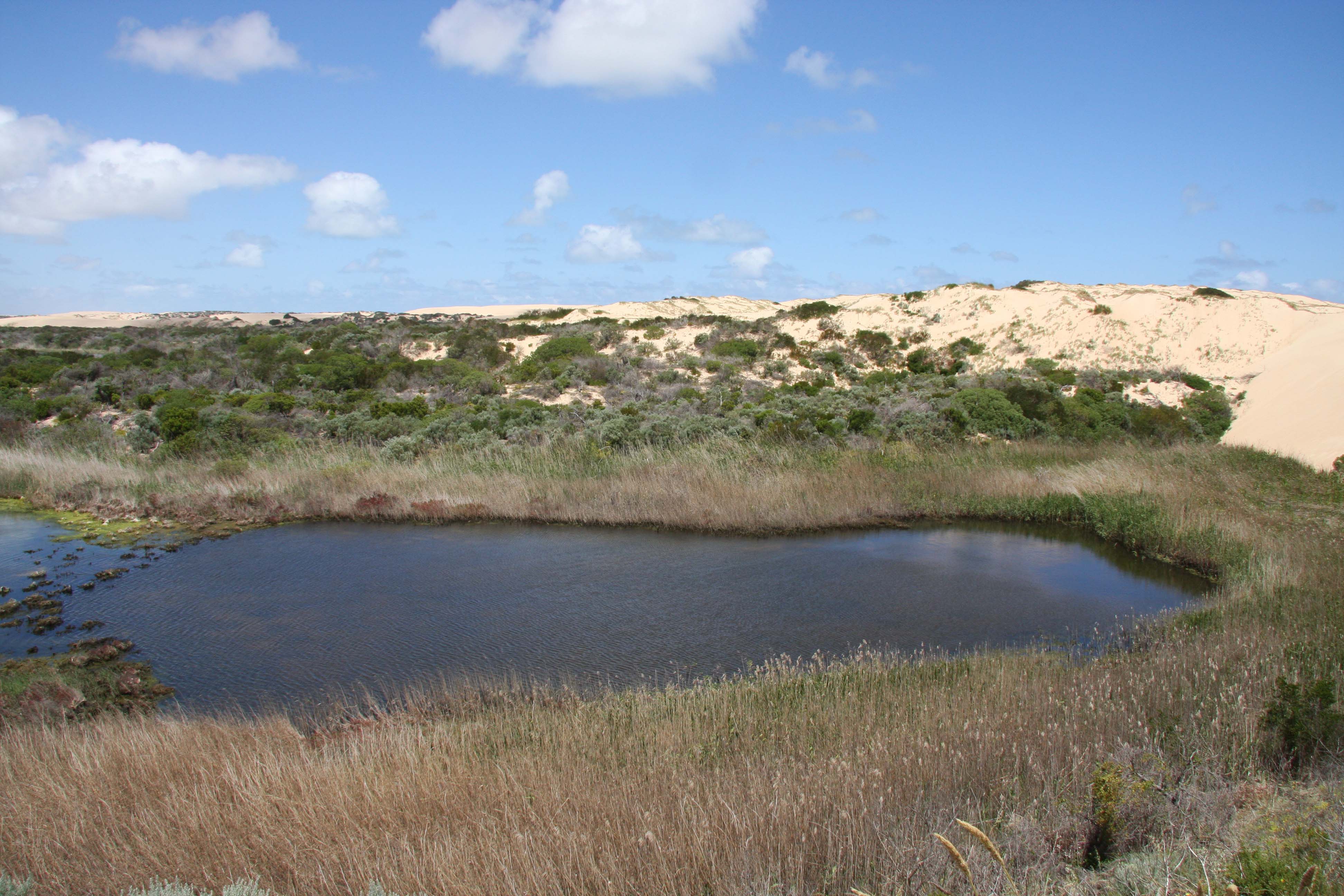
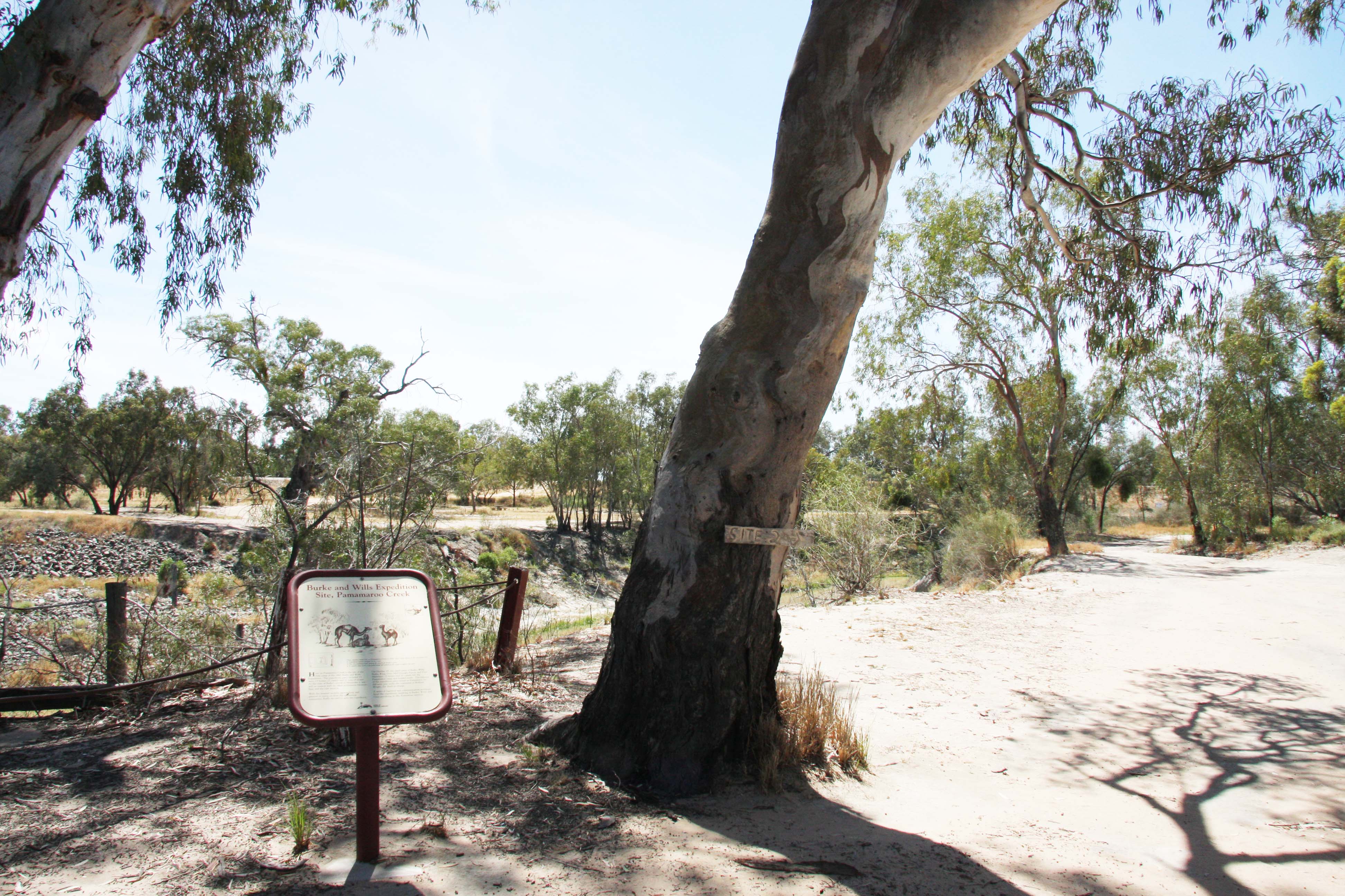
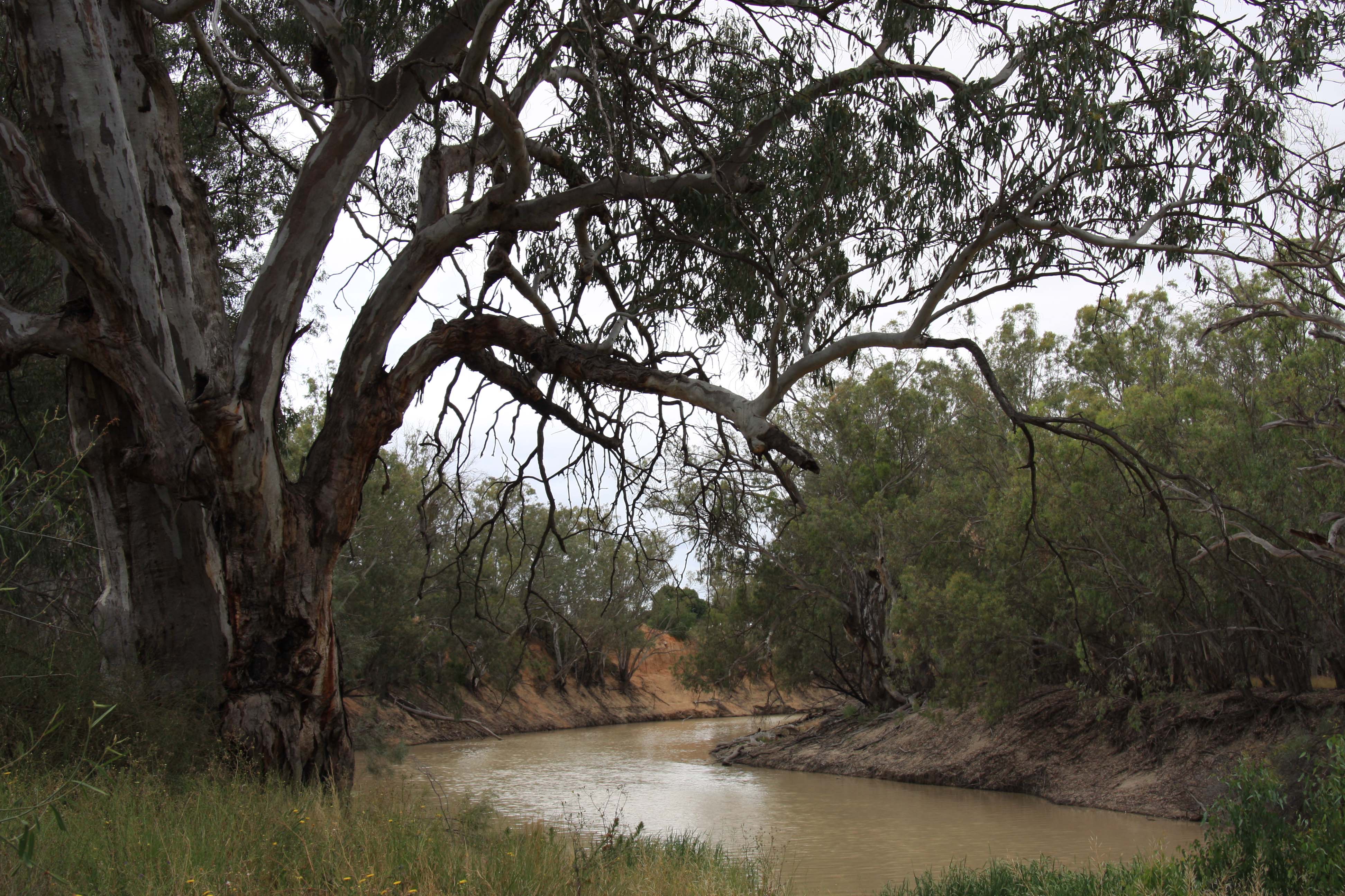
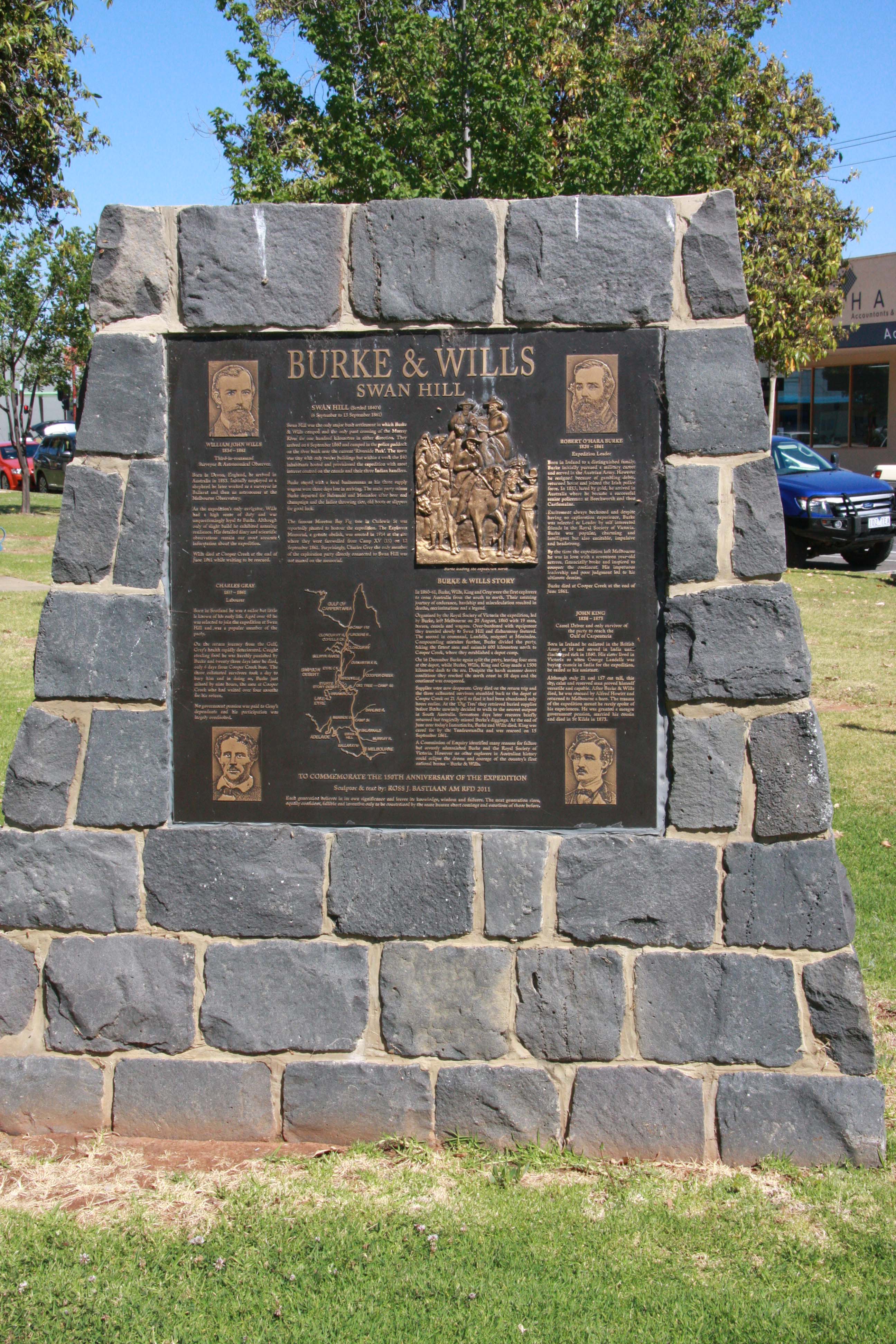
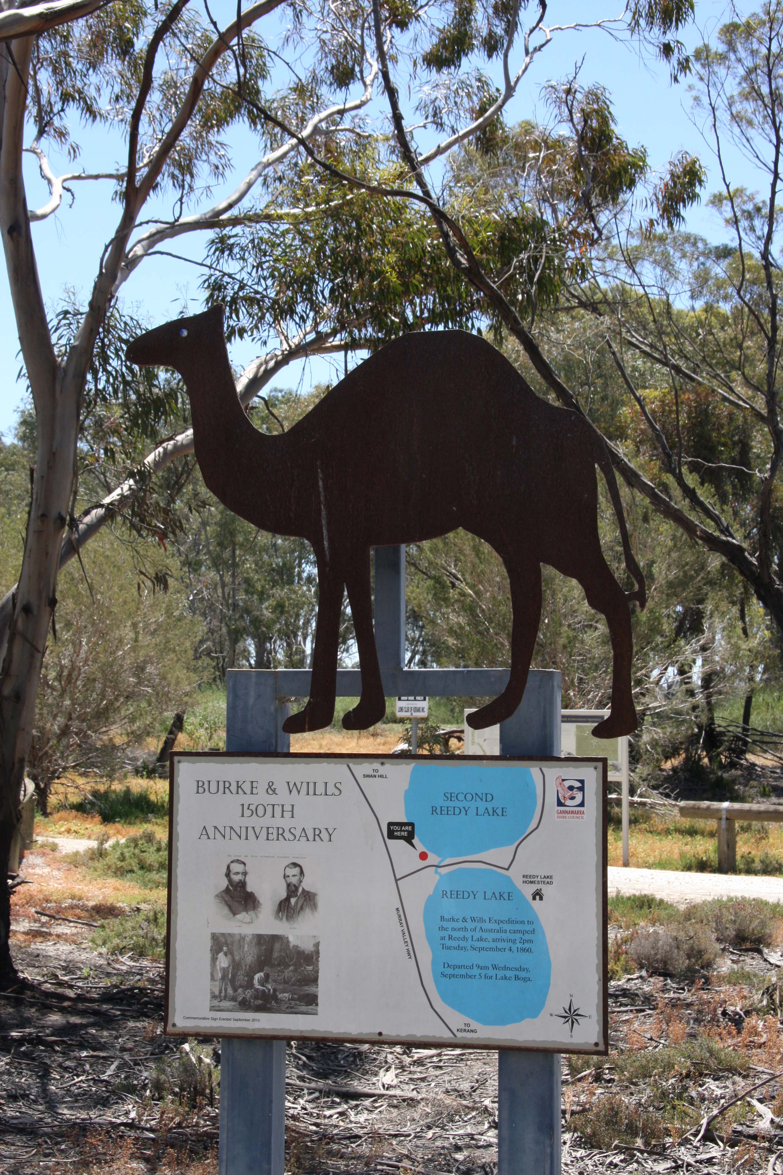
Today is my last day following the journey of Burke and Wills and I visited depot camp situated on Pamamaroo Lake about 10 Km north on Menindee.  This camp was established after Burke had left for Coopers Creek on October 19 1860 from the Menindee camp.  After Burke and his party had left, the rest of the VEE moved the remaining 9 camels, 3 horses and 10 tonnes of supplies to the depot camp.  It was set up by early November 1860.  When the VEE arrived at Menindee the expedition consisted of 15 men, 23 horses, 27 camels and 21 tonnes of supplies, despite having offloaded a lot of their supplies on the way.

20161115-depot-camp-menindee-med 20161115-sign-at-depot-camp-menindee-med

Burke set off set of with Wills, Brahe, King, Gray, McDonough, Patten and Dost.  They had 15 horses, 27 camels and 11 tonnes of supplies.  They were going to bury some supplies at Torowoto to use on the return journey, Torowoto is about 60 Km south east of Tibooburra.  Burke was going to rest for 14 days near waterholes near Torowoto.

Wright, an expert bushman, had lead Burke the 300 Km to Torowoto where they buried some supplies.  Wright then headed back to Menindee where on his arrival there were urgent despatches for Burke from the organising committee.  These told Burke that Stuart had failed to cross the continent and that this left him clear to win the race.  So Wright then organised Dick and 2 others to head off to catch Burke who should be resting near Torowoto.  They covered the 300 Km in 5 days but when they got there they couldn’t find the buried supplies despite Dick being there when they buried them.  Lyons and McPherson decided to catch up to Burke but the party had already moved on.  Their horses died and they only survived on seed cakes that the local tribes showed them how to make.  They got back to Torowoto and Dick then set off for Menindee on the only horse, which died after 40 Km, so he walked the remaining 260 Km to Menindee.

With nearly all their horses dead, the people at Menindee had to request extra funds and then buy and break-in more horses.  This they did and a party of 7 set off to resupply Coopers Creek.  The journey was very arduous and a number of horses died and they had problems with the aborigines.  With all the men sick, Wright decided to turn back to Menindee.  But his preparations were interrupted by Brahe and the 3 other men who had left Coopers Creek for Menindee on April 21, the day Burke, Wills and King arrived back, they missed by only 6 hours.  Brahe found Wright by accident while looking for strayed horses.  Brahe told Wright they had stayed at Coopers Creek for 19 weeks and that Burke had only supplies for 12 weeks, so he felt justified in leaving.  He had been asked to wait for 3-4 months.  On of Wrights party, Becker, died that afternoon.

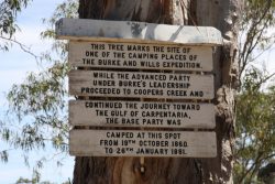
The combined party set off for Menindee on May 1, but had to stop after that days travel for a few days to let Patten and McDonough recover some strength.  While the group was resting, Wright and Brahe wanted to carry out one last check of the depot at the dig tree so they both rode back to Coopers Creek to check.  When Burke got to the dig tree he removed the supplies, and placed a note in the buried box and then smoothed the ground so the aborigines would not take the note.  So when Brahe and Wright arrived at the camp on Coopers Creek they thought it untouched, as if no one had been there, so they left again.  After a very difficult journey back to Menindee because of lack of water, fatigued horses and sick men (Patten also died on the way), they raised the alarm and search parties were organised.  It is a very unforgiving part of Australia.

So what if?

Burke had been a less impetuous and better leader.

Burke had used a steamer to bring supplies to Menindee and saved tiring the horses and camels.

The buried supplies at Torowoto had been found.

Lyons and McPherson caught up to Burke and told him there was no urgency to cross the continent.

Brahe and the 3 others had not left Coopers Creek the same day that Burke arrived.

Burke had not covered up that fact that the buried box had been opened.

Brahe and Wright had looked a bit harder at Coopers Creek.

Burke, Wills and King had stayed at Coopers Creek, rather than trying to walk to Mt Hopeless.

It all could have been so different.  They did achieve their objective of crossing the continent, but died in the process.

“Follow Burke and Wills” is to be continued.

My journey so far:

journey-to-menindee

Posted in 2016 | 14 Comments

Balranald to Menindee

Today I was to head off to Mungo National Park but the Prungle Mail Road from Balranald was of uncertain condition after rain on Friday.  So I had to head across to Euston and Wentworth and then north to Pooncarie and Menindee.  So I missed out on seeing Mungo National Park again and missed passing a number of VEE camps, plus travelled an extra 100-150 Km.  Even so my journey was much easier than the VEE enjoyed.  They had lots if issues with the six wagons and often had to uncouple one team of horses and join it to a team on another wagon to get through a soft patch,  They also had to cut down lots of Mallee trees in their way and had to do this without chain saws.  Progress was slow.

At Mungo the main group headed north west to Pooncarie and the wagons headed due west to avoid sandhills.  The Darling at Pooncarie is typical of the Darling, high banks and low water level.

20161114-darling-river-pooncarie-from-old-wharf-med

Everyone eventually caught up at Pooncarie, even then a small settlement.  For the first time for a while the whole expedition was together.  Burke had been frustrated by the slow progress of the wagons so they abandoned them at Pooncarie Camp 29 and loaded all the supplies onto the horses and camels and a paddle steamer and headed for Menindee.  Burke was criticised by some of the members of the VEE for not bringing all the supplies to Menindee by steamer from Adelaide.  Had he done that the camels and horses would have been in good condition rather than badly knocked up.  Burke was also having an ongoing dispute with the cameleer Landells and eventually it came to a head and Landells resigned.

20161114-camp-29-med 20161114-camp-30-pooncarie-med

You can see from the photos of Camp 29 (left) and Camp 30 how barren the country is, and remember they are carrying no water, but relied on billabongs and rivers for water and the water was of poor quality.  They still had lots of sandhills to cross  20-30 feet high and soft under foot, energy sapping.

At Menindee they crossed the Darling at Camp 34A just below Menindee and then moved to Camp 34 right behind the Menindee Hotel; Burke and Wills and some other senior members of the expedition stayed in the hotel.  “Luxury”, better than a soap box in the middle of the road!!  It is interesting to note that in general when they set up camp they just crawled under bushes and went to sleep, which happened quickly because they were so tired.  At Menindee there is a park named after Burke and Wills and a memorial plaque.

20161114-burke-and-wills-park-menindee-med 20161114-burke-and-wills-memorial-menindee-med


There is also a grave of Dost Mahmet who was one of four Indians employed to look after camels.  A Bull camel attacked him and he lost an arm but recovered and stayed in Menindee and used to pray each day at the place he was buried.  At the moment there is a lot of water flowing down the Darling and this is being directed into Menindee lake which is a massive water storage dam which now has water in it after some years of being dry.

20161114-darling-river-water-filling-lake-menindee-med

In travelling from Wentworth to Menindee I have now completed the Darling Run, a journey to follow along the entire length of the Darling from where the Darling meets the Murray at Wentworth to the start of the Darling River between Bourke and Walgett.  The Darling starts where the Culgoa River meets the Barwon River to become the Darling River at a location between Bourke and Walgett.  We stayed on a sheep station on the Barwon once with a friend of my brothers.

I also had a drive through Kinchega National Park which is the site of a former sheep station.  At its peak it was 800,000 hectares.  There are lots of good campsites along the Darling each with a BBQ, picnic table and rubbish bin but the park is extremely dry at the moment and not very inviting.  There was only one occupied camp out of 40.  Tomorrow I will visit the VEE depot camp from which Burke set off for Coopers Creek and the Gulf.

Posted in 2016 | Leave a comment

Balranald and Yanga National Park

Near to Balranald is Yanga National Park which has a big frontage on the Darling River, and is well worth a visit.  Yesterday I visited Yanga woolshed in the National Park about 6 Km south of Balranald.  A very big wooshed built in 1896 after an earlier woolshed burnt down.  It is massive, being able to house 3000 sheep under cover in the woolshed, having stands for 40 shearers and able to store 2000 bales of wool.  The area where the sheep were penned under cover were called the sweat pens for obvious reasons.  The sheep were held under cover to keep them dry should it rain.  Yanga could carry up to 100,000 sheep, so they needed a big shed.  The yards outside the woolshed could hold around another 5000 sheep.  The record for ones days shearing was 5000 sheep.

20161111-yanga-woolshed-med 20161111-inside-yanga-woolshed-med

Behind the shearing area shown above was the wool room where wool classing was carried out.  In the photo you can see a classing table and the bins where the classer threw the classed wool into the correct bin.

20161111-wool-room-yanga-woolshed-med

Behind the bins are the wool presses that compress each class of wool into bales which are labelled with their micron size, classer registration number and the station name.  In the early days the wool was shipped on paddle steamer from a wharf right behind the woolshed.

Today I headed north to visit camps 21, 22 and 23.  The VEE split into several parties at this stage and Burke sacked three of the team.  The country was very flat but was quite green with patches of mallee scrub.  Saltbush covered parts of the plain and the camels with the VEE apparently really enjoyed eating this plant.  The VEE were still travelling without water so relied on finding lagoons or lakes.  Some stations had built small dams which were utilised for water.  The journey was not following established roads, which did not exist, but followed faint aboriginal tracks.  Along the way I passed Bald Hill which was only about 50 feet above the plain, but was still considered worthy of being named, it was the only hill I passed.  Camp 21 was just at the start of a road that now roughly follows the VEE journey and is called Burke and Wills Track.

20161112 Camp 21 Med

Photos of the next two camps give you an idea of how flat and empty the country is.

20161112 Camp 22 Med20161112 Camp 23 Med


After camp 23 I returned via Box Creek Road which was a bit boggy and I had the Prado in 4WD.  It was a bit strange though because the wind was blowing dust over the road and it was hard to see ahead yet the road was wet, unusual.

I then went to Yanga National Park to visit the homestead, which was interesting.  It was drop log construction in which they cut cyprus logs about 5 feet long with bark left on and with tenons each end that slotted into vertical supports.  The gaps between the logs were sealed with mud.  It was built between 1862 and 1872 and is surrounded with well maintained gardens.  The homestead is on Yanga Lake which is a massive lake that is normally full, but it dried out in 2000 and people wondered if it would be full again.  Well it is full right now.  There was commercial fishing carried out on the lake in the past, nine licences, and massive 4 foot long Murray Cod were frequently caught.  It is reported that 7 tonnes of fish were caught in 3 days.  The commercial fishers used nets.

20161112 Yanga Homestead Med

20161112 Garden at Yanga Homestead Med


As well as using cyprus logs to build the walls the verandah posts were also cyprus logs with bark left on.

20161112 Yanga Homestead #2 Med
I had a drive around Balranald, but lots of walks and drives were flooded.  For example, there is a pedestrian swing bridge across the Murrumbidgee near the caravan park which I walked across, but the other side is flooded so the nature walk is not available.

20161111 Swing Bridge at Balranald Med

I also went out to see Redbank Weir on the Murrumbidgee but the access road was flooded.  I have a rest day tomorrow with nothing planned so it will be good to have a sleep in.  On Monday I head off again toward Mungo NP, Pooncarie and Menindie.

Posted in 2016 | Leave a comment

Swan Hill to Balranald

When I hooked up at Lake Bolga I found that both indicators did not work on both car and van, so I rang the RACV as I didn’t know here the fuses were (I now do).  This is the fourth time that I have had issues with connecting the van and car in the last seven of so coupling ups.  I did pull the plug on the van apart and fixed one dodgey connection while waiting for the RACV.  They arrived from Swan Hill within 20 minutes, found the fuse, checked it and put it back and all was good.  Apparently fuses can develop poor connection over time.  The good thing about this is that I now know where the fuses are under the bonnet, I had thought they were all under the dash.  The camp at Lake Boga was pleasant apart from the mozzies which were horrendous.

20161110-camp-at-lake-boga-med

After this delay, I headed north from Swan Hill through very flat country with lines of trees along creeks, billabongs and lagoons.  When the VEE (Victorian Exploring Expedition) travelled through this area it was covered with mallee scrub but most of that has since been cleared.  It was great to see all the billabong and creeks brimming with water.  Camp 17 was on a creek near an out station (small house on the outskirts of a big station that houses workers used in the area), the creek was full unlike when the VEE camped here.

20161111-camp-17-speewa-med

Heading north from camp 17 the VEE faced crossing two big rivers, the Wakool and Murrumbidgee rivers.  There was some dissension in the VEE at the two river crossings.  At the Wakool the cameleer was upset at Wills interfering with the camels.  That crossing took 4 hours.  At this stage the VEE was the biggest it had ever been with 21 men 26 camels, 25 horses, a spring cart, 3 wagons, plus 3 hired wagons, their drivers and horses.  Camp 18 was on the south side of the river and the Wakool crossing took 4 hours using a punt run by the Wakool Crossing Hotel, now the Kyalite hotel.  The photo on the left is of the flooded camp and on the right of the Wakool river

20161111 Camp 20 Across Murrumbidgee in Flood Med
20161111-plaque-at-wakool-river-crossing-med

The Edwards branches off the Wakool river at camp 18 and starts on the Murray between Deniliquin and Echuca where we all camped one Novemeber, the Wakool ends on the Murray about 50 Km north of Swan Hill.  Together they form an ana branch of the Murray.  The photo is of the Wakool at Kyalite.

20161111 Wakool River Kyalite Med


Camp 19 was on the plains in fairly nondescript mallee country.  At the time of the VEE there would have been many more trees making travel more difficult.

20161111-camp-19-med

After the Wakool they had to cross tributaries of the Murrumbidgee which were flooded and up to four feet deep and soft mud, but they got through.  At the Murrumbidgee it was Burke who upset the cameleer by trying to speed things up and overloading the punt.  As a result some supplies were water damaged.  But they did get across fairly quickly.  Camp 20 was on the south side of the Murrumbidgee at Balranald.

20161111-camp-20-across-murrumbidgee-in-flood-med

Then there was a dispute with the people running the three hired wagons (the other three were owned by the VEE).  The horses were used to fresh feed, but had had to eat hay and dry feed, so they were lacking condition.  They demanded that the loads be reduced, which they did.  The off loaded supplies were later sold at auction.  Unfortunately they offloaded Lime juice which was to combat scurvy and that proved to be a problem later in the expedition.  Vitamin C was not identified until 1907 and Becker, the VEE doctor, thought that the citric acid they retained would replace lime juice, but citric acid does not contain vitamin C.  It is worth noting that the VEE were not carrying water, but relied on rivers, creeks and billabongs for their water, which so far had been sufficient.

I booked into the Balranald Caravan Park and decided I could enjoy 3 nights at what is a lovely park right on the Murrumbidgee, and not many mosquitoes.  Yanga NP is nearby and surprisingly I haven’t visited it as it is a new park only being opened in 2009. I visited the woolshed today and it was very interesting with 3 audio visual displays showing aspects of shearing. The footage was from the last shearing in 2005 when the station was acquired by NSWPWS.  More of that in the next blog.

Posted in 2016 | Leave a comment

Swan Hill

Camp 15 in Swan Hill must have been bliss for the VEE after the country they had just travelled through and they stayed a week.  The camp was right on the Murray and the area is now a wonderful riverside camp.  Lots of tables, seats and BBQs amongst red gums alongside the Murray, Marg’s favourite river.  After enjoying lots of hospitality they crossed the river and set up Camp 16 on the opposite bank.20161110-camp-15-swan-hill-med 20161110-looking-toward-camp-16-swan-hill-med

Swan Hill was named by Major Mitchell because of the large numbers of Swans.  On the way into Swan Hill I passed a Bell Fruited Mallee in flower alongside the road.  As you can see it is growing in barren soil just beside the highway.  I carefully tended and tried to grow this tree about 6 times over the years and they all died, there is no justice!

20161110-bell-fruited-mallee-near-lake-boga-med20161110-bell-fruited-mallee-flower-lake-boga-med

Just by the river near Camp 15 is a memorial to Charley Gray one of the four to make it to the gulf but who died on April 17 1861 on the return journey to Coopers Creek.  He was buried by Burke, Wills and King but later dug up and buried in Melbourne general Cemetery.

20161110-charley-grey-memorial-swan-hill-med

There are two other memorials in Swan Hill one is an obelisk and the other a sculptured plaque.  The council in their wisdom have placed a wheely bin between the two memorials so you have to photograph them separately.

20161110-1914-memorial-swan-hill-med 20161110-2011-memorial-in-swan-hill-med

On the way back to camp I visited the museum that commemorates the RAAF flying boat base at Lake Boga which existed from 1942 to 1947.  It was very interesting with lots of displays on WW2 as related to flying boats, plus an interesting and well produced DVD which you could watch.  There was an underground bunker that was the communications centre and that bunker housed lots of radio equipment that Marg’s dad could have worked on while he was stationed there.  They have a restored Catalina in the museum which was quite impressive.

20161110-catalina-lake-boga-med

Tomorrow I head off into NSW.  After crossing the Murray the VEE will have to cross the Wakool and Murrumbidgee rivers.  The complete journey so far.

journey-to-swan-hill

Posted in 2016 | 2 Comments

Rochester to Lake Boga/Swan Hill

Swan Hill is the site of camp 15, but I am staying for 2 nights at Lake Boga just south of Swan Hill.  Before I cover today’s journey it seems I forgot to cover camp 5, the camp before camp 6 at Mia Mia.  Camp 5 was 15 Km along the Bourke and Wills Track after leaving Lancefield, the road follows their journey, hence the name.  There was nothing to distinguish the camp so I didn’t take any photos.  Thanks Deen.

Today I went back to Elmore from Rochester and followed mainly minor dirt roads that zig-zagged along and across the track Bourke and Wills followed.  The roads were very dry and the dust was amazing, as bad as any I have travelled.  A lot of the journey between Elmore and Kerang travelled through lots of swamp country and Bourke and Wills had difficulty crossing the swamps with their wagons and camels.  It was cold and wet through this part of the trip, which added to their misery.  The journey started getting all the team across the Campaspe River on a punt at Barnadown camp 8 as I mentioned.  The river crossing was reported as “a tedious if not dangerous operation”.  Lots of people from Bendigo watched them set off and a number of the party were entertained by local landowners.  Bourke wanted to increase the size of the party with a saddler and second surveyor plus a man he met in Castlemaine.

From Barnadown they headed across the Terrick Terrick Plains which are extremely flat with no hills until the Terrick Terrick hills.  Camp 9 was at Quinlivens Bridge, nothing marks the site but is is a nice creek.

20161109-camp-9-at-quinlivens-bridge-med

They did have a problem keeping the unfettered camels close to camp and often had to chase after them on horses.  Not sure why they were unfettered unlike the horses.  There was a cameleer in the party but he and Bourke often were at odds.  The cameleer had a few barrels of rum which he used to calm the camels.  Lots of zig-zagging on some very minor roads got me to camp 10 at Oak Ridge just near Terrick Terrick National Park.  It was in flat cropping country with little of note except a crop duster plane flying back and forward over a crop about 20 feet above the ground right along side the road and then pulling up over an single strand power line and immediately dropping down again.  Completely fearless but exciting to watch.  The expedition climbed the Terrick Terrick hills to get their first good view of the surrounding area.  The National Park is very dry and rocky and the camping area poor, so I decided not to stay, but I did walk around a bit.  Marg and I visited Terick Terrick for a picnic a few years ago, it looks just the same, but there is (or should it be are?) heaps of bird life.

20161109-camping-area-terrick-terrick-np-med 20161109-terrick-terrick-national-park-med

There was a station at Mt Hope that the expedition visited, but to call it a mount is a major exaggeration, but Camp 11 was made here.  Major Mitchell named Mt Hope on his Australia Felix exploration, but as you can see it from the photo it is not a mountain.

20161109-mt-hope-and-major-mitchell-plaque-med 20161109-mt-hope-from-the-distance-med

I then zig zagged again across some ordinary flat country passing many abandoned farmhouses to Tragowel Swamp.  Bourke and Wills were travelling through some cold, wet and windy weather so things were not too comfortable and some horses escaped from a paddock so they wasted time chasing these down.  They did comment that the journey to Tragowel was the worst so far because of the weather.  Camp 12 was on the edge of the swamp and there is a commemorative sign.  The swamp is a wetland but with lots of dead trees so it is not too attractive.  They arrived here at 6.30 pm and left at 9.15  am so they did put in big days and got going early.

20161109-camp12-tragwel-swamp-med

The camels were really suffering in the cold, mud and rain and Landells the cameleer gave them big doses of rum to warm them up (he had bought 60 gallons of rum for the purpose).  Fortunately there was a station nearby so they could enjoy some hospitality.  They decided to have a rest day at Tragowel.

The next day they travelled over muddy ground to the Loddon River and crossed this at a drovers crossing and found that the roads now were reasonable.  They set up Camp 13 at Reedy Lake Station.  Reedy lake is a RAMSAR wetland and has masses of birdlife which you can view from a two story bird hide.  There is a nice picnic area here as well.  Their track follows the Murray Valley Highway so it was much easier for me after the dusty dirt roads.

20161109-camp-13-reedy-lake-sign-med 20161109-reedy-lake-med

After Reedy Lake I headed to Lake Boga for a couple of nights.  Marg’s dad worked with the RAAF at Lake Boga during WW2 servicing flying boats, so I will have a look at the museum and visit Swan Hill following the VEE (Victorian Exploring Expedition) as it is known.  I passed Camp 14 at The Clump, but there was nothing to distinguish the camp from the surrounding country.

journey-to-mt-hope

Google maps only allow 10 destinations so the map above is my journey to Mt Hope.  It is much more zig zag than shown but most of the roads are not in Google maps.  So the journey from Mt Hope to Lake Boga is below.  Again there were many more minor roads than Google maps show.

journey-mt-hope-to-lake-boga

Posted in 2016 | Leave a comment