East MacDonnell’s

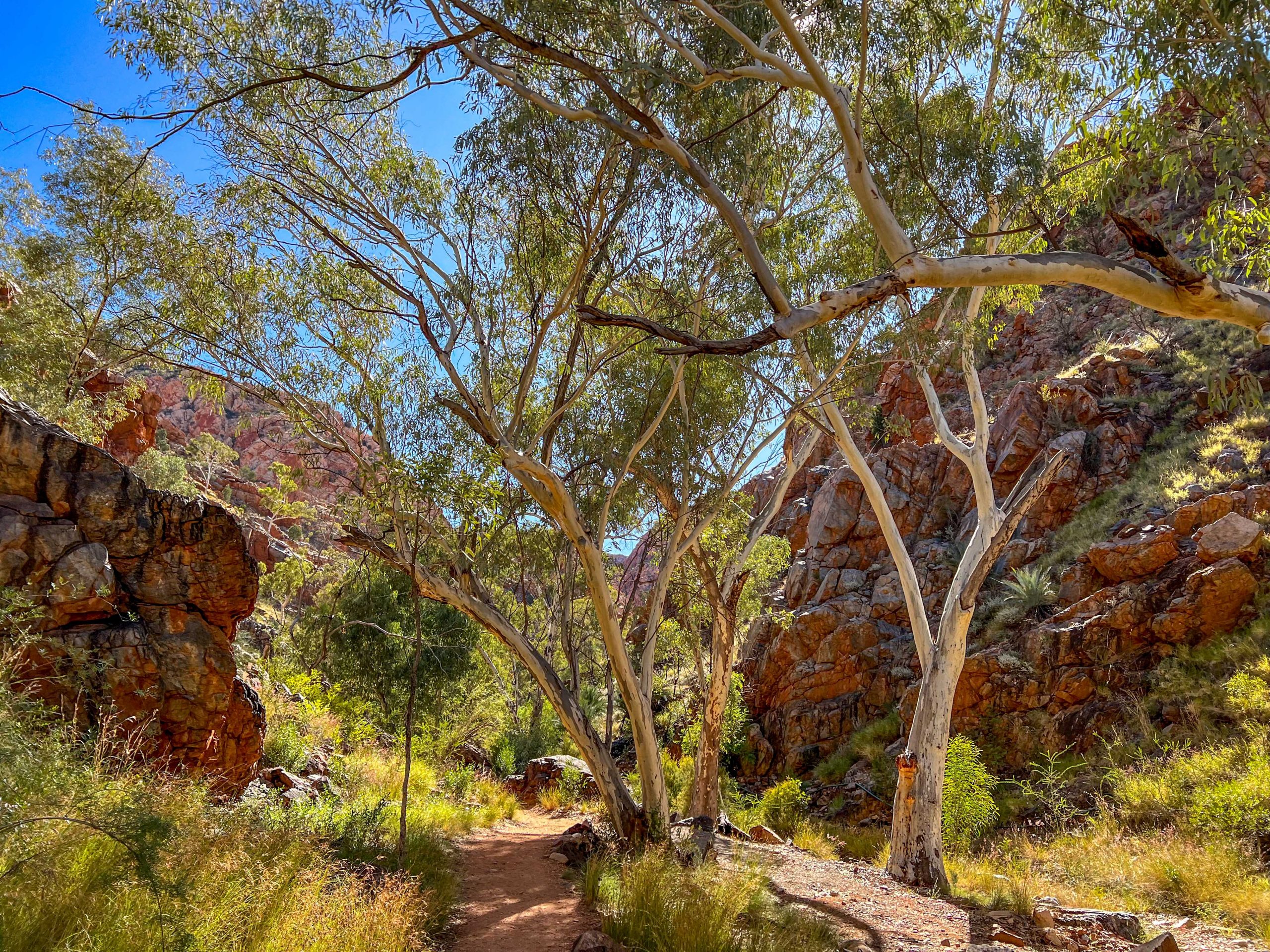
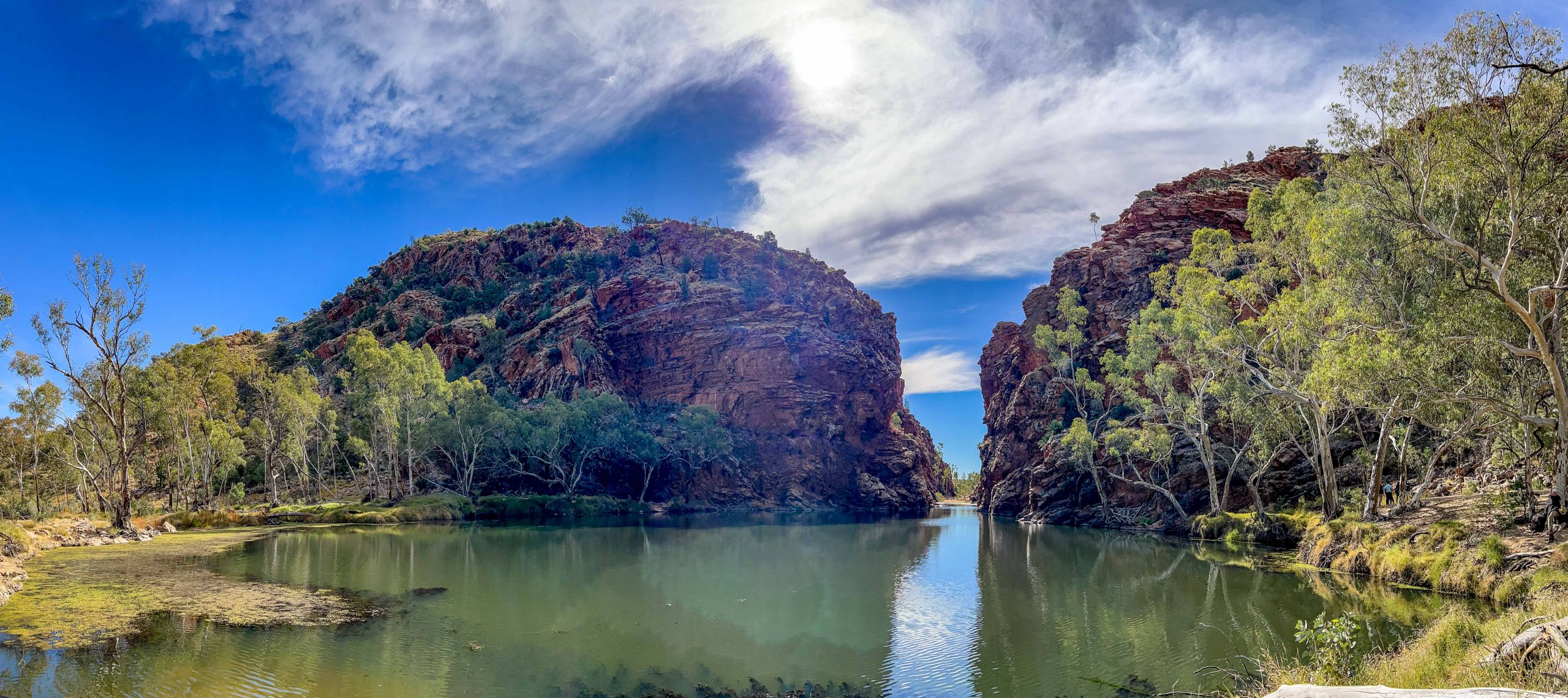
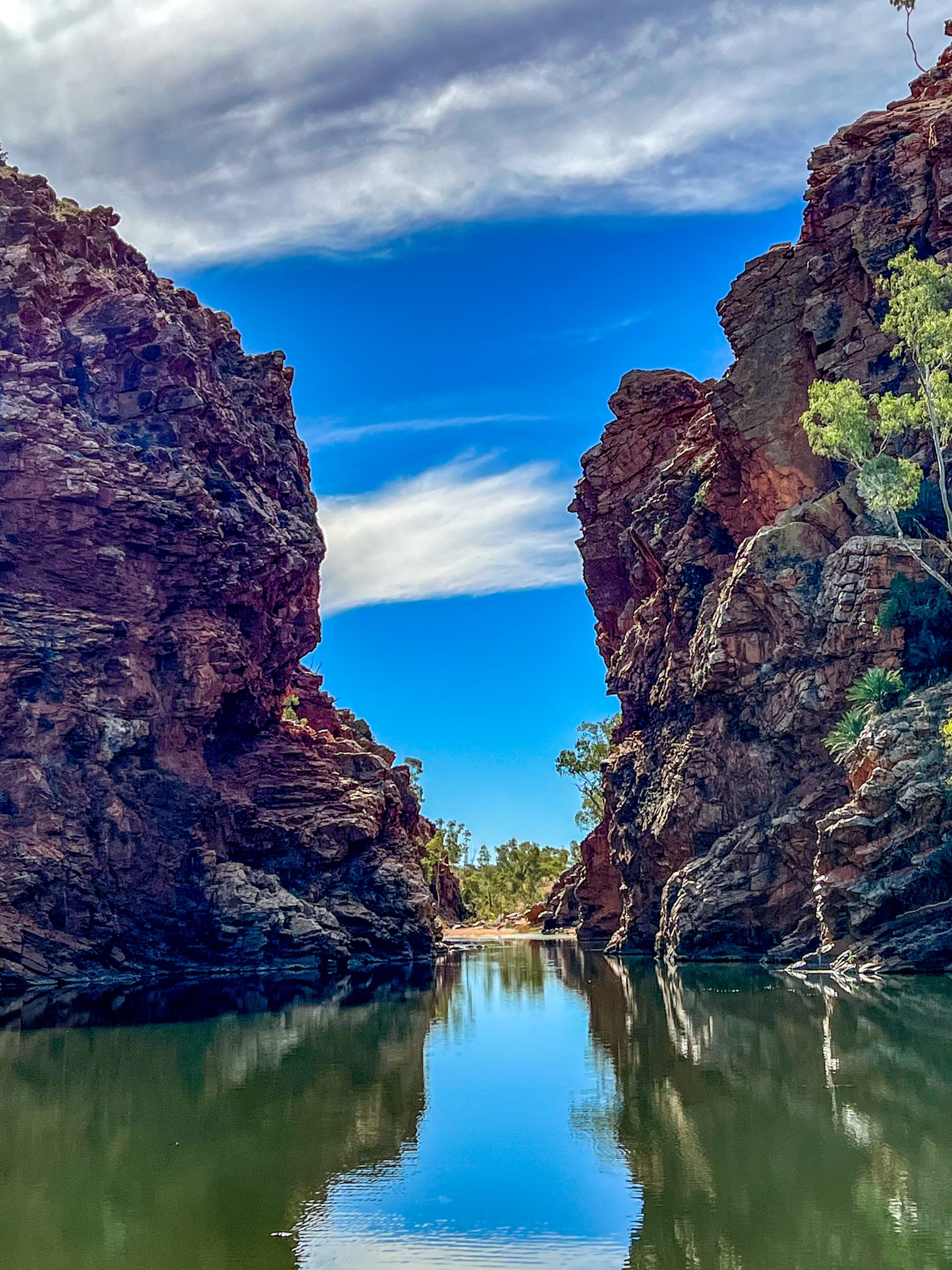
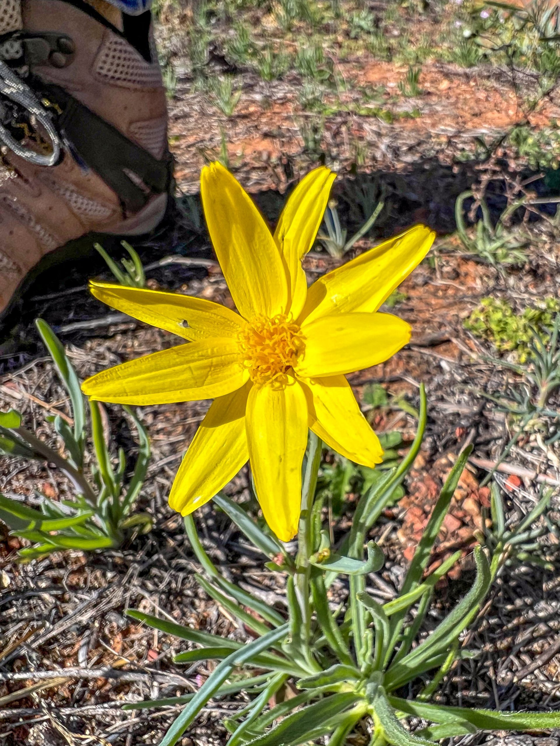
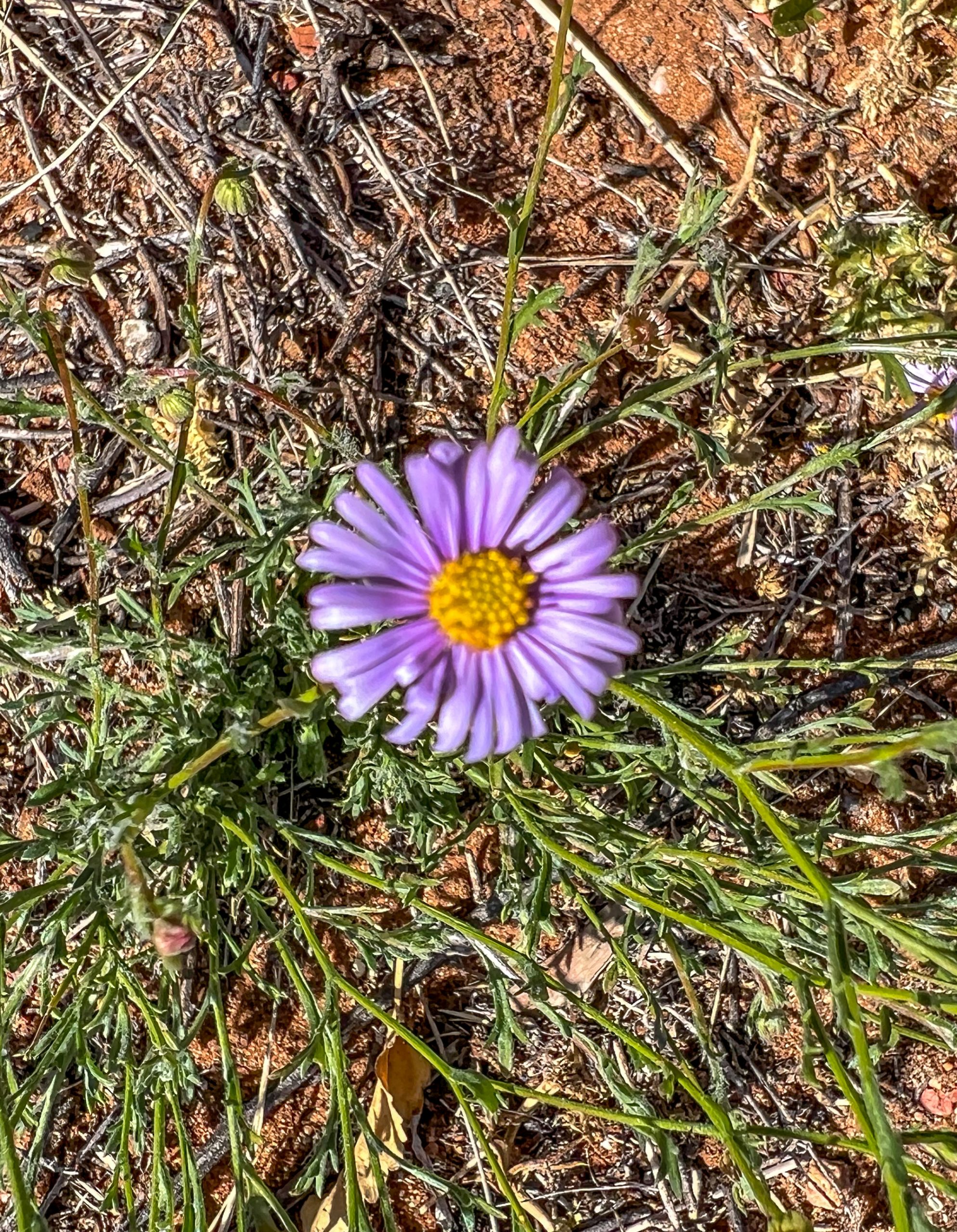
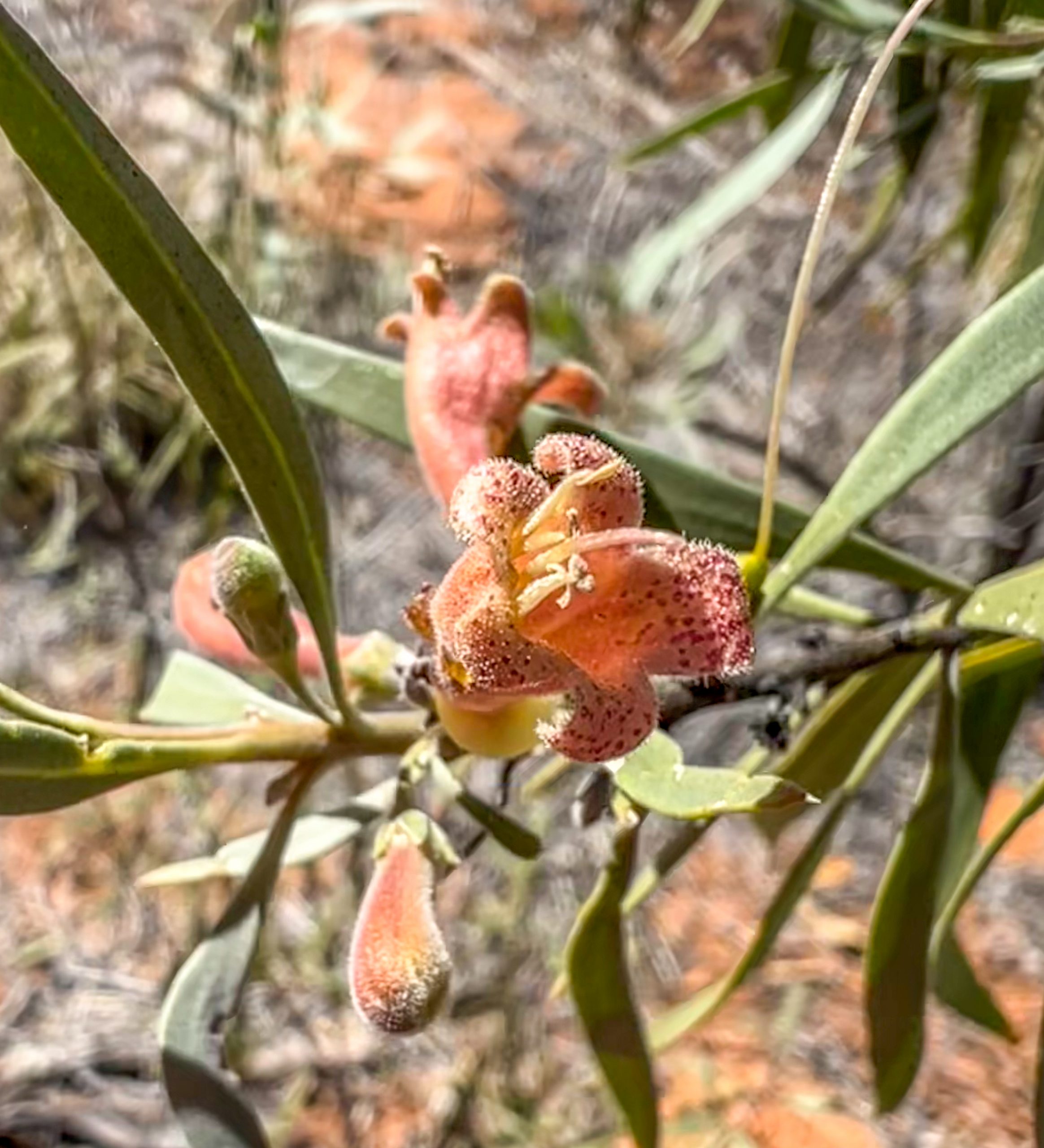
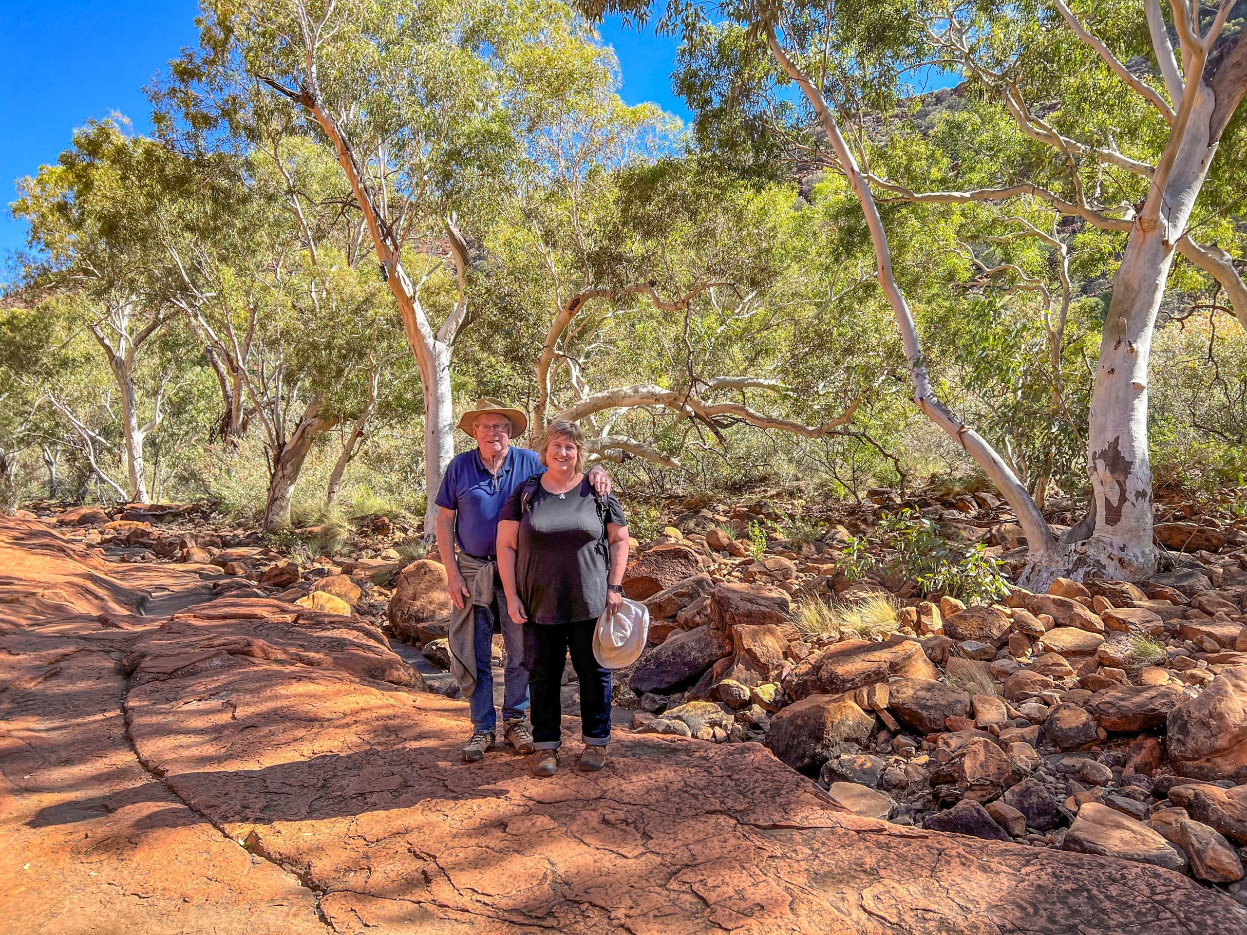
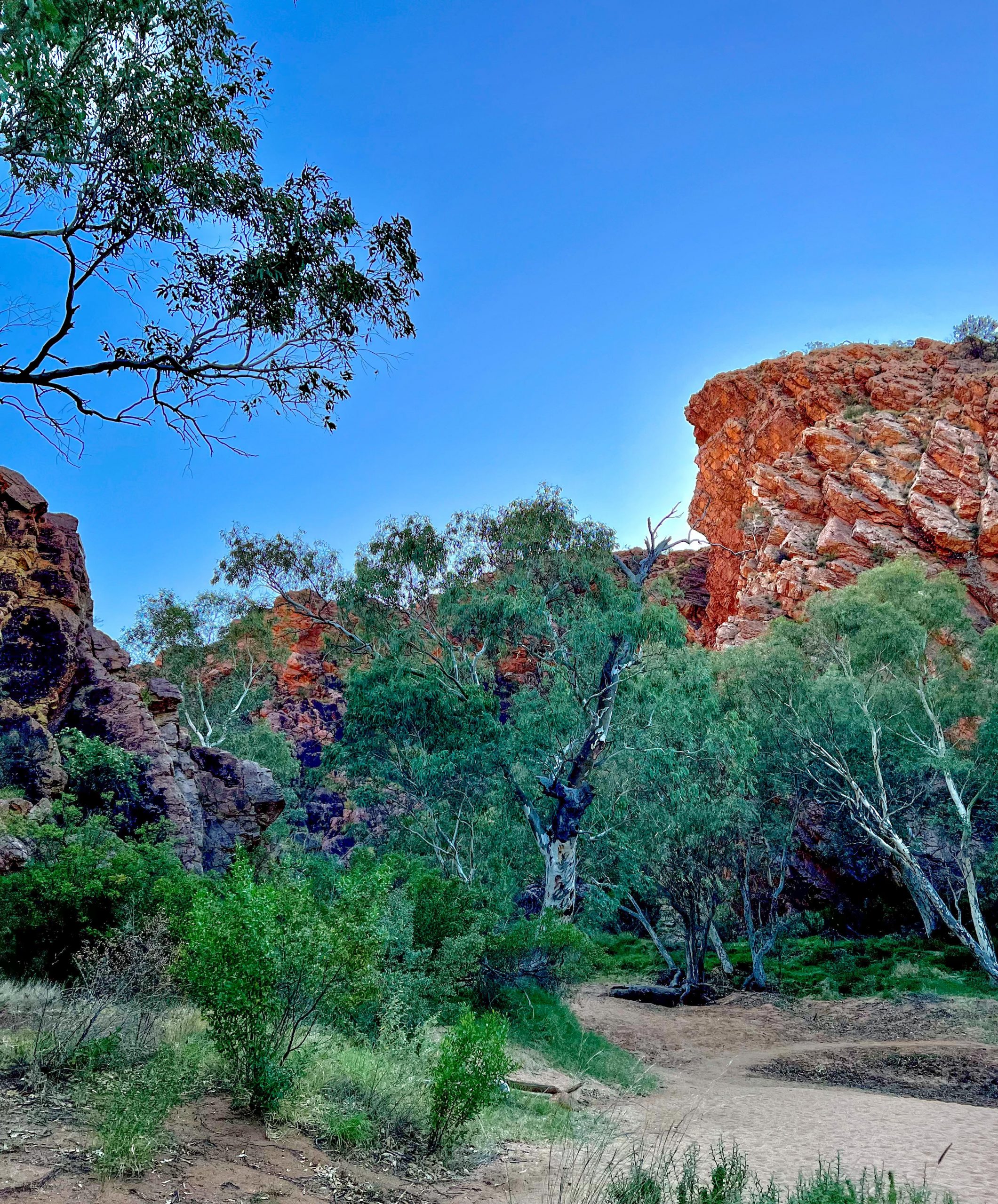
We had enjoyed our stop at Alice Springs and had visited some wonderful places, but it was time to move on to the eastern part of the MacDonnell Ranges which are on the other side of The Alice.  They are not continuous range like the western but consist of many high hills and short ranges of similar height to the west MacDonnells and even though they have had the same rainfall they appear to be much drier than on the west.  Our first stop was at Emily Gap which was set off with the usual river red gums and their white trunks. Emily and Jesse gaps are thought to have been named after the daughters of Charles Todd who very successfully managed the construction of the overland telegraph line from Adelaide to Darwin.

Emily Gap

Then another 7 Km further on was Jessie Gap similar to Emily Gap.  Both these Gaps are within 30 Km of Alice Springs.

Approaching Jesse Gap
Jesse Gap
Jesse Gap

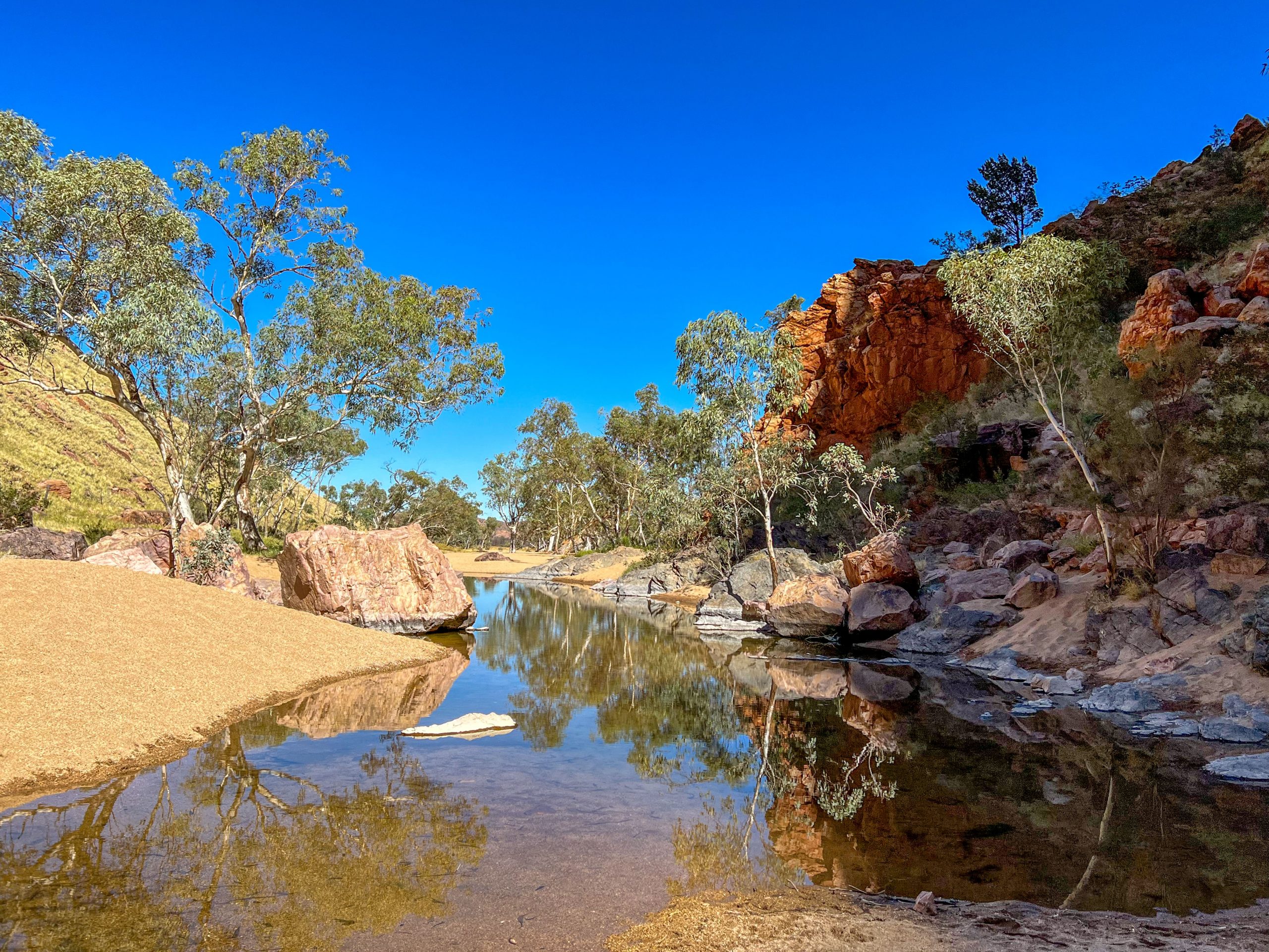
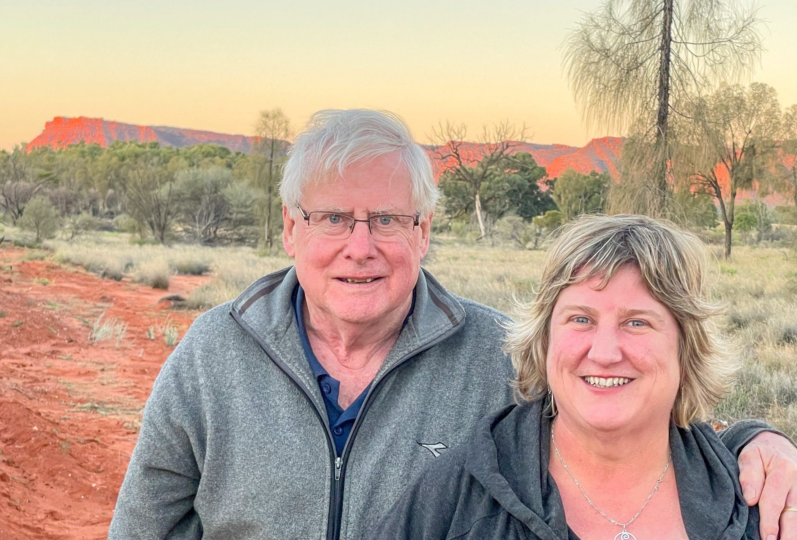
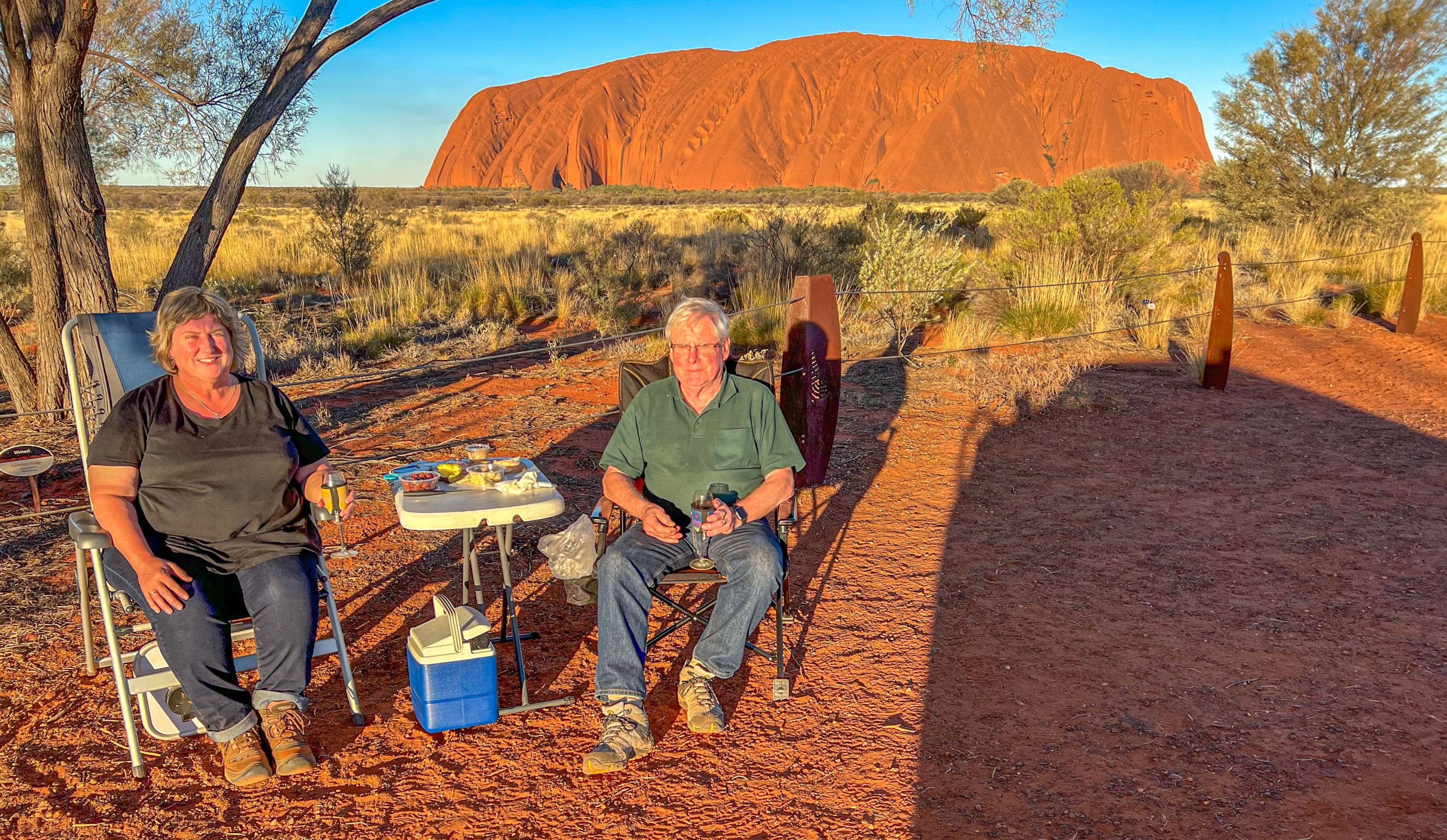
An easy drive followed to Ross River Station where there is a caravan park set among lots of big eucalypts.  Here is a photo of our camp with Deen and I enjoying a campfire after our dinner of BBQ’d rump steak and roast potatoes.

Camp at Ross River

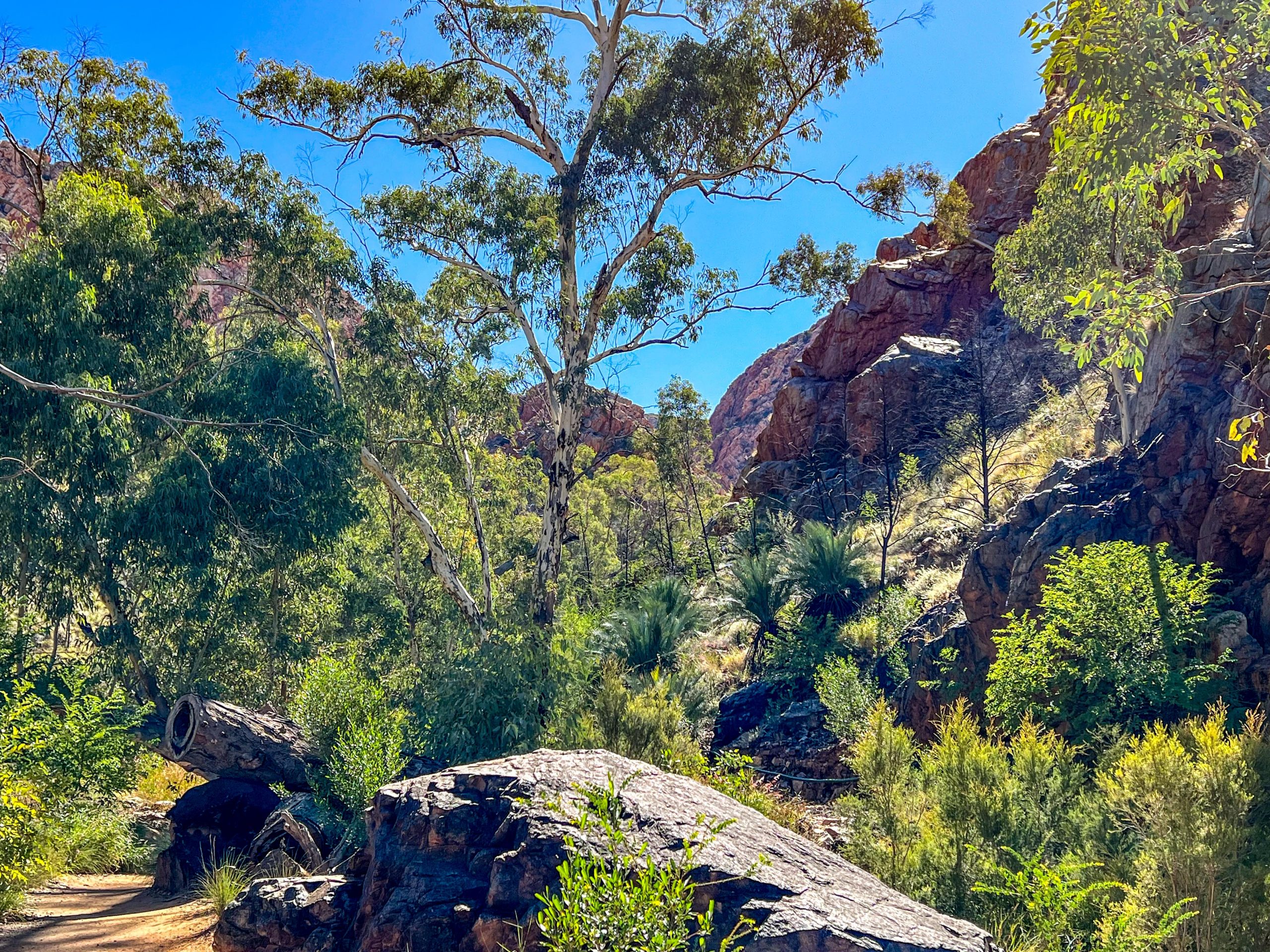
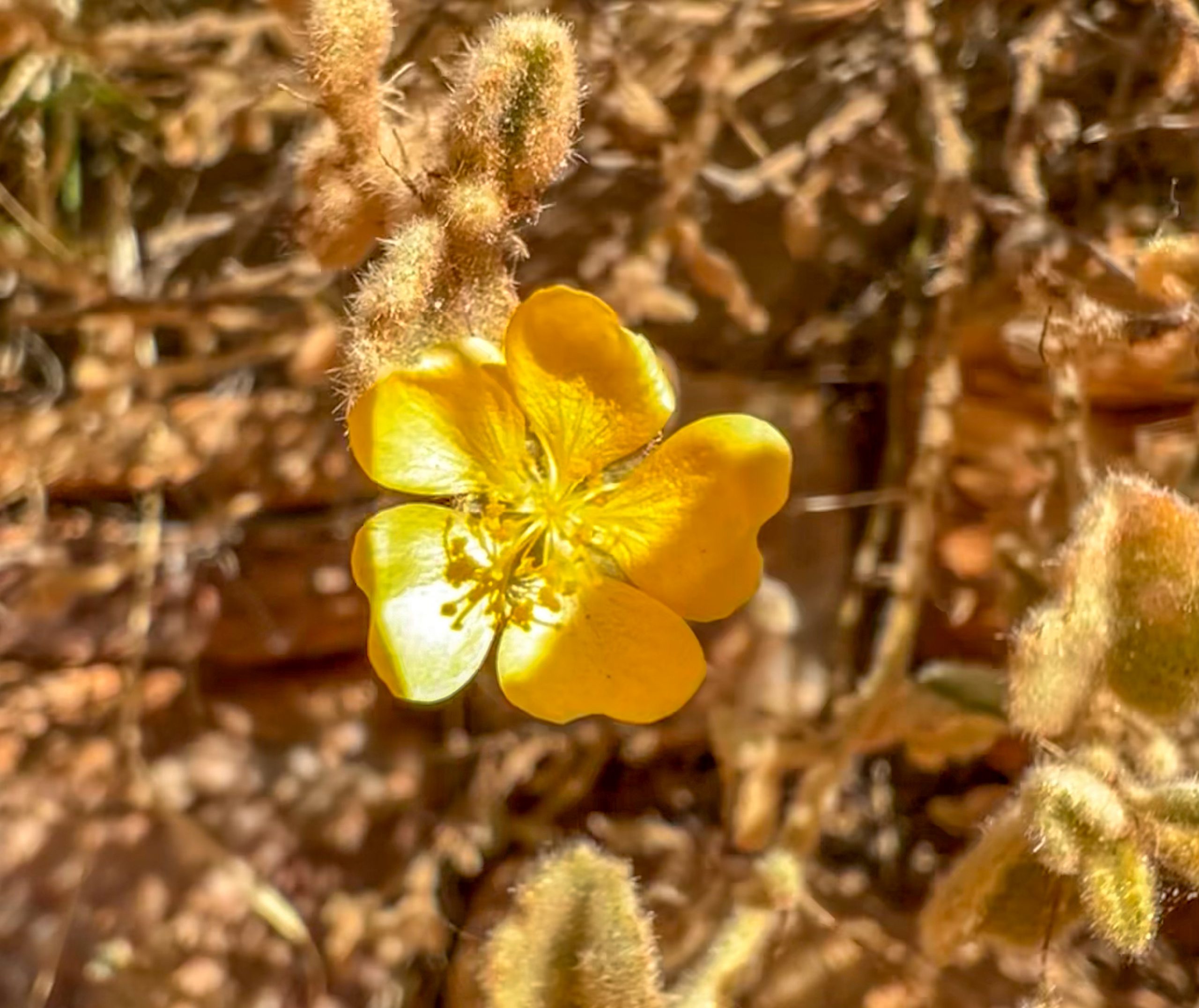
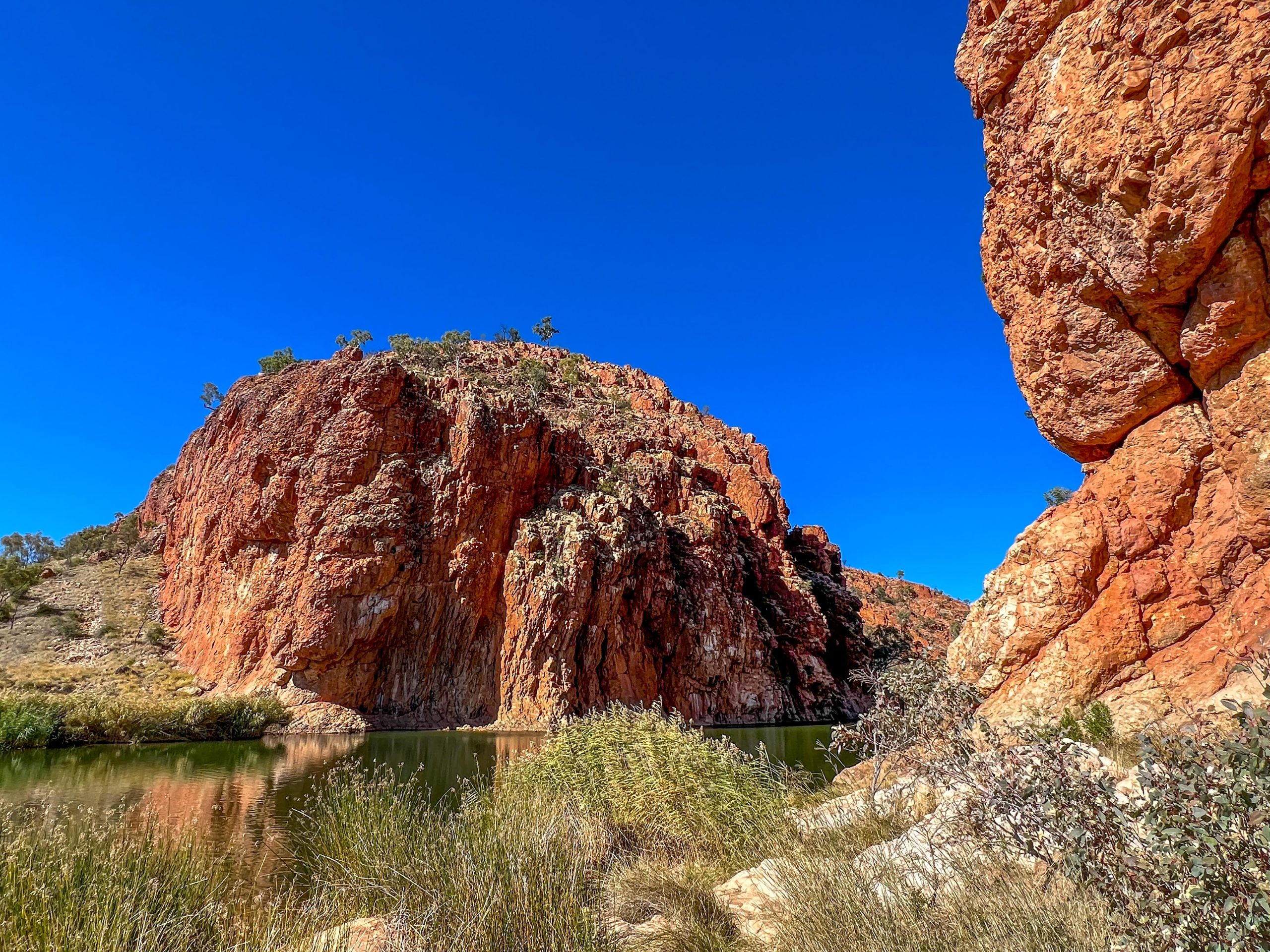
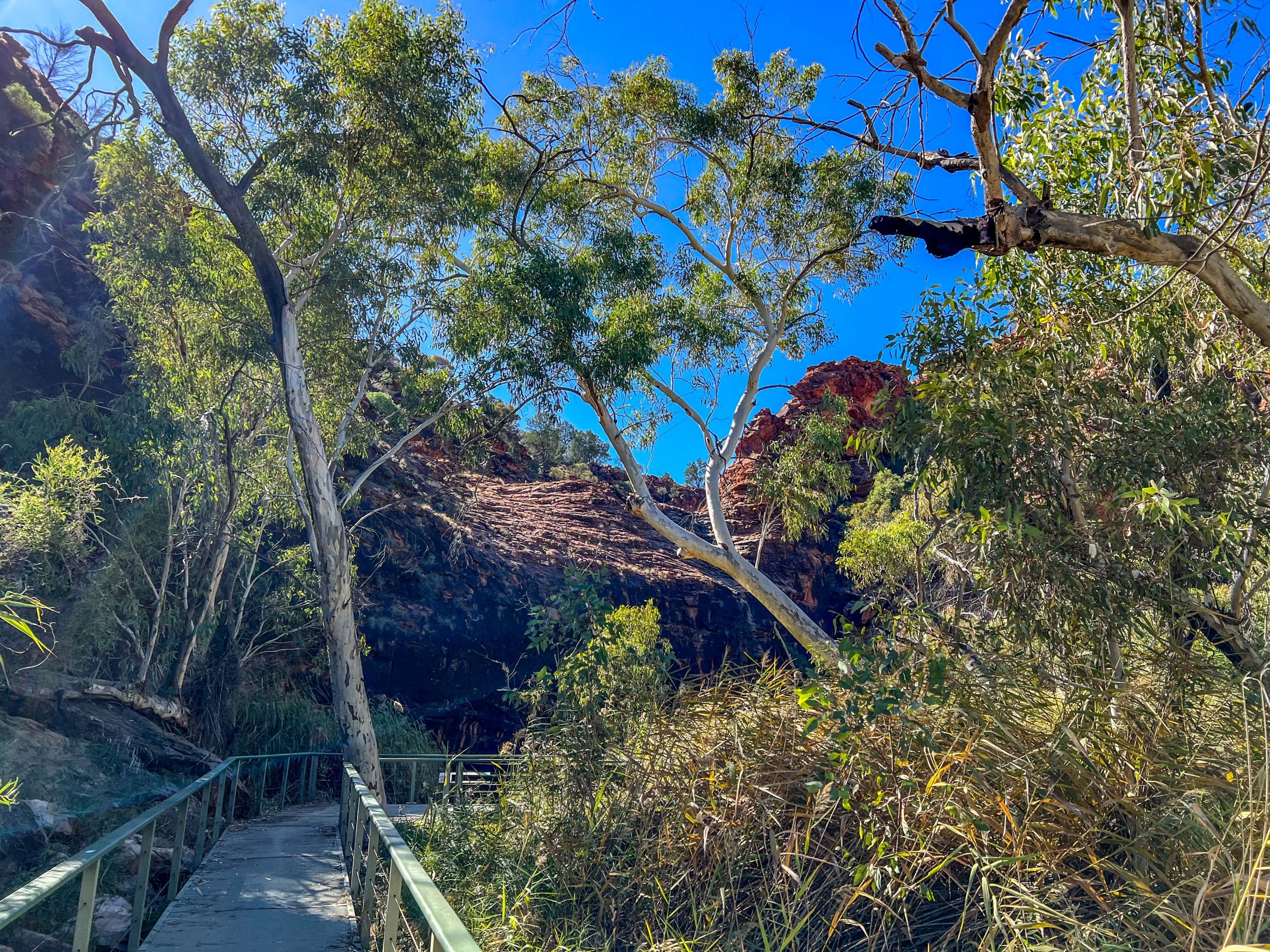
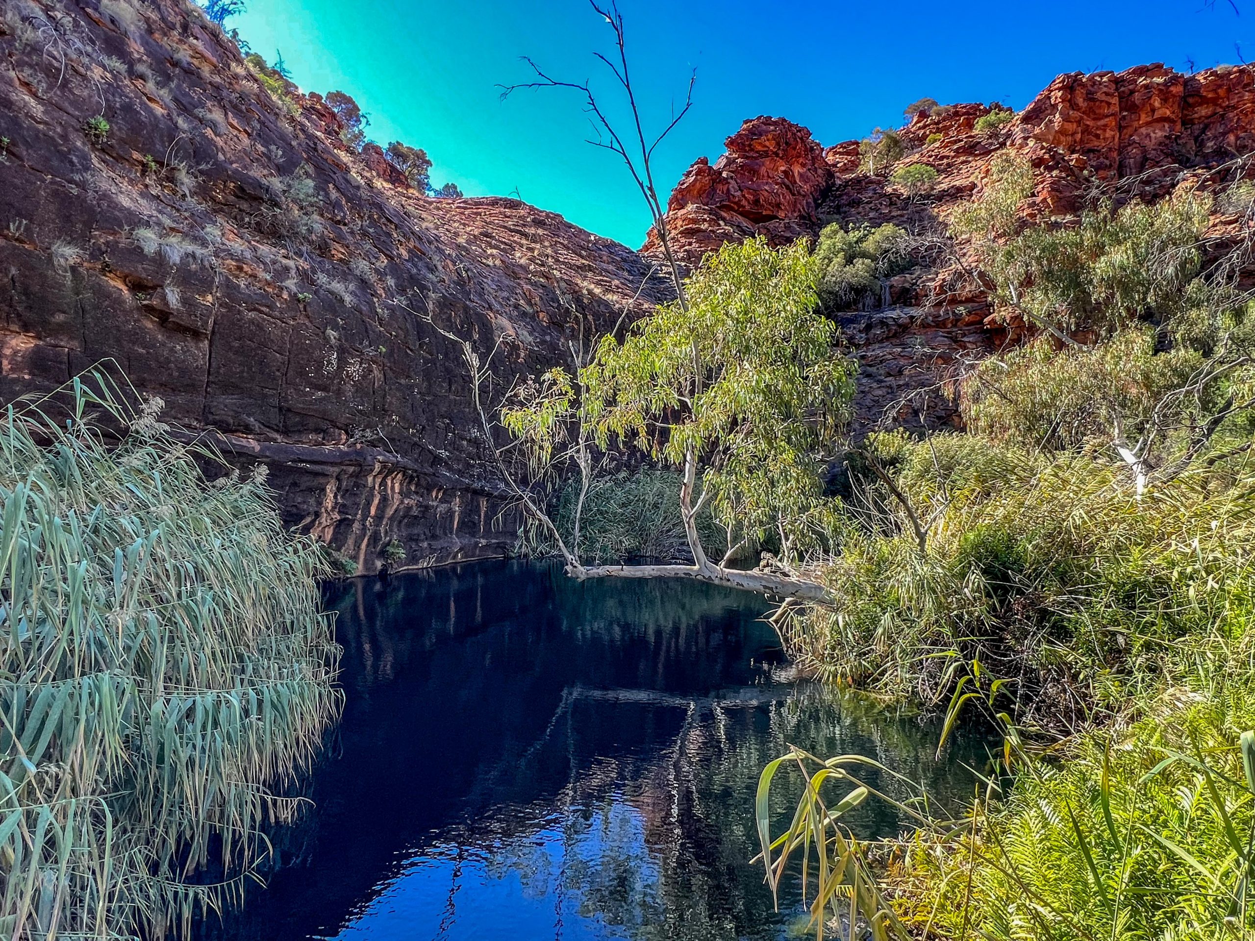
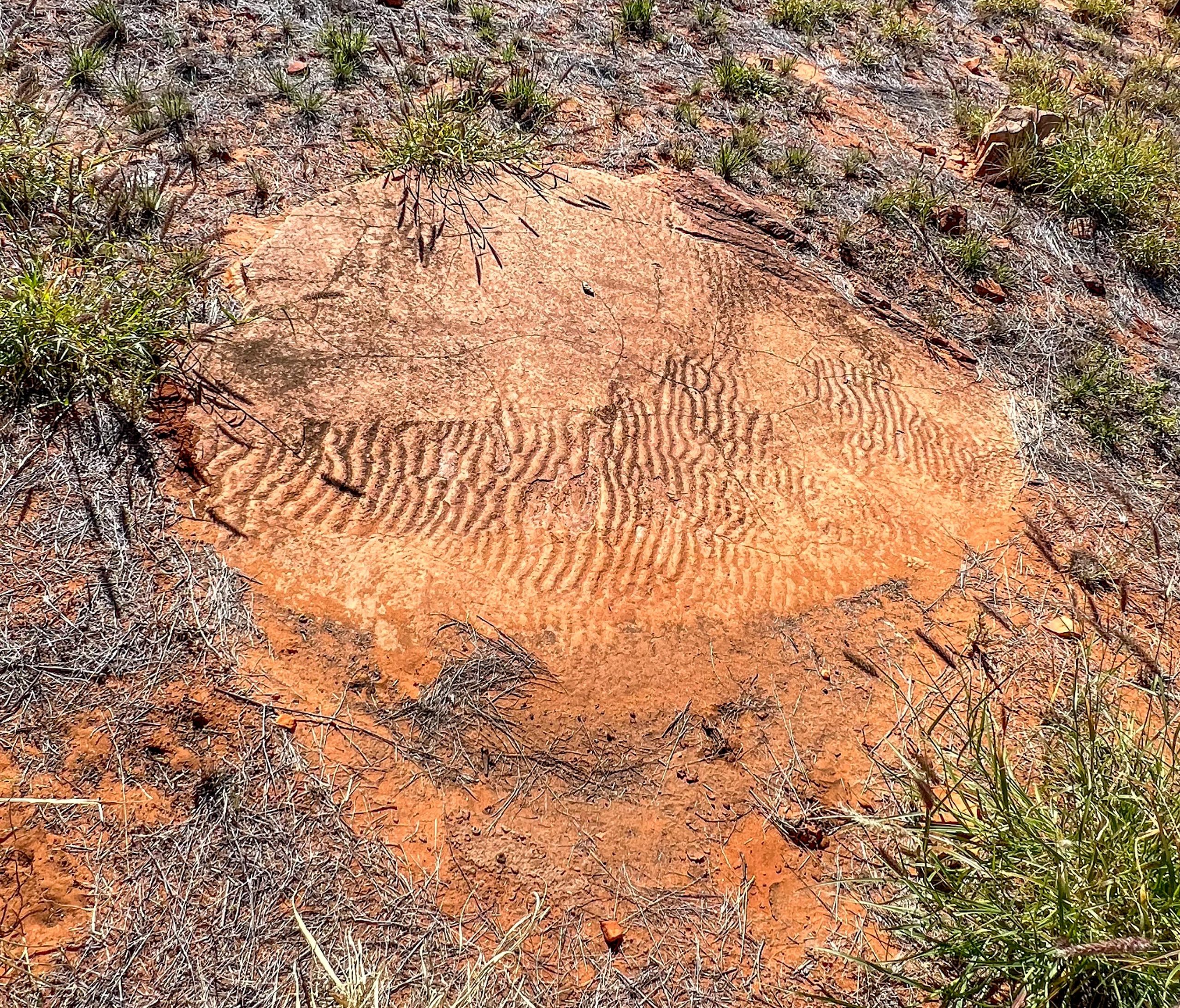
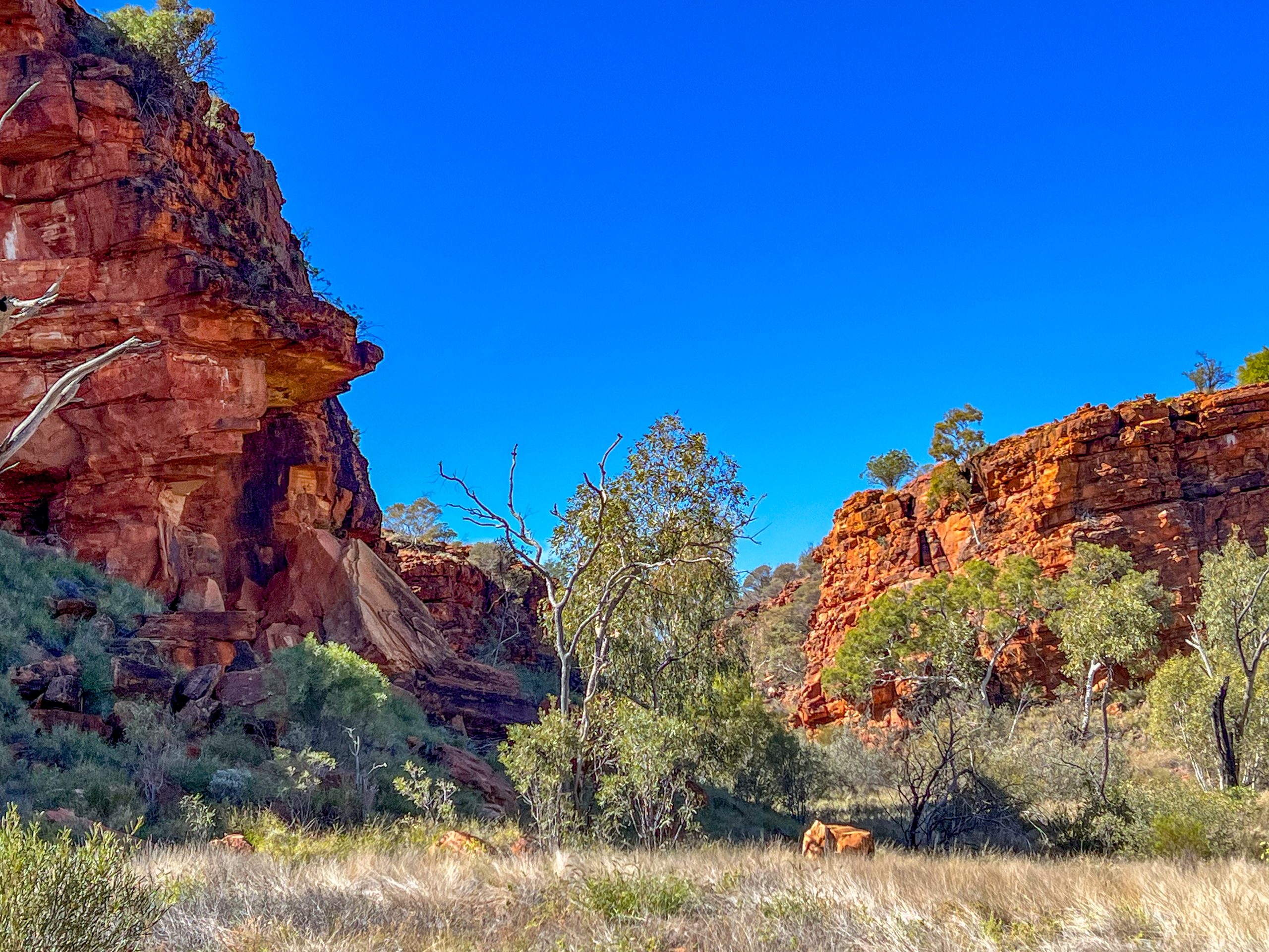
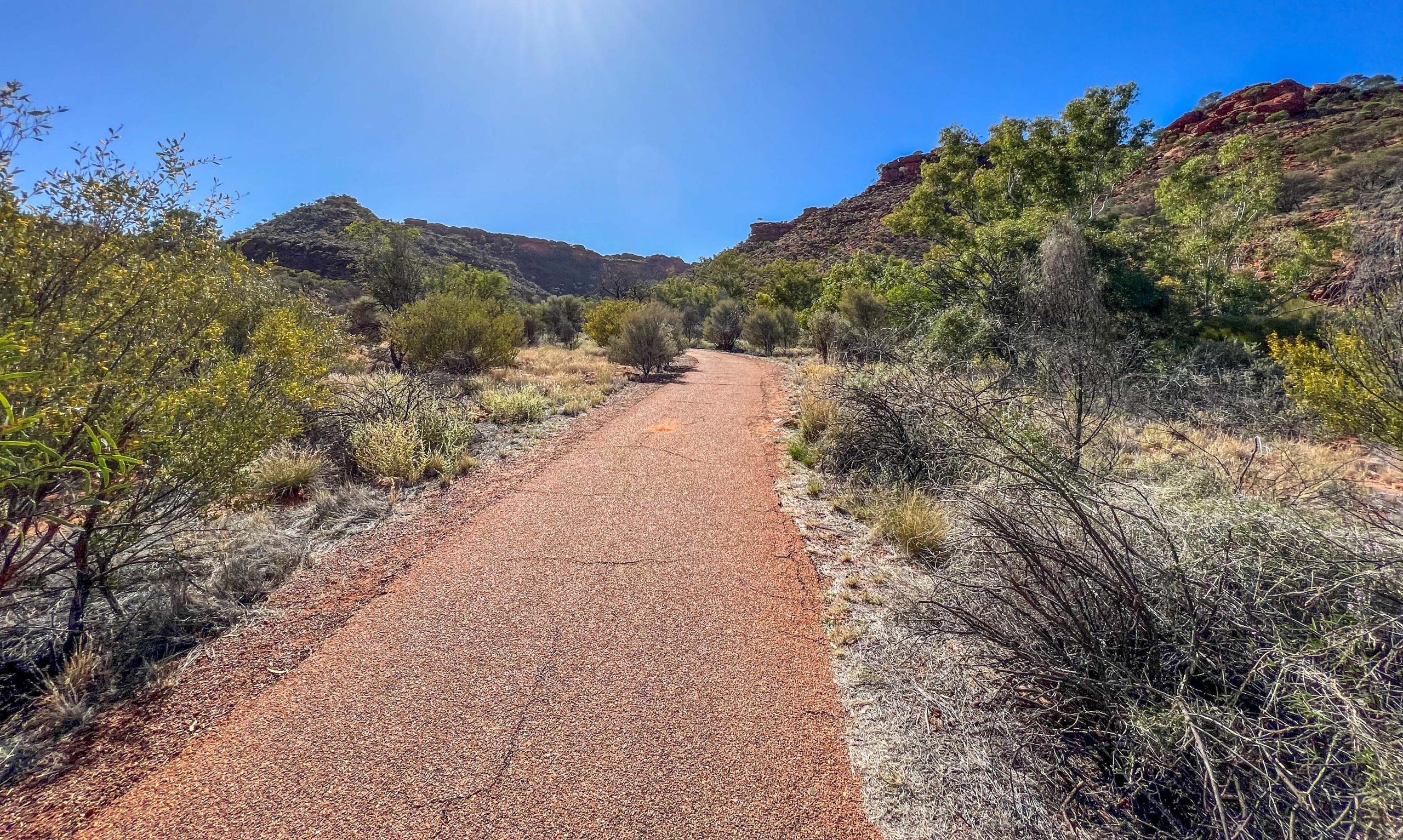
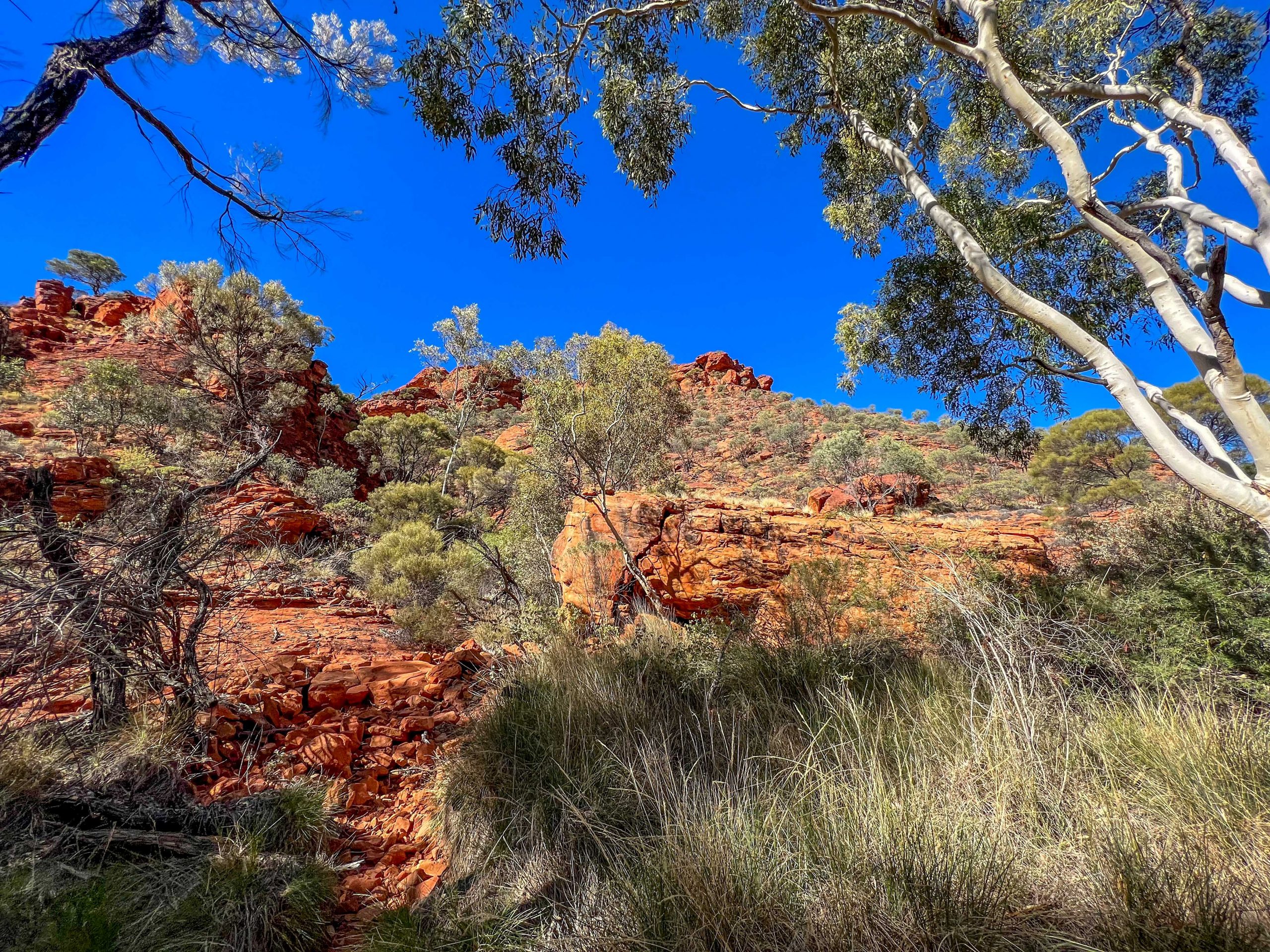
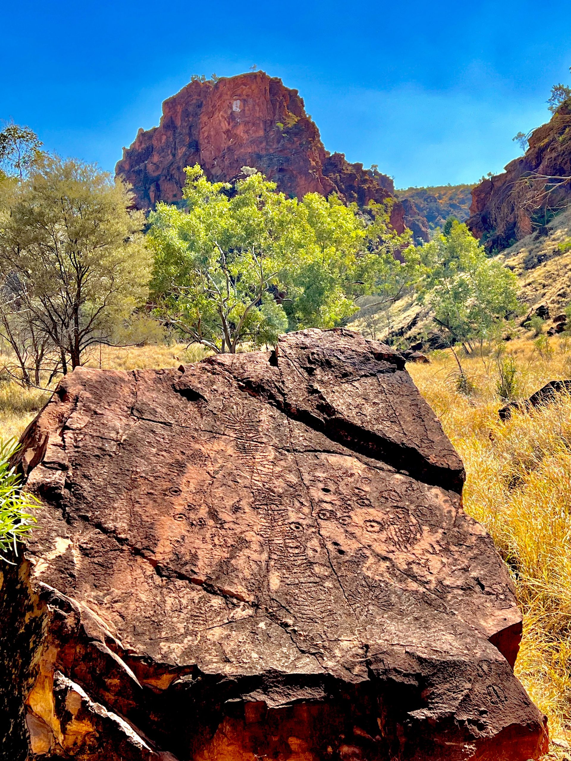
After setting up we drove off on a rough dirt track some 15 Km to N’Dhala Gorge where there are a number of aboriginal rock carvings but we only saw two.  The first one was a story about butterflies, from caterpillar to butterfly.  The lines across the centre are the track of a butterfly walking after just emerging from the cocoon; the circles are butterflies resting.  The other rock carvings we saw were too indistinct to even get a reasonable photo.

Rock Carving at N’Dhala Gorge

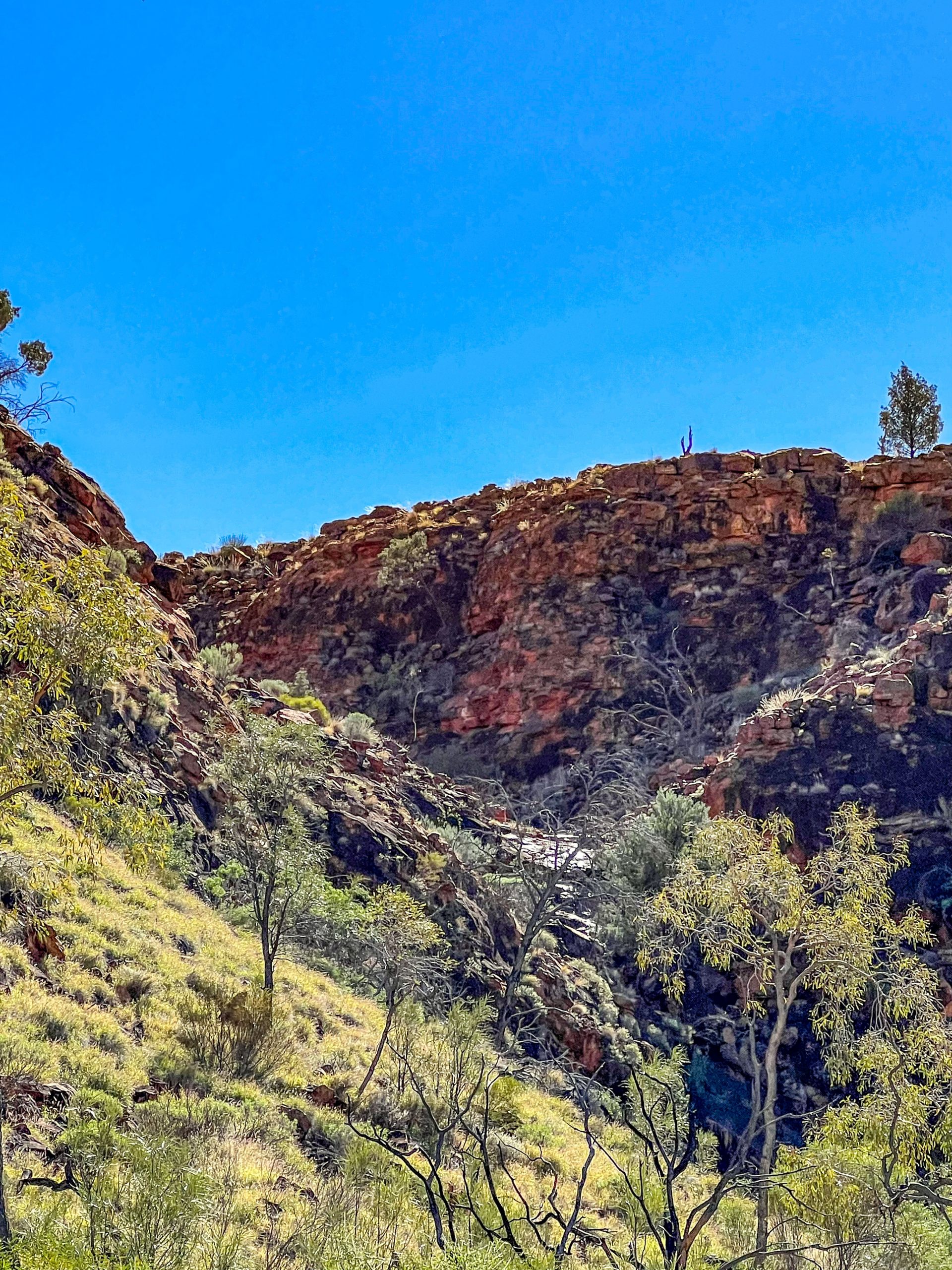
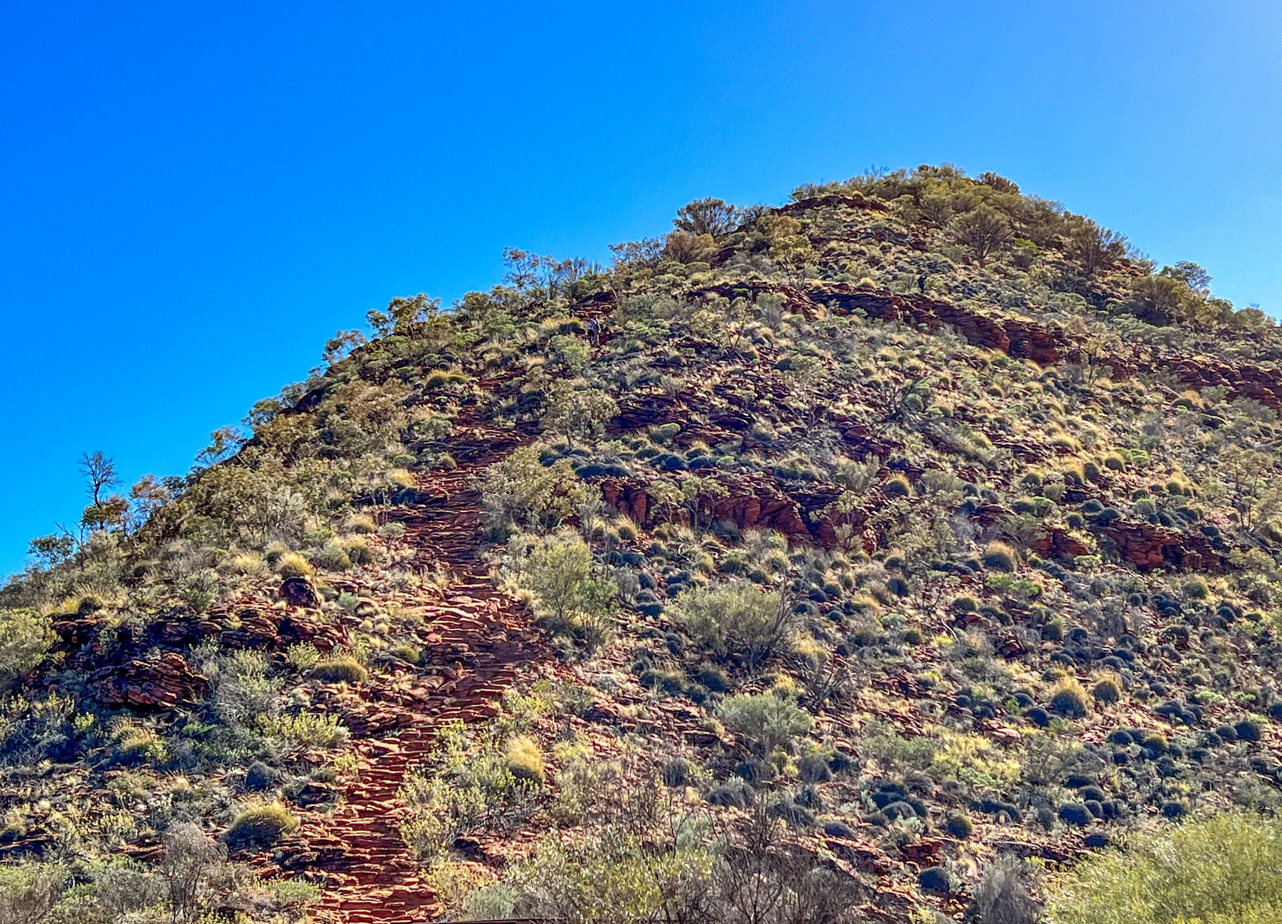
The walk was extremely rocky in places and just rough in the rest and very hot. A cave on the way gave us welcome respite.

Cave at N’Dhala Gorge

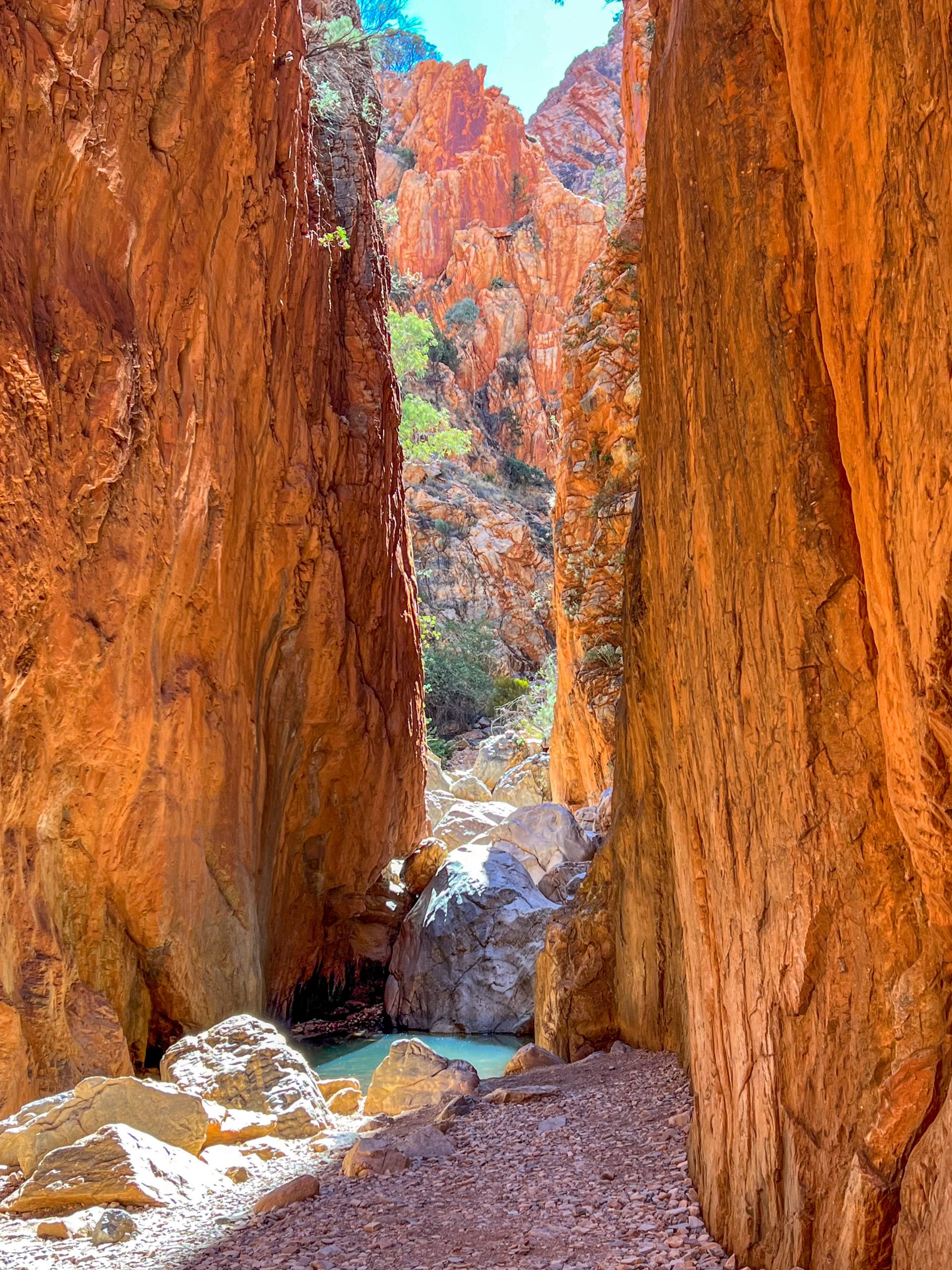
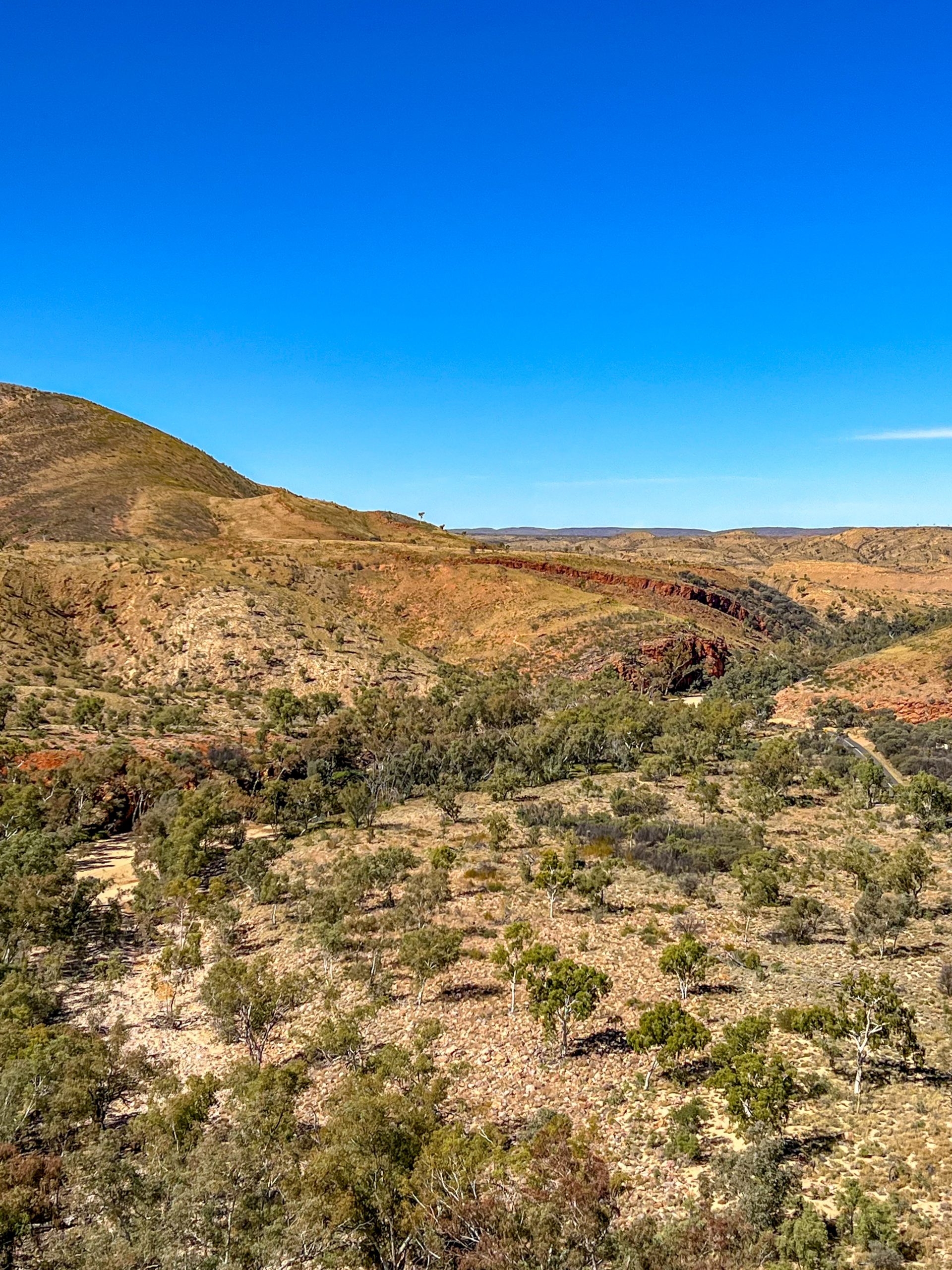
We did pass a dried up water hole which holds water for about 3 months after reasonable rain, so it has been dry for a while.

Waterhole in N’Dhala Gorge

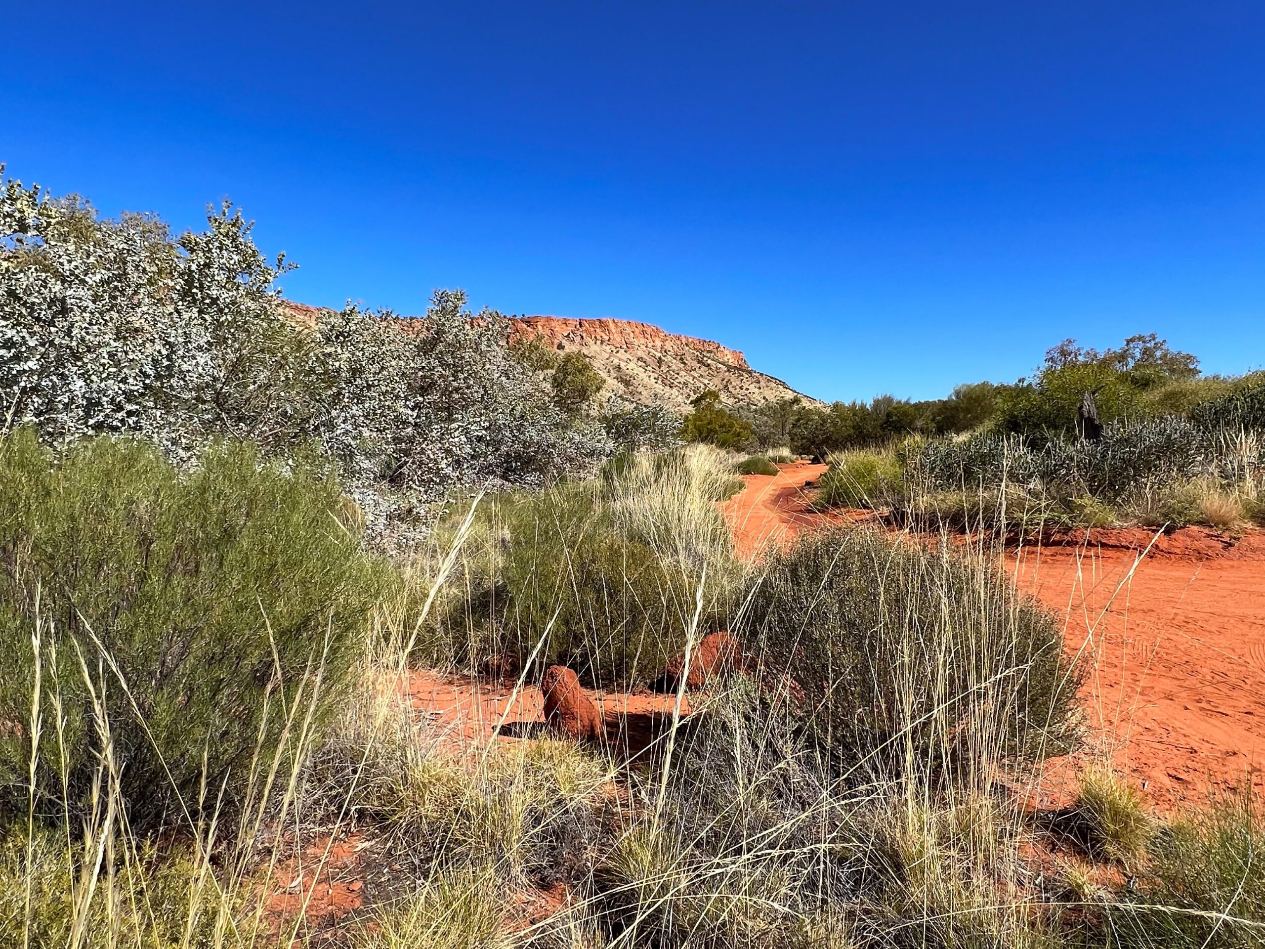
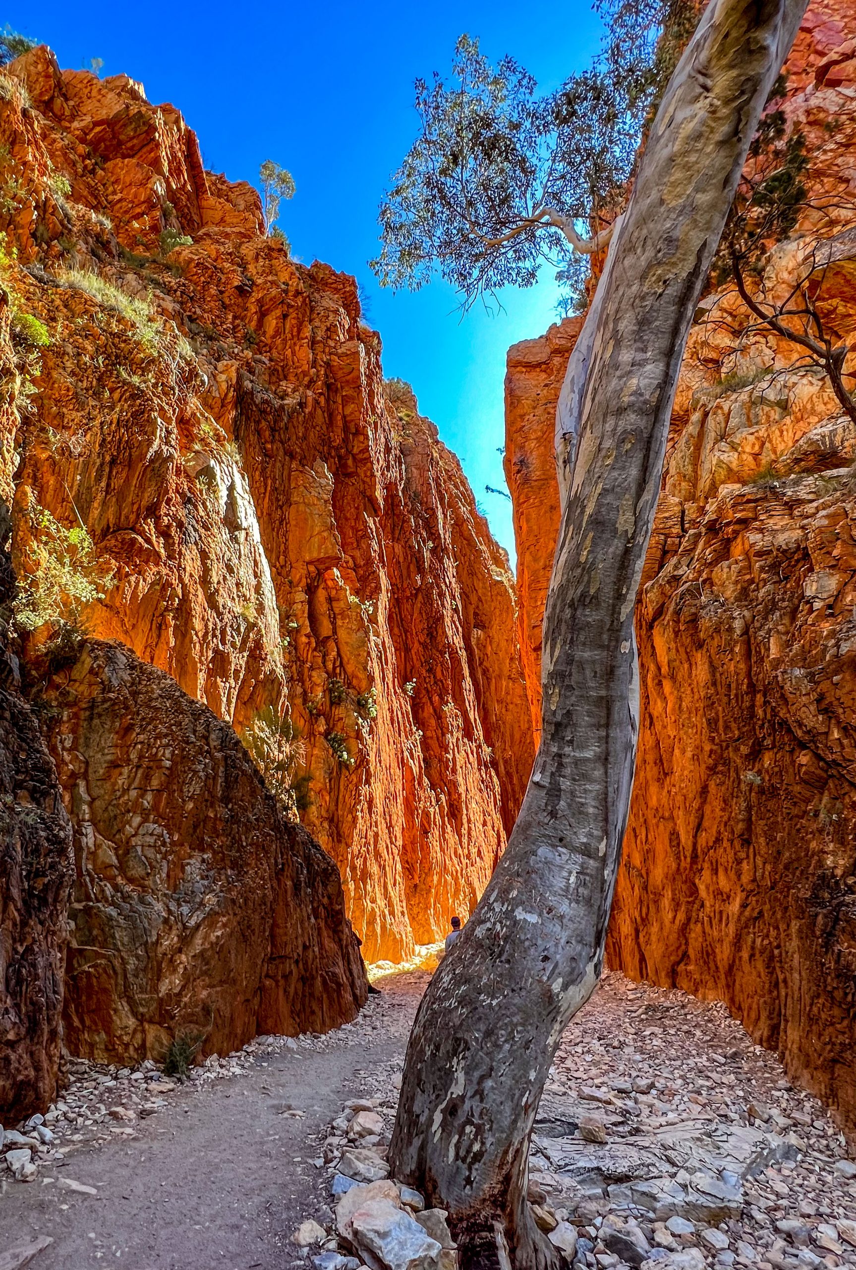
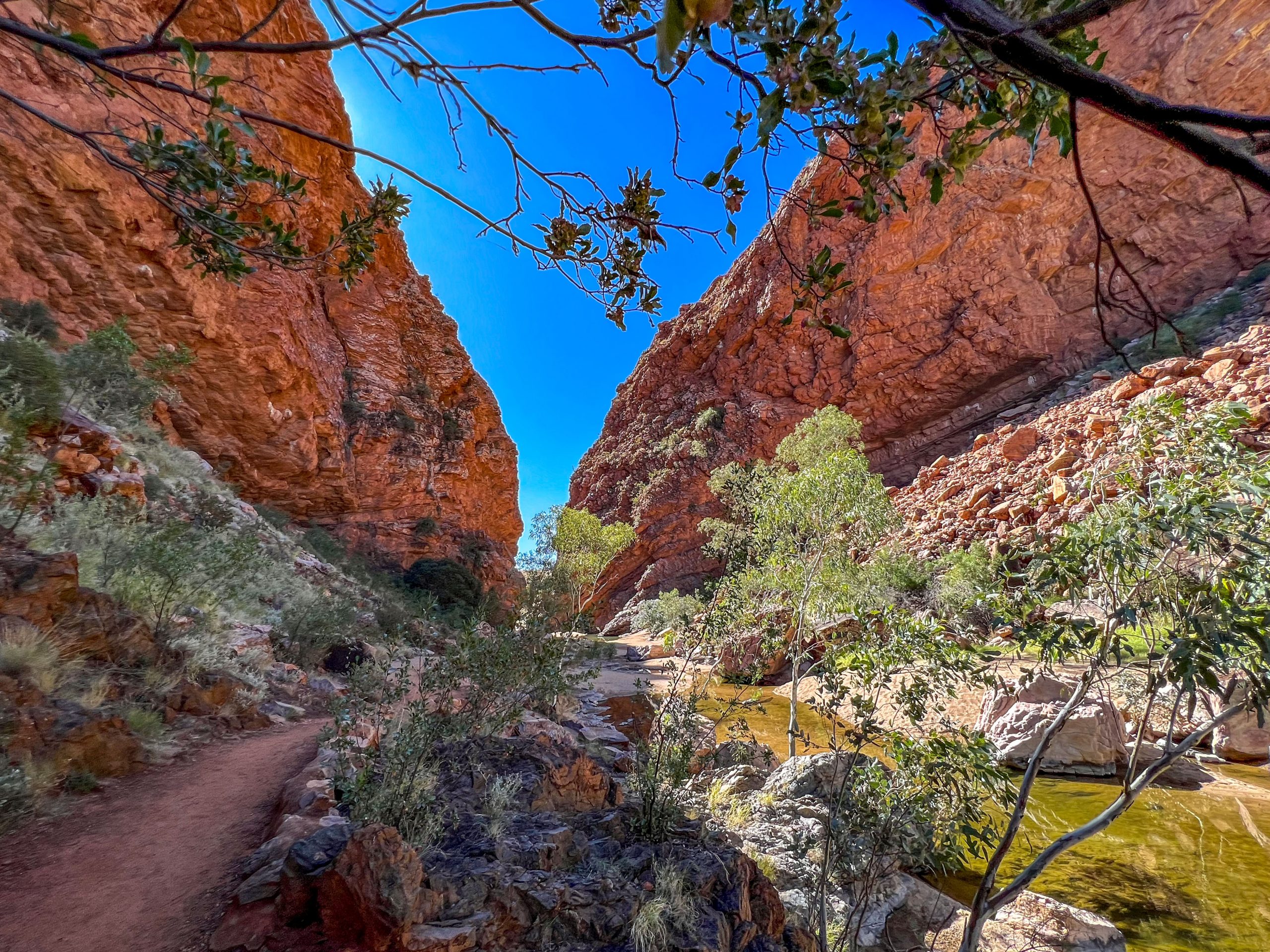
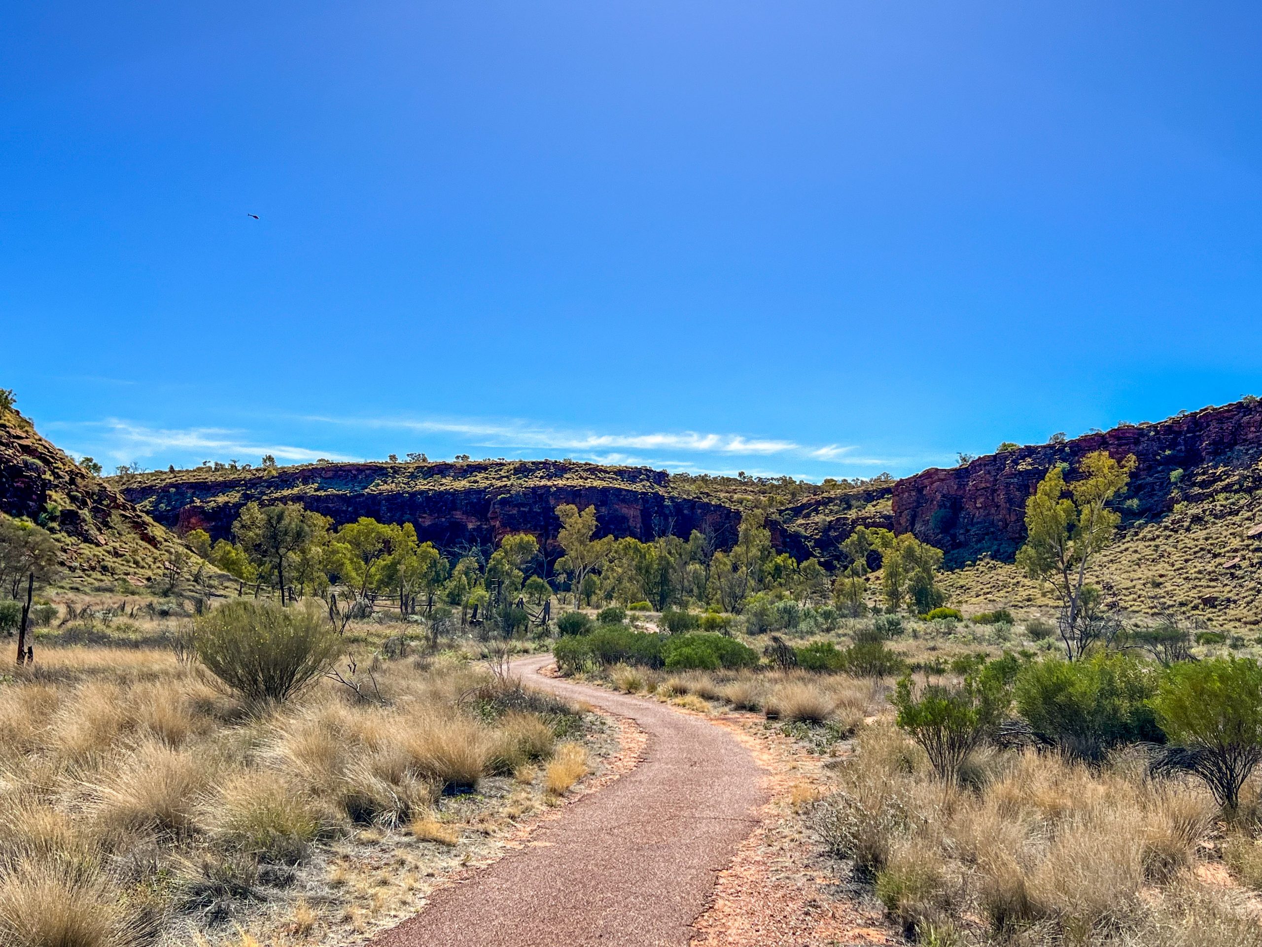
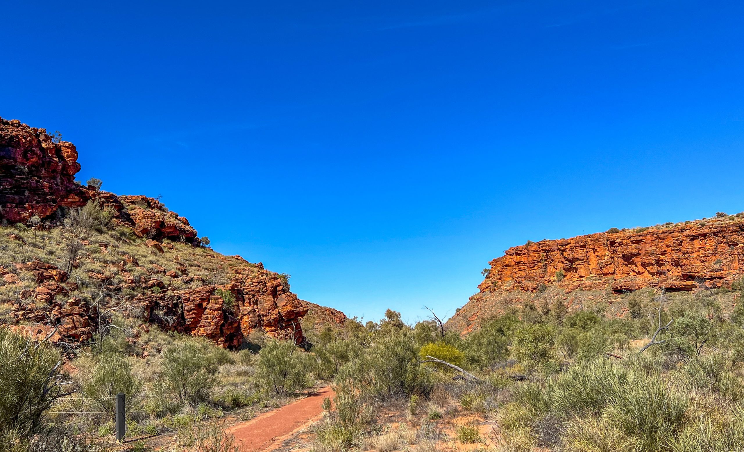
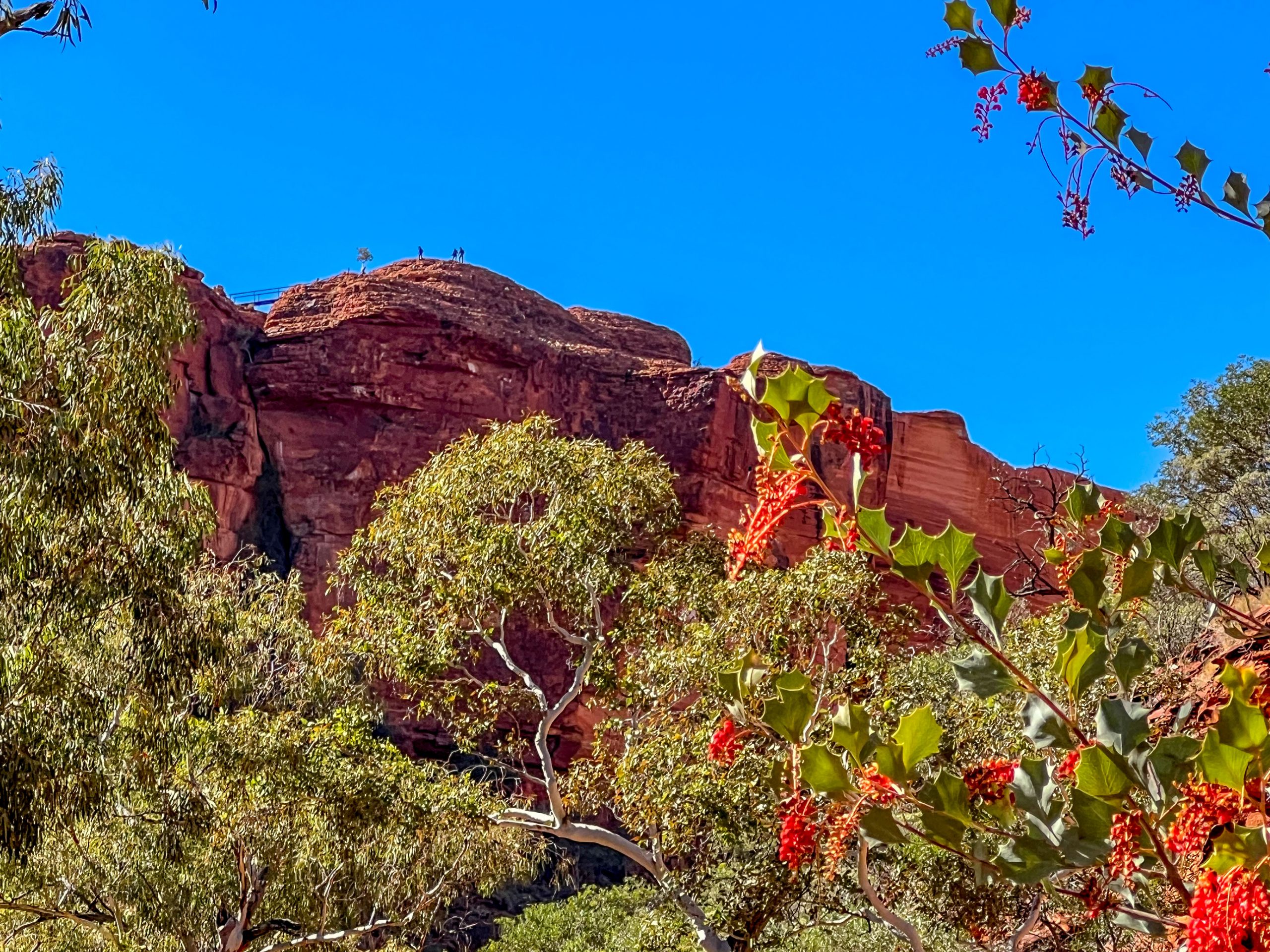
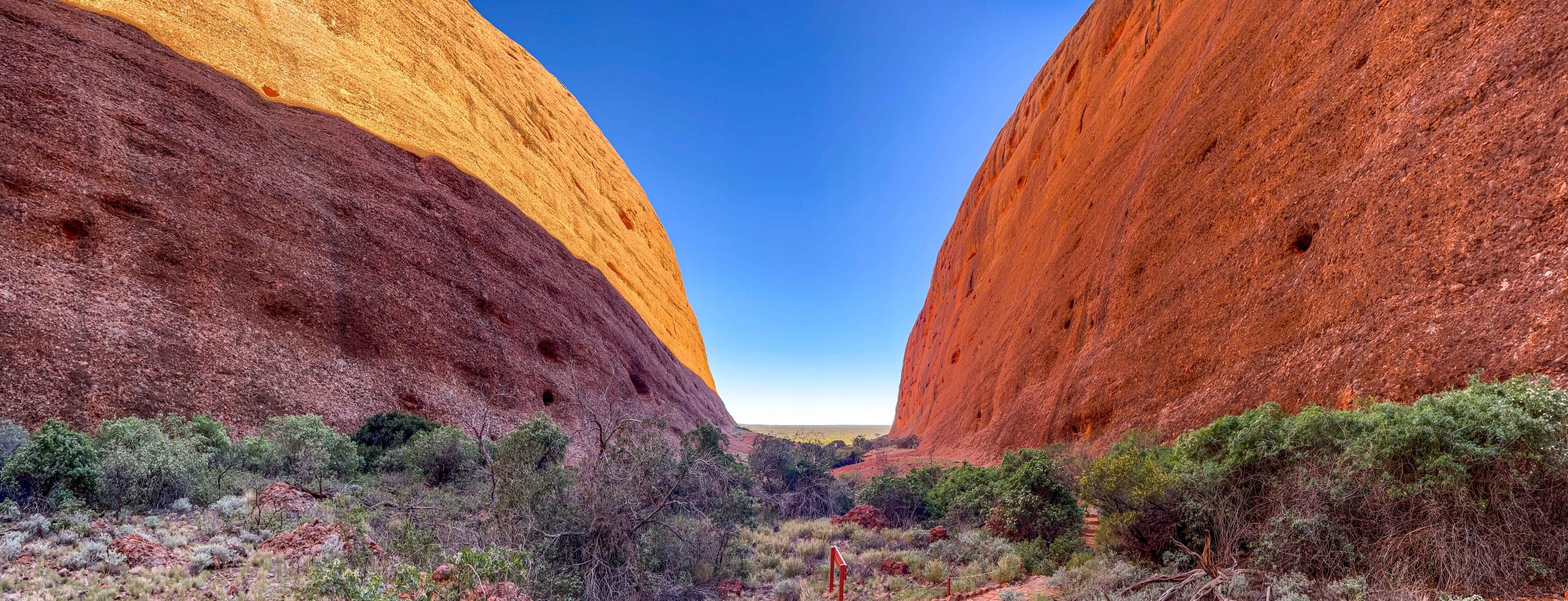
We decided to return to the carpark after about 1 km and this was the view on the way out of the gorge. You can see part of the rough path we had to traverse in this photo on the bottom left, and that is a smooth section.

N’Dhala Gorge

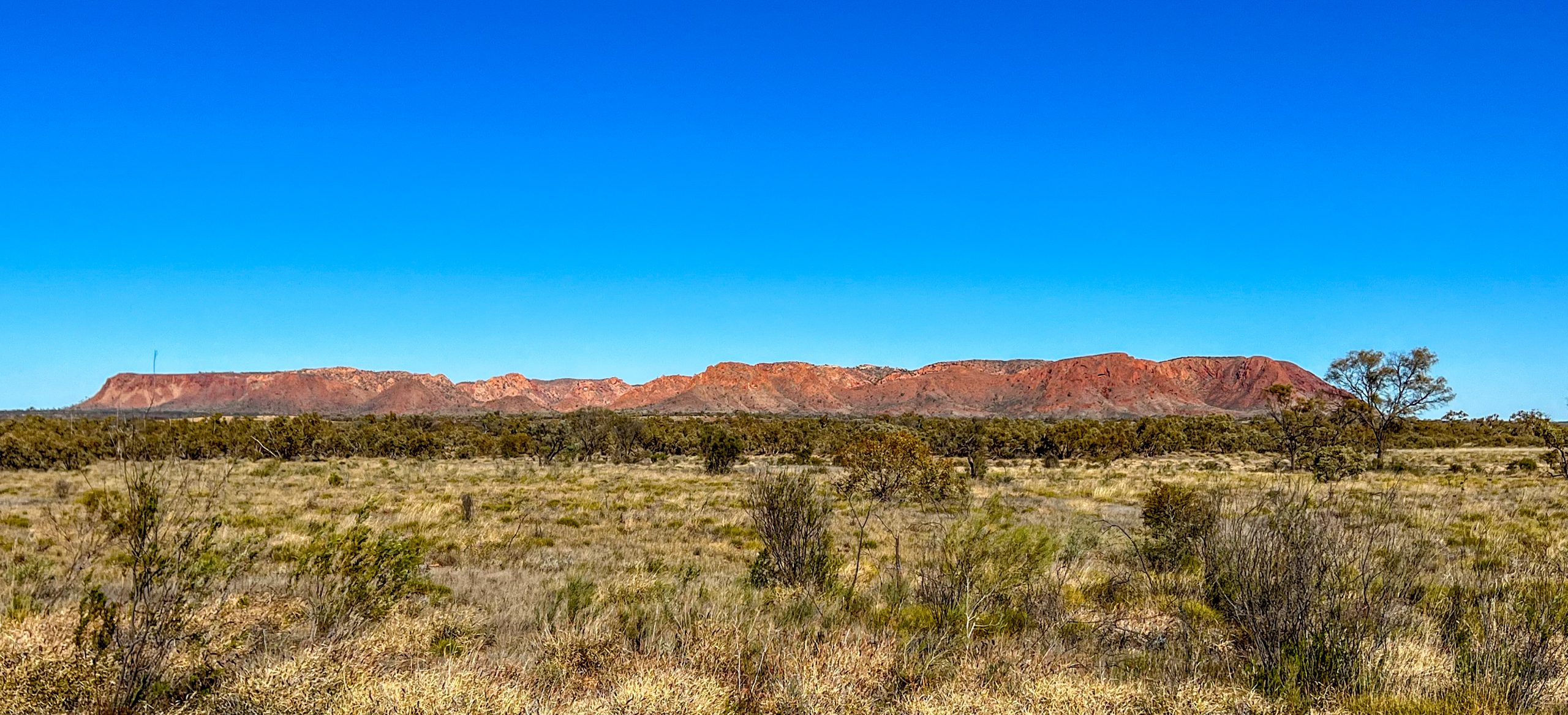
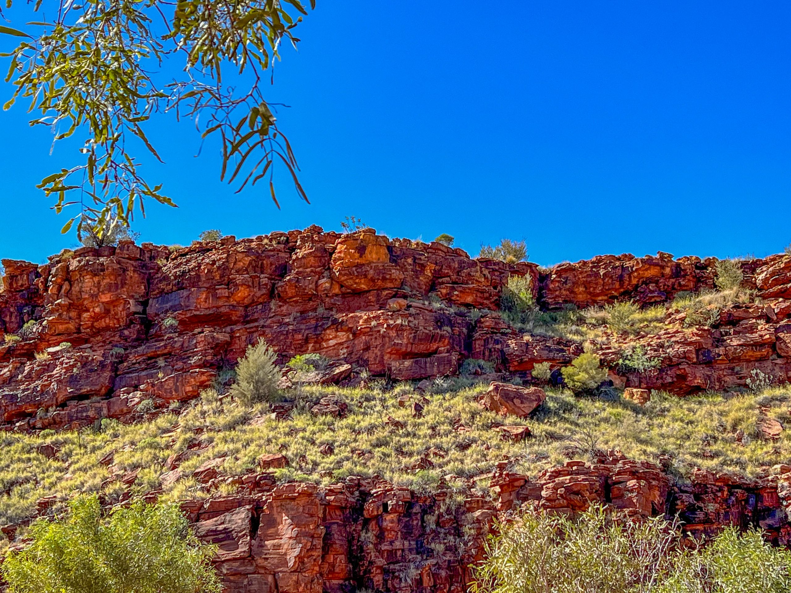
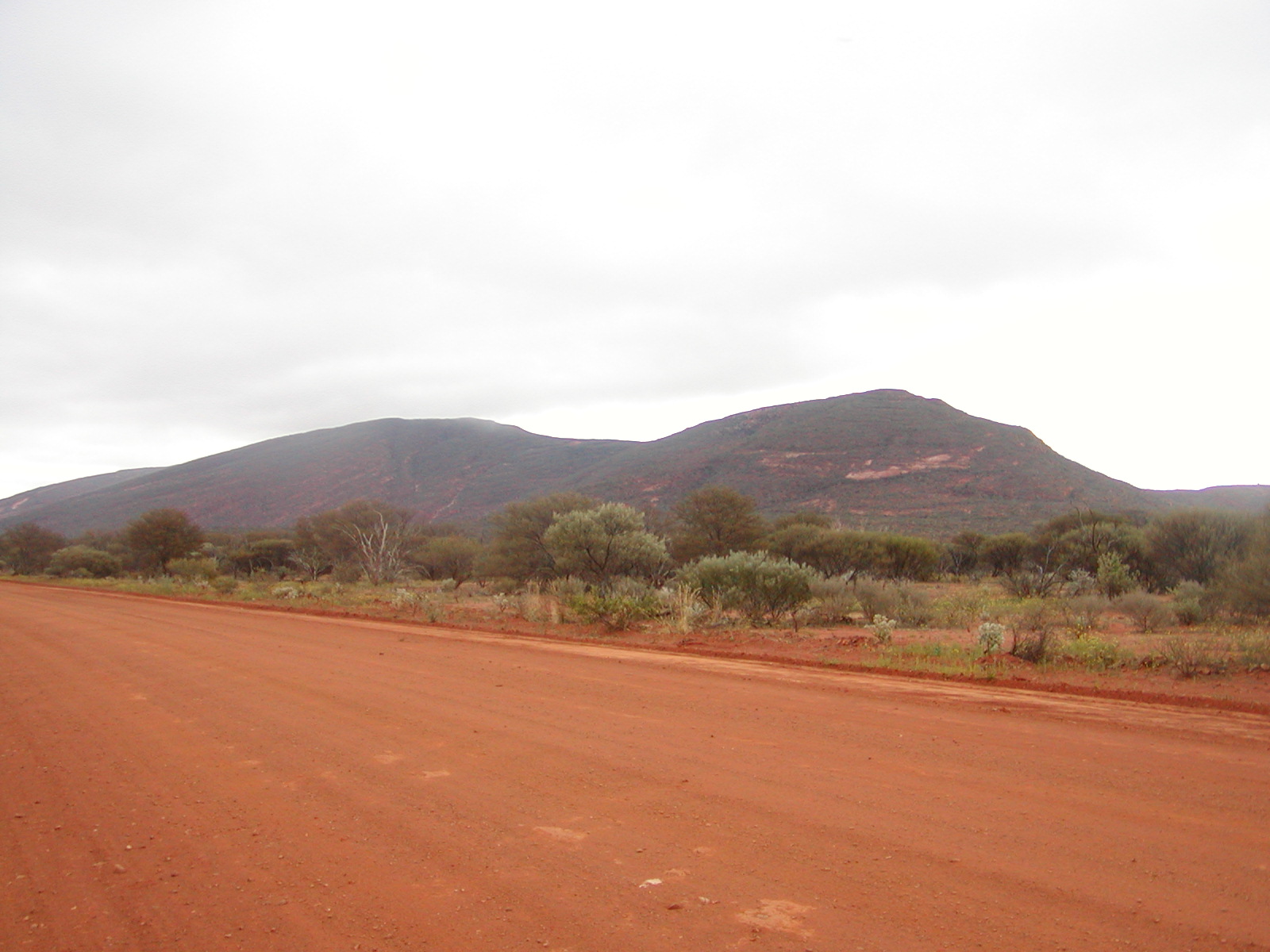
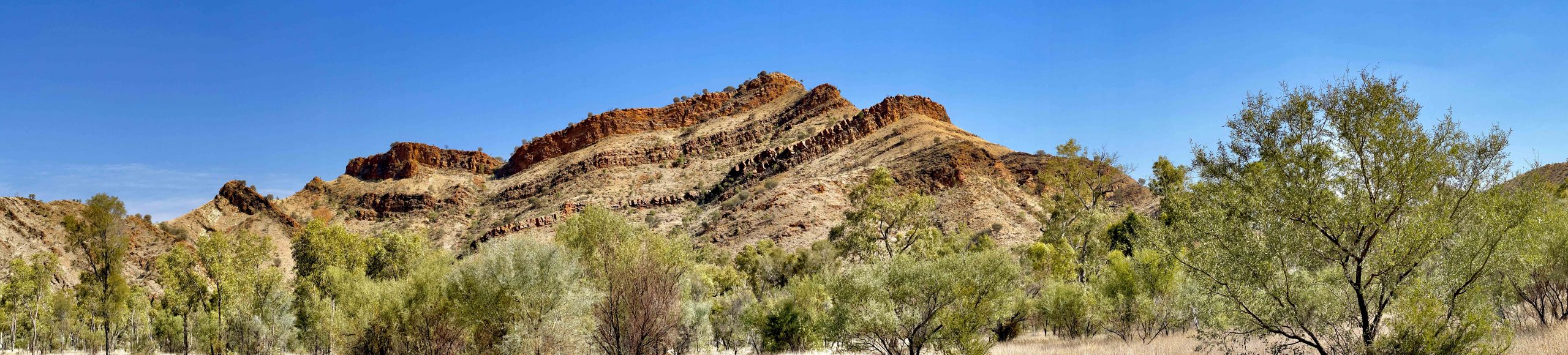
On the way back we passed a mountain that clearly showed the layers of sedimentary rock and how massive pressures over eons has distorted them. In places the layers are pointing up vertically and it is these vertical strata that gets eroded to makes places like Standly Chasm where the faces of the chasm are hard rock and the gap was softer rock that has been eroded.

Tomorrow we will journey to Artlunga an old ming town about 75 Km away.

If you would like to receive an email each time I publish a blog simply enter your email in the box below and click Subscribe.

Posted in 2023 | Leave a comment

Alice Springs Desert Park

On Thursday, our second last day at Alice Springs we went to the Desert Park. This park is a native plant garden covering different types of desert regions and a wildlife park 7 Km from Alice Springs. It is situated on 1,300 hectares, with a core visitor area of 52 hectares.  It is a must see if visiting this area. There is a free bird show at 10 am and 3 pm each day so we decided to do the early show. It is in a roofed auditorium with tiers of seating in a semi circle, everyone gets a good view and it would fit over 100 people. The first show was a magpie swooping to get food from the handler. Apparently they can memorise 100 faces so if you upset one they will attack you for their whole life and their offspring will learn you as well. This bird was too fast to photograph. However there was a rogue willy wagtail who kept making an appearance during the show.

The next display was by a Kite who has learned to break an emu egg using a stone. He picks a stone up in his beak and thrusts it down onto the egg and after 4 or 5 throws the egg broke. He was an orphan kite so this skill seems to be inbred as all kites do this apparently.

Then an owl appeared out of a dead tree stump and flew into the arena. From the back wall he would swoop down and grab the feed from the keeper and fly back to another part of the wall.

Here is a photo of the owl on top of the wall and one of the tawny frogmouth who was happily perched in the roof structure for the whole show.

The next display was by a wedge tail eagle, a massive bird who came in on the arm of its trainer. It would fly up and grab the thrown food and return to the ground or to the trainer. Were are a couple of photos.

There were another couple of birds who did some tricks but I didn’t catch them on camera, the show lasted about 20 minutes. After that we set off to walk around the park and visit the various exhibits. We omitted the dingoes, kangaroos and emus as we have seen plenty of those in the wild. There were 8 or 10 aviaries scatted through the park and we visited them all. Some are walk through ones with two doors on each end with a vestibule between so birds cannot easily escape. Others are viewed through a window. The photos that follow are of the birds I managed to capture on the camera, many are so quick of movement you just cannot catch them on the camera.

Red Tailed Black Cockatoos
Bourke Parrots – Rare and Endangered
Bush Bustard

The bush surrounding you as you walked around was beautiful, this area is the sand garden path.

The photo below is in the river country area.

Among the visits to the various aviaries we visited the nocturnal house. Some of the photos have strange colours, that is due to the lighting. There was a guide showing people around and he had a red light to show things up. It was very dark inside and we had to use 2 to 2.5 seconds exposure to get a photo. Here are some of them.

Death Adder
Bush Rat
Pie-dish Beetle

We were lucky to see a Bilby running around, but it was so quick it was impossible to photograph in low light. Of course as you would expect there were lots of flowers in the gardens, here are some.

Yellow Mallee
Everlasting Daisy

People say that the Australian bush is dull and boring, I think you can see that there is a lot of variety and beauty in our bush. We have been visited at camp lots of times by Australian Ringneck Parrots, here is a photo Deen captured.

Finally a photo of our camp with the range behind the park highlighted at sunset.

Tomorrow, Saturday, we move to Ross River Station for 3 nights where we will visit features of the East MacDonnells. After that we will start wending our way home.

Posted in 2023 | 2 Comments

West MacDonnell Ranges #2

On Wednesday we headed off to see another couple of features of the MacDonnell Ranges. The first stop was Standley Chasm, Angkerle Atwatye to the aborigines. The chasm is owned by an aboriginal tribe so you have to pay a separate entrance fee. It is named after Mrs Standley who was the first school teacher at Alice Springs and worked there from 1914 to 1928. To visit all the other places in the national parks you purchase a two week pass for $30. The walk in is quite beautiful on a dirt path that is reasonably flat and smooth. There are Cycads scattered in the bush some of which are up to 1000 years old. The trunks on these are massive. The cycads have a special place in the aboriginal folk law.

Plants, bushes and trees somehow find a foothold in the very rocky terrain and this gum tree shows.

The path was very beautiful with a photo opportunity at every corner. The following were taken on the walk in.

In the next photo you can see some cycads on the hill opposite the path.

We didn’t know about the best times to view the chasm but we arrived at it at 12 noon which was right at the best time as the sun only lights up the walls for about an hour at noon. The rock walls are so rugged , it is a wonderful sight.

At the end of the chasm is a small rock pool.

Along the walk in were many wildflowers, here is a selection.

We walked out and stopped for a refreshing ginger beer in the delightful open cafe that is at the start of the walk, then it was off to Simpsons Gap.which is 40 Km closer to Alice Springs and only 10 Km out of the town. By the way all of the places we visited are on the same road that runs west from Alice Springs. Simpson’s Gap was named after A.A. Simpson, President of the South Australian branch of the Royal Geographical Society. The Simpson Desert was also named in his honour. Simpsons Gap was another delight both visually and because the walk in was only 6-800 metres long.


A pool alongside the walk approaching Simpsons Gap
Another view approaching the gap
Simpsons Gap

The view out alongthe creek that runs from the gap is special as well.

View out from Simpsons Gap

There was a good picnic area at Simpsons Gap but all the BBQs were out of order including the one at the rangers station on the road out. So we headed for the Olive Pink Botanical gardens and had a picnic there using our own stove. These gardens were started by Olive Pink a botanist and artist, her focus was on plants of the desert. Marg and I bought a couple of tree seedlings in the early 1990s but sadly both have since died. On that visit Eric bought one as well which is still thriving. Tomorrow we will visit the Desert Gardens which are a native plant garden with lots of bird aviaries and enclosures for animals.

You can subscribe to receive an email notice each time I publish a new blog, just enter your email address in the box below and click Subscribe.

Posted in 2023 | 4 Comments

West MacDonnell Ranges #1

I forgot to mention that on the drive to The Alice we passed Gosse Bluff which is a crater is thought to have been formed by the impact of an asteroid or comet some 140 million years ago near the end of the Jurassic period. The original crater rim has been estimated at about 22 km in diameter, but this has been eroded away to a 5 km diameter, 180 m high crater. We both flew our drones but because of the height of the side of the crater we couldn’t see inside. This photo was at ground level, the bluff is still impressive if only a quarter of its original size, must have been a big bang!

On the Monday we arrived we went into Alice Springs to top up supplies and while there we visited the old telegraph station. This building marks the site of the first European settlement in Alice Springs established in 1871, it is a lovely place for a picnic and the old buildings are very well preserved.

Our next day was exploring the features of the West MacDonnells, Tjoritja to the aborigines. The first stop was at Glen Helen Gorge on the Finke River. This river is the oldest river in the world having followed the same path for 100 million years, some sections are even older. The Finke finishes its journey at the edge of the Simpson Desert where it looks like a dry river delta with lots of tress scattered across the many channels. The old Ghan railway crossed the Finke and the line was regularly washed out in floods, which is one reason they moved the track further west about 50 years ago. We used the old sleepers as firewood in the 1980/90s when we travelled the Oodnadatta track a number of times. The gorge is located about 140 Km west the Alice Springs near the western end of the West MacDonnell Ranges.

Glen Helen Gorge
Finke River at Glen Helen Gorge

From here we went to the Mt Sonder lookout, a very short drive away. This mountain is the second highest in the MacDonnells at 1380 metres behind Mt Zeil at 1531 metres. The MacDonnells, when originally pushed up, were around 10,000 metres high, as high as the Himalayas. Erosion over millions of years has reduced them to a fraction of their original height.

Mt Sonder
Mt Sonder and the West MacDonnells

From here we headed east to Ormiston Gorge. We chose to climb up to the gorge lookout which included a couple of hundred steps and a narrow path along the edge of a steep drop so it was not the most enjoyable walk but the view was worth it.

Ormiston Gorge from partway up the climb to the lookout platform
Ormiston Gorge from the lookout showing the rock pool

From the lookout you could see the Ormiston creek valley that flows from the gorge, it is a tributary of the Finke river

Ormiston Creek Valley

Along the climb there were a few wildflowers growing in very rocky ground.

After Ormiston, we called into the Ochre Pits where the aborigines used to quarry ochre and trade it all over Australia. They would powder the ochre, wet it and then roll it into a ball and let it dry into a hard ball that made it easy to carry.

After the Ochre Pits we headed for Ellery Creek Big Hole, an ordinary name for a beautiful waterhole and gap in the ranges. There is camping allowed here and you can swim in the “big hole”, which some people were doing. There was also a pleasant picnic area with a couple of gas BBQ’s so we had our lunch here in a picnic shelter out of the sun. Here are some photos of the water hole.

Approach to Ellery Creek Big Hole
Ellery Creek Big Hole

After lunch we headed back to camp but paused at a lookout over the MacDonnells. I couldn’t get the whole range in one panorama so that each photo follows on from the one above.

It had been a good first day in the MacDonnells, but we were a bit leg weary as we headed home looking forward to an ice cold stubby.

If you would like to receive an email each time I post a new blog simply enter your email address in the box below and click Subscribe.

Posted in 2023 | 2 Comments

Kings Canyon – Watarrka to Alice Springs

On the last night we wandered over to the edge of the campground to get a last shot of the George Gill Range at sunset. The first photo was taken at 4.30 pm, the orange of sunset is just starting to show. The light towers (unlit) can be seen in the foreground. This shot was taken from the sunset viewing platform next to the park.

George Gill Range 4.30 pm
George Gill Range at 6.00 pm

This photo and the next were taken from the edge of the park, we had done a bit of walking that day and did not fancy another walk up the hill to the viewing platform.

Another part of the George Gill Range at Sunset 6.00 pm

We started a conversation with a couple and they offered to take our photo and it would have been churlish to refuse.

It was early to bed as it was a very cold night and I woke early the next day so I walked up to the viewing platform and took a couple of photos before the sun rose.

We were on the road that day at 7.30 heading for Alice Springs on Mereenie Loop, a notorious dirt road that cuts about 150 Km off the journey. The corrugations were terrible and the dust blinding and so fine (I was following Nadine, but a long way back!). There were rocks, stoney rough sections and deep dips, it was a road to be done but not enjoyed. A couple of road signs on the approach to a corner and on exiting it, raised a smile.

A short section of the road was paved going up onto a jump up so we stopped and Nadine took a photo of the view back down the valley toward Kings Canyon.

Eventually we hit the bitumen on Larapinta Way and headed to a bushy caravan park about 15 Km out of Alice Springs. It is a basic caravan park but has lots of trees, big sites and very clean, but not modern, amenities, well worth considering if you are up this way, Wanngardi Caravan Park. Tomorrow, Monday, we will start exploring the West MacDonnell Ranges.

Posted in 2023 | 2 Comments

Kings Canyon – Watarrka #2

On our second day at Watarrka we decided to walk into Kathleen Springs. It was a more open walk than the Kings Creek walk but still a very enjoyable one. The walk was paved all the way and started with a climb over a sand dune and then a fairly flat walk to the spring. The path wended its way between two escarpments making it like a small gorge. In this photo we are approaching rock wall that leads to the spring,

Cattle have been grazed here for many years and the Aboriginal stockmen when mustering used the tapering valley to trap the cattle who came to drink the water from a tank that the station had installed. There are remains of the cattle yards built in 1962. In the foreground is what is left of the loading ramps used to load the cattle trucks.

The rock formations on both sides of the walk were stunning, made more so in the bright sunlight. The other thing of note was how green the slopes below the rock faces were, a clear reflection of the rain that the centre of Australia has received over the last few months.

As we approached the spring there was a rocky but nearly dry waterfall that also fed water to the spring pool when it rained.

The last 30 metres of the walk was on a metal “boardwalk” along the edge of the rushes that led from the waterhole, it had a bit of a tropical feel with quite luxuriant trees and plants

The pool itself was quite large and really beautiful and framed by a wonderful rocky escarpment.

Along the way we passed a large rock which had the wave markings of an ancient sea made when the rock was sand before it was buried and compressed into rock. These are the marks of the rainbow serpent of Aboriginal legend.

There were many small wildflowers along the walk many much less than a centimetre across but still beautiful, here is a selection of them. The day was quite windy so it was a bit of a job to take the photo of the flower when the wind stopped and it had stopped waving about. Some of the longer stemmed flowers needed Nadine to hold them steady while I took the photo.

On the way out we noticed a side gorge that also had stunning rock faces and lovely trees.

The photo below is our view as we walked away from the spring.

By the path was a grinding stone left by the aboriginal women who used it to grind the seeds they had gathered.

Tomorrow we head off via Mereenie Loop to Alice Springs and we will we travel through Aboriginal lands so we have to buy a permit to travel that way. It is a notoriously rough road so we will have to lower the tyre pressures a bit to protect them and our vans. This way to Alice Springs is around 150Km shorter so it is worth putting up with the corrugations and dust (we hope!).

If you would like to receive an email each time I publish a new blog, just enter your email address in the block below and click Subscribe.

Posted in 2023 | Leave a comment

Kings Canyon – Watarrka #1

We left Uluru and Yulara looking forward to spending some time at Kings Canyon, or Watarrka, it’s original Aborigine name. It’s my third visit here, my first was with Marg in 1990 when there were few facilities and you could camp near the gorge. I remember we were in a two man tent (maybe I should say a two person tent) and the wind blew so hard overnight that we had almost as much sand inside the tent as outside. This time we are staying in the caravan park away from the gorge which is the only place you can camp nowadays. It is an extremely well run camp with lots of amenities and they have covered the sites with crushed rock so you are not tramping red sand everywhere. On the first evening we watched sunset on the George Gill Range from the campground.

Adjacent to the park they have set up a light tower display that you can walk through while music is being played. You have to pay for this privilege so we chose to just observe from our campsite.

So next day it was off on the Kings Creek walk which follows the creek that cut its way through the rock to make Kings Canyon. It was a really beautiful walk, one of the best, through wonderful bush on a rock path that had been arduously assembled by the workers making the walk a very easy one. The bush surrounding the walk was in top condition from the recent rains as the following photos will show.

We had chosen not to do the rim walk around the top of the canyon, the 500 steps to start the walk put us off, I have done it twice before and it is an arduous climb followed by a 4 hour walk. These are the steps that start the walk.

Steps up to the Kings Canyon Rim Walk

I will let the photos of the Kings Creek walk talk for themselves about how beautiful the walk along the creek was. The first photo is of the first part of the walk which was on a smooth paved surface.

In this photo you can see three people on the top of the gorge and the bridge that they walked across to get to that vantage point. The flowering plant in the foreground is a Holly Grevillea.

At the end of the walk the National Park people had built a wonderful set of three viewing platforms from which to view the valley ahead, they had even built the deck around a big rock which was a feature in itself, apart from the stunning view.

The sun was in an awkward spot to allow me the get a really good photo but this was the view at the end of the walk.

The parks people had even added some birds to the railing of the viewing platform to add to the experience.

Here is another view from the end of the walk.

Along the way there were many wildflowers in bloom and the following are a selection.

The tiny pink flower on the left produced the red berries shown on the right. It was quite windy on the day so Deen often had to steady the stem f the flower so I could get a reasonable photo

The flower on the left is a Bush Tomato flower which produces an edible fruit, but there are a number of similar flowering plants that are poisonous so care is needed before eating the fruit. The flower on the right is Mulla Mulla which was growing at our picnic area.

So after the walk we moved to the Sunset viewing picnic area where there were gas BBQs for lunch. The picnic table was under cover in a peaceful setting where we were the only people enjoying the facilities. A photo of Deen and I on the walk to finish this blog.

If you would like to receive a email each time I publish a new blog enter your email in the box below and click Subscribe.

Posted in 2023 | 2 Comments

Kata Tjuta (The Olgas)

The last day of our stay at Yulara was spent at Kata Tjuta a wonderful collection of massive rocks that stand out on the horizon from 50 Km away. There is good reason for this as Kata Tjuta is bigger than Uluru, 22 Km in circumference (Uluru 9.4Km) and 546 metres high (Uluru 348m). It used to be called the Olgas so named by the explorer Ernest Giles, who spotted the domes in 1872. He named the highest peak Mount Olga, after Queen Olga of Württemberg (a kingdom in Germany). The nickname of ‘the Olgas’ developed when tourists first visited the area in the 1950s. Mt Olga now called Mt Olga/Kata Tjuta is the highest peak in the Olgas at over 500 metres, it is around the centre in the photo below. The trees in the foreground are desert Oaks. This view shows how long the Olgas are and why their perimeter at 22 Km much longer than Uluru at 9.4 Km

The view from the Sunset viewing area is the photo below also taken late morning when the sun had moved to that side of the Olgas.

We decided to walk into Walpa Gorge before a picnic lunch a very uneven rocky gradual climb into the gorge between two parts of Kata Tjuta. The photo below shows the path in detail, and that’s a smooth part. Our destination is in shadow as was part of the walk which had a very welcome coolness.

The photos below were taken at various stages as we walked into and out of the gorge. The water in the spring fed little creek at the top of the gorge had very clear and cold running water.

The sky ad the gorge wall on the left are strange colours as I had to lighten the photo so you could see the country beyond the gorge. The photo was taken looking back out of the gorge.

In this photo you can see how green the floor of the gorge is, any earth between the many rocks has a bush, or a tree or grass growing from it.

Panorama looking out of Walpa Gorge

There were plenty of flowing plants along Walpa Gorge, here are some photos of a few of them.

Kata Tjuta Wattle
This flower was less than a centimetre across
Another tiny flower about 1/2 cm across

After walking out of the gorge it was time for a BBQ lunch so we returned to the Sunset viewing area where there were picnic tables we could use. Deen managed a Selfie with Kata Tjuta in the background.

With that we ended our visit to Uluru and Kata Tjuta, we had enjoyed our stay very much. Tomorrow it’s off to Kings Canyon/Watarrka for 3 nights. If you have enjoyed this post and would like an email notification when I post a new blog, simply enter your email address in the box below and click subscribe.

Posted in 2023 | 4 Comments

Up Close with Uluru

On Wednesday we decided to spend a few hours driving and walking at the rock, come home and then go back to view Uluru at Sunset, we didn’t fancy a Sunrise viewing. At the sunset viewing point we found a few trees facing the western side of Uluru and BBQ’d some snags for lunch. It was quite restful in the shade after we had covered everything with Aerogard. At this time of day all the crevices in the rock show up quite clearly.

Picnic at Uluru

We then drove around Uluru and walked in to Mujitjulu Waterhole. It was a short pleasant walk which was extremely cool once in the shadow of Uluru. Lots of trees around the waterhole and the path in and plenty of green grasses. Before we set off on the walk we took a photo of Uluru in the early morning shadows.

The photos below are of Uluru at the waterhole and nearby.

Pathway to Mujitjulu Waterhole

The waterhole was dry but apparently there is permanent water here so I guess if you dug down you would find water. The area was very green and the shapes on Uluru were interesting and added another dimension to the walk. We did walk a kilometre or so along the walk around the rock to observe some of the rock formations and shapes. There was a section where you were asked not to take photos and some international tourists were taking photos against the wishes of the aborigines as there were sacred sites in that part of Uluru. I suggested that they would not do that at Sacre Coeur in Paris where you are also asked to not take photos. They did apologise and move on.

This face of Uluru looks a bit like a lions face with bared teeth.

We walked back to the car and drove around Uluru where there were some interesting sculptures eroded in the rock.

From here we went to the area of the rock that people used to climb, we did think that Uluru looked so much better without a trail of “Ants” climbing up and down. You can still see where the walk was located, no doubt over time that will heal. The shot below is a panorama and shows Uluru sloping up on the left, which it doesn’t.

So from here it was off home to return for a picnic of nibbles and champers (real stuff courtesy of Deen) while we watched Uluru in the sunset. We really enjoyed the food and the view and as it was cooling the flys were no much of an issue. We arrived and set up at 5pm, someone commented to Deen about this photo she posted online, “How come you’re sitting next to Kevin Rudd?”

Picnic at Sunset while watching Uluru Change colour.

The next series of photos show the progression from 12.30 when we had a picnic lunch to about 6.45. The times of the photos are below each one.

Mid-morning
12.30 pm
5.10 pm
5.47 pm
6.03 pm
6.08 pm
6.45 pm

So that was Uluru. For the dimensionally minded Uluru is 9.4 Km in circumference and 348 metres in height. It is not Australia’s largest monocline, that honour goes to Mt Augustus in Western Australia, which is also the world’s largest rock. Mt Augustus is 1-1/2 times the size of Uluru and 717 metres high, circumference of 49 Km and it’s granite is 1,650 million years old. Mt Augustus is located 460 Km east of Carnarvon in W.A. It is not so renowned as Uluru as it’s harder to get to and is not just a big bare rock with vegetation on parts of it.

Mt Augustus, photo from our visit in 2008

Tomorrow we are off the tour Kata Tjuta (The Olgas). If you would like to receive an email when I publish a new blog just enter your email address in the box below, you will not be bombarded with emails.

Posted in 2023 | 2 Comments

Uluru Field of Lights

Last night we attended the Field of Lights show which is held on the top of a sand dune near town facing Uluru. It was a fantastic show and I would recommend anyone visiting here to see this show. A bus picked us up at the entrance of the camping ground at 5.30 pm and took us to the dune where we were greeting with a chilled glass of Australian Sparkling. We found a seat and enjoyed sipping several glasses while being served delicious canapés. The view of Uluru as the sun set was wonderful in itself as the rock changed colour as the sun dropped in the sky.

The field of lights then started to show in the foreground.

At the same time we were also being entertained by incredibly fast moving tiny hopping mice. They emerged from under a dense bush to dash out and grab a crumb and then dash back. They moved so fast I had plenty of photos of red dirt as they moved faster than I could take a shot even with my finger poised on the shutter button. There must have been about 20 in the family of mice. Here are a couple of photos I managed to get. There are four in the photo on the left, their tails were about 10 cm long at least with a 1cm bushy end to it.

At the same time the sky behind us was putting on its own wonderful display. The big blob is the moon and the other is Venus.

Now it was dark we walked down the dune and among the lights. It was just wonderful. The lights cover an area of 49,000 square metres and there are 50,000 individual lights of all sorts of colours and all hand made. Even the cabling joining the lights to the solar generated electricity added to the image as they glowed with reflected light. Here are a couple of close up photos so you can see the cables and the globes.

The photos below will speak for themselves. To take the photos we had to turn our flashes off and use night mode which held the shutter open for between 2 and 3 seconds during which we had to hold the camera still, not an easy task so one or two are blurred.

This photo is a bit blurred but it does show some stars in the sky, which made there own field of lights.

The photo below shows the pathway into and between groups of lights, the yellow circles are the path lights. You can also see some shadowy Desert Oaks in the photo.

The glow in the background in the photo below is created by the lights of Yulara.

You can just pick up a couple of stars near the two taller trees, there were plenty of other stars but they were not captured by the camera.

In this final photo you can see a display of lights in the air behind the field of lights. This was a moving pattern of lights that was constantly changing. It was hard to work out what the display represented and harder to get a reasonable photo because the shutter was open for 3 seconds and the lights were changing constantly. This is the best I could do, many did not capture any image.

So that is my collection of photos of a wonderful evening’s entertainment. We wended out way across the field of lights to the bus and were dropped off at camp at about 8 pm, the whole event from pickup to drop off was 2-1/2 hours.

It will be nice to not have to pack and leave in the morning. We plan to visit Uluru tomorrow and have a picnic lunch somewhere. If you would like to be notified by email when I post a new blog, just enter you email address and click Subscribe.

Posted in 2023 | 2 Comments