Lincoln National Park to Uluru

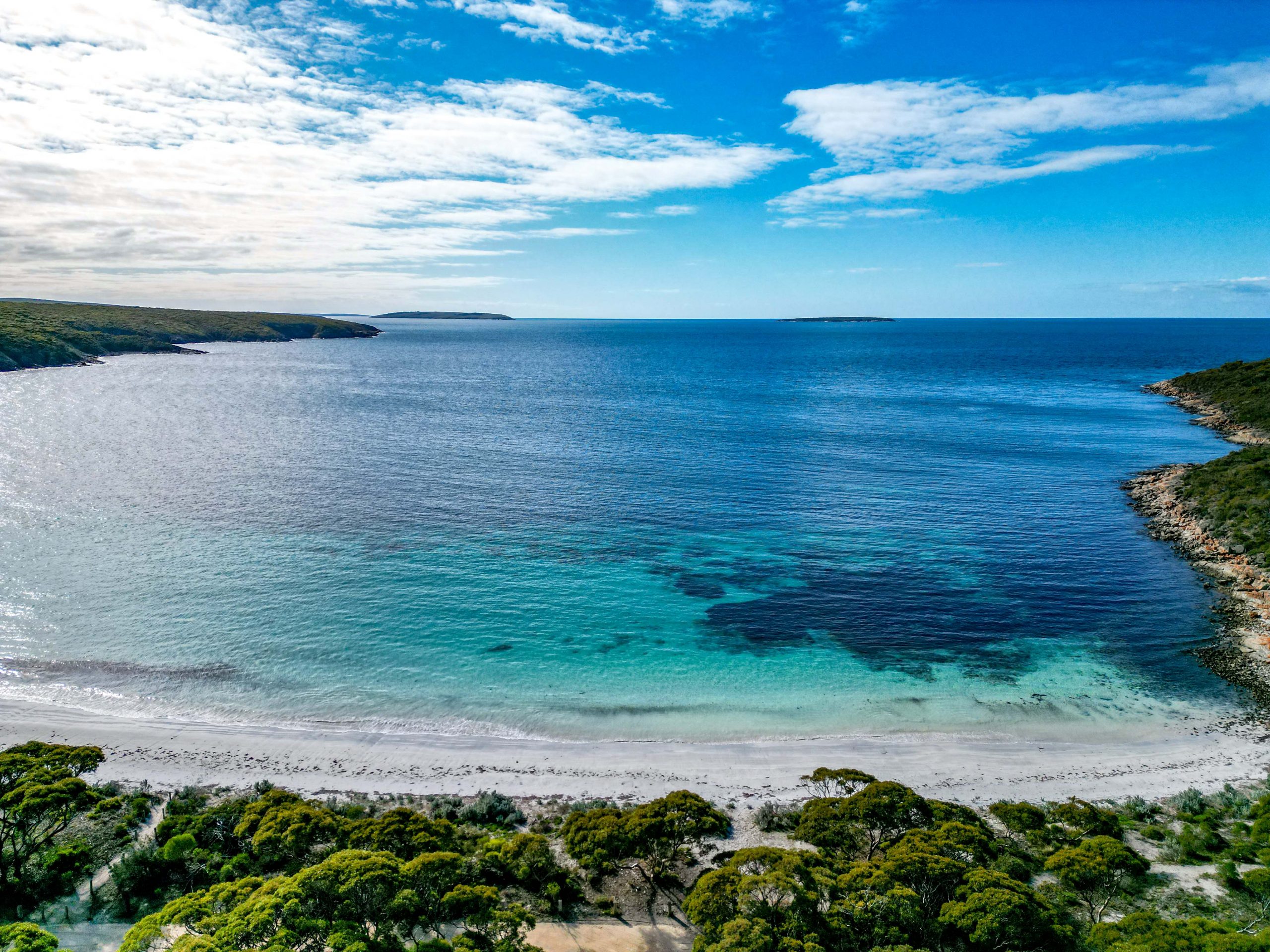
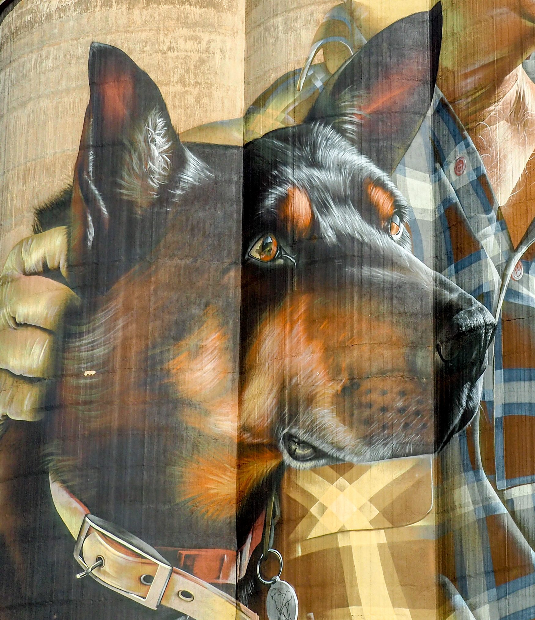
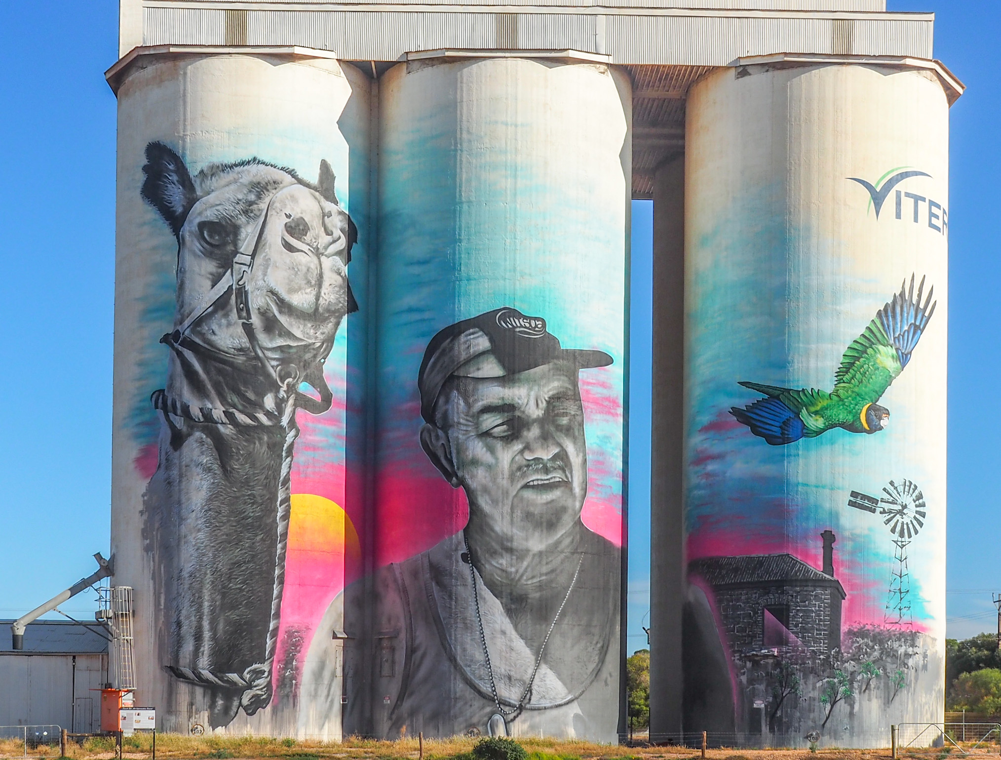
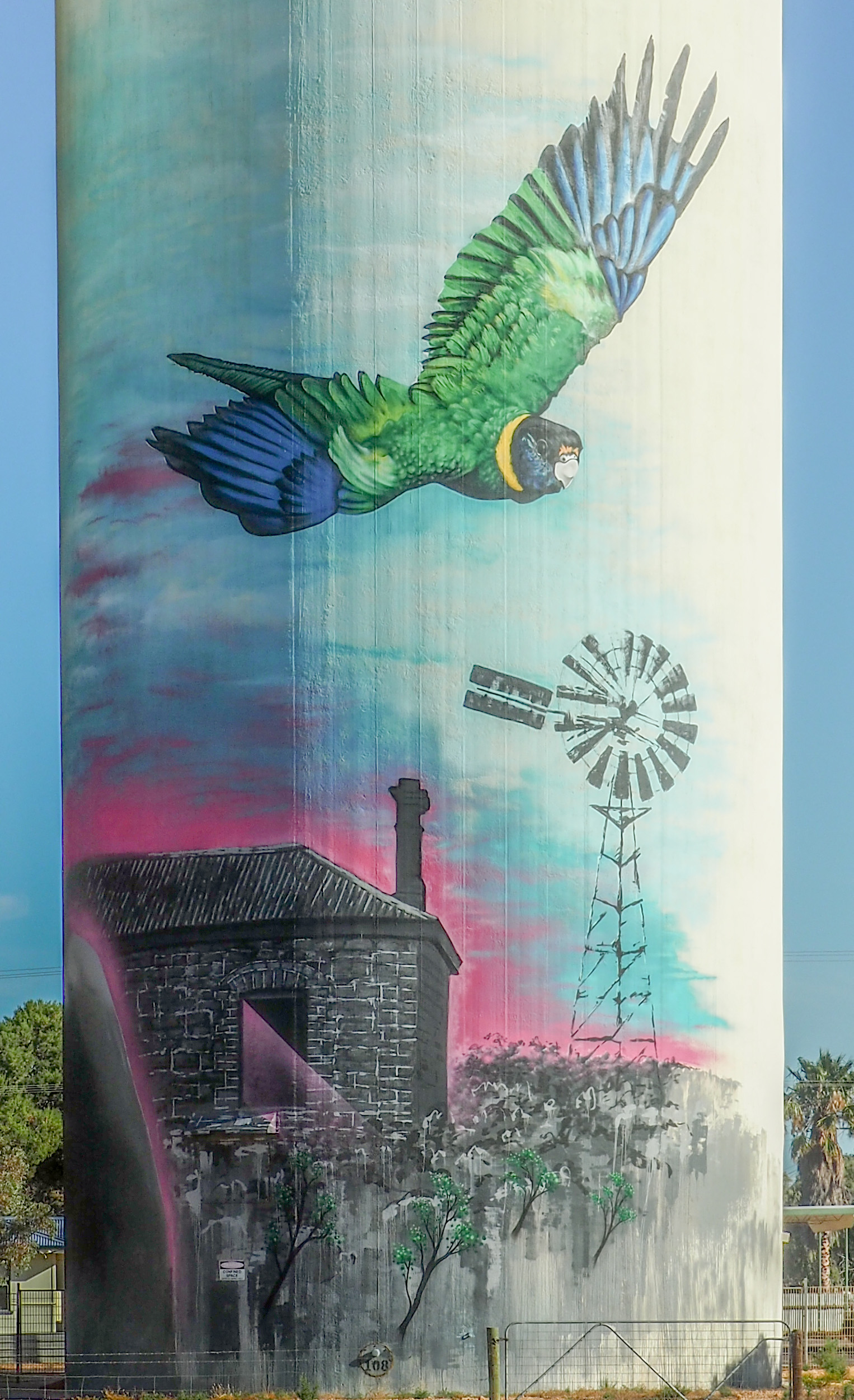
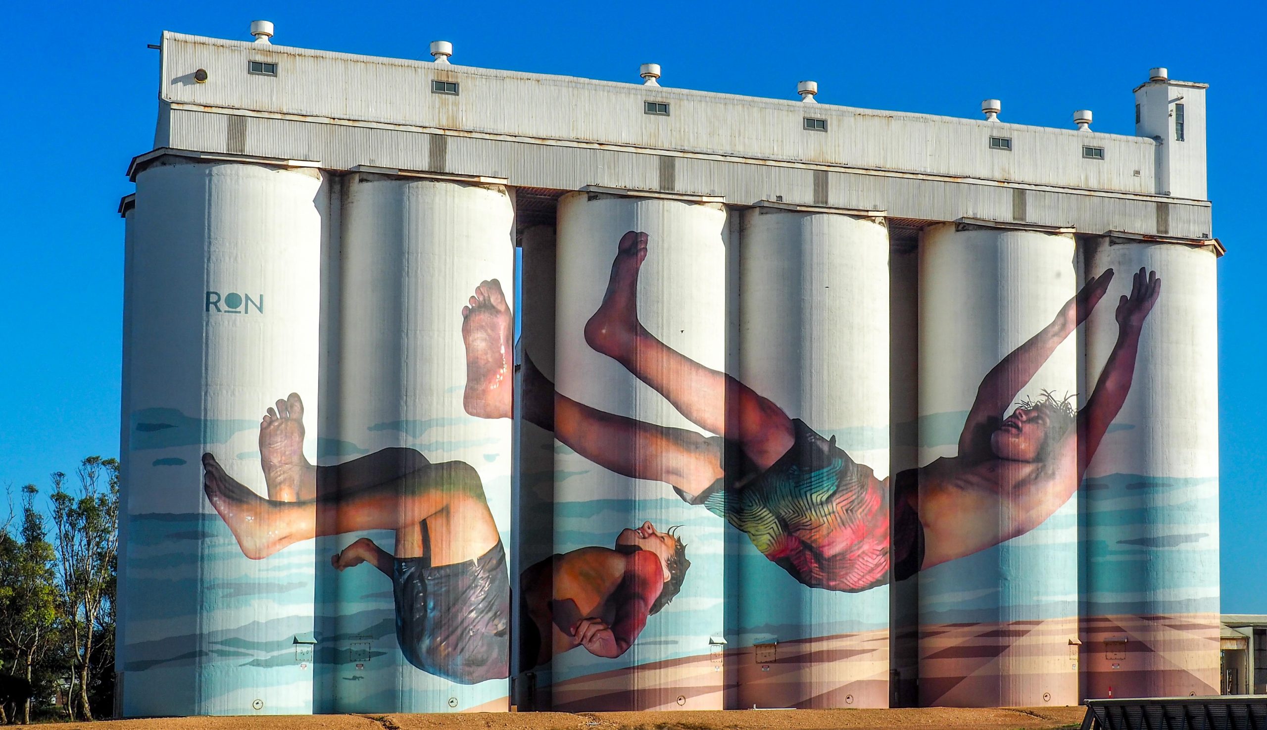
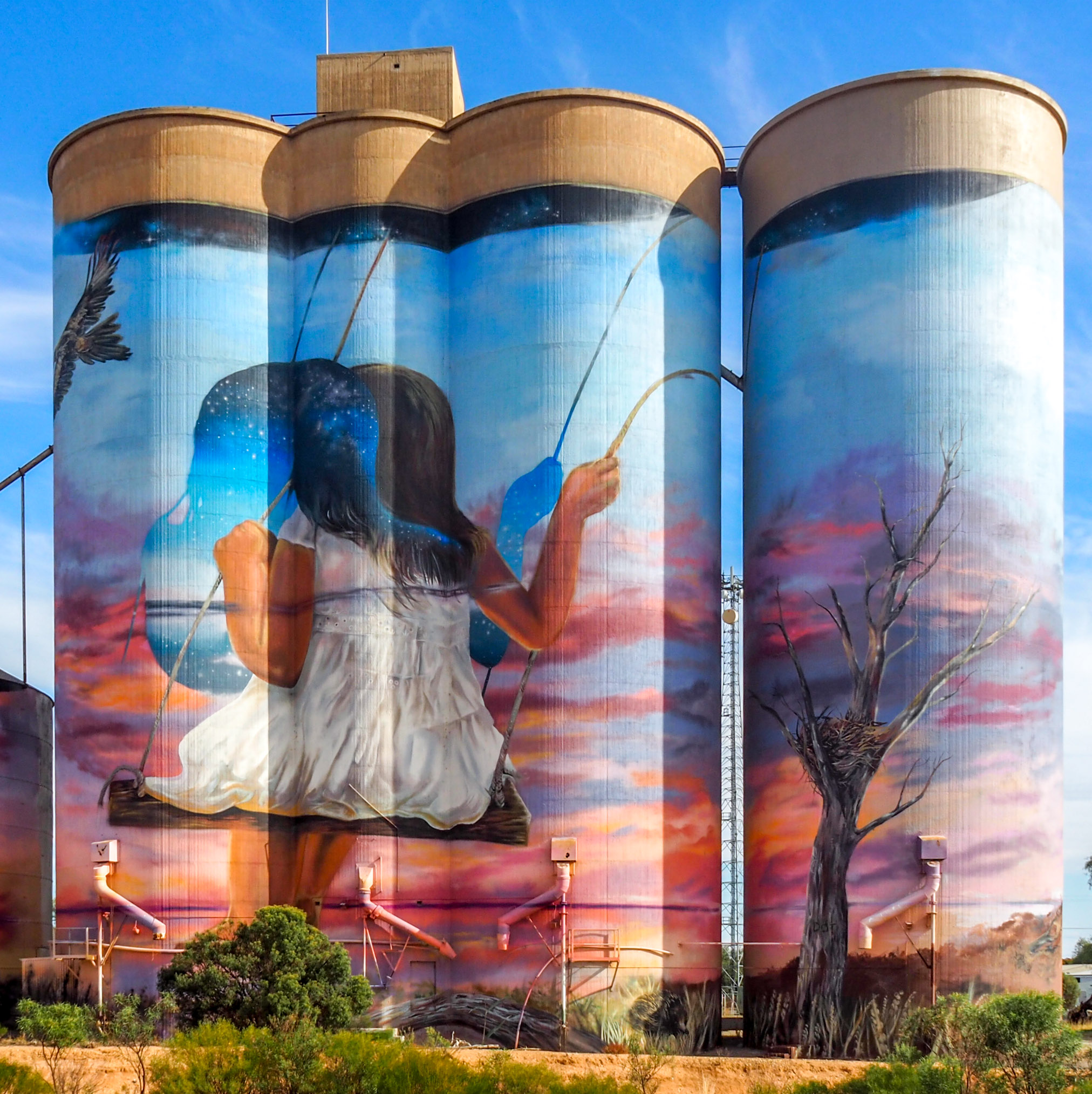
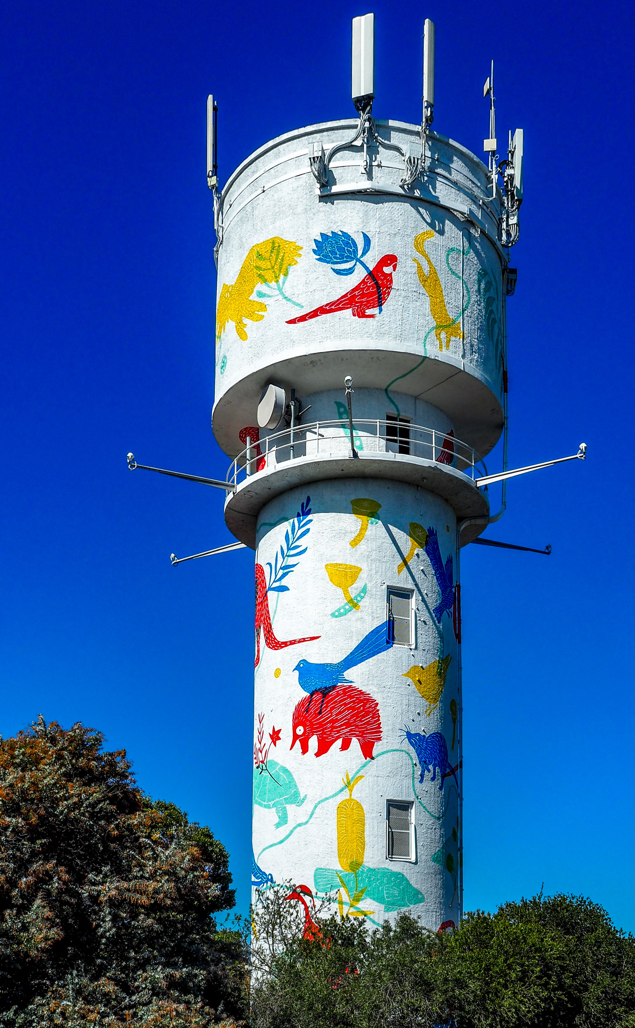
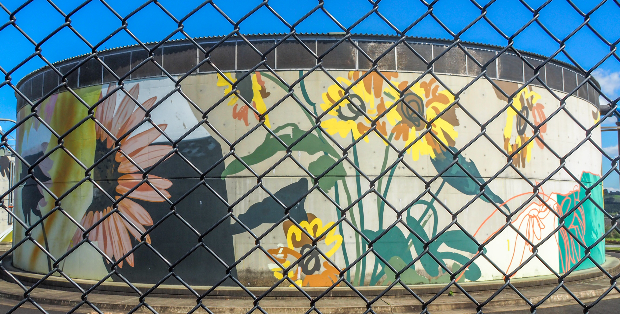
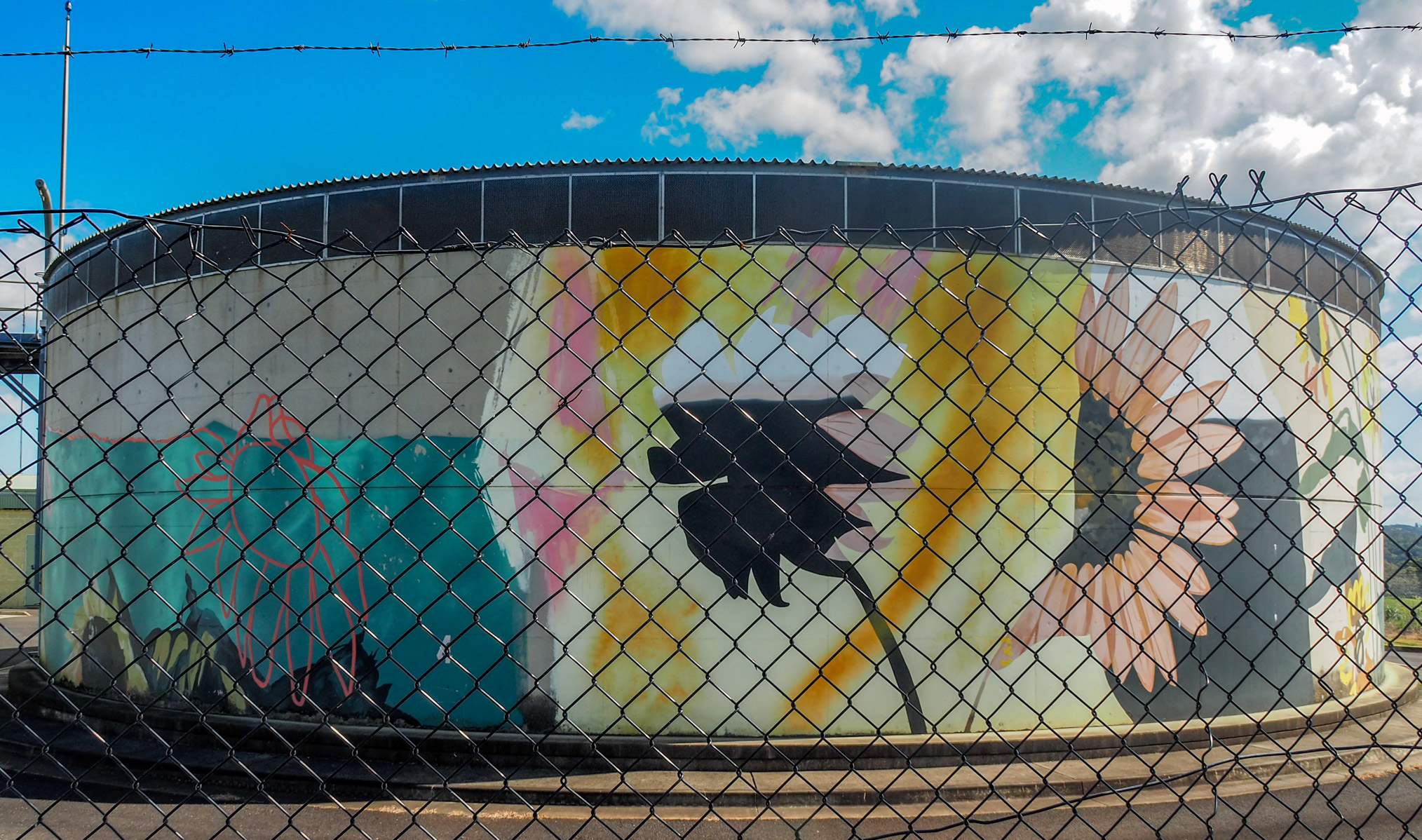
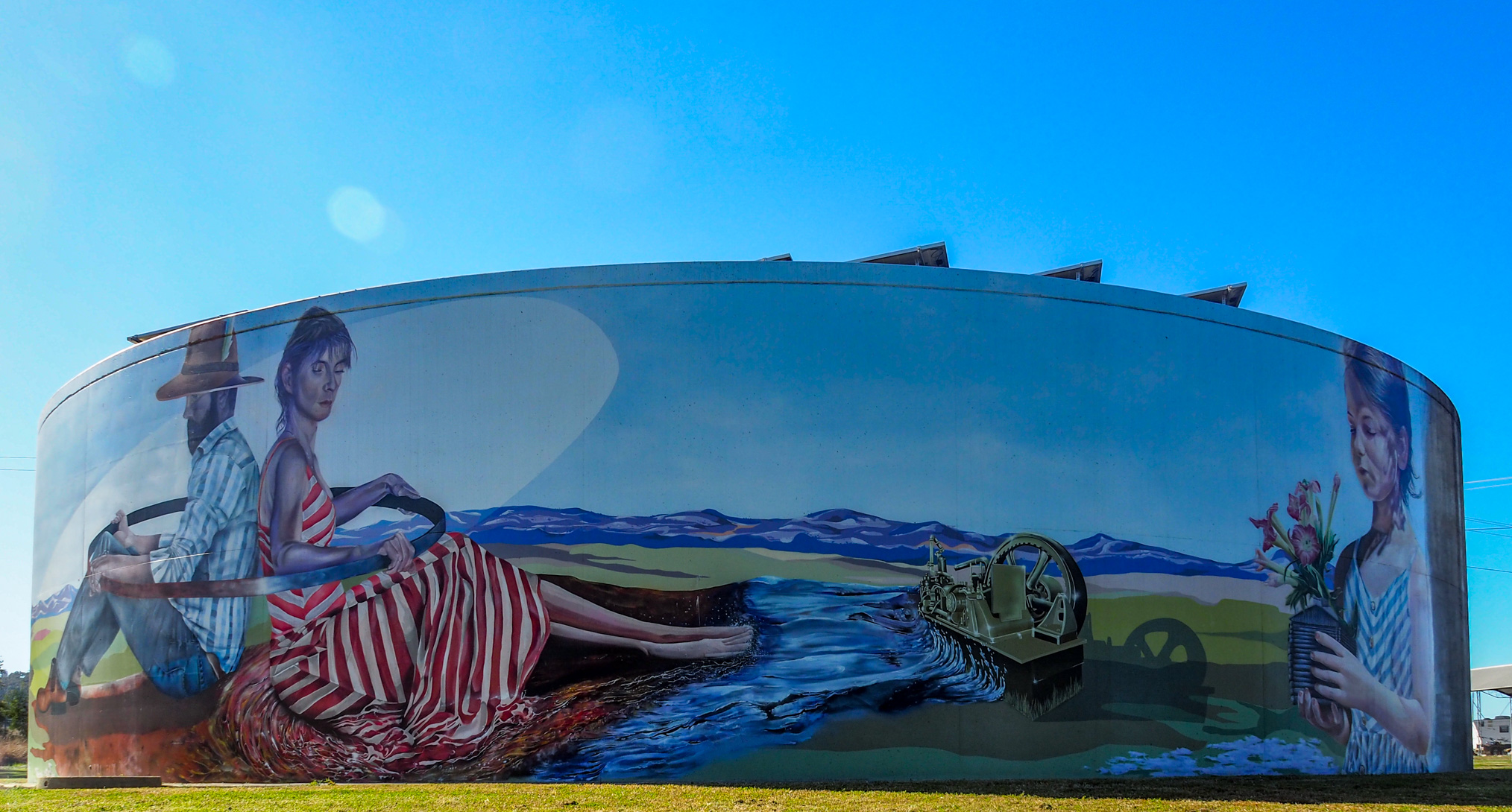
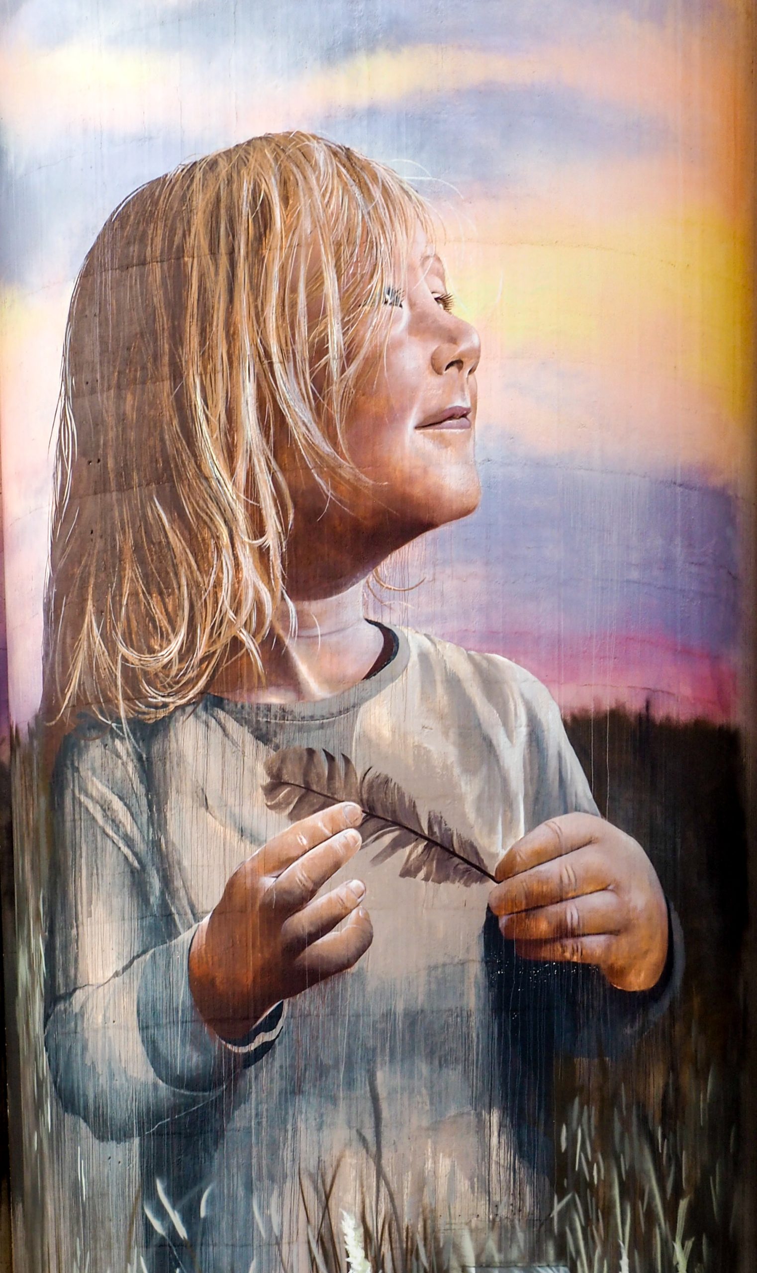
it is a long way from the bottom of the Eyre Peninsula to Uluru so we decided to have big first day of 585 Km and then a couple more of around 400 Km and then a final 320 Km which would get us to Uluru in a reasonable time and not too worn out. We also decided that an 8 o’clock start was early enough so at that time we set off from Port Lincoln on our journey which was to go through Kimba where there was some silo artwork. The trip to Kimba was enjoyable as that part of the Eyre peninsula was a bit hilly with lots of mallee scrub and trees. The silo art was OK but nothing spectacular.

Kimba Silo Art

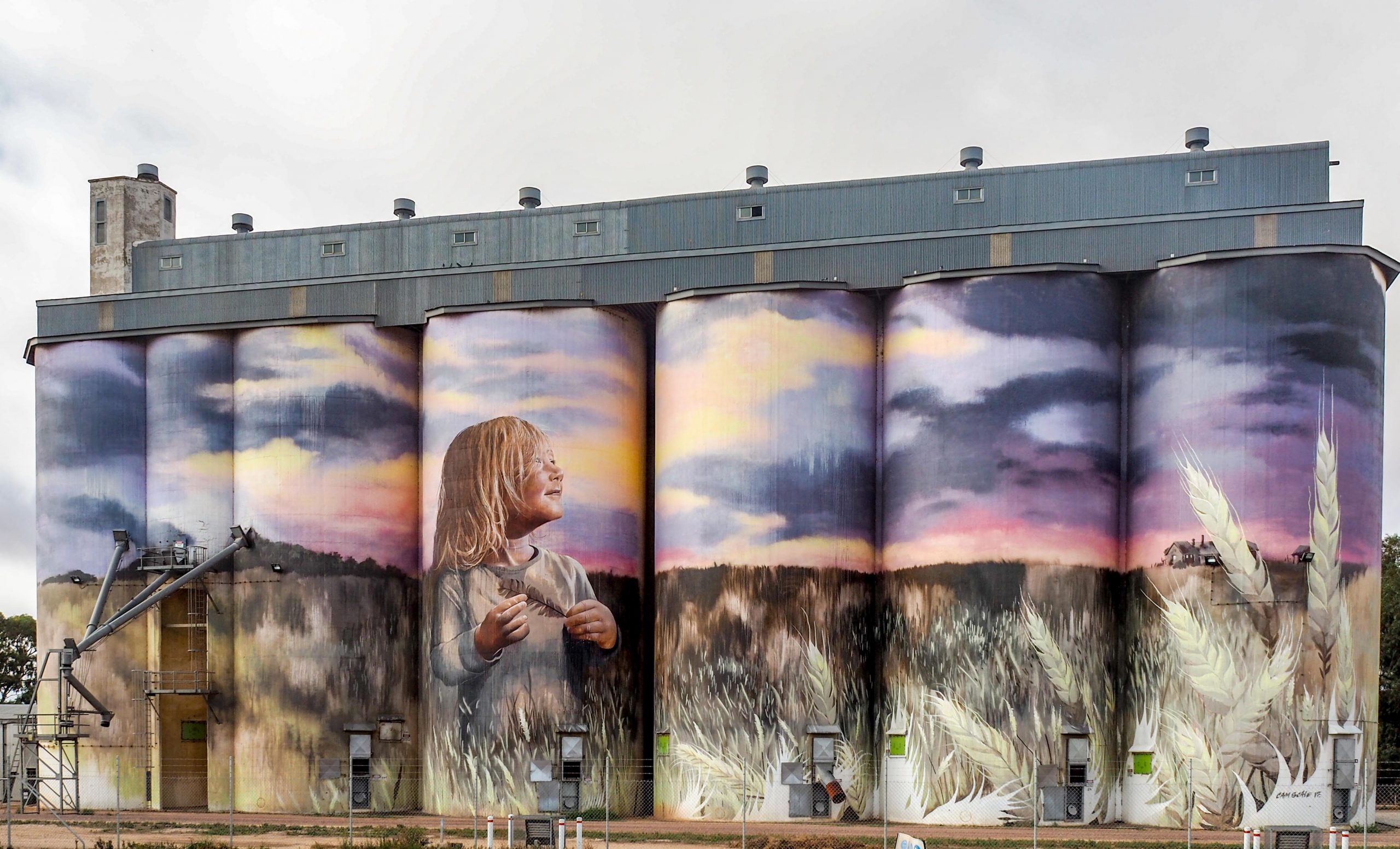
The theme is about the growing of wheat which is the main agricultural activity on the Eyre Peninsula. Every town on the Peninsula has a set of silos which stand out in the flat terrain of the Peninsula.

Kimba Silo Girl

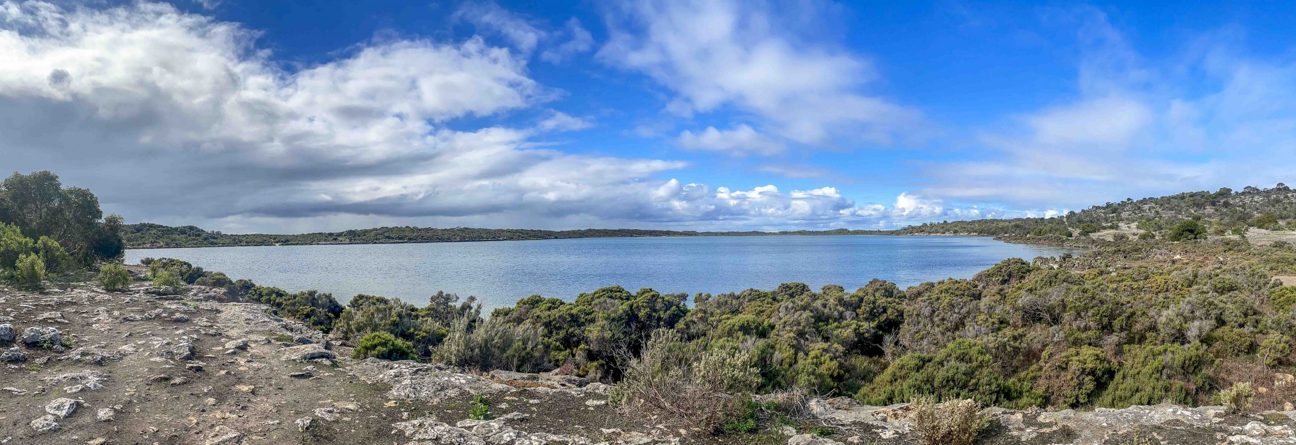
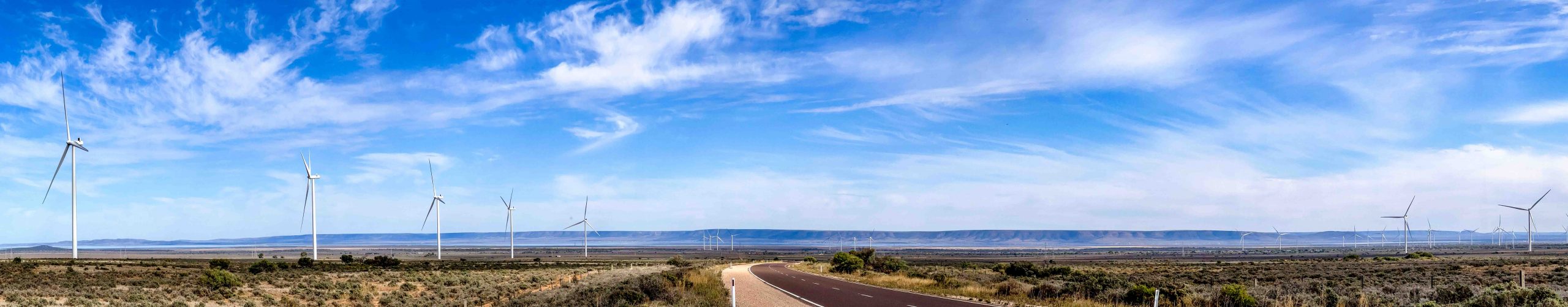
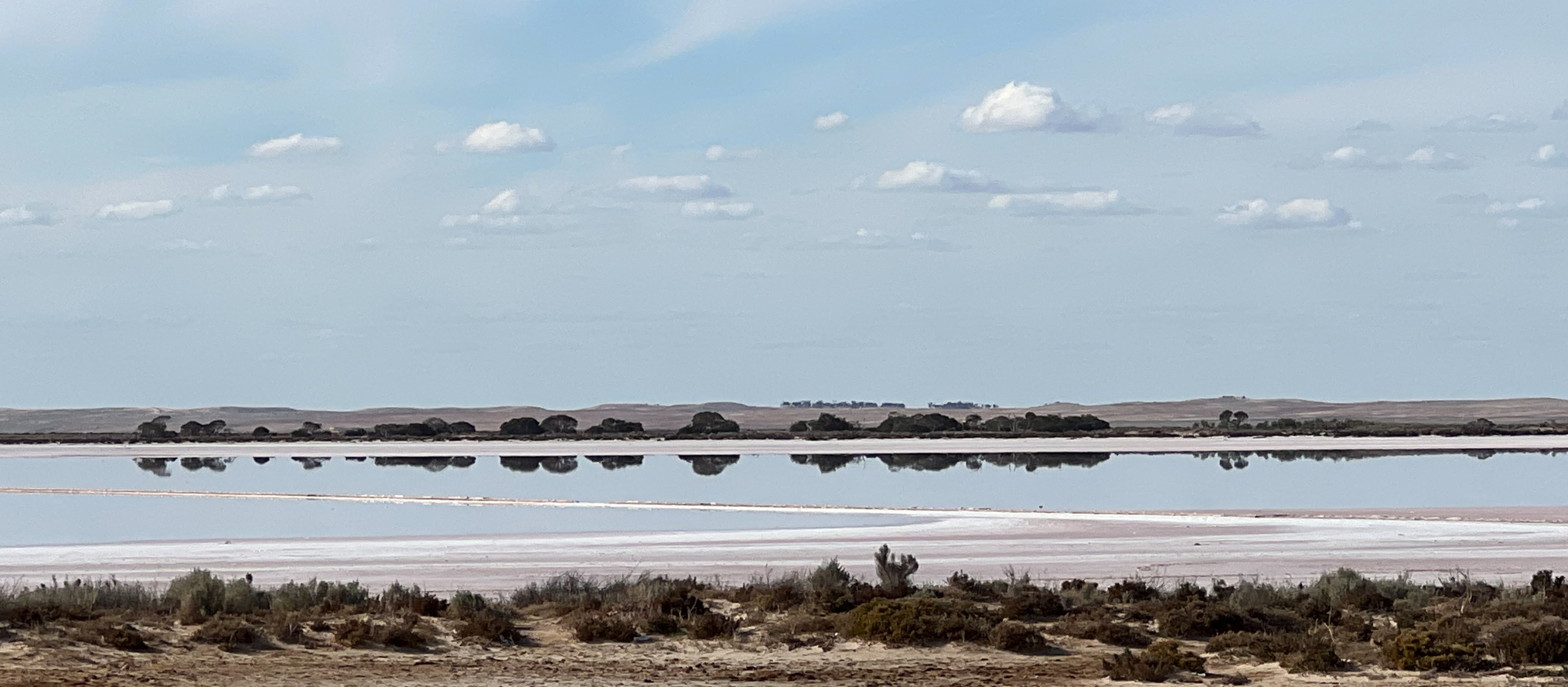
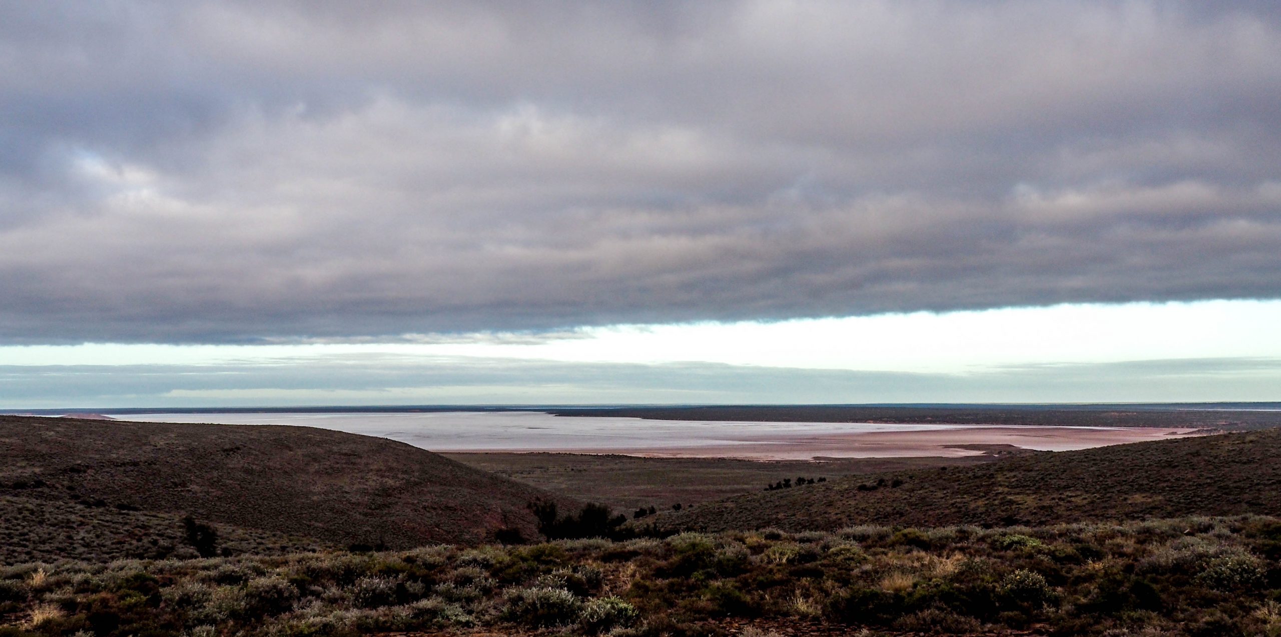
After Kimba we bypassed Port Augusta and headed north toward Woomera where we stopped for an overnight stay. The next day we headed to Coober Pedy through dreary flat treeless plains. Everything was a dull olive green which was a reflection of the good rains we have had, normally we would be travelling through brown country. Not many highlights but Island Lagoon was one, otherwise there was nothing to note in the journey except for a few more salt lakes

Island Lagoon

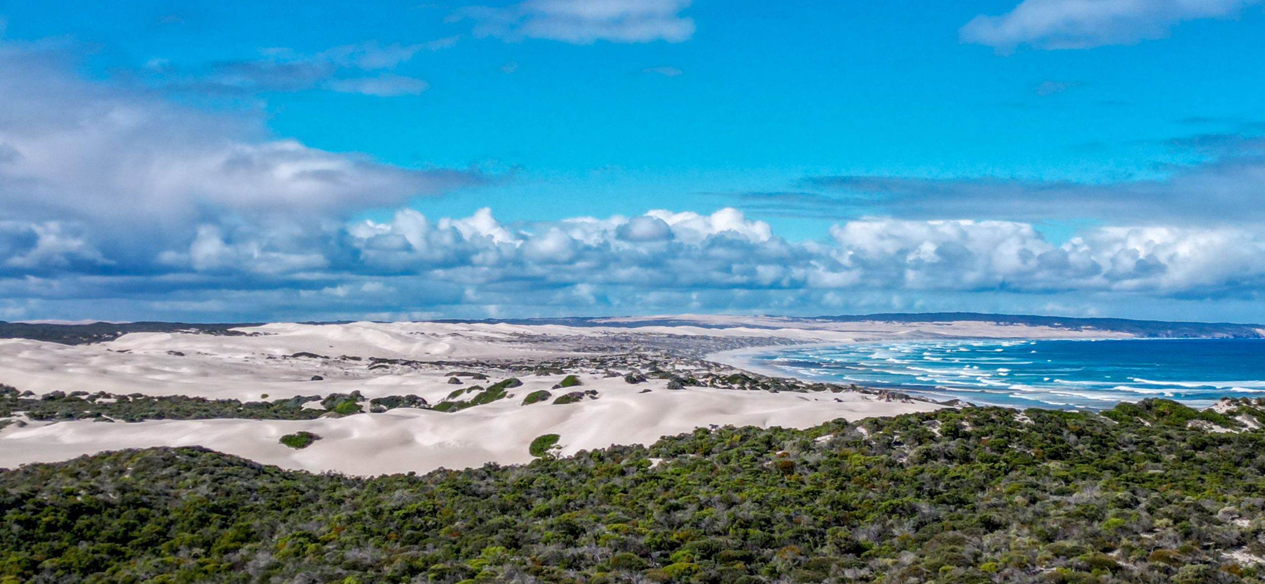
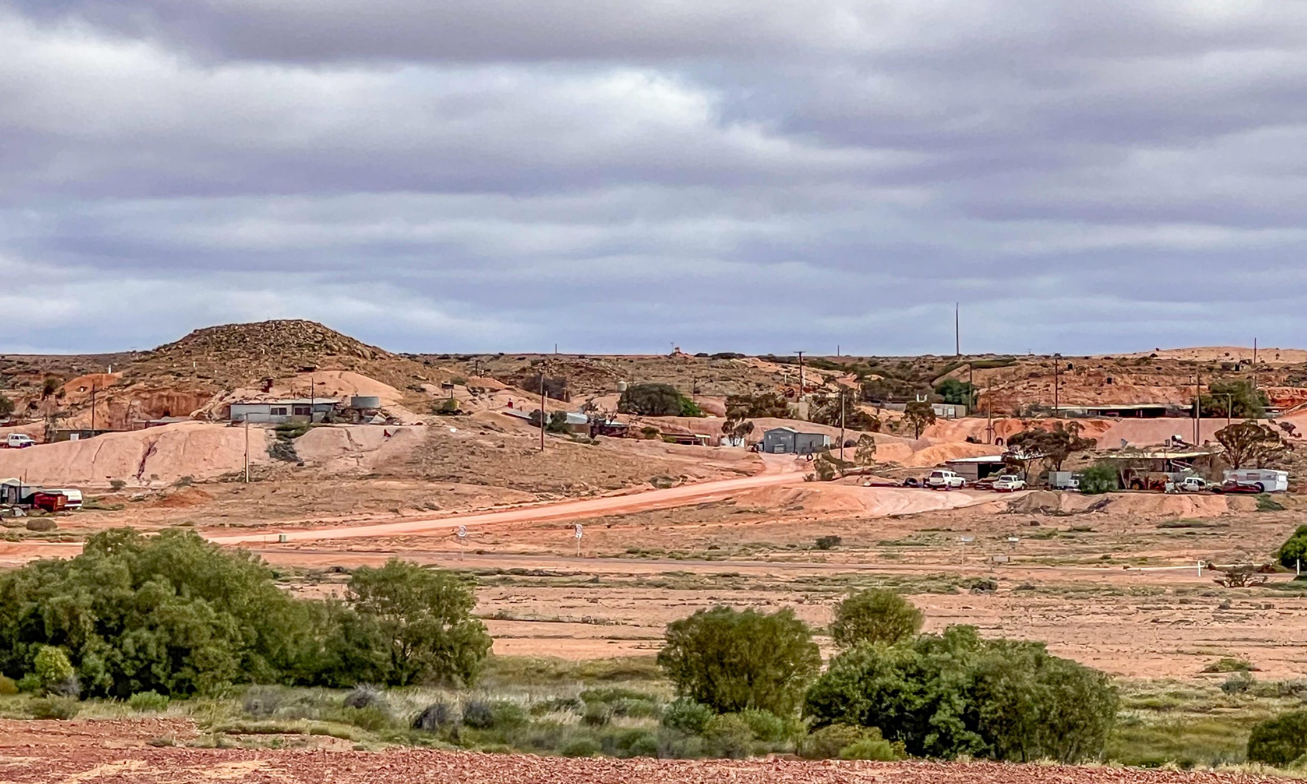
So to Coober Pedy. We were first here in the 1980s and not much has changed, maybe a bit bigger, maybe a few more trees, but still a dirty dusty outback town. The name “Coober Pedy” comes from the Aboriginal Australian kupa piti, meaning “boys’ waterhole.” However, another type of hole has become quite a hazard. Over the years, miners have dug over 250,000 shafts, making Coober Pedy a dangerous place for people to walk around. For 50 Km either side of Coober Pedy the landscape is dotted with mullock heaps

We stayed at Rudy’s caravan park which was a bit out of town but an experience. The camp sites were caved out of the hillside which gave us some protection from the wind.

Camp at Coober Pedy

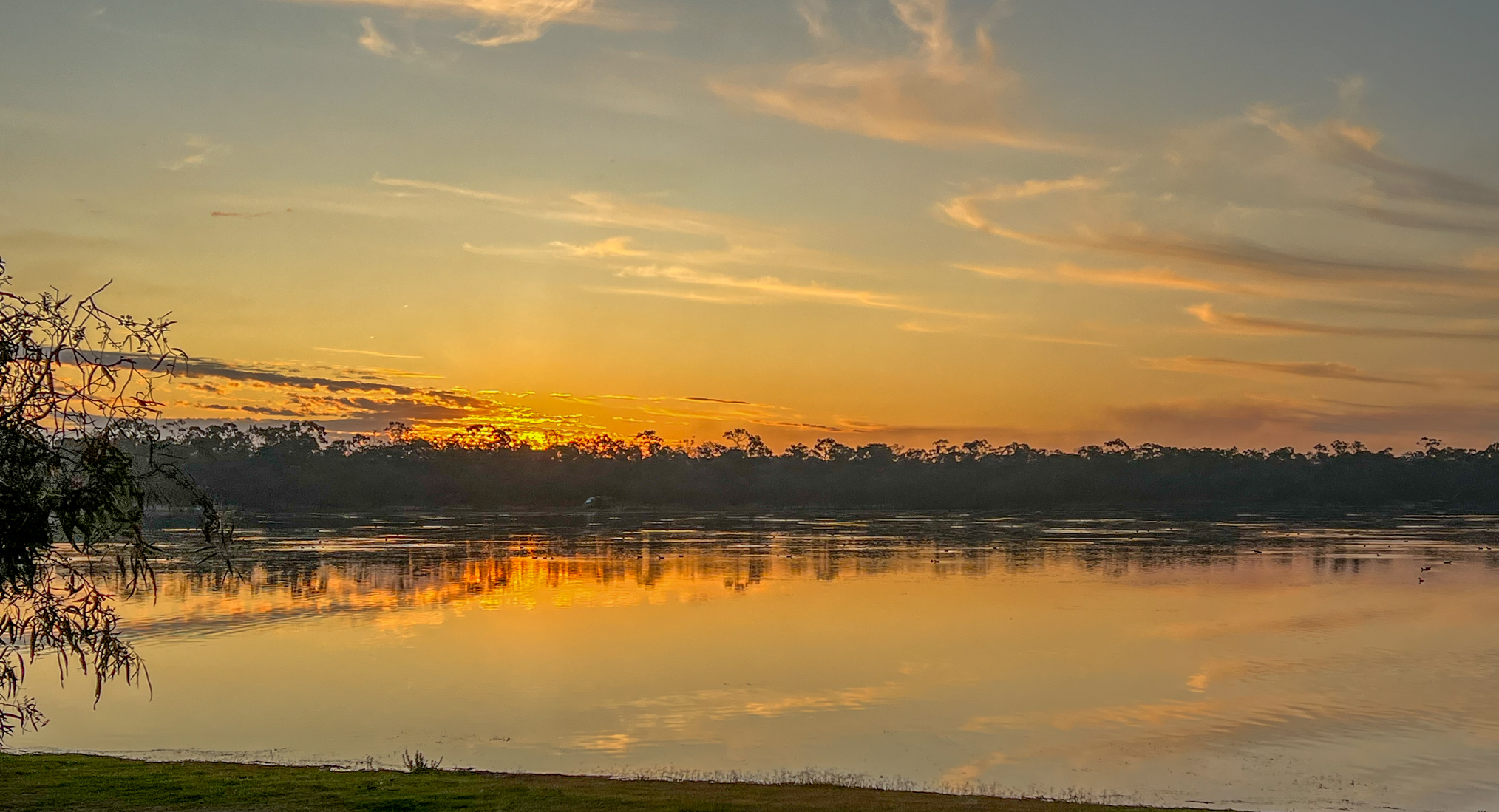
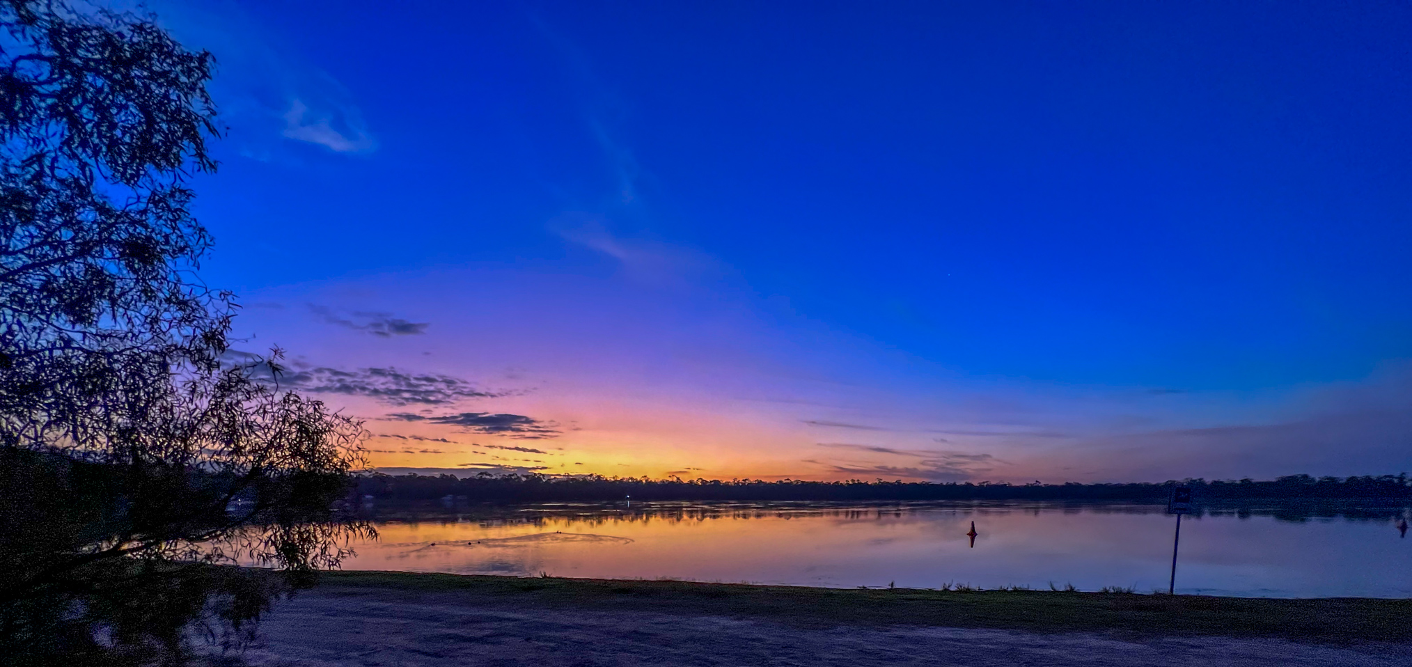
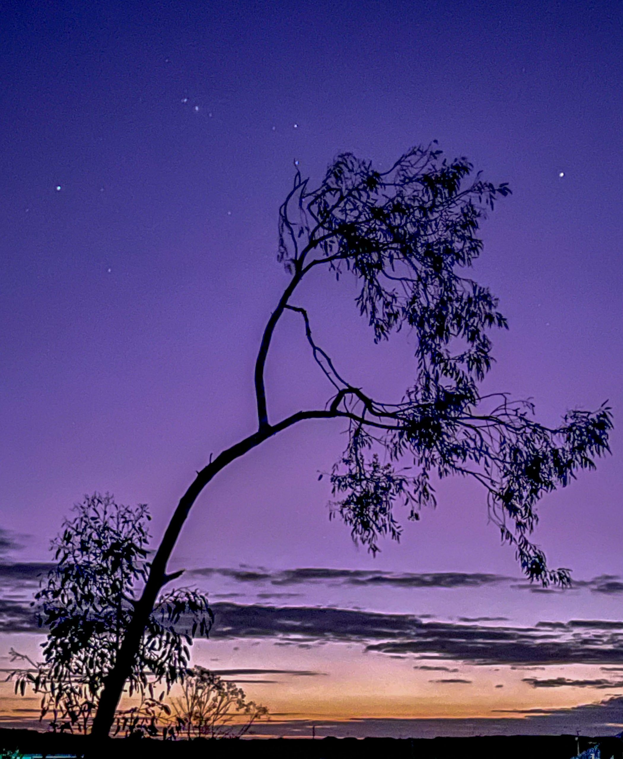
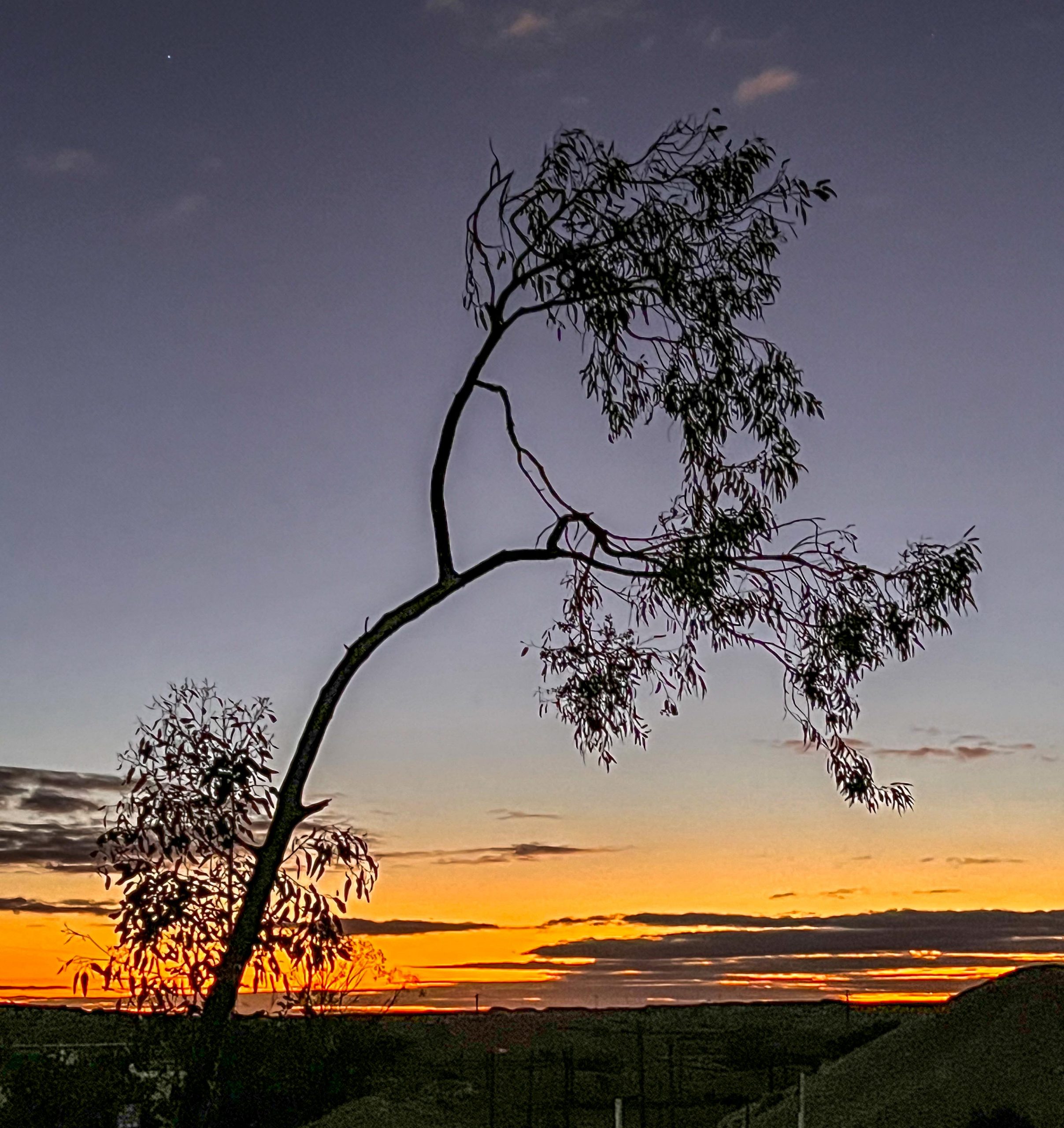
The sunset was a typical beautiful one, the photo on the left is one of Deen’s Photos taken half an hour or so after mine, the change of colour was amazing.

We toured Coober Pedy before sunset and on a small ridge running parallel to the main street were lots of dugout homes overlooking the town, but it was difficult to get a good photo so here is just a segment of the row of dugouts. Most have a structure at the front with lots of rooms carved into the hill behind the entrance room.

Dugout homes on a hill at the back of Coober Pedy

The caravan park had a dugout TV viewing and eating area which was interesting as we had never been in a dugout before.

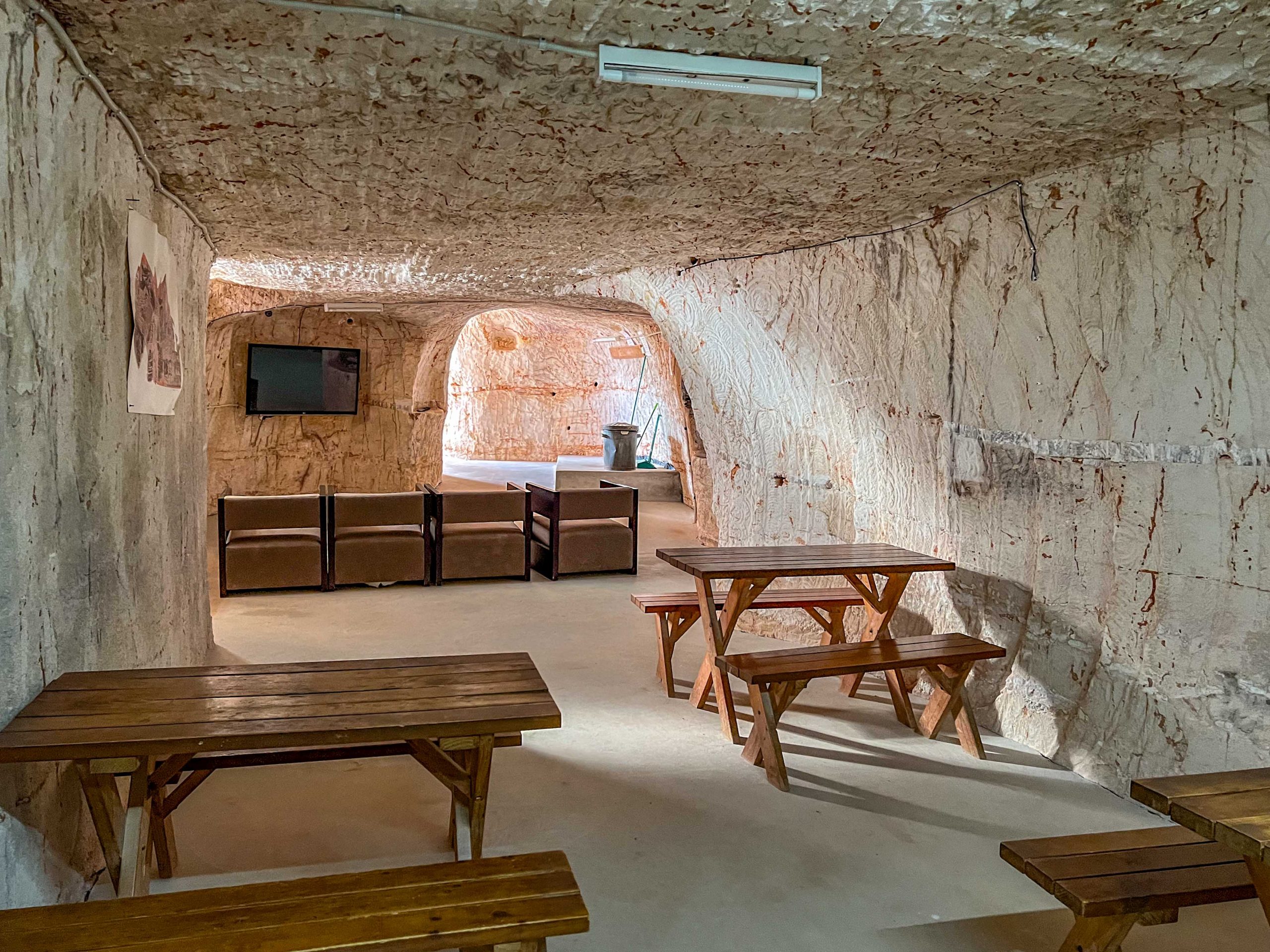
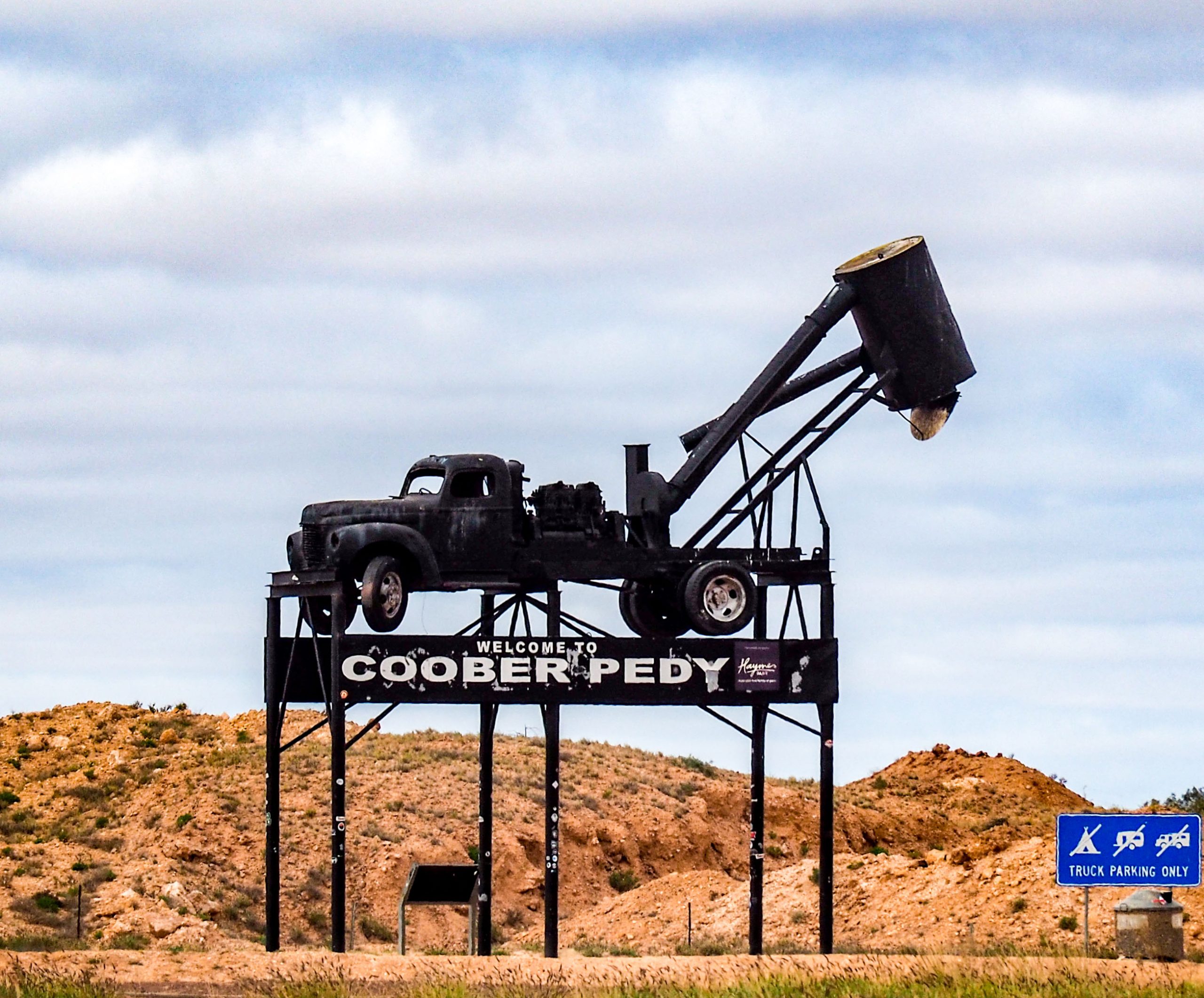
This room even had a fireplace. I forgot to mention the sculpture on the approaches to Cooper Pedy. It is of a blower truck which has is a vacuum blower with a large motor.  It functions to draw the dirt in from the bottom of a tunnel in the mine and brings it to the surface into a drum shaped cyclone where the waste is separated from the air and dumped.

On the way to the caravan park we passed an unusual tree, the fruit must have been ripe as there was a fallen example on the ground. I often wondered where these hats came from!

The tree Hatus Hardeai, a rare desert plant noted for the variety of the colour of its fruit.

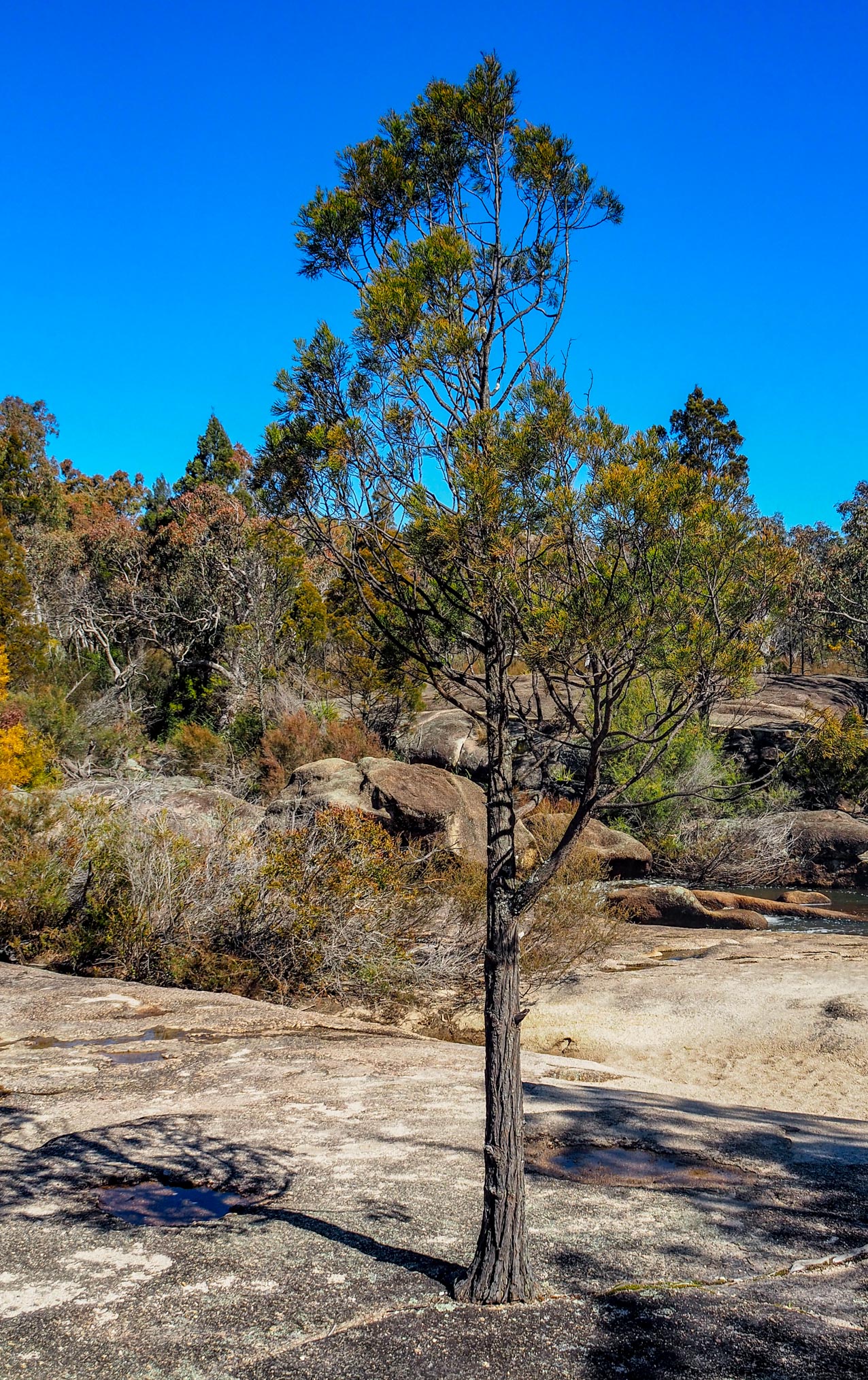
On the next day we left Coober Pedy and journeyed further up the Stuart highway through flat fairly uninteresting terrain to Kulgara, a Roadhouse and caravan park 20 Km over the border in the NT. Once inside the Northern Territory the terrain seemed to improve with more and healthier Mulga trees, such that in places they were touching each other. Tuesday saw another early start but a bit shorter drive to Yulara where we will be stopping for three nights. As we got closer to Yulara there were thickets of desert oaks which are a Casuarina. They are an interesting tree as the juvenile form is different to the adult form as shown in the photos below.

Juvenile Desert Oak
Mature Desert Oak

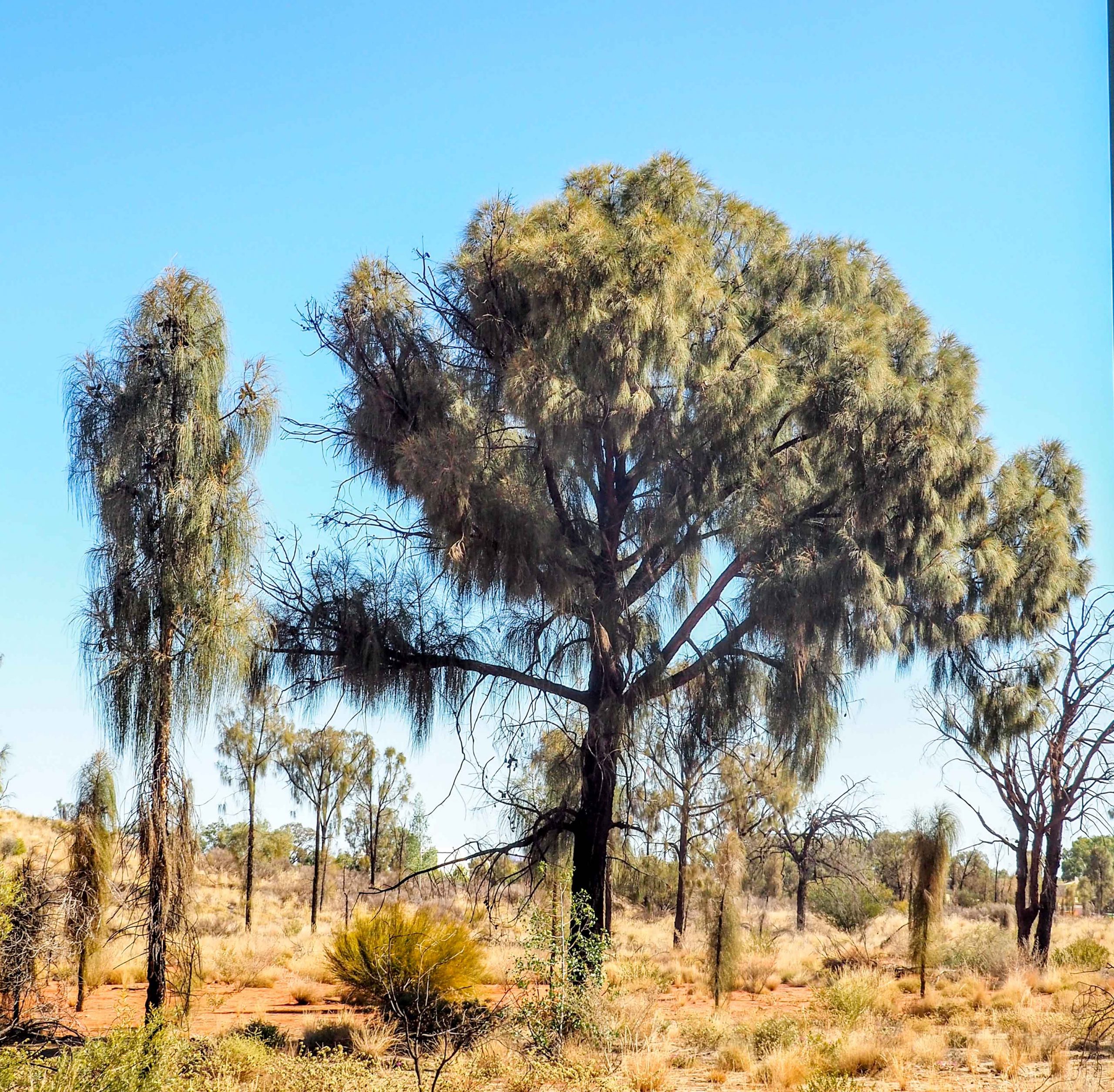
The young trees develop a long strong tap root which eventually reaches the water table. The tree then matures and puts out branches and starts to look like a normal tree. The young trees look like fuzzy icy-poles. If the young tree fails to reach the water table it will die, the tightly wrapped foliage directs any rain falling on the tree to the root zone and helps the young tree conserve water.

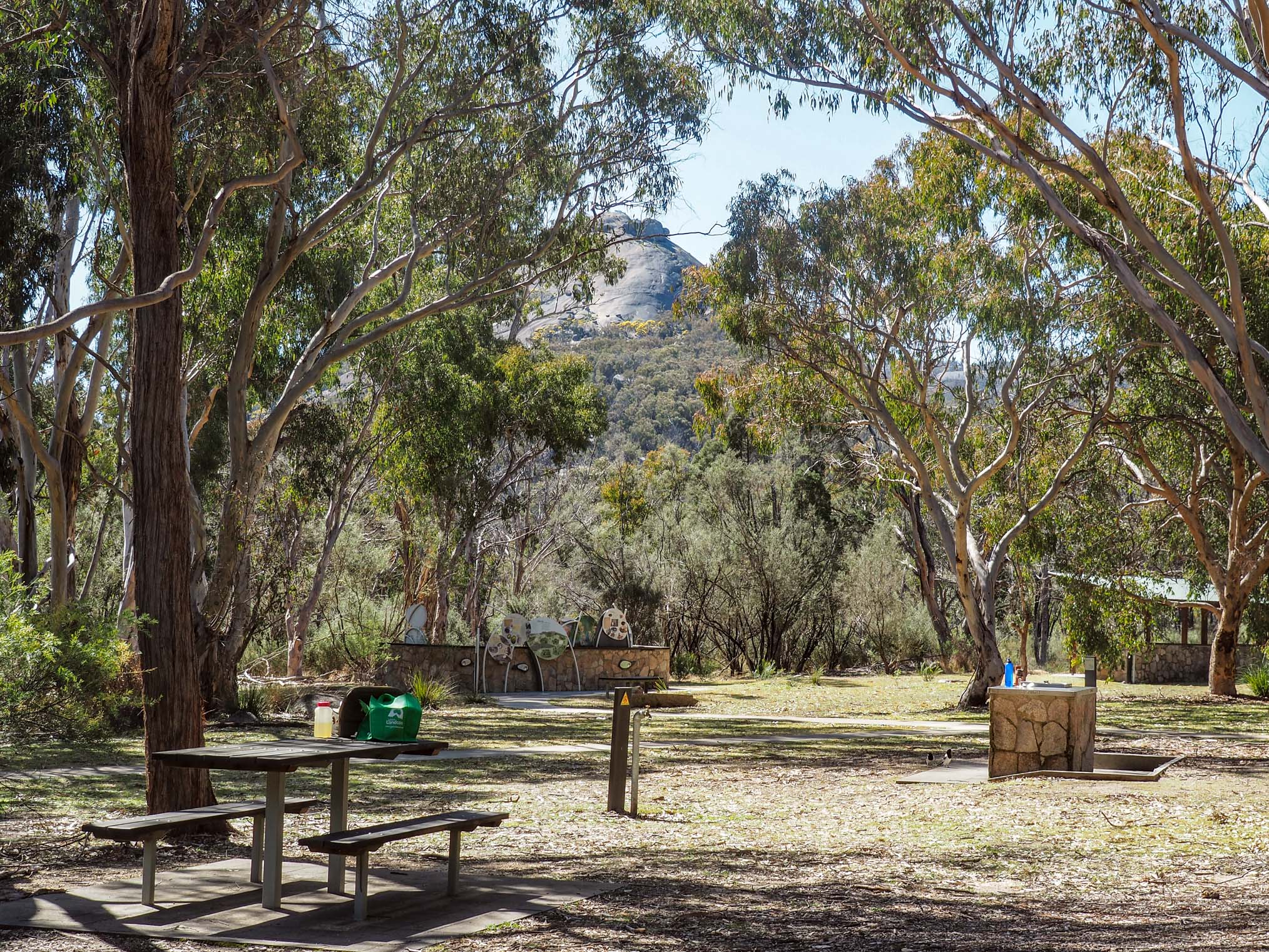
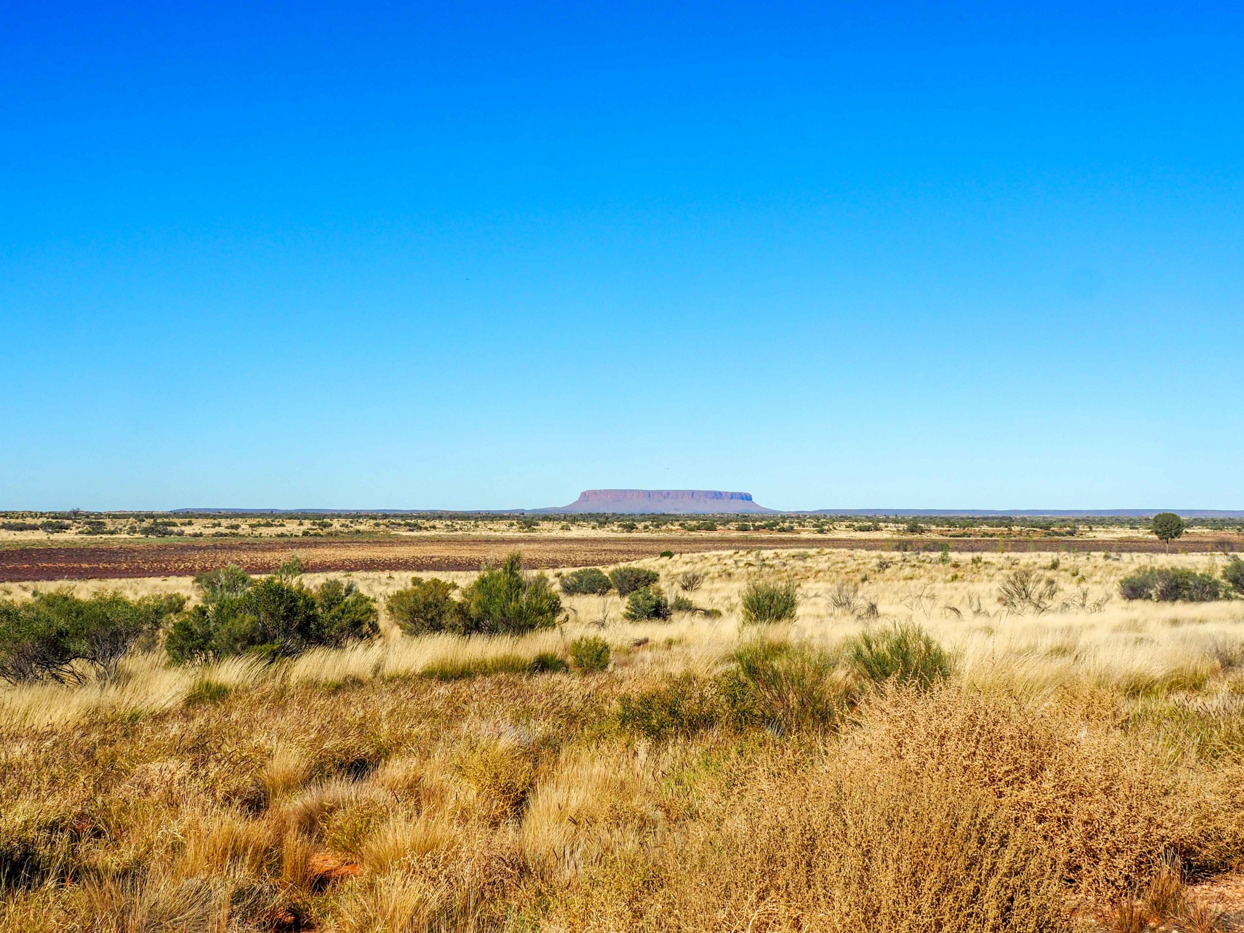
About 100 Km from Yulara is Mt Connor often confused by visitors as Uluru. The photo of Mt Connor in the distance shows how flat and treeless much of the country is that we have travelled through.

Typical Central Australian Terrain with Mt Connor in the distance
Mt Connor

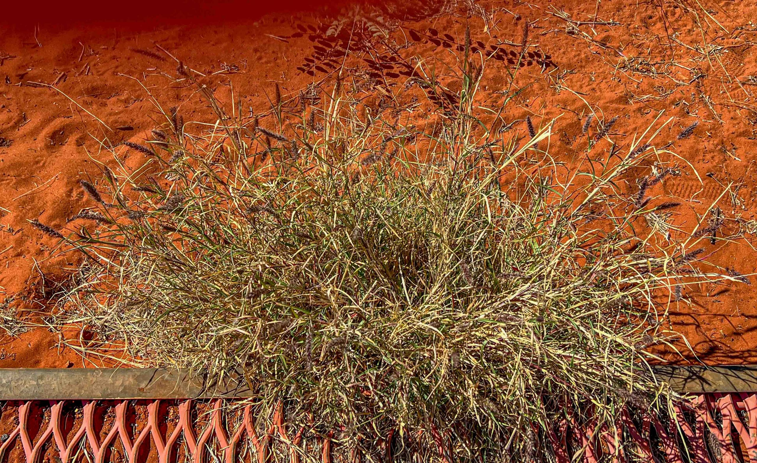
The Lasseter Highway runs from the Stuart Highway Yulara and it was an easy drive through unusually green country. The predominant grass visible from the road was Wallaby grass which grows about a foot high with lots of seed heads.

Wallaby Grass beside a Dune Walkway

So our 1700 Km journey to Uluru from Lincoln National Park is behind us which feels great. Tonight we are going to see the field of lights display with Canapés and sparkling wine before to enjoy. Our camp is a very pleasant one, we have sites 2 and 3 as we booked them many months ago, plenty of space and some nice trees and bushes. Water is on tap, which is good, and it tastes OK. Water was not available at either Coober Pedy or Kulgara, so if you are travelling this way and need water you need to check if the caravan park supplies it. Water can be purchased from bowsers in Coober Pedy for $1 for 40 litres.

More on our experiences at Yulara to follow. If you would like to receive an email notification when I publish a new blog, just enter you email address in the box below and click Subscribe. I will not send anything else apart from the blog notification.

Posted in 2023 | 2 Comments

Coffin Bay National Park

On our second last day at Lincoln National Park we headed across the Peninsula to Coffin Bay National Park where Marg and I had camped in 2001 after we left our camp at Memory Cove.  There are several campgrounds in the park but all except Yangie Bay require 4WD and travel along beaches, so we just visited the Yangie Bay campground where Marg and I had camped.  It is a delightful camping area with lots of trees and a view over the bay.

Yangie Bay at Coffin Bay NP

While walking around the campsites we were being observed.

In the Coffin Bay National Park there are a few vantage points that offer wonderful scenic views. The first was Golden Island which is a small island a few hundred metres off the coast with a wild current running in the gap.

Golden Island at Coffin Bay NP

The next view was of the wide sweep of Almonta beach with large sand dunes behind the beach.

Almonta Beach in Coffin Bay NP

The road through the park was in itself very scenic, winding through the low seaside scrub with ocean views popping up along the way. However all this sightseeing made us hungry so we lobbed into Oyster HQ in Coffin Bay for lunch where they have an amazingly extensive seafood menu. It overlooks Coffin Bay and is a very modern restaurant. We both had wonderful meals starting with Whitebait which were excellent with a yummy dipping sauce. I had breadcrumbed garfish with a salad and Deen had battered flathead (dipped in batter not smashed!), both were so so fresh and delicious. Not to be missed if you are down this way. The view from the restaurant was excellent as well.

View from 1802 Oyster Bar at Coffin Bay

We couldn’t leave Coffin Bay without some oysters so we bought a dozen each from an oyster farmer, only $12 per dozen, but un-shucked. We devoured these for our last meal at September beach and they were delicious, such a wonderful sea taste. It was the first time Deen had shucked oysters and she did very well.

So a great days outing was complete and we returned to September Beach where Deen put up her drone again to get one last picture.

Camp at September beach

Friday was our last day in Lincoln National Park so we decided on an easy day around camp with a short trip for a picnic lunch in the park. So we went to Stamford Hill picnic area about 15 Km from September beach. This delightful picnic area is where Mathew Flinders landed in 1802 not long after the drowning tragedy at Memory Cove. He was seeking water and thought that the heavily treed hill would have water underground at the base of the hill, unfortunately it was brackish. However he climbed the hill and spotted another likely location and was successful in finding water. Had he failed he would have had to return to Sydney and not complete his coastal mapping task. The climb to the top of Stamford hill was 800 metres up all the way. We climbed to within 100 metres of the top where we got an excellent view and decided that was enough and returned to the picnic area. In the photo the spit of land in the distance on the right is where September Beach is located on the opposite side.

View from Stamford Hill in Lincoln National Park

Tomorrow is Saturday and we start our long journey to Uluru, the first day will be 585 Km to Woomera. We will travel via Kimba to see the artwork on the silos there. It has been a great stay at September beach but we are looking forward to our visit to central Australia.

If you would like to be notified with an email when I publish a new blog, just enter you email below and click Subscribe, you will not be bombarded with any advertising.

Posted in 2023 | Leave a comment

Memory Cove

The bottom section of Lincoln National Park is the Memory Cove wilderness area so called because of the small bay – Memory Cove – which is in the wilderness area. In 1802 Mathew Flinders was looking for a place to anchor so he despatched a small clipper carrying eight men to find a safe passage. They did not return. Another sailor set out to find them and returned with the wreckage of the boat but the sailors were never found. So Mathew Flinders named the cove Memory Cove and named eight nearby islands after each of the sailors and another Catastrophe Island. This cove is where I have chosen to scatter some of Margies ashes because of the name and the fact that we enjoyed camping at Memory Cove in 2001.

The road in to memory Cove was being repaired and parts were very rough where the grader had pushed dirt and lots of rocks into the centre of the road. Coming back out was not nearly as bad as they had rolled the road with a massive roller and squashed all the rocks into the dirt to produce a flat surface. We stopped to take a photo of our destination in the distance. The island in the distance is Thistle Island named after the leader of the sailors who drowned in 1802 during the Mathew Flinders expedition around Australia.

The road into the camping area was just as I remembered, as was our camp site. The only difference was that the sites and road were just sand when we were there in 2001, rather than the current gravel. I remember I had to use the towbar I had fitted on the front of our Patrol to extract our camper from the site, I had backed the camper into a corner of the site that prevented me from hooking up and driving out as the turn was too sharp.

The approach to Memory Cove Campsites
Our 2001 campsite as it is now

We took our shoes off on the beach and waded in to scatter the ashes, the water was freezing.

Russ wading out to scatter ashes

It was an emotional time for us both, so we settled at the picnic table for a BBQ of Deen’s hamburgers and raised a toast Margie. A little silver eye joined the proceedings.

I forgot to mention on the way in to Memory Cove we had to wait for quite a time for a family of emus to move off the road. After our lunch, Deen put her drone up again and took a photo of Memory Cove.

On the way out we called in at Wanna which is on the edge of the wilderness area.

View of an island off the coast at Wanna
View north from the cliffs at Wanna

So that completed a successful day of mixed emotions, one we had been trying to complete for the last 3 years. Tomorrow we will be off to Coffin Bay for some oysters and fresh seafood.

If you would like to be notified each time I post a blog, just fill in your email address in the box below and you will get a simple email notification, you will not be badgered with heaps of emails.

Posted in 2023 | 6 Comments

Morgan to Lincoln National Park

We had a big drive of 480 Km on Sunday from Morgan to Colwell which is on the west coast of the Spencer Gulf on the Eyre Peninsula. Most of the country we travelled through had been cleared for farming and hardly any trees remained, the hills were all completely bald, it was a bit of a dreary drive. However on these hills were probably a couple of 100 wind turbines slowly turning out power. On approaching Port August after crossing a low mountain range through Horrocks Pass, the shoreside flats were dotted with more wind turbines and a massive solar cell array.

We did stop at Stone House Bakery (in Stone House the village, well 6 houses!) for a delicious homemade pasty and Coke, Deen had a beef pie with the essential coffee. We also passed the Wirrabara silo art on the way to Port Augusta. The artwork of a farmer and his dog were excellent. I forgot to mention we did call in to see the Waikerie silo art just before Morgan which I had seen on a previous trip, but the regent parrot was just too good to resist another photo. Jimmy D’Vate is my favourite silo artist and his birds are just excellent.

The Harbour View caravan park at Cowell was a bushy one with lots of Mallee trees and small shrubs with lots of space between the sites. While there we visited the Cowell silo art which was OK, nothing special. It was Sunday and the town was deserted and the only fish and chip shop was closed, Deen and I were hanging out for fish and chips.

On Monday we had to drive only 200 Km to our campsite at September Beach in Lincoln National Park. The National Park park hooks around the Port Lincoln bay to the east and September Beach is on the east side of the point of the “hook”. There are lots of fish pens in the bay with a couple of big factory ships in attendance. Tuna are caught in the wild and transferred to the pens and fed sardines until they are at market size. Yellow tail kingfish are also farmed here and at Arno bay north of Port Lincoln.

We called in at Tumby Bay to view the silo and street art there. The silo art is unique as the two boys are painted across the curves of the six silos. Most silo art is painted vertically on one silo with the painted background linking the major artworks. Getting the images to align across the curves of the silos is a difficult job. ,Argentinian artist Martin Ron created the Tumby Bay silo mural, he is an internationally recognised leader in large wall murals and has worked on sites around the world.

We drove through the main street of Tumby Bay where there is some street art, some of which was quite good, but we couldn’t find parking with the vans attached so we drove on to September Beach. We have a large site which can easily accomodate us both in our own bushy enclave. This is Deen’s first drone photo, the sea was really that blue.

Here is another drone photo of the bay behind our site.

We drove around the National Park and visited a few camp sites, ours seemed the best to us. Richardson’s Shack was a bushy camp site but no toilets. I really liked the shape of these small trees at Richardsons.

Tuesday was a shopping and resting day so at about 11 am we headed into Port Lincoln (43 Km) collected the key for the Memory Cove wilderness area, did our shopping and had our fish and chips. We went the the Fresh Fish Place for a delicious meal. Beautifully cooked fish, so fresh, they sell about 20 different types of fish plus calamari, prawns, oysters, baby octopus, etc. etc. whatever you fancy all caught locally. I had King George Whiting and Deen had Flathead. Don’t miss this place if you ever visit Port Lincoln, not fine dining but yummy food.

Tomorrow we are off to Memory Cove having obtained a special clearance as the road is closed for roadworks. NPWS agreed to let us in as we had cancelled three booked trips because of COVID. The road contractor was contacted and he agreed that we could travel in. We will be the only visitors there, just like when Marg and I camped there for 3 days about 20 years ago.

Our Internet here is very slow so my posts may be irregular. The Internet is OK today so I took the opportunity to make this post. If you would like a simple email notification when I make a post, fill in your email address in the box below and click Subscribe

Posted in 2023 | Leave a comment

Mt Eliza to Sea Lake

Deen and I set off for a 5-1/2 week holiday to the Eyre Peninsula and Central Australia on my birthday, May 12th. We are so looking forward to the trip as we have booked this trip three times in the past only to have to cancel each one because of COVID lockdowns. It is an important trip because one reason for the trip is to scatter the last of Marg’s ashes at Memory Cove in the wilderness part of Lincoln National Park. Even then we had to get special clearance to go to Memory Cove as they are repairing the road in the week we are visiting. NPWS wanted to cancel our booking but, on hearing the tale of woe, made special arrangements with the road contractor to let us in. Our first stop was at Green Lake near the town of Sea Lake in the Mallee. It is a lovely rustic campsite for $10 each a night for a power site. We met up with a friend of Deen’s, Dey and her dog Marla who was camped at Green Lake to collect a solar panel from Deen. We absolutely loved our first campfire and the wonderful sunset.

After setting up camp we drove into Sea Lake to see the silo art. It is good but in my opinion would have been much better if the girl was facing the viewers.

A nearby silo had a couple of emus which were good and an echidna which was behind a bush in the silo photo.

We then visited Lake Tyrrell a nearby salt lake that has had the salt harvested since the late 1800’s. It can have a pink tinge at times but not the dat we visited. There were interesting reflections of bushes and the clouds in the water of the lake.

So it was an excellent start to our holiday. On the way to Sea lake we stopped to view the silos at Nulliwal which had an excellent painting of a farmer with his Kelpie.

Tomorrow we head off to Morgan on the Murray in SA and the next day down to Cowell on the shores of Spencer Gulf on the Eyre Peninsula, we will then have covered just under 1400Km, Australia is a big island.

To receive an email notification each time I publish a new blog just enter your email address in the box below and click Subscribe.

Posted in 2023 | 6 Comments

Sydney to Mt Eliza

It is so good to have a GPS to guide you through Sydney, especially when you travel alone, I use two, a Garmin and the inbuilt one. They come up with different routes at times so I follow the shortest one. My first stop was at Wilton for some water tanks about 80 Km south of Sydney on the Hume Highway. The artwork was good, I especially liked the eagle. You could only get to within 100 metres of them because of a barbwire fence.

I stoped overnight at Coolac on a farm stay, a delightful small caravan park with about 20 sites, lots of birdlife around set in farmland and very peaceful. I didn’t book as usual but the park was full, but the manager managed to find a spot on the grass near a power-pole so I was OK, I need that electric blanket! The journey down the Hume the next day took me to a water tank 12 Km south of Tarcutta, I really liked this one.

The big old gum trees made a perfect frame for the artwork. I decided to spend a few days at Chiltern which is between Wodonga and Wangaratta. I have stayed here a couple of times, it is a lovely historic small town and the caravan park is next to a small lake. It is close to Rutherglen and the Chiltern-Mt Pilot National Park where Marg and I have enjoyed a number of picnics over the years with hampers from the Pickled Sisters Cafe in Wahgunyah.

I went to Wangaratta to see the water tower there, it is near the railway station and the whole area has been renovated and landscaped. The tower has been rendered and the artwork painted on the render. It depicts lots of native birds and animals the live or used to live in the area, plus plants and insects.

The arms protruding at the bottom of the tank are flood lights that light the tower at night, It would look spectacular.

Back at Chiltern to the local toilet block which has a painting of a Regent Honeyeater, a small bird that is now endangered. The Chiltern – Mt Pilot National Park, which protects a Box Ironbark forest, is an important refuge for this bird and the small population is slowly rebuilding. From memory I think the bird depicted is named Red, Red, Yellow from the marking bands on its legs. I love the red gum blossoms. This was painted by Jimmy D’Vate who paints animals, birds and flora exceptionally well, I have mentioned his work previously.

On Monday I headed to Eldorado where we camped in 1976 over cup weekend, the third cup camp of what now totals 50 camps over cup weekend when we gather this November, our golden anniversary camp. The drive through the National Park and along Woolshed creek was very enjoyable. The caravan park at Eldorado has changed little over the years. It is a tiny town now but when they were running the gold dredge, Wangaratta was an outpost with 2 policemen compared to 13 at Eldorado. The electricity consumption of the dredge made Eldorado the second largest consumer of electricity in the state after Melbourne.

From Eldorado I went to the peak of Mt Pilot in the National Park and enjoyed a picnic lunch and great views from the summit.

It’s Tuesday and my holiday is drawing to and end so I decided to treat myself to lunch at Tulleries in Rutherglen. I had a Wagu steak with wild mushrooms and Wakame (an edible seaweed). It was delicious, the thick sauce had just a hint of mustard and I enjoyed that as well.

On the way home I drove through the National Park again along Donchi Road that loops around through the park and back to the main road. Marg and I have picnicked by this road, but the picnic table has disappeared. I spotted an orchid while driving slowly so I was pleased with that, Marg used to be the expert orchid spotter. The Lady’s Finger Orchid is about the size of a 5 cent piece.

The country is so green, I have never seen eucalyptus forests green on the ground, but they are now, the ground is covered with native grasses and tiny plants. I think the coming wildflower season will be wonderful.

So a good holiday has been had, around 6,000 Km travelled, flooded roads generally avoided and mostly good weather. Back home on Thursday to cold wet weather, bugger.

If you want to be notified when I post my next blog just put your email address in the box below and click Subscribe. The next blog maybe in November when our camping group gather for the 50th time over cup weekend

Posted in 2022 | Leave a comment

Evans Head to Sydney

You can subscribe to receive an email each time that I publish a new blog, just enter your email address in the box and click subscribe

I decided to skip an overnight stop and made the 575 Km trip from Evans Head to Myall Lakes in one hit. Most of it was on the divided Pacific Highway and very easy driving. I did take a diversion to Crescent Head to see artwork on a water tower, I should have saved my time. Unusually most of the mural had graffiti over it, which is very unusual, and maybe a commentary on the quality of the artwork, maybe that is a bit harsh. I managed to find a part with only a couple of “Tags”

However the view south from the headland (Ness for Cryptic Crossword aficionados) was wonderful.

I stayed at the NRMA caravan park at Myall Lakes, which is in the National Park, a great park with lots of trees and other plants, a really beautiful spot.

I went for a drive through the Myall Lakes National park, which was a delight, very much like the Mountain Ash forests of Victoria except the tree ferns are replaced by palms. You can get an idea of the forest from the photo of the walk the the tallest tree in NSW. The flooded gums in the photo below are 50 years old and, while tall, are still very slender compared to the big one.

The big tree, called Grandis, is massive, I had to take a panorama shot to get it all in the one photo. It is a Flooded Gum, 400 years old, 76.2 metres high, 11.5 metres circumference and the first branch is 25 metres above the ground and the diameter of the trunk at that height is still 1.8 metres. A massive tree.

I then drove on through the forest to the Whoota Whoota lookout which gives you a wonderful view north along the coast. This photo is a panorama.

The photo from the lookout below is a conventional photo.

After four restful days at Myall Lakes, I moved onto Sydney where I stayed at Lane Cove National Park. It is a an excellent park with lots of trees and only 16 Km from the centre of Sydney. I booked in for four nights as I wanted to visit several manufacturers of motorhomes. I have decided that I will stop towing a caravan when I turn 80 in a couple of years. I am still comfortable towing and really enjoy living in the van on holidays, but I guess I should make the decision by choice rather than being forced into it.

I have chosen a Trakka Akuna based around a MWB VW Crafter van. It has 4WD which I wanted as I enjoy travelling on dirt roads which can be quite rough. It also has the raised suspension and larger wheels options, but it is not a go anywhere van by any means, you have to make compromises. I will be down-sizing as there is far less storage than in a car and van so I will have to work on that. Hopefully it will be delivered in the first quarter of 2024. Here is a photo of one, mine will be white of course!

I looked at conventional motorhomes built on a cab-chassis but I didn’t like the width of these and the finish was not as good as Trakka. It is a compromise though as the shower toilet is very squeezy and there is less storage. Horizon motorhomes built in Ballina were similar to the Trakka and excellent quality but they use a Fiat van as the base vehicle and they are not imported into Australia in 4WD versions. So the Trakka was my choice.

Tomorrow I start heading back home but will take a week or so to get to Melbourne. I will post another blog on the way. Remember you can subscribe to get an email when I post a new blog, just enter your email below and click Subscribe.

Posted in 2022 | 2 Comments

Tenterfield to Evans Head

The drive from Tenterfield to Evans Head crossed over the Great Dividing Range. It was a very windy road but generally dropping down to the coast. Lots of road works along the way repairing significant damage from the constant heavy rain earlier this year, wash-aways, landslides, rock falls, all sorts of damage. I had a charmed drive as in all but one restricted area I got a green light and went straight through.

The first stop was Casino where there was reported to be a painted water tower. The artwork was OK but the tower was on a hill and the only spot I could get to was in a road cutting almost directly below the tower. The painting was on the tank which was on top of a tall concrete structure, I’m glad it was on my way and I didn’t have to drive a long way to see it.

The lines across the tank are power lines, I had to position myself between the poles, very hard to get a good photo. The sun was right behind the tower which made it doubly hard. The detail of the painting was excellent, maybe the colours chosen were not so good. The lady to the right was very well painted.

Evans Head is at the mouth of the Evans river which is a tiny river being only 17 Km long and dropping only 21 metres over its course, but at Evans Head it is quite wide and impressive by Australian standards. There is only one caravan park at Evans Head and it is a massive park, probably over 300 sites and chock-a-block with vans. Not my favourite type of park, but it is right on a beautiful beach and extremely well run and in walking distance to town, not that I did!

When I arrived I took all the tape off the caravan plug and took a photo of how bad the connector was, only the tape held it together, some pins had to be pushed in individually. But it held together for a couple of hundred Ks. The plug on the car was a 7 pin large round one which seems to be obsolete and only one of the many shops I visited had one and then it was their last. The seven pin flat plug seems to be the norm, so I fitted that to the van and made an adaptor to go to the car so all is good. Here is a photo of the broken connector after I took off all the tape and unplugged it.

While at Evans Head I visited Ballina where there is a water tank on top of a hill overlooking the town. The painting is past its prime and maybe the tank was not prepared so well as the paint is peeling in places. The cyclone fence around it made photography a challenge. This photo was taken through a gap in the gate, the other photos have the cyclone in them.

Back to Evans Head, at the hardware shop, where i bought one replacement plug, I asked about a fish and chip shop in town and the lady directed me to the fisherman’s Co-op. What a find, six pieces of breadcrumbed whiting for $12, absolutely delicious. I was lucky as I had just been to the bottle shop and I had a cold six pack of Coopers Pale Ale in the car. So I bought the fish and chips and sat in the nearby park alongside the river and enjoyed a lovely repast. I repeated it today, just as delicious.

The beach at Evans Head runs forever passed Broadbeach National Park, an undeveloped part of the coast.

The two groins in the photo are the outfall of the Evans River. Tomorrow I’m off the Myall Lakes about 500 Km down the coast with one water tower on the way at Crescent head.

Posted in 2022 | 2 Comments

Tenterfield & Surrounds

On the way to Tenterfield I went through Texas where there was a water tank with artwork. Not the greatest but still worth stopping. I was lucky as a worker opened a gate to drive into the depot so I was able to sneak in and get photos without the fence being in the foreground.

The drive from Coolah to Tenterfield was through undulating country and a really pleasant drive, the roads were a bit average but otherwise I enjoyed the trip, especially stopping at Girraween National Park for a BBQ lunch. The picnic area is wonderful with many picnic tables and a half dozen gas BBQs. The picnic area has a view to Pyramid Rock that can be glimpsed in the background.

From the picnic area there is a short easy walk of a couple of Ks through a bush scattered with granite boulders, it is so scenic, you cross a small creek and then head on a loop through the bush.

The granite arch is spectacular and a feature of this walk.

I really enjoyed the walk, in places it was like a landscaped native plant garden. It was also amazing to see trees apparently growing out of the rock, it’s hard to imagine how they survive.

So off to Tenterfield and set up camp, I have decided to stay here for 4 nights. So on Friday I set off for Undercliffe Falls, sadly there is no viewing platform as the falls would be very spectacular if you could see the whole drop. As it was you had the very carefully climb your way down on wet sloping ground to get to a vantage point. The falls descend 150m over a 30m wide rock face into a deep pool that is used for swimming in summer. They looked great in reality but not so good in photos.

From Undercliffe Falls I headed for Bald Rock National Park where the picnic area was wonderful. I really enjoyed the solitude and quiet and spent a bit of time in quiet reverie, lost in my thoughts. I BBQ’d a couple of sausages and had a battle with a Kookaburra which made 5 or 6 dives trying to grab one. One time he nearly got one when I had a sip of wine and he dived in, I had to slam the wine down and wave my hand to shoo him away. It was close, about 6 inches from success.

Bald rock is so massive that is is impossible to get a photo to show how big it is, I wish my drone was working, this was the best I could do. The rock is the biggest granite monolith in the southern hemisphere, it rises about 200 metres above the surrounding country and measures about 750 metres long and 500 metres wide. The gentle climb to the top was closed for maintenance and I didn’t fancy the steep climb straight up the rock so I missed the view from the top.

The next day I went to Boonoo Boonoo (pronounced bunna-bunoo) National Park, I had intended to visit Basket Swamp Falls but the road had been closed because of damage from recent rains, but the Boonoo Boonoo Falls made up for it, they are impressive falls. Apparently Banjo Patterson proposed to his future wife Alice Walker at these falls. The walk in is an easy 300 metres through delightful bush and the falls are stunning, not sure the photos do justice. The falls drop 210 metres over a granite rock shelf.

Above the falls there were many small waterfalls but the trees made it hard to get a good photo but the walk was very enjoyable.

The road to the falls gives you glimpses of the Boonoo Boonoo river which runs over granite with lots of pools and small rapids between, it is a very beautiful river.

Back in Tenterfield I caught up on some shopping and had to take a photo of the Tenterfield Saddler shop made famous by Peter Allen.

So that is Tenterfield, a very restful stop. Tomorrow I’m off the Evans Head for a few days. After packing up the van I usually couple up on the evening before I leave, which saves me having to do that in the freezing morning temperatures. Today I found my electrical connector to the van was falling apart, one connector fell out as I pulled the plug out, fortunately it was an unused one. Being a Sunday no shops were open so in the end to get mobile I had to remove the plastic centre assembly of the connector from the outer body and carefully plug that into the car socket. Luckily it worked, so I taped it in place with lots of PVC tape so it would not fall out while travelling. I’ll buy a new connector and a second spare so I’m not caught out again. You have to be prepared for all sorts of things when camping it seems.

Posted in 2022 | Leave a comment

Coolah to Cranky Rock

I was pleased to be leaving Coolah, it hardly stopped raining while I was there and the caravan park was muddy, lots of pools of water, an ancient toilet block, a blocked toilet, no camp kitchen, not good. For example, when I was packing up I had to move my van to avoid big puddles and even then to do up the last two roof clips I had to move it again to miss another puddle. Definitely don’t stay at Coolah, I booked in before I saw the park, I had stayed here a few years ago and it was in excellent nick, but run by different people.

So I headed off for Cranky Rock Scenic Reserve a few hundred Ks further north. On the way I passed through Barraba and saw the water diviner silo art again. I was going to take a drone photo this time but my drone was not working properly, something wrong with the camera gimbal.

Cranky Rock Reserve is a delightful camping area and perfect for a drone shot, if my drone was working. There are tress scattered through the park, most of the power sites back onto the bush, you can have fires and the caretaker lights a communal campfire each night. There is a short walk to the “Cranky Rocks” that gave the park its name. The local legend is that a “cranky” Chinese cook killed a local woman after an argument with her, he was “cranky”. He ran away into the bush and was rumoured to have jumped from the balanced rock, on the right in the photo below, and died, hence “Cranky Rock”.

The truth is that he ended up on a station about 30 miles away where his body was eventually discovered. It is amazing how these massive rocks just balance without falling and have done so for eons.

There are so many of these balanced rocks.

As I said the camping area is delightful and very peaceful, one to put on the list for a revisit.

Next stop Tenterfield and a couple nearby National Parks

Posted in 2022 | 2 Comments